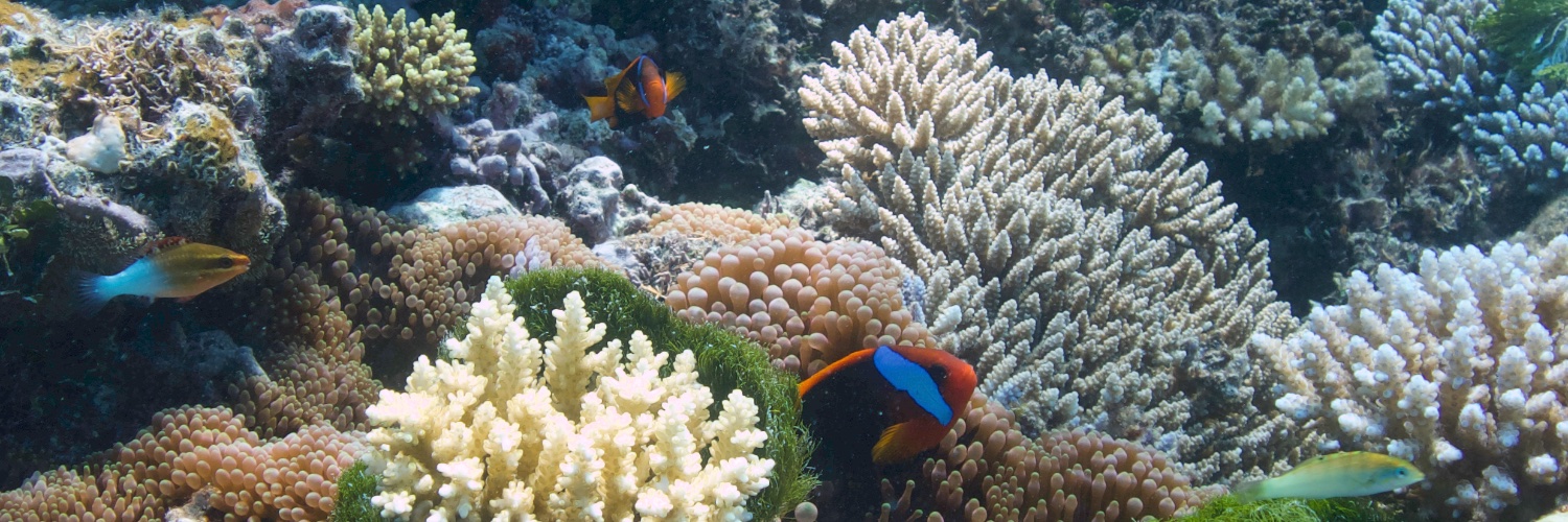
January 2025 was the warmest January ever recorded. Last month was 1.75°C above the pre-industrial level and 0.79°C above the 1991-2020 average. The persistence of high temp. underscores significant climate trends.
Read the full #C3S Climate Bulletins: https://t.co/PCInDl2rNO
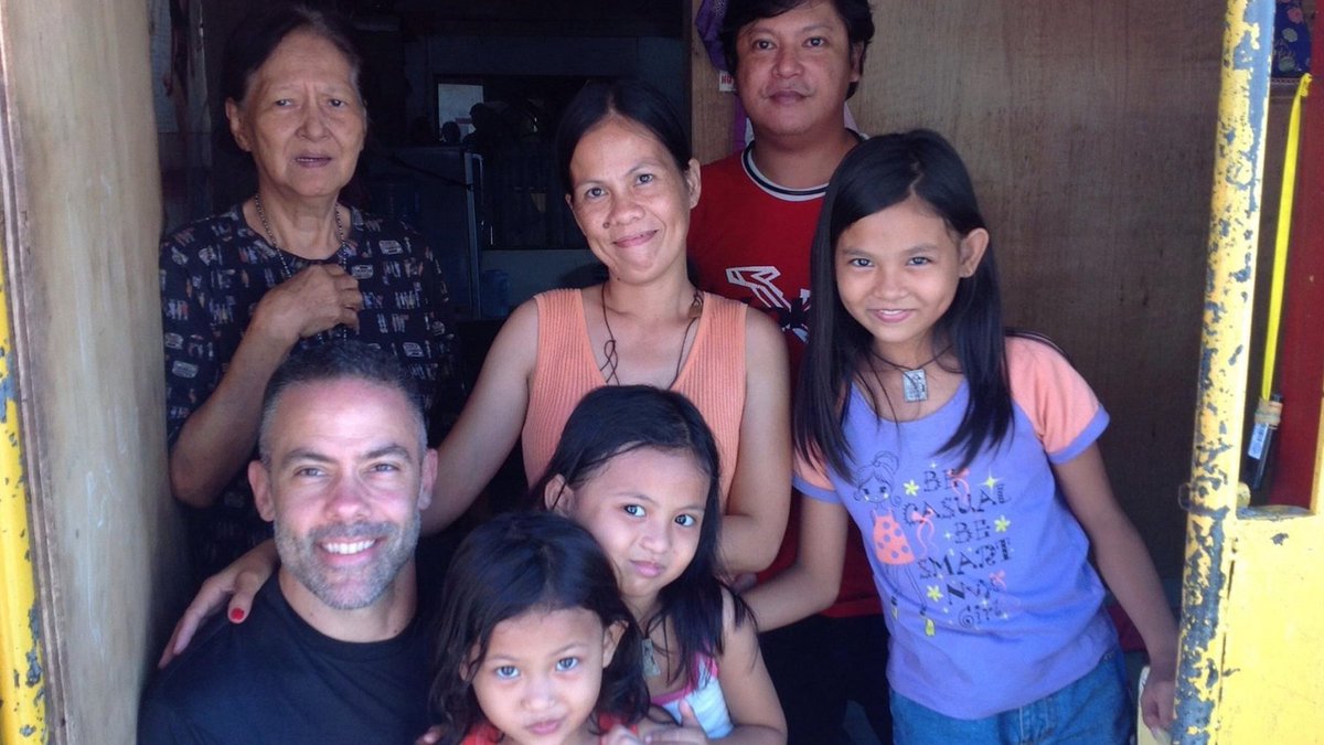
11 years ago today I hunted Cat-5 Super #Typhoon#HAIYAN in Tacloban City #Philippines. Estimated winds of 165 knots make it one of the strongest landfalling cyclones in history. At the top of a narrow bay & in the cyclone's right-front quad, Tacloban City (pop. ~220K) was in the perfect spot for a cataclysmic storm surge. Huge & fast-moving, it swept the entire city like a tsunami. Our hotel went underwater & at a certain point I threw down my camera & jumped into the surge to drag people out. The water was dark & dreadful; I had no idea what was in it. We barely got everyone upstairs in time—but we did, thank God. While @EarthUncutTV & I came out of the rescue effort with little more than scratches, fellow chaser & rescuer Mark Thomas cut his leg so badly he almost lost it. (Days later, doctors in Taiwan were able to save it.) The family pictured here struggled through the surge & made it to the hotel's front gate just before getting swept away. I carried the little girl in purple upstairs. I have zero recollection of doing this—my mind was in a wild, disconnected state, & I only remember random moments, like a dream—so I only know I carried her because James caught it on video. Our hotel was a beacon of good fortune. Every soul within its walls survived while many, many thousands across the city died. I wear my deceased father's high-school ring & never take it off. It slipped off my finger during the rescue effort. But hours after the storm passed, I found the ring in the mud & wreckage—incredibly—glimmering in the dull sunshine. This seemed like magic to me—a tiny flash of goodness in the deep blackness of the aftermath. Dead bodies everywhere. Whole neighborhoods obliterated. The experience rattled me & made my feelings about cyclones more... complex. It's helped to be involved with the recovery, to stay in touch with other survivors, & to occasionally return to where it all happened—trips that have come to feel like sacred pilgrimages. Last year it was especially healing to return for the 10th anniversary—to see the city risen from the ashes & reborn. You never forget a storm like HAIYAN—& you feel a lifelong bond with folks you ride it out with. The little girl in purple is now in college & getting ready for a career in hospitality. ❤️
Guidance still wants the western Caribbean to generate something late next week. As to what that is, where it forms, and where it will go... that's anyone's guess at this time. GFS is having fun with daily Halloween scare scenarios so don't get caught up in that. Euro keeps trying to push later. Much time to watch it. If NHC feels a need to monitor you will see them outlook the area over the weekend or early next week. If not they won't.
The position of the Bermuda High at the start of Novemeber is very important should anything develop in the Caribbean. In some years, a Ridge develops in the Gulf of Mexico, however it doesn't seem so this year. The ridge sets the edge and the rest flows.
Milton has absolutely went bonkers. Now a CAT 4 150mph Major Hurricane. Some models showed a CAT 5 now we might actually see that. Weakening is expected. But how much. Should we even say weakening at this point as it nears Florida. Significant impacts regardless. https://t.co/0EQMEw6Iu0
Does this get shares the way a house in OBX falling into ocean does. I love OBX...love the mountains. We are all One #Carolina ... look at speed & splash of the house, #landslides like an #avalanche but #MUD not snow. thanks for sharing @MrGunSlinger69
.@NOAA's @JPSSProgram satellites captured the upwelling of water and sediment in the eastern Gulf of Mexico after Hurricane #Helene. The first image is from Sept. 24, and the second from Sept. 27, 2024.
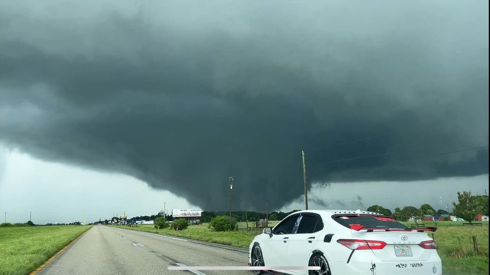
Ominous signs this morning. #HELENE is getting “that look” to it, and a dangerous situation is developing. Some of the computer models remain aggressive with this thing, showing it getting very strong (Cat 4) before landfall.
Three IMPORTANT POINTS for Floridians:
1) Don’t make any assumptions about HELENE based on your experiences with IDALIA & DEBBY—or HERMINE back in 2016. This one is likely to be much more severe. Take it seriously.
2) This hurricane will have huge wind field. Huge wind fields mean higher storm surges across wider areas. For this reason, much of W coast of Florida will see dangerous tide heights—including places well E of landfall point that are well outside direct hit zone. Some communities that escape extreme winds may still see dangerous & destructive surges.
3) HELENE will be moving fast as it comes in. This means it’ll bring hurricane winds well inland—much further inland than a typical hurricane. On current forecast track, for example, Tallahassee will get pounded by destructive winds. Be ready.
Finally… This is a fast-evolving situation. Stay up on the latest, and if you’re in the Hurricane Warning zone, PREPARE TODAY (Wednesday) & try to have your preparations completed by nightfall.
Most concerning is how aggressive GFS has gotten with potential #Hurricane HELENE today. The 12Z ensemble run shows many scenarios with an intense hurricane coming ashore—with many sub-950-mb members & even one sub-930 mb member (which would be a bad thing).