🚨 Now Hiring in Wisconsin! 🚨
Are you looking for a career where science meets the outdoors? The USGS Upper Midwest Water Science Center is hiring a GS-7 Hydrologic Technician to help collect water data that keeps our region informed and prepared.
The Hydrologic Technician will collect streamflow, groundwater, and water‑quality measurements in the field and manage instrumentation and data.
📍 Duty location: Madison, WI
📅 Apply by August 14, 2026 (11:59 p.m. ET)
Apply via USAJobs:
https://t.co/vntYnc4Yf1
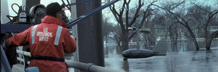
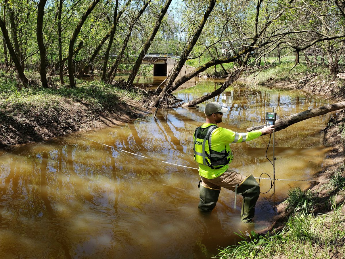
📸: A USGS Upper Midwest Water Science Center Hydrologic Technician monitors streamflow data transmitted from an acoustic Doppler current profiler. Credit: USGS
#MadisonWI #WaterScience #STEMCareers
Monitoring PFAS in Milwaukee's waterways 🌊🧪
PFAS (Per- and Polyfluoroalkyl Substances, aka "forever chemicals") are a group of human-made compounds that have been widely used in consumer products and industrial applications for decades. Because they can persist in the environment, understanding where they occur and how concentrations change over time is an important part of protecting our water resources.
Each year, scientists with the U.S. Geological Survey (USGS), in cooperation with the Milwaukee Metropolitan Sewerage District (MMSD) collect water and sediment samples from 22 stream sites and three estuary sites throughout the Milwaukee, WI area as part of an annual PFAS monitoring effort.
This monitoring effort includes:
💧 Water sampling – Collecting water samples to monitor PFAS concentrations in streams and estuaries throughout the Milwaukee area.
🏞️ Sediment sampling – Analyzing streambed and estuary sediments to better understand where PFAS are present in the aquatic environment.
📍 25 monitoring sites – Sampling 22 stream sites and 3 estuary sites each year to provide a consistent picture of PFAS across the region.
📊 Annual environmental monitoring – Conducting routine sampling to monitor PFAS concentrations over time and provide resource managers with high-quality scientific data.
Working together, USGS and MMSD are helping build the scientific understanding needed to inform water-resource management and protect the Milwaukee region's waterways.
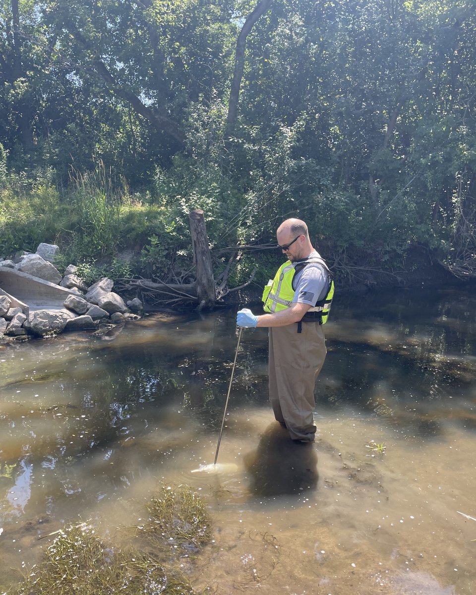
📸 1: A USGS scientist collects water from Root River in Greendale. This sample will be analyzed for PFAS to provide information on its occurrence in the aquatic environment and to support ongoing annual monitoring. Photo by Kathryn Morgan, USGS.
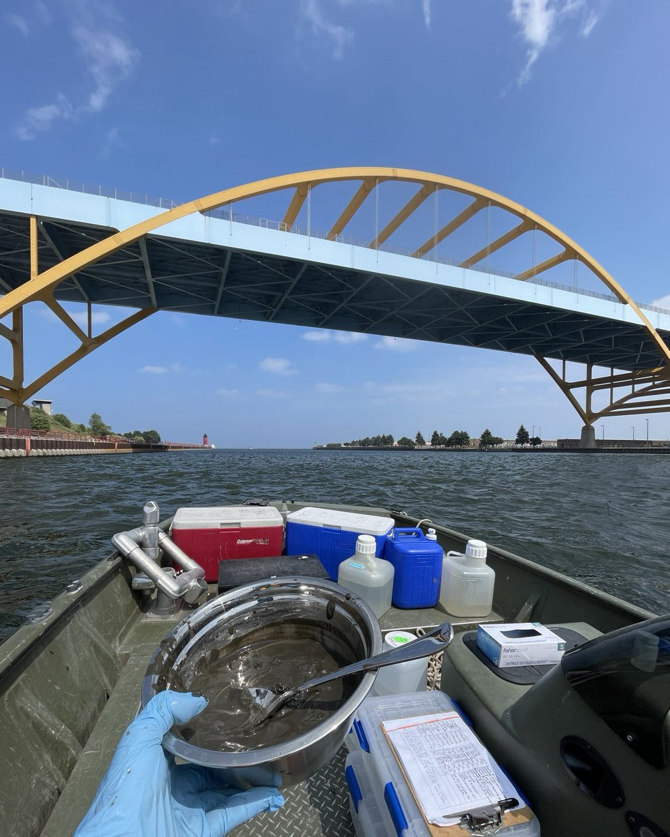
📸 2: A USGS scientist holds up a bowl of homogenized sediment collected at the mouth of the Milwaukee River, near the Hoan Bridge. Annual sampling helps document environmental concentrations of PFAS in streams and estuaries across the Milwaukee area. Photo by James Romano, USGS.
📸 3: A USGS scientist holds up a water sample from Honey Creek in Wauwatosa as part of annual monitoring for PFAS. Water and sediment samples are collected from surface waters across the Milwaukee area to help monitor environmental concentrations. Photo by James Romano, USGS.
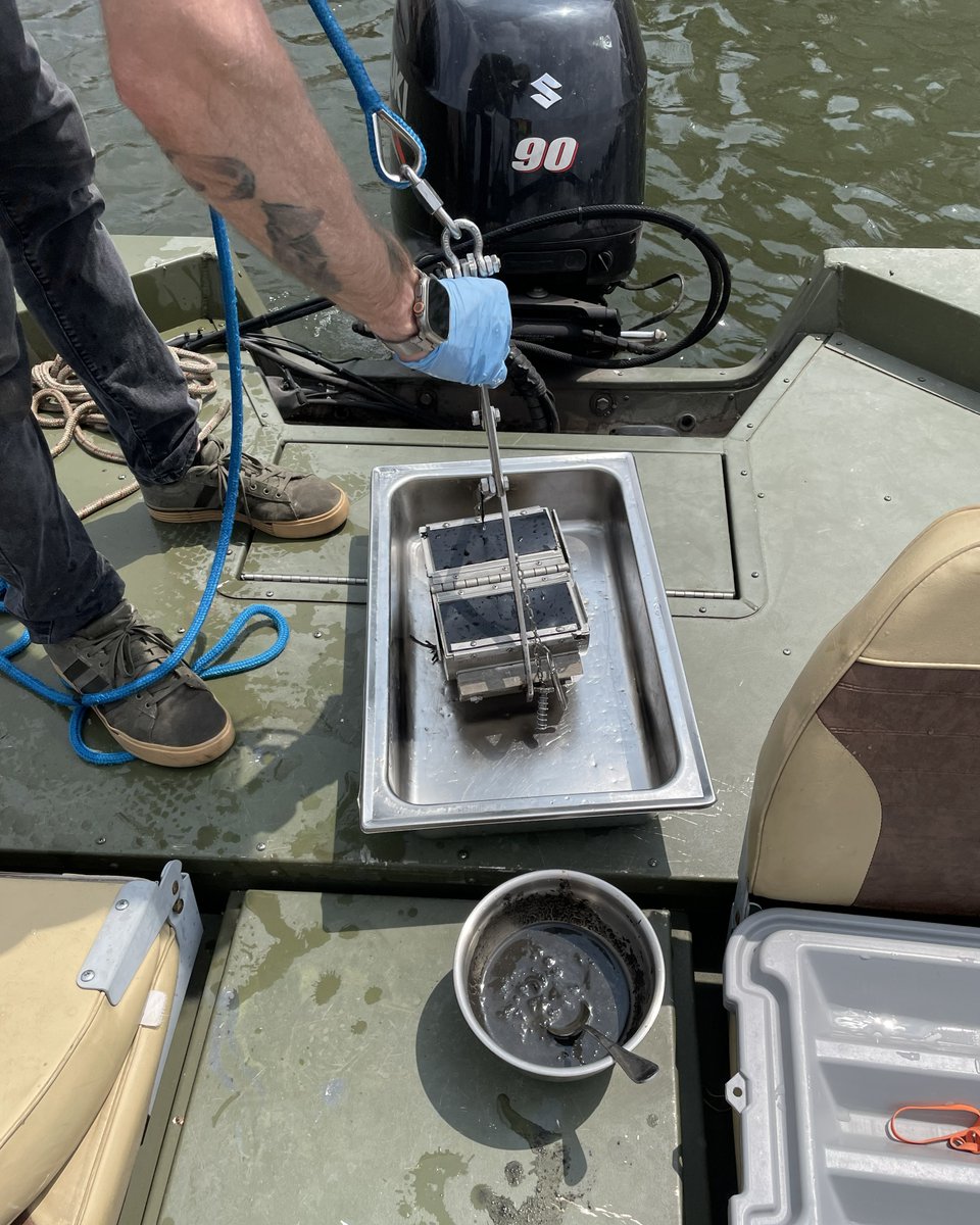
📸 4: A USGS scientist sets down a Petite Ponar sampler containing sediment from the Milwaukee River estuary. This sediment will be analyzed for PFAS as part of an annual monitoring effort that helps characterize environmental concentrations. Photo by James Romano, USGS.
@MMSD_MKE
#WaterScienceWednesday #WaterQuality #PFAS
Understanding harmful algal blooms starts with getting your boots wet! Our team is back on Lake Superior for a second season of research for the Mixing Zones Harmful Algal Blooms project.
This June, our team collaborated with the Lake Superior National Estuarine Research Reserve, Rensselaer Polytechnic Institute, and the Burke Center for Ecosystem Research for hands-on training ahead of a busy field season.
From June through October, we're sampling in the St. Louis River Estuary (Superior, WI) and Siskiwit Harbor (Cornucopia, WI) to track changes in cyanobacteria populations and better understand their potential to produce toxins.
This kind of long-term, on-the-ground monitoring helps communities and resource managers spot harmful blooms early, protecting drinking water, fisheries, and everyone who relies on the Great Lakes.
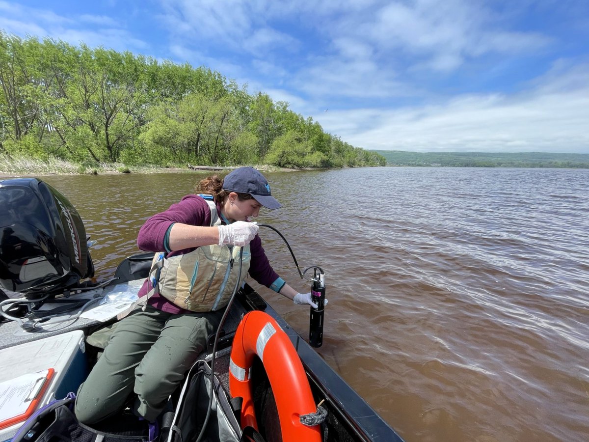
📸 1: Olive Stern of Rensselaer Polytechnic Institute takes a measurement of pH, specific conductance, dissolved oxygen, and turbidity at Clough Island.
📸 2: Addi Knoll of the Lake Superior Reserve captains the boat to Clough Island and Pat Perner of USGS leads the training in sampling methods at this site.
📸 3: Graduate student Olive Stern of Rensselaer Polytechnic Institute and Pat Perner of USGS collect water samples at Allouez Bay in the St. Louis River Estuary.
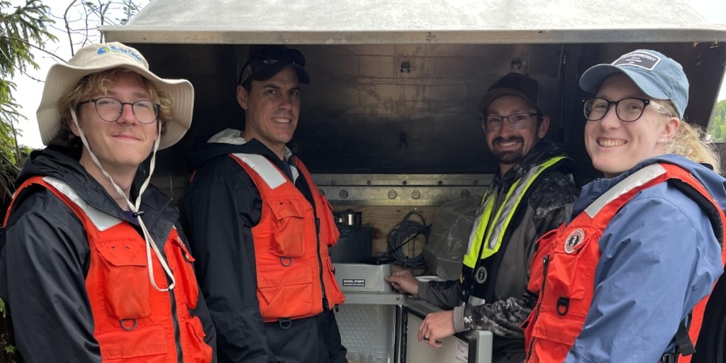
📸 4: Pat Perner of USGS demonstrates the programing of our ISCO autosampler to collaborators Matt Hudson, Rachel Ottinger, and Jack Frame from Burke Center for Ecosystem Research at Siskiwit Harbor in Cornucopia, WI.
Credit: Anna Baker, USGS.
@LSNERR@RPI@BurkeCenterEco
#WaterScienceWednesday #LakeSuperior #HABs
Upper Midwest Water Science Center scientists, working with the National Park Service (NPS), have launched a three‑year study to track waterborne pathogens, identify contamination sources, and assess illness risk in Pipestone Creek at Pipestone National Monument.
By combining pathogen measurements with fecal source tracking, the project will guide NPS management decisions to protect human health and support watershed actions to address contamination.
Learn more: https://t.co/vfFf4KNtka
📸: USGS Biologist and Principal Investigator Joel Stokdyk (left) and Physical Scientist Aaron Firnstahl (right) visited Pipestone National Monument in April 2026 to meet with NPS partners.
#WaterScienceWednesday #PipestoneNationalMonument #PipestoneCreek
The Spring 2026 Great Waters Newsletter is here!
Dive into the latest issue from the Upper Midwest Water Science Center, featuring:
🌊 A look at the historic April floods in Michigan and Wisconsin
🚁 Information on low‑level flights mapping geology and aquifers in Michigan
📹 A milestone of the 1,000th active HIVIS webcam monitoring real‑time water conditions
📈 New research on cyanotoxin detection, stream temperature trends, and flood‑warning sensor networks
🌳Field stories, community connections, conferences, and more
To learn more about our USGS work across Michigan, Minnesota and Wisconsin, this issue is packed with features to explore.
👉 Read the newsletter: https://t.co/OxvYvivMS0
📸: A hydrologic technician takes a streamflow measurement of the Manistique River during a flood event in April.
#UpperMidwestGreatWaters #Newsletter #WaterScience
📣Attention university students and recent graduates! Are you interested in joining USGS scientists this summer to survey America's water resources?
The Upper Midwest Water Science Center, in partnership with the Oak Ridge Institute for Science and Education (ORISE) Program, is offering three new summer research participation program opportunities for recent graduates and current students interested in gaining hands‑on experience in environmental science.
Participants will train alongside USGS chemists, microbiologists, and hydrologists while contributing to active research projects. They will engage in both fieldwork and laboratory analysis, gaining practical experience with USGS scientific methods and mission‑driven research.
This summer research program is funded by ORISE and is not considered federal employment.
Projects and locations include:
🧬 Environmental DNA for wildlife monitoring — Lansing, Michigan
♻️ Microplastics in groundwater — Madison, Wisconsin
🌊 Stream and river ecology assessment — Milwaukee, Wisconsin
To be eligible, applicants must have completed a Bachelor’s or Master’s degree within the past four years or expect to receive their degree by June 1, 2029.
Anticipated start date: June 15, 2026
Learn more and apply for the positions: https://t.co/kldbLlPofi
📸: Two USGS scientists collect a sediment core from a river.
Earth Day 2026 at the USGS Eastern Ecological Science Center (EESC) was a celebration of science, discovery and community connection. 🌎🔬
EESC hosted a free, family‑friendly Earth Day open house at their Kearneysville, West Virginia campus on Saturday, April 26.
More than 345 attendees explored 23 research-driven exhibits and connected through two welcome tables, supported by 70 dedicated USGS volunteers who helped translate ecological science into hands‑on discovery.
Families learned about bugs, birds, and fish, saw live animals, participated in crafts, and engaged directly with scientists studying the ecosystems of the eastern United States.
USGS also hosted three external exhibitors at the event, each contributing specialized scientific expertise:
🐻 US Fish and Wildlife Service National Conservation Training Center
🌱 US Department of Agriculture
🐟 West Virginia Department of Environmental Protection Mobile Aquarium
Together, these partners helped visitors explore the science behind species conservation, watershed health, and ecosystem resilience.
Lauren Privette, an Upper Midwest Water Science Center Geographer from the Web Informatics and Mapping (WIM) team, volunteered at the event.
📸1: USGS scientists Shonte Jenkins and Julien Martin greet Earth Day event attendees at the USGS booth.
📸2: USGS Upper Midwest Water Science Center Geographer Lauren Privette from the Web Informatics and Mapping (WIM) team runs the Bird Bingo activity at Earth Day.
📸3: Young Earth Day attendee watches a Lesser Scaup diving in a mobile tank. EESC uses Lesser Scaup and other diving ducks to conduct hearing studies.
📸4: An Earth Day attendee gets an up-close look at bee specimens from the USGS Bee Lab.
#EarthDay #TBT
USGS biologists Alexei Rose and Jeanette Cruz from the Michigan Bacteriological Research Laboratory (MI‑BaRL) recently partnered with the M3 Research Laboratory in Madison, Wisconsin to advance methods for detecting cyanotoxins in aquatic plants.🦠🪴
Cyanotoxins, which are produced by certain blue‑green algae during harmful algal blooms (HABs), can pose health risks to wildlife, pets, and people. To help tribes and resource managers better understand potential exposure risk, the team tested three extraction methods using cattails, a common Wisconsin aquatic plant, as a surrogate for wild rice (Manoomin).
By studying how plants absorb, concentrate and store cyanotoxins in different tissues, this research supports communities that harvest and eat wild rice or other plants from waters affected by HABs.
After extraction, samples were analyzed at MI‑BaRL using enzyme linked immunosorbent assay (ELISA) techniques to measure four key cyanotoxins: microcystin, anatoxin, saxitoxin, and cylindrospermopsin.
This work is part of a three-year study, “Influence of Headwaters Harmful Algal Blooms on Wild Rice and Downstream St. Croix River” in cooperation with the Wisconsin Department of Natural Resources (WDNR).
Findings will be published later this year. Stay tuned for more USGS science in action!
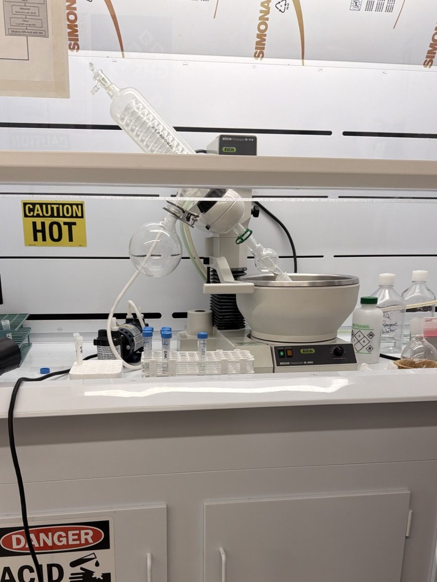
📸 1: Rotary evaporation system used to evaporate methanol from plant extracts, concentrating the sample so crystals containing cyanotoxins can form on the glassware.
📸 2: The rotary evaporation system set up in the laboratory.
📸 3: A closeup of crystals containing extracted cyanotoxins forming on the glassware during
the extraction process. The crystals are then resuspended and added to a sterile tube.
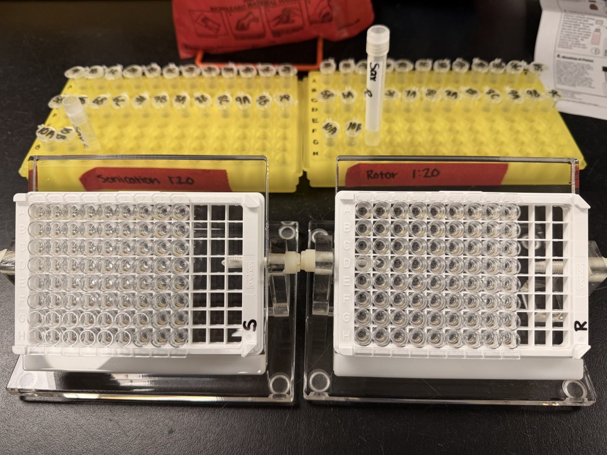
📸 4: Enzyme-linked immunosorbent assay (ELISA) plates prepared for cyanotoxin analysis, with labeled sample tubes in the background. ELISA is a laboratory technique used to detect and quantify specific antibodies, antigens, proteins, or hormones in biological samples.
All photos by Alexei Rose, USGS.
@WDNR
#HarmfulAlgalBlooms #Cyanotoxins #Biochemistry
Flooding footage from the field!
Last weekend, hydrologic technicians from the Upper Midwest Water Science Center responded to historic flooding across Wisconsin.
Field crews were deployed to respond to changing conditions, working efficiently to collect USGS water data as flood waters rose in our communities.
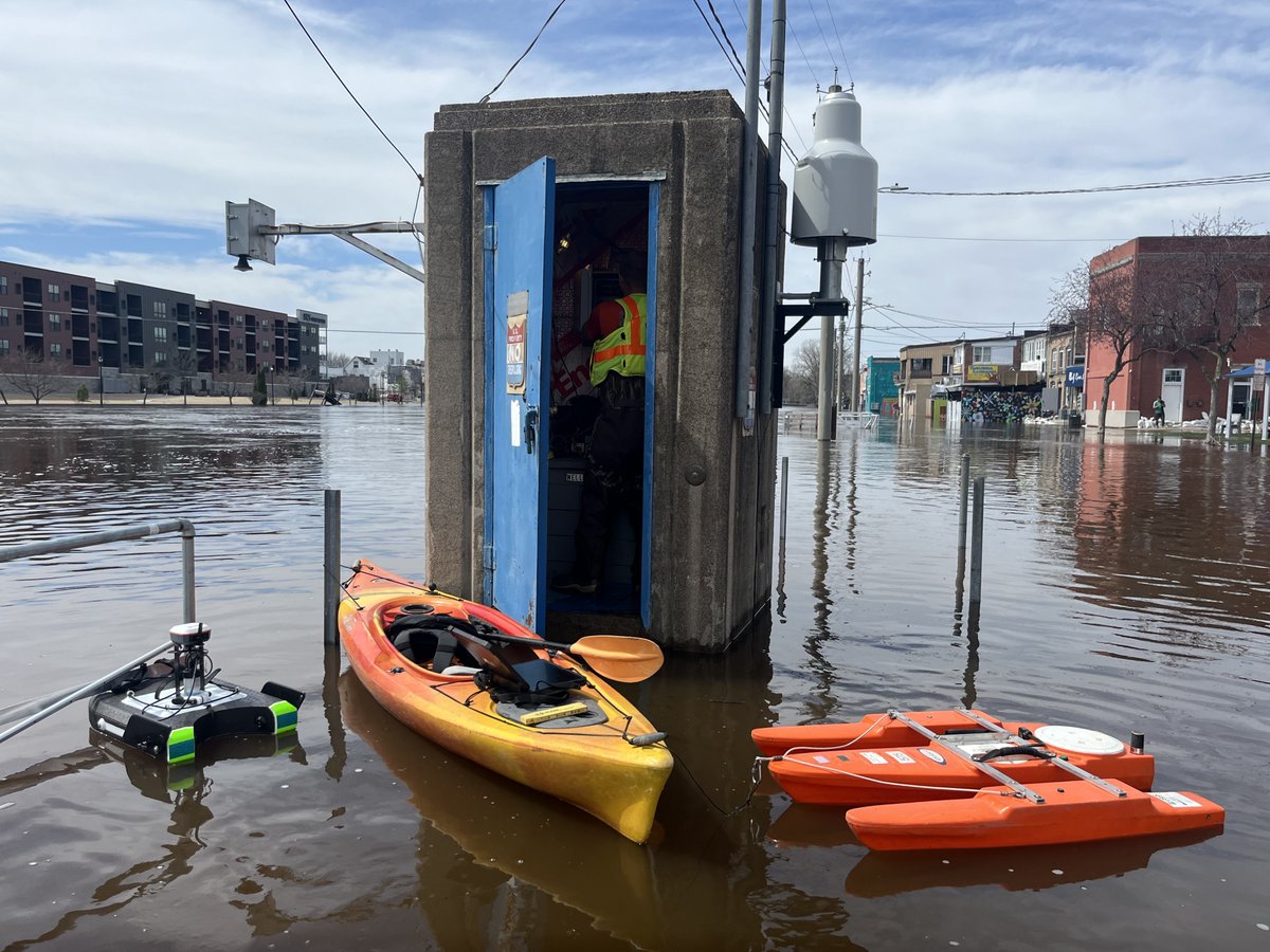
In these photos, a crew from the USGS Green Bay and Rhinelander offices visited the Wolf River at New London, where one of Wisconsin’s oldest streamgages recorded a new all‑time high: 12.12 feet on April 18, 2026.
See real‑time data from this streamgage: https://t.co/ewBfsUVibe
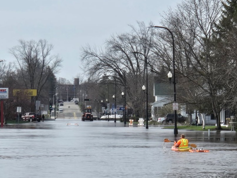
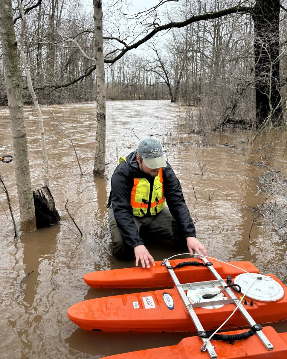
📸 1: USGS hydrologic technician Jarvis Kaderlik paddles a kayak down Shawano Street (Highway 45) in New London, Wisconsin, towing an acoustic Doppler current profiler (ADCP), measuring stream overflow that bypassed the stream gage in the main channel.
📸 2: USGS hydrologic technician Scott Hagar services the streamgage, reads sensors and compares data to outside reference points to verify accurate gage height data.
📸 3: Scott Hagar performs a moving bed test using an ADCP on the main channel of the Wolf River off of the Shawano Street bridge.
📸 4: Graph from the USGS National Water Dashboard featuring data from the Wolf River at New London, showing major flood stage and peak gage height in feet.
#FieldPhotoFriday #Wisconsin #Flood
Happy Earth Day from the Upper Midwest Water Science Center! 🌎
Clean, reliable water is essential for healthy ecosystems and resilient communities across the Upper Midwest.
Our scientists monitor rivers, lakes, wetlands, groundwater, and water quality to better understand how our environment is changing, and how we can protect it for future generations.
From tracking nutrients in streams to mapping chemical transport in groundwater to studying contaminants that affect aquatic life, our work provides the data needed to make informed decisions about water resources across our region.
Today and every day, we’re committed to advancing water science that supports people, wildlife, and the landscapes we all depend on. 💧🌱
📸: An acoustic Doppler current profiler (ADCP) rests near the foggy shoreline of a lake on an early summer morning.
#EarthDay #WaterScienceWednesday
As flooding hits the Great Lakes, USGS water is there.
USGS crews from the Upper Midwest Water Science Center responded to flooding as days of prolonged rain hit WI and MI.
View near real-time streamgage status and weather: https://t.co/ERBt9Pvf4t
📷: USGS hydrologic technician prepares to measure streamflow on the flooded Duck Creek in Howard, Wisconsin with an acoustic Doppler current profiler (ADCP). Photo by Matt Bach, USGS.
@usgs_umid
#Flood #WI #MI
Heads up, southwest Michigan! 🚁
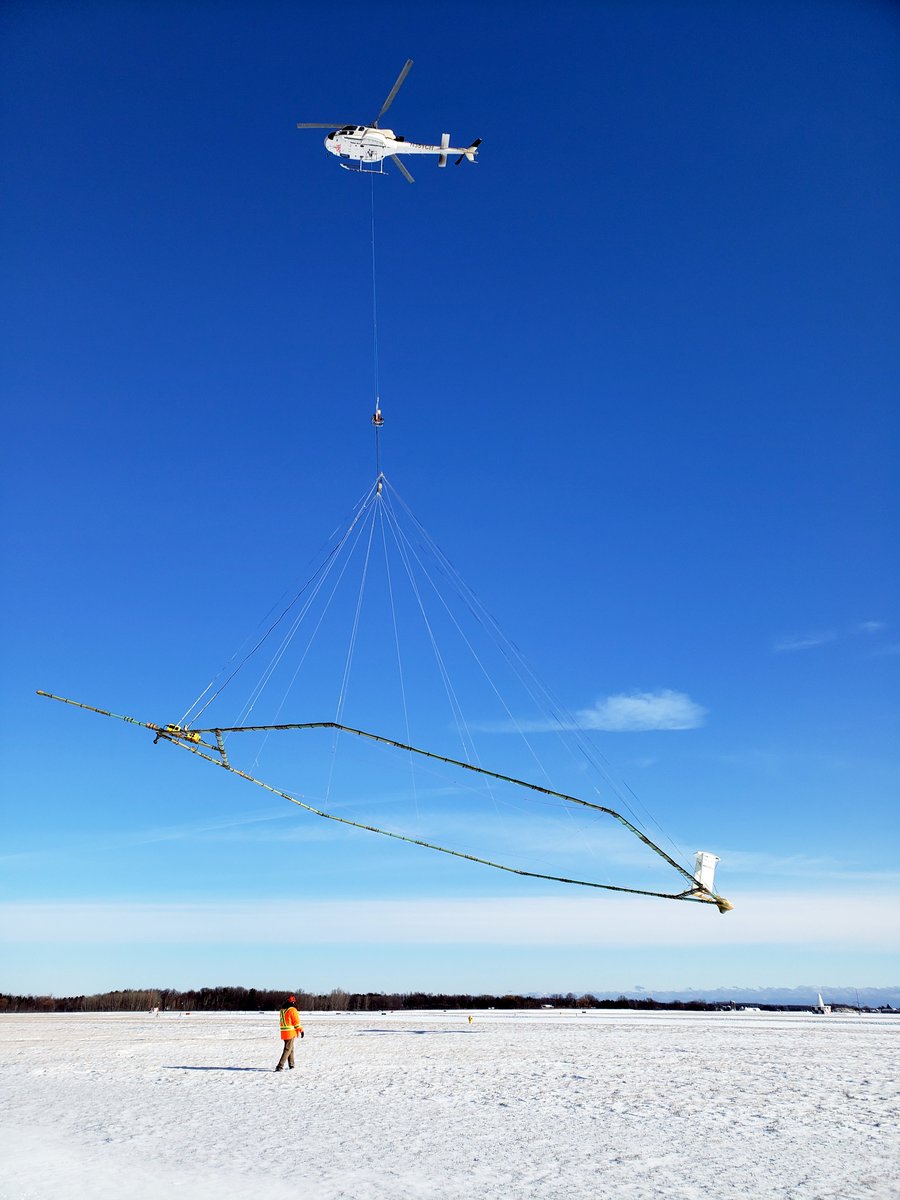
Starting in April 2026 and lasting over the span of four months, a helicopter towing a large hoop from a cable will make low-level flights to enhance understanding of groundwater resources.
https://t.co/sVbE0Z2xug
@MichiganEGLE#Michigan
📣Job Announcement
The USGS is hiring a Hydrologic Technician (Field Assistant) (GG 5) to work at the Upper Midwest Water Science Center.
This position's duties include:
✅Collect surface water, groundwater, and water quality data from gaging stations, wells, and monitoring sites using established hydrologic methods.
✅Perform laboratory analyses of water samples to determine sediment, chemical, biological, and physical characteristics.
✅Operate and maintain hydrologic measurement and recording instruments, ensuring accurate setup, servicing, and data capture.
📍Grand Rapids, MN
📍Green Bay, WI
📍Lansing, MI
📍Madison, WI
📅 Open March 31 – April 6, 2026
Learn more and apply: https://t.co/T3gSpFNsdj
📷: Two Hydrologic Technicians measure water level of a Minnesota stream.
🌊 Mapping the future of Milwaukee Harbor's estuary
The USGS and Milwaukee Metropolitan Sewerage District are teaming up to better understand, map, and evaluate physical habitat in the Milwaukee Harbor Estuary.
This effort will help shape long‑term habitat restoration strategies for the Great Lakes Areas of Concern.
🔍 What We’re Doing
The study focuses on the dynamic mixing zone where river and lake meet. This is an area shaped by shifting river flows, seiche-driven currents, and fluctuating lake levels.
The team is integrating detailed topographic and bathymetric data for the Milwaukee Harbor and three tributaries with Milwaukee Harbor water level data.
📊 Why It Matters
This framework will guide future restoration, support Great Lakes ecological indicators, and ensure new data is openly available through USGS ScienceBase.
🔄 Milwaukee Harbor’s estuary is constantly changing, and our research gives us the tools to understand it now and in the future.
Learn more: https://t.co/p9zLFPYcit
📸: Modern Milwaukee skyline with the Milwaukee Art Museum's white, wing-like brise soleil prominently displayed on the Milwaukee Harbor.
@MMSD_MKE
#WaterScience #Milwaukee #Estuary
📣Job Announcement
The USGS is hiring a Hydrologic Technician (Field Assistant) to work at the Upper Midwest Water Science Center.
This position's duties include:
✅Collect surface water, groundwater, and water quality data from gaging stations, wells, and monitoring sites using established hydrologic methods.
✅Perform laboratory analyses of water samples to determine sediment, chemical, biological, and physical characteristics.
✅Operate and maintain hydrologic measurement and recording instruments, ensuring accurate setup, servicing, and data capture.
This is a temporary excepted service position not-to-exceed one year but may be extended without further competition. Employment may not exceed 1,039 hours in a service year.
📍Gladstone, MI
📍Lansing, MI
📍Mounds View, MN
📍Madison, WI
📅 Open March 26 – April 2, 2026
Learn more and apply: https://t.co/yHXbAWLmgL
📷: A Hydrologic Technician measures spring discharge at a Wisconsin creek.
Restoration efforts along Underwood Creek in Milwaukee County, Wisconsin are paying off for local fish communities, highlighted in a new USGS publication in cooperation with @MMSD_MKE. 🌿
🌊 Four reconstructed stream reaches were surveyed in April 2021, revealing 25 fish species thriving in the improved habitat. Reach D, one of the newest restored sections, stood out with 14 species and 391 individual fish.
🐟 White suckers were found in three of the four reaches, meeting a key restoration goal. While young northern pike weren’t observed this time, spawning steelhead were spotted, showing that the creek now supports passage and habitat for migratory fish.
Learn more: https://t.co/FhUba6wxcS
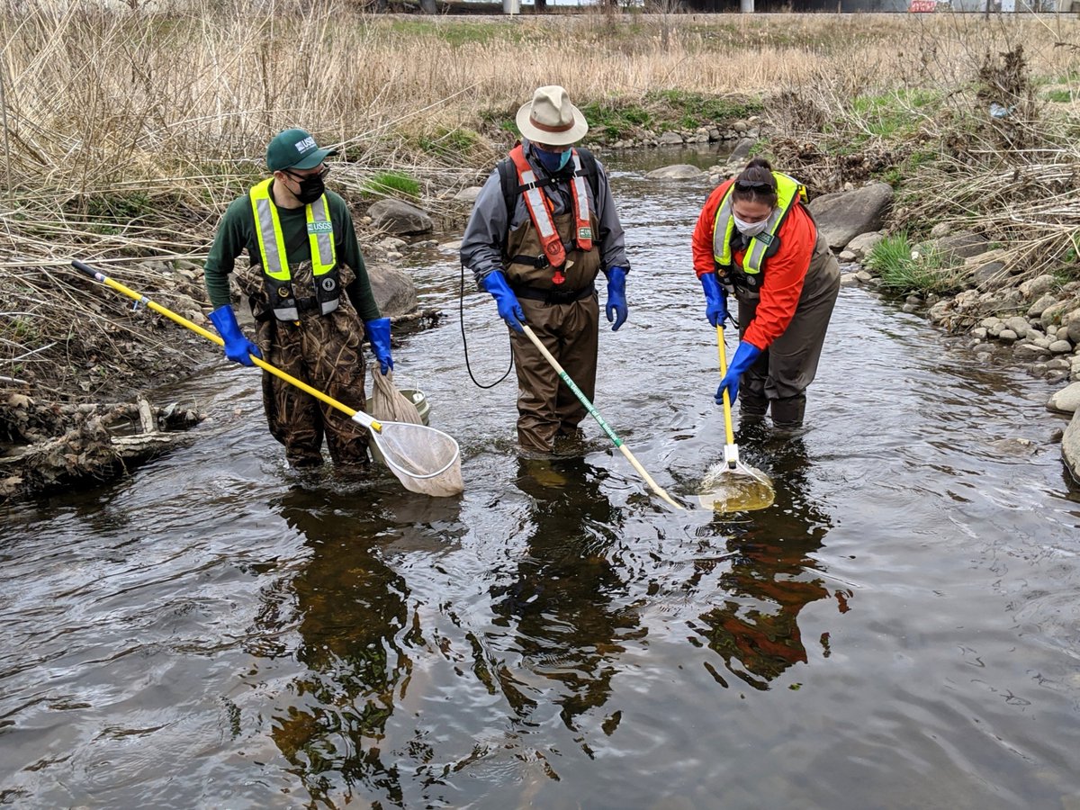
📸 1: Three USGS scientists electrofishing with a backpack shocker at Underwood Creek at Wauwatosa, Wisconsin in April, 2021. Electrofishing momentarily stuns the fish with an electrical shock; they are netted, identified, and measured, then released alive to the stream as quickly as possible to reduce any stress. The shock does not harm the fish and does not cause lasting effects.
📸 2: A scientist identifies a white sucker (Catostomus commersonii)
📸 3: A scientist measures a brook trout (Salvelinus fontinalis)
📸 4: A steelhead trout in a net (Oncorhynchus mykiss)
#WaterScienceWednesday #UnderwoodCreek #Fishing
Forgot it was St. Patrick’s Day… wore green anyway.
USGS hydrotech life means our “holiday outfit” is just our everyday gear.
When your closet is full of USGS‑green T‑shirts and hats, bright green safety vests and PFDs that could double as high‑visibility shamrocks, you end up looking festive without even trying!
Learn more: https://t.co/gKm3t182i2
📸: A USGS scientist paddles a canoe during a research trip on the Namekagon River in Wisconsin while scouting sites to deploy a passive sampling device as part of a joint USGS-NPS water quality project.
#StPatricksDay #Hydrotech #WaterData
A recent publication highlights research using 30 years of USGS data from thousands of wells across agricultural, urban, and domestic areas.
About 50% of the world’s population relies on groundwater for drinking. New long‑term assessments show that naturally occurring “geogenic” contaminants are becoming more common in United States aquifers.
Researchers found:
💧Many contaminants show rising concentration trends, even when overall changes aren’t statistically significant.
💧Lithium, sodium, radium, sulfate, and uranium increased in more than 10% of the study networks.
💧Urban and domestic wells saw more increases in lithium and sodium.
💧Manganese rose most often in domestic wells, while uranium increased more in agricultural and urban wells.
💧Complex mixtures of elevated contaminants are becoming more widespread over time.
The study estimates that over 2.3 million people using domestic wells may be exposed to elevated levels of one or more geogenic constituents.
Although this assessment provides an unprecedented national-scale perspective, it encompasses results for only a small portion of domestic well users nationwide. Nevertheless, these results provide valuable information to inform further national-scale study as well as local assessments because results indicate that millions of domestic well users are potentially using groundwater resources with elevated geogenic constituent concentrations.
Learn more: https://t.co/6FygqprrIQ
📸: A USGS scientist takes measurements of groundwater quality from a monitoring well near Zimmerman, Minnesota
#GroundwaterAwarenessWeek #GWAW26 #Groundwater
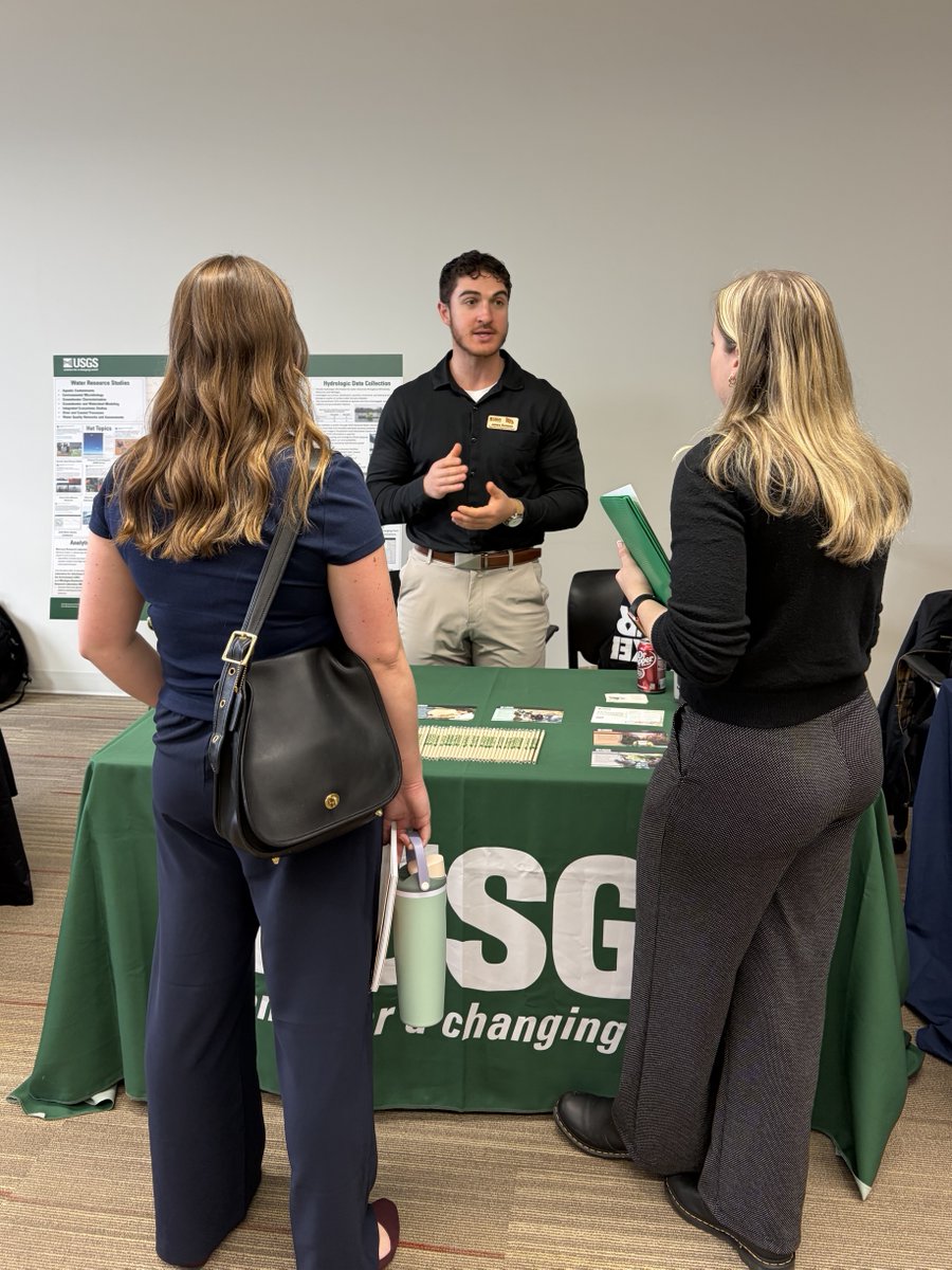
Last week Physical Scientist James Romano and Hydrologist Hailey Trompeter represented the USGS at the University of Wisconsin-Milwaukee School of Freshwater Sciences Career and Networking Fair.
James and Hailey spoke with students about career paths at the USGS, shared insights from their research and field work, and highlighted the many ways USGS science supports natural resources in communities across the Nation.
📸: Physical Scientist James Romano speaks with students at the University of Wisconsin-Milwaukee School of Freshwater Sciences Career and Networking Fair.
#USGSCareers #Hydrology #FreshwaterScience
Earlier this month members of the Web Informatics and Mapping (WIM) team represented the USGS at a booth at the ESRI Federal GIS Conference in Washington, DC.
USGS Director Ned Mamula even stopped by for a photo!
#FedGIS2026#WebInformaticsAndMapping#TheNationalMap