For much more frequent crowd-sourced road and weather updates, join our Facebook group and interact with over 28,000 members providing real-time personal observations on the road. Please share this with others!
https://t.co/rl3cmhxVip
❄️ Road Weather Alert ❄️
📍WASATCH BACK FORECAST
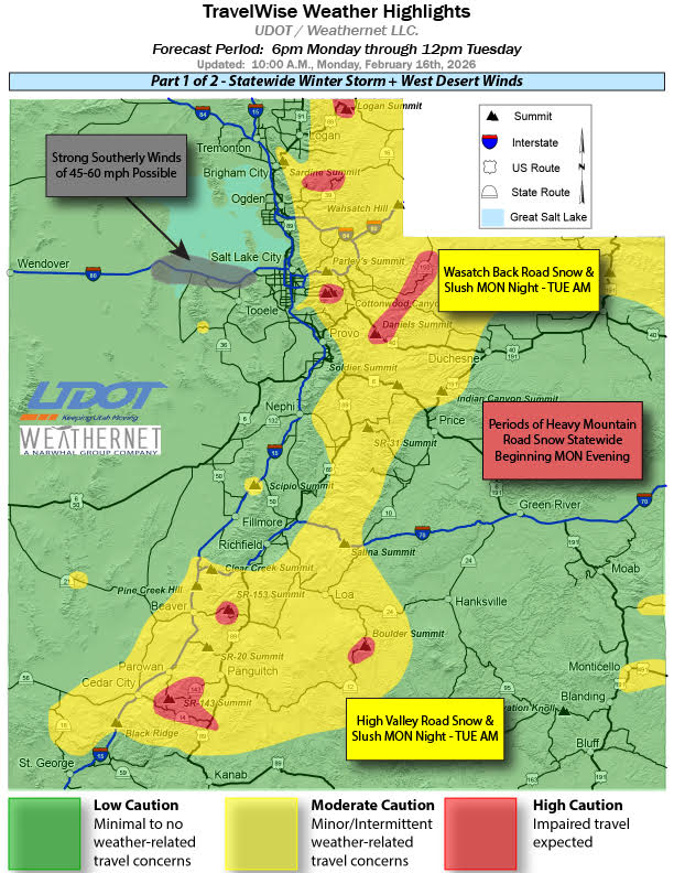
6pm(2/16)-6am(2/17): Rain/snow after 9pm, snow after 12am becoming spottier after 2am. Road snow above Mountain Dell with 1-2" at Parleys Summit toward Park City, 1-3" at Mayflower, 2-4" at Ontario Mine.
A Strong Cold Front Arrives Tonight
Ahead of the front, strong gusty southerly warm winds will blow today. Snow develops after midnight and continues into the morning commute tomorrow. Then snow showers persist through the day.
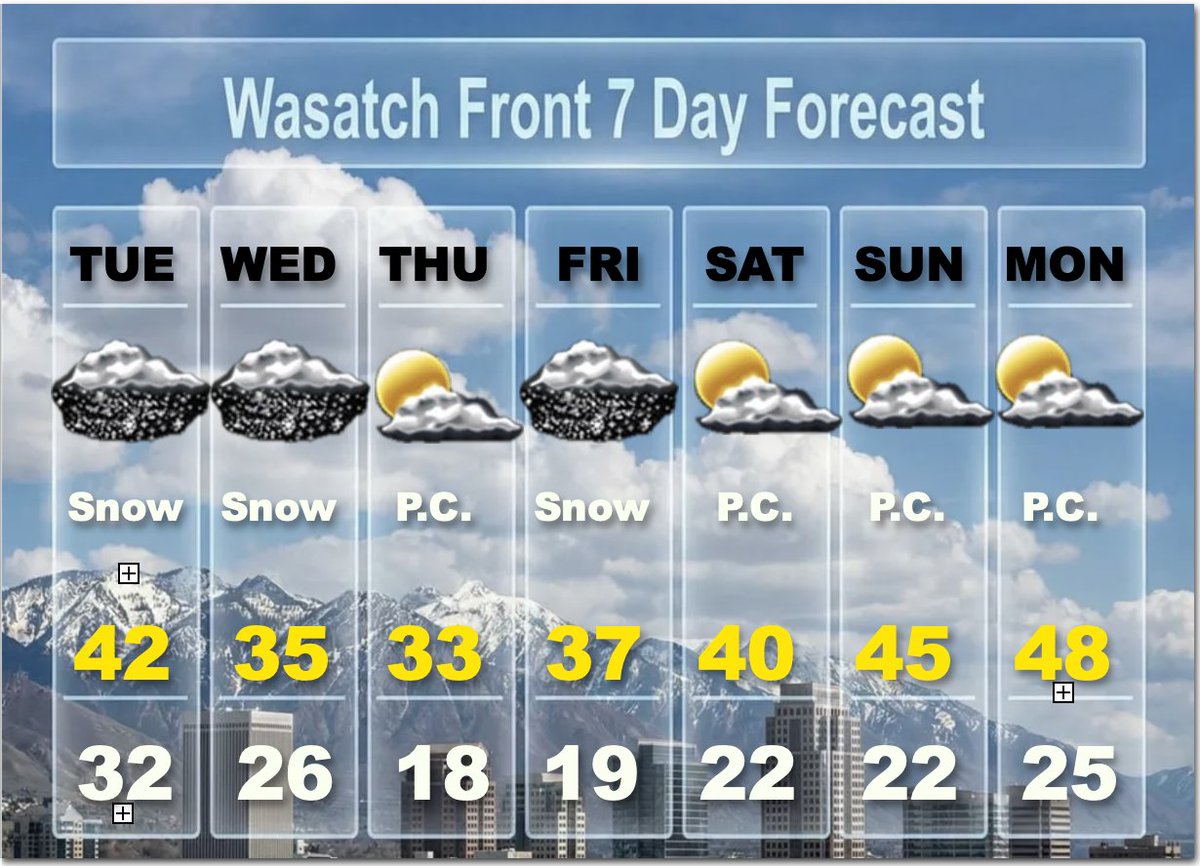
Another strong front hits early Wednesday and continues all day. Travel will be difficult in most of Utah. Two day accumulations will be 2 to 3 feet in the mountains, with locally 4 feet or more in the upper Cottonwoods. Valley's will see 2 to 5 inches and Benche 5 to 10 inches when you add both Tuesday and Wednesday together.
The next weaker storm arrives on Friday, but cold winter temperatures are expected. A slow warming trend is anticipated for this weekend, as skies turn partly cloudy. @weathercaster #utwx
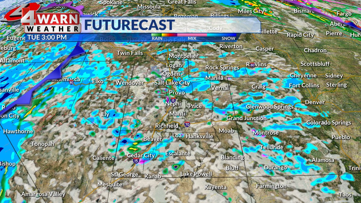
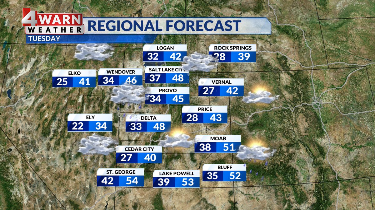
TUESDAY: Showers are expected today with snow levels falling to the Benches while valleys see a rain/snow mix. Temps will be cooler with highs in the 40s for most of the state. By Wednesday it'll cool enough to bring us periods of heavy valley snow!
Good snow in the Southern Mountains right now! This is a live view from Ruby's Inn in Bryce Canyon City, but if you were to look at radar you wouldn't see anything over the southern mountains. that's because it's snowing so hard we've lost conncetion to the dish #utwx
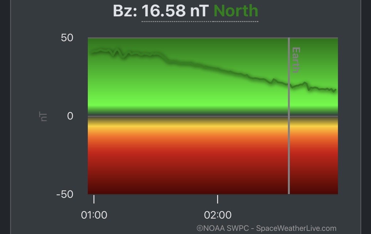
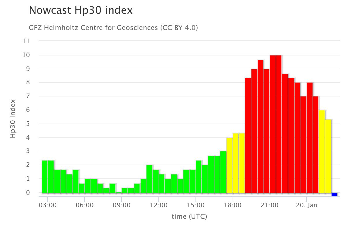
We’d really like to see the Bz – the direction of the magnetic field – flip negative. When it’s negative, it allows the aurora to move southward.
That would mean better viewing and a more impressive show for us here in Northern California.
#CAwx@ABC10
Crash
EB US-6 at 400 N (Utah County) Utah Co.
Right Lane (of 2 Lanes) Blocked, Right Shoulder
Est. Clearance Time: 08:46 PM
For updates:
https://t.co/VgkTUoK33I
So the CME came in like a 105-mph fastball and the batter (Earth’s magnetosphere) was set up swinging in the wrong direction.
No home run aurora.
If the Bz can flip negative… then even a check swing goes over the fences.
👋 I-80 ROAD CONDITIONS
📍I-215 to East Canyon: wet
📍Lambs to Parleys Summit: wet
📍Parleys Summit to Kimball: wet
‼️ BE ALERT: Crews are out. Travel with caution, don’t pass plows.
#DroughtMonitor 1/6: Improvements to large parts of the West. But winter precipitation in the form of rain has led to widespread snow drought.
Degradations: Eastern Rockies, Plains, Midwest, South, East
#Drought2026's Footprint: 37.5% of USA
https://t.co/mljsjQDvLB @NOAA
Crash
NB I-15 to EB I-80 ramp, SLC Salt Lake Co.
Exit Ramp Right Lane Blocked, Right Shoulder
Est. Clearance Time: 09:08 AM
For updates:
https://t.co/nro7j4mZ5h
Crash
SB I-15 MP 335 (S of 650 N, Clearfield) Davis Co.
Right Lane (of 4 Lanes) Blocked, Right Shoulder
Est. Clearance Time: 09:11 AM
For updates:
https://t.co/pgIKcxnkkK
📍 WASATCH BACK FORECAST
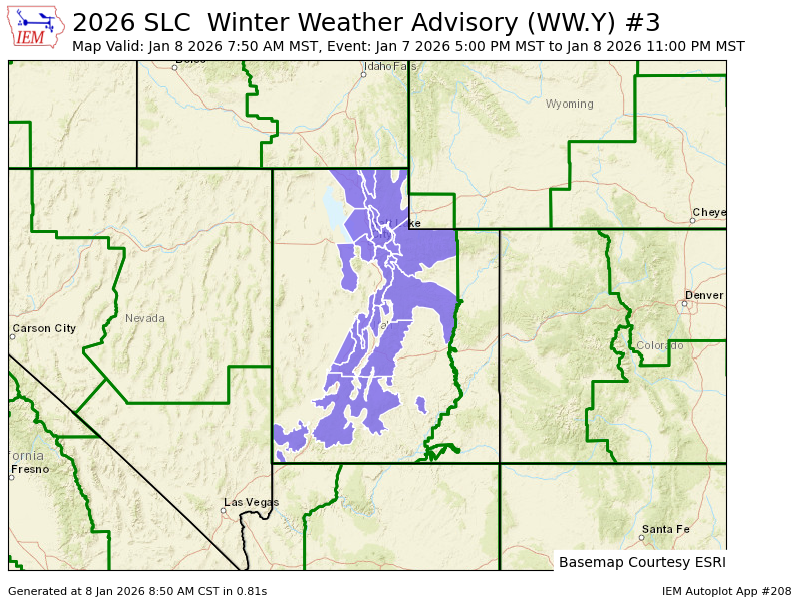
6am-6pm (1/8): Snow continues in AM with another 1-2" road snow at Summit/Mayflower, and 1” lower canyon. Lingering snow until early PM.
6pm (1/8) - 6am (1/9): Likely dry. Icy spots possible as temperatures drop overnight.
SR-190 & SR-210 FORECAST
6am(1/8) - 6pm(1/8): Snow continues through the day w/ another 3-5" road snow expected in upper canyons. Chance of lake effect snow in afternoon could bring another 1” to benches.
6pm(1/8) - 6am(1/9): Chance of lake effect snow continues into evening.
👋 I-80 ROAD CONDITIONS
📍I-215 to East Canyon: wet
📍Lambs to Parleys Summit: slush
📍Parleys Summit to Kimball: slush
BE ALERT: Crews are out. Travel with caution, don’t pass plows.