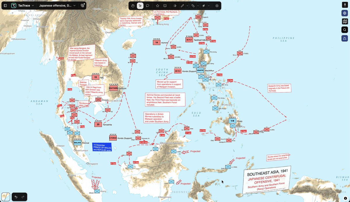
A great thing about trying to recreate the West Point War Atlas maps is that it exposes missing TacTrace functionality. I definitely need better annotation tools and typography controls.
Operation Unified Resolve Bolsters National Security at Southern Border 📈
Soldiers conduct mirrored patrols in Texas: coordinated, parallel patrols with Mexican military that survey side-by-side along the border.
@usnortherncmd@DeptofWar@CBP#ArdentVanguard#UnifiedResolve
"Filled with examples of how the multifaceted nature of civil affairs, and addressing the complex challenges of conflict zones, requires a broad and nuanced approach. Nothing in the book suggests there are simple solutions, but it rejects the fallacy that because counter-insurgency operations are difficult, that we should give up in our attempts. ... 'Warrior Diplomats' is both a practical guide to the theory and practice of integrating civil affairs into operations, and a reminder of the importance of this to all types of operations, including conventional combat." —The British Army Review https://t.co/pgMMzapRv6
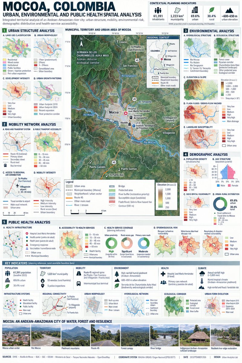
Durante todo este año, he tenido la meta de desarrollar soluciones GIS basadas en prompts aplicadas a la Salud Urbana, la Epidemiología y la Salud Pública.
Mi objetivo principal es ayudar a las personas que no conocen a fondo el territorio que habitan, aprovechando la enorme cantidad de datos abiertos que generan los equipos de georreferenciación, pero que lamentablemente pocos saben utilizar. Aunque todavía me falta camino para perfeccionar esta herramienta, estoy convencida de que democratizar este conocimiento es clave para transformar nuestras comunidades. Muchos contamos con bases de datos GIS inmensas, pero falta capacidad de análisis; a veces cuesta visibilizar que la epidemiología espacial es fundamental para tomar decisiones correctas. Además, todavía hay quienes se quedan atrapados en tablas y gráficos planos, y les cuesta muchísimo creer que la epidemiología espacial es clave para cambiar la realidad.
Pronto dictaré una conferencia sobre este tema, con la firme intención de conectar con personas que crean en este propósito, me ayuden a multiplicar la idea y trabajen por construir territorios cada vez mejores.
Les dejo un ejemplo de Moca en Colombia.
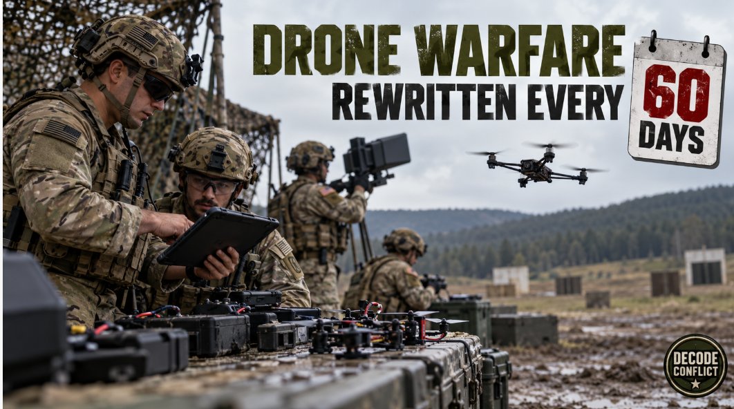
Drone warfare is being rewritten every 60 days
The U.S. Army is updating parts of its drone-warfare curriculum every 60 days.
That extraordinary pace reflects a battlefield where technology can become obsolete before a traditional training manual is approved.
Lessons from Ukraine and the Middle East are moving into American exercises involving FPV drones, electronic warfare and counter-drone systems.
The military that learns fastest may defeat the military with the largest arsenal.
Modern warfare is becoming a continuous software update.
Decode Conflict Assessment
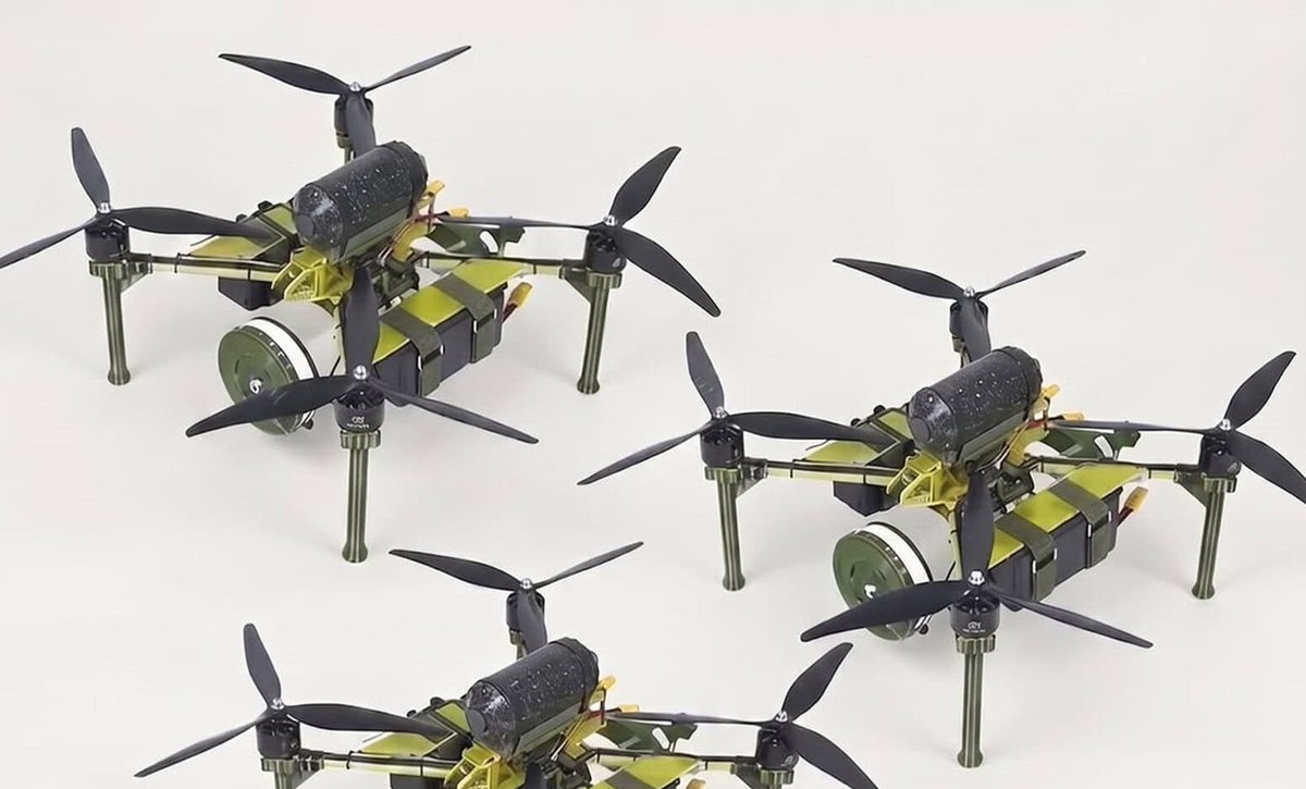
Ukraine’s Ptashka Drones has put microphones and a Multizhdun standby mode on all its FPV airframes, Militarnyi reported.
The firm says a mic can pick up a vehicle on a road from 200 m (656 ft). Multizhdun lets an unlimited number of parked drones sit on one ground station: the operator listens to one in headphones while the others show a volume light.
A 15-O-30km model can wait five hours after landing 25 km (16 miles) out. Photos showed 17-O-50 km types.
Ptashka also supplies the net launcher on Postup’s Scan Horizon C-FPV kit, which mixes acoustic, visual and radar sensors.
#Ptashka #Ukraine #FPV #Multizhdun #DroneWars #Drones
There is training and there is training.
Realism - the drone WILL hit you in the face if you do not shoot it down - brings fear, maximum awareness and deep learning.
Shooting at a paper box, is a starting point,
but it is not 'learning'.
I remember writing my drone book in 2022 and writing about drone repeaters. Now it's happening.
The problem with physical repeater towers is that they are vulnerable to attack and sabotage if you don't control the terrain around them.
Drones you can pop up where you have a radio dark spot and get instant coverage. Gotta shoot the drone down to stop the signal (or jam it). Can't just blow up a tower or shoot the power supply.
Also the fact that it can move makes it harder to DF the source of the signals. A little deception.
Remember Grunts: If it’s not yours, always destroy these ones first.
-they will be protected, so have a layered track back mitigation plan …think “tracers work both ways” but in spectrum
Ahora Google Maps es una BESTIA con la inteligencia artificial.
El 99 % de los usuarios no tiene ni idea.
Aquí tienes 15 funciones de IA que son una locura y que TIENES que ver 👇