⚠️ ALERT: A SEVERE THUNDERSTORM WARNING has been issued for southern Smith County by @NWSJacksonMS until 9:00PM. 70mph wind gusts and penny-sized hail are possible with this storm. SEEK SHELTER IMMEDIATELY!
⚠️ ALERT: A TORNADO WATCH has been issued for Smith County by @NWSJacksonMS until 10:00PM CDT. Several tornadoes are likely, plus scattered hail up to 2-inch size and wind gusts to 75mph are possible. Secure outdoor property and remain alert for warnings!
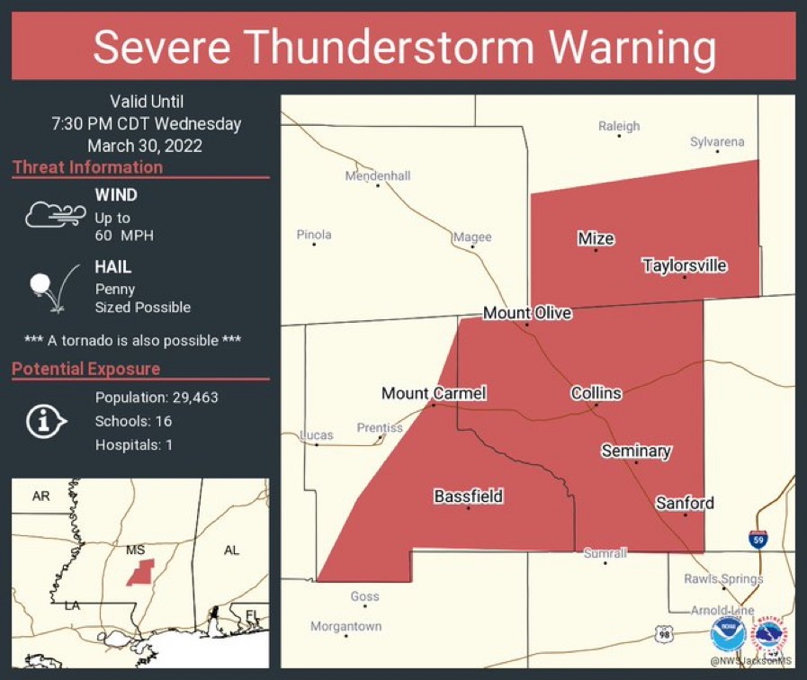
⚠️ ALERT: A SEVERE THUNDERSTORM WARNING has been issued for southern Smith County by @NWSJacksonMS until 7:30PM CDT. Wind gusts to 60mph and penny-sized hail are possible with this storm. A TORNADO IS ALSO POSSIBLE. SEEK SHELTER NOW!
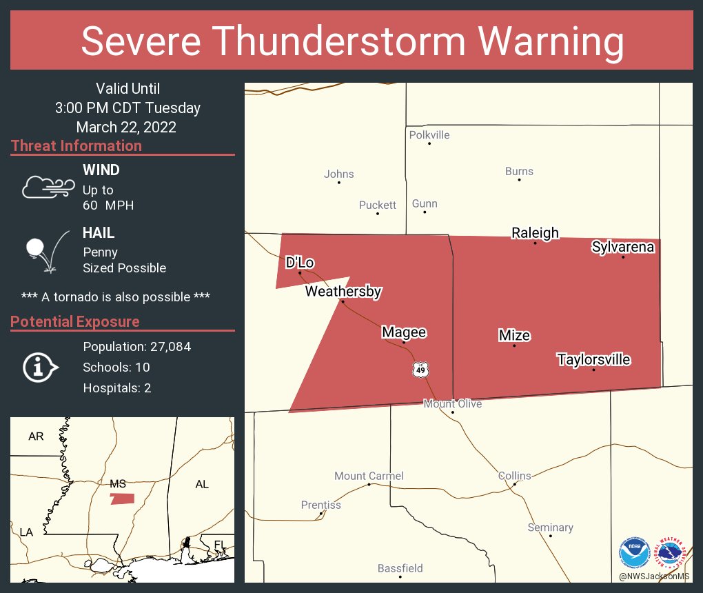
⚠️ ALERT: A SEVERE THUNDERSTORM WARNING has been issued for southern Smith County by @NWSJacksonMS until 3:00PM CDT. Winds up to 60 mph and penny-sized hail are possible with this line of storms. A TORNADO IS ALSO POSSIBLE. SEEK SHELTER IMMEDIATELY!
⚠️ ALERT: A TORNADO WATCH has been issued for Smith County by @NWSJacksonMS until 7:00PM CDT. Residents should take steps now in case a warning is issued. Secure outdoor property and remain alert for warnings and changing weather conditions!
⚠️ ALERT: A SEVERE THUNDERSTORM WARNING has been issued for Smith County by @NWSJacksonMS until 5:15AM CDT. Wind gusts up to 60mph and penny-size hail are possible with this storm. SEEK SHELTER IMMEDIATELY!
⚠️ ALERT: A SEVERE THUNDERSTORM WARNING has been issued for Smith County by @NWSJacksonMS until 5:00PM CST. Winds up to 60mph and penny-sized hail are possible. A TORNADO IS ALSO POSSIBLE.
⚠️ ALERT: A TORNADO WATCH has been issued for Smith County by @NWSJacksonMS until 6:00PM CST. A few tornadoes are likely, along with ping-pong ball-sized hail and 70mph wind gusts. Secure your property and stay alert for warnings!
🚧 TRAFFIC ALERT: Old Gilmer and Pine Street are down to one lane until the morning due to a water leak in the area. Please use caution in this area as crews work to repair this issue.
⚠️ ALERT: A TORNADO WARNING (DRILL) has been issued for Smith County by @NWSJacksonMS until 9:20AM CDT. Use this time to review your tornado precautions and make sure you have a plan in place should severe weather threaten the area.
⚠ ALERT: A SEVERE THUNDERSTORM WARNING has been issued for Smith County by @NWSJacksonMS until 7:30PM CDT. 60mph wind gusts and nickel-sized hail are possible with these storms. SEEK SHELTER IMMEDIATELY!
⚠️ BOIL WATER ADVISORY: Contractors working on the 4-way stop project in downtown hit a main water line. Customers serviced by the Town of Taylorsville should immediately cease using water that has not been boiled until testing on water quality has been completed.
Happy 4th of July from the Mayor's Office! We wish everyone and safe and enjoyable weekend. City Hall will be closed Monday in observance of the holiday.
Work continues on the CR 19 bridge replacement project just north of town. Crews have finished the bridge deck, and are getting ready to pour the side walls and pave the approaches. We appreciate your continued patience as our county partners work to complete this bridge!
⚠️ ALERT: A SEVERE THUNDERSTORM WARNING has been issued for Smith County by @NWSJacksonMS until 5:30PMCDT. 60mph wind gusts and penny-sized hail are possible with this storm. SEEK SHELTER IMMEDIATELY!
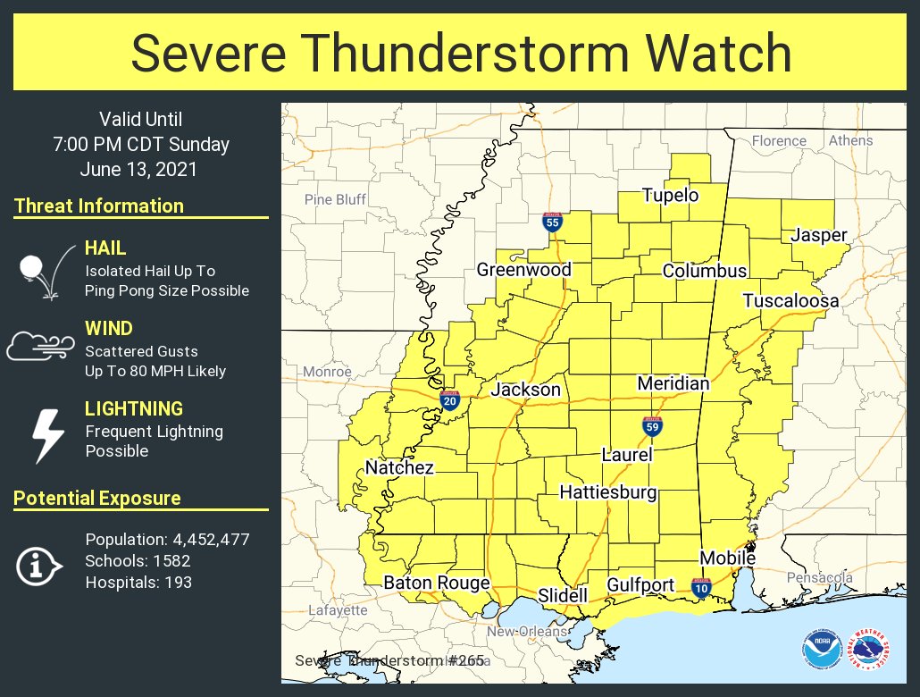
⚠️ ALERT: A SEVERE THUNDERSTORM WATCH has been issued for Smith County by @NWSJacksonMS until 7:00PM CDT. Hail up to ping-pong ball size and 80mph wind gusts are possible with storms today. Secure your property and remain alert for warnings!
⚠️ ALERT: A SEVERE THUNDERSTORM WARNING has been issued for Smith County by @NWSJacksonMS until 4:30PM CDT. Damaging wind gusts to 70mph and nickel-sized hail are possible with this line of storms as they move through. SEEK SHELTER NOW!
⚠️ ALERT: A TORNADO WATCH has been issued for Smith County by @NWSJacksonMS until 4:00PM CDT. A few tornadoes, isolated hail to lime-sized, and wind gusts to 75mph are possible. Secure your property and remain alert for warnings!
⚠️ ALERT: A SEVERE THUNDERSTORM WATCH has been issued for Smith County by @NWSJacksonMS until 8:00PM. Ping-pong sized hail, wind gusts to 65mph and a couple tornadoes are possible. Secure your property and remain alert for warnings!