Hi,
We are trying so hard to keep our anger and our sorrow in check.
Anger at ourselves mainly that had we chased this cyclone we had the capacity to get people out.
People could have survived if we weren't so cautious
We did our best to help Hawkes Bay...We Failed.
We know some of our meteorologists are excited to get into the scout vehicles and chase #CycloneGabrielle however our health and safety officers have said that this cyclone is unpredictable and dangerous.
Therefore scouting operations will be ceased.
#cyclone update
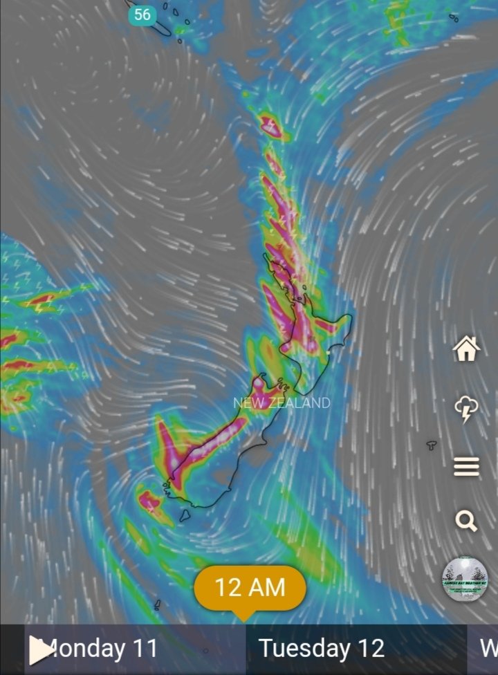
Here is the cyclone model for Tuesday,
Hawkes Bay will be caught in the inflow likely to last for several hours,
So make a plan if you need to evacuate quickly.
Currently Tracking Cyclone Gabrielle
Latest weather models have made us rethink the Hawkes Bay threat assessment.
We are moving from level 4 which was "Possible" to Level 3 which is "Probable"
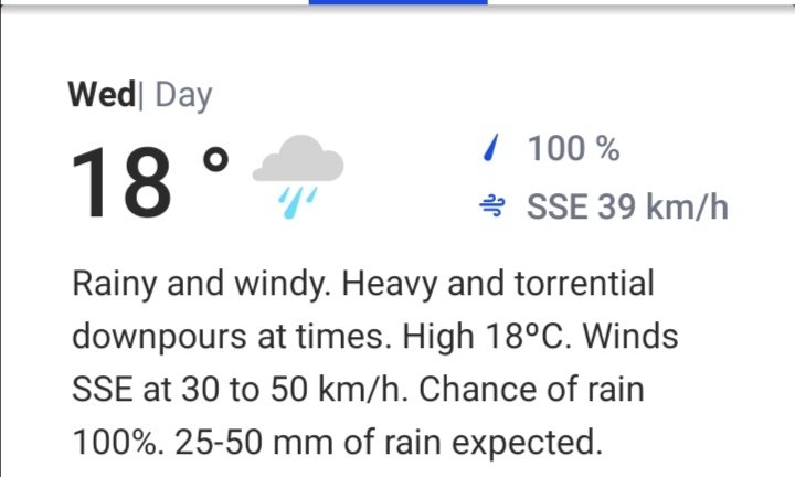
Strong winds and rain from Monday.
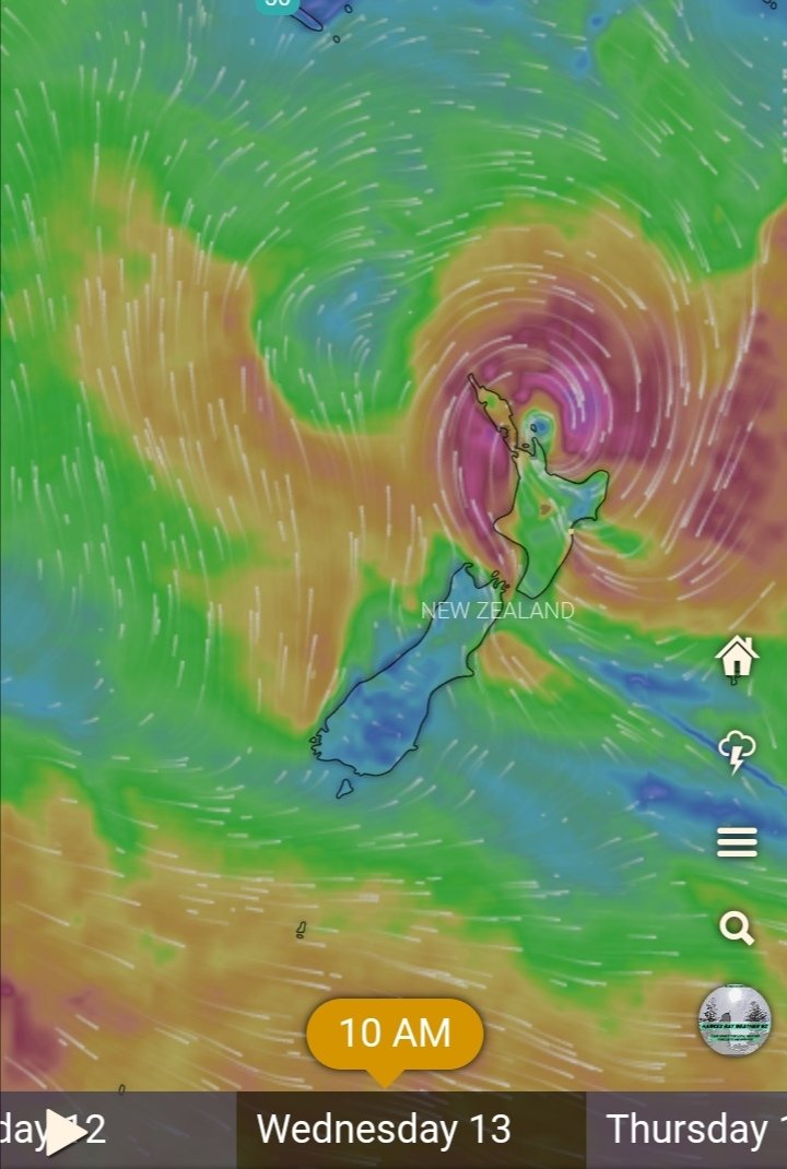
Here is our prediction for the cyclone track, dosent seem to be following the usual track but soon it will face humid winds coming from the north pushing it more south.
Latest models have it moving North east away from the North Island with the outer bands just over Auckland but I suppose it's way too early to judge which track it will take.
With Cyclone Hale bearing down on us we will be out in force with our measuring equipment, our main goal is to have vehicles down the east cape tracking the storm.
We are back in force today,
Major weather system forming in the ranges of Hawkes Bay.
We will follow the storm system down from Te Haroto back to Napier.
Heavy rain is meant to continue through to tomorrow afternoon after that a few fine breaks.
High of 22 degrees for Napier, 23 for Hastings and 23 for the CHB regions.
Possible thunderstorms around Hastings and Napier from 12:30pm
Good morning everyone,
It's been a while since we have done any kind of meteorological research.
But we are back and gearing up for summer as weather models predict more severe storms and extreme weather events.
Our vehicles have been newly outfitted, more to come.
^AW
Forecast for HB
Hastings: early morning drizzle followed by heavy showers late morning to clear this evening high of 20
Napier: rain to start from 8am onwards drizzle to heavy early afternoon, slight chance of thunderstorms and strong winds this afternoon.
Our feedback as we are @CocaCola fanatics, Zero Sugar is meant to replace No Sugar and Coke Zero, No Sugar tastes watered down compared to normal coke, but does Zero sugar taste like normal coke.....in a nutshell...nope, there's something floral in the aftertaste. We don't likey.
Severe Gust front to impact Hawkes' Bay from 9am onwards until 11pm
140km/h gusts in exposed places or 60-80knots in layman's terms.
Visit https://t.co/0N5VkjzEQ0
For updates every minute
It's been some time since we have been operational, we have the staff some much needed rest while we upgraded our Radar operations and computer systems,
BUT WE ARE BACK
And we are watching this storm front moving up the country.
Most of New Zealand is to be hit with a storm trough coming down from Fiji from Monday 11th April, Hawkes Bay may cop a bit of it but nothing too major.
#severeweather