The showers and storms have taken hold south of Highway 40 for now. These storms have produced wind gusts up to 65 mph, so stay alert as severe weather remains possible. #kswx#newx#cowx
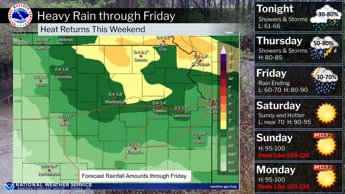
Additional showers and storms will move across the area tonight into Friday, some bringing heavy downpours and potentially leading to localized flooding. Conditions dry out and become hot and humid this weekend into early next week! #kswx
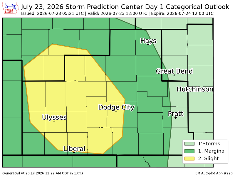
Thunderstorms have developed across western Kansas. They will continue to move northeastward. These are strong storms, and some may become briefly severe at times as they continue to move northeastward into this evening. #kswx
Dangerous heat is building across parts of the West and Central U.S. through this weekend and will expand into the Central U.S. and Gulf Coast early next week. The latest Key Messages are below.
Rain and storm chances continue into tonight and into Thursday and the morning hours on Friday. Temperatures will warm up through the end of the week with highs in the 90s and low triple digits on Saturday. #newx#kswx
The forecast has a couple chances for heavy rain tonight and again Thursday night. If the rain moves over the same locations both nights, there could be some isolated flooding. The rain should move out on Friday with hot and humid weather building in this weekend. #kswx
Though a few showers will be possible today mainly before 1PM, the potential for and coverage of showers will be expected to increase Wednesday and Thursday. Highs will mainly stick between the mid 70s to low 90s between Wednesday and Friday. #newx#kswx
A frontal boundary will sweep across the state on Tuesday bringing temperatures back down to normal for Wednesday and Thursday, along with a few thunderstorm chances. Another warmup is expected to begin on Friday. #KSwx
Dangerous heat will continue on Tuesday, mainly across southern Kansas. High temperatures will reach over 100 degrees with heat index values around 110 degrees. #KSwx
Hot and humid conditions are expected today and again Tuesday. Heat indices will approach 105 degrees area wide today and up to 110 degrees Tuesday, especially across southern Kansas. Stay hydrated and take frequent breaks when outdoors. #kswx
A Heat Advisory will be in effect from 10AM to 10PM today. Highs will be expected to reach the upper 90s to 103 degrees with heat index values as high as 105-110 degrees. #newx#kswx
High heat and humidity continue for a few more days. Monday will be the hottest day and a Heat Advisory has been issued with heat index values expected to range from 105 to 109 degrees. Cooler weather and rain return midweek. #kswx
An isolated thunderstorms may impact southeast KS again on Saturday afternoon, although most areas are expected to remain dry. Mostly dry and hot conditions are expected as we move into Sunday and Monday with highs in the mid to upper 90s. #kswx
Mostly clear tonight with a slight chance of a thundershower through early evening. Hot and dry with a few afternoon clouds for your weekend and into early next week! Expect light winds of 5 - 10 mph, generally from the south / southeast. #NEwx#KSwx
Isolated showers and storms may return to portions of southeast Kansas on Wednesday. Otherwise, dry and warming conditions alongside mostly clear skies are expected into the weekend, with highs in the upper 90s by Saturday. #kswx
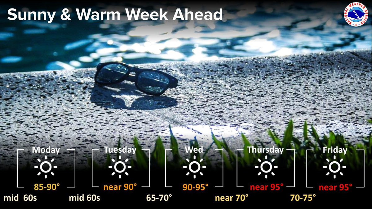
A quiet weather pattern is expected to bring warm and sunny days to the area this week. For a specific forecast for your location, check out https://t.co/sR2R7QNaQR #kswx
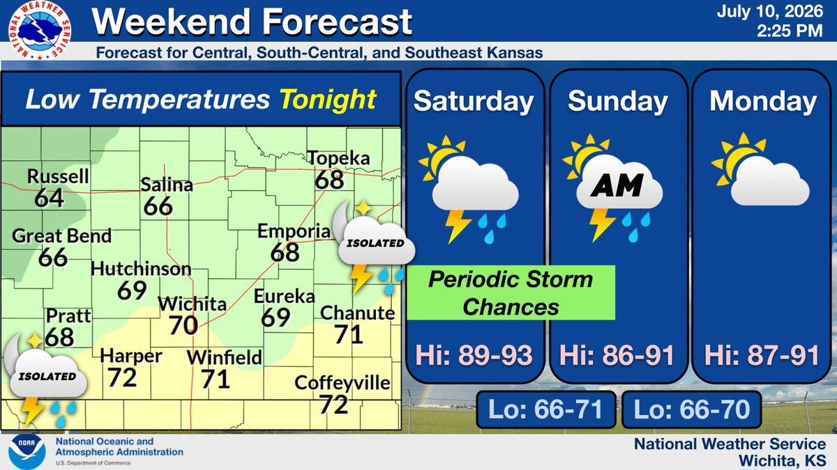
Periodic chances for showers and storms will continue from this evening through Sunday morning, mainly for southern and southeast Kansas. Meanwhile, temperatures are expected to remain near average for this time of year through the beginning of next week. #kswx