Spring (March 1 to May 31) temperatures for the Nation ran 4.88°F above-normal...second warmest on record...only 2012 was warmer...5 of the six warmest springs on record for the Nation have occurred during this century
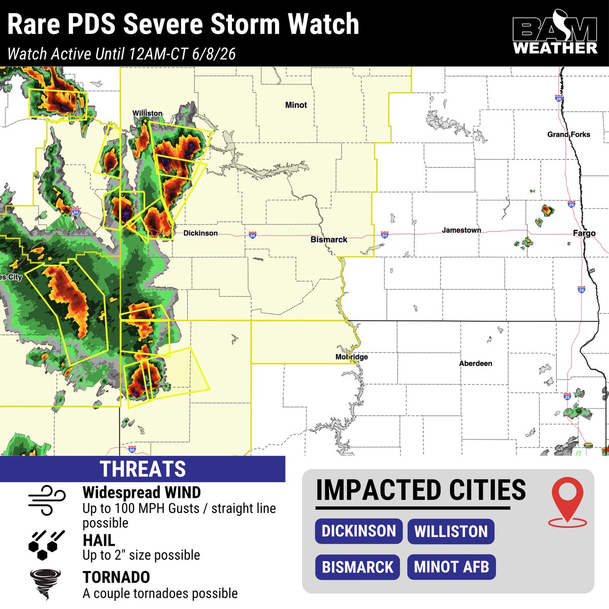
A rare, (PDS) Particular Dangerous Situation Severe Storm Watch has been issued for parts of North Dakota and South Dakota. Damaging winds of 80-100mph will be possible, with hail / tornadoes to remain additional threats.
Storms have already fired off and are forming into a line!
This May there were zero Tornado Warnings in Indiana! This is only the fourth time since 1986 that this has happened. Though it wasn't completely quiet with 70 Severe Thunderstorm Warnings across the state. Historically May is one of the more active months for Indiana, so seeing a tornado free May is a rarity.
The last 30 days have been extremely wet across the OH Valley - pockets of Southern Indiana have seen 6-10" more of rain than normal for this period with widespread much above normal rainfall.
No drought concerns in this area heading into the start of summer with these rains - but a drier period is arriving now to help folks get into fields and finish up planting.
Drier than normal conditions and warmer temperatures over the coming weeks will allow for plentiful chances to get out into the fields, however for some dry conditions can persist for too long. Expanding drought conditions are a risk for our friends in the plains as high pressure and drier conditions set in.
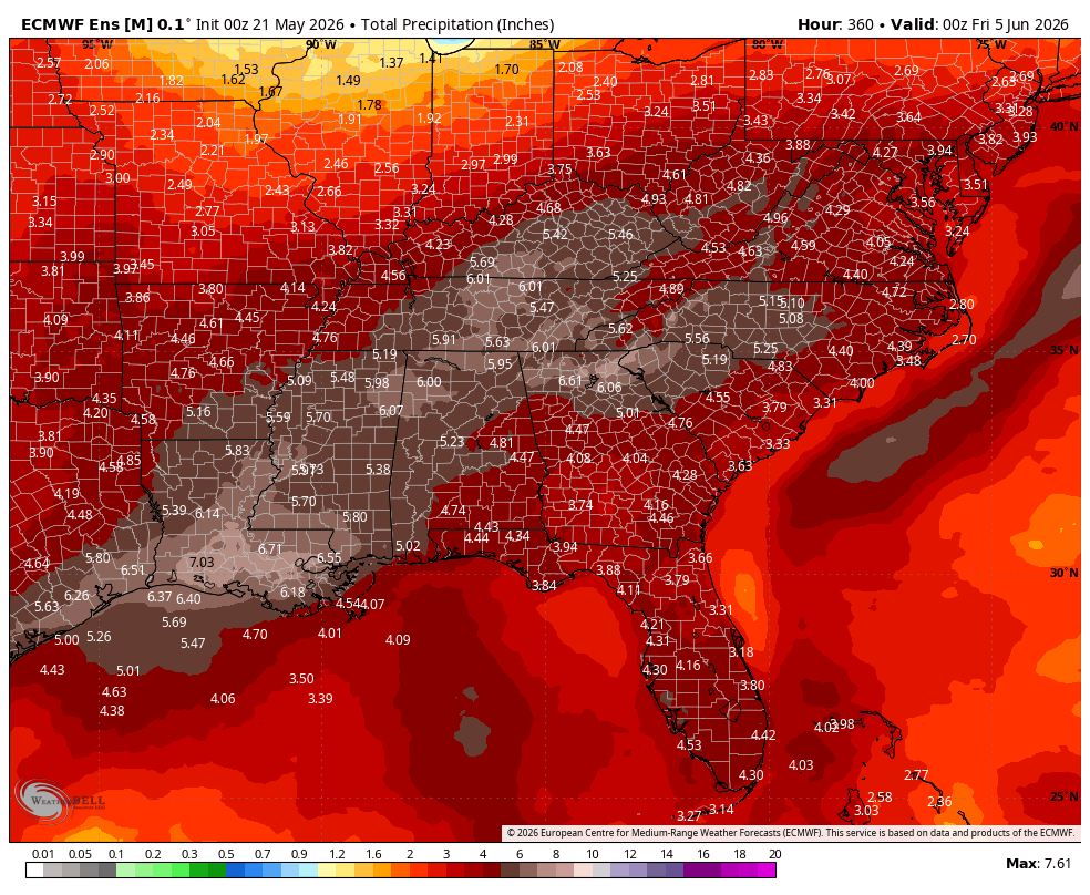
A very wet period is commencing today. Here is the EPS forecast precipitation amounts and anomalies the next 15 days. Hopefully putting a big dent in the drought. Have your umbrellas on hand for a while.
Spring 2026 has been a spring of extremes across the United States as a whole.
Three separate areas (TN Valley/Carolinas, W. Plains and Desert SW) have seen a top 10 driest meteorological spring on record to date. The Great Lakes have been experiencing a top 5 wettest spring on record.
Next week in our Summer Webinar we'll discuss whether this persists into Summer or if we have a change on the way. Get signed up for free here: https://t.co/8vjRGDf9OF.
April 2026 is going to average out as one of the warmest ever. The locations with 1 represent the warmest on record since 1893!
👀With May’s current outlook, there is a very good chance that parts of the Midwest & OH Valley will end up COLDER than April on average.
Since March 1st through April 20th:
It is the wettest stretch of weather ever since 1893 for the Midwest and Great Lakes region.
It's been ONE OF the driest periods ever for the central plains and the Southeastern US.
Believe it or not it's also been one of the warmest periods in history as well since records started being kept.
Wild stats!
1= wettest/warmest
Higher number=Drier/cooler
Over the past 24 hours, over 450 severe thunderstorm/tornado warnings have been issued with 364 confirmed severe weather reports (tornadoes, hail and wind).
The busy pattern for the Midwest finally winds down today, but a few strong/severe storms possible this afternoon in E. OH, PA and NE KY.
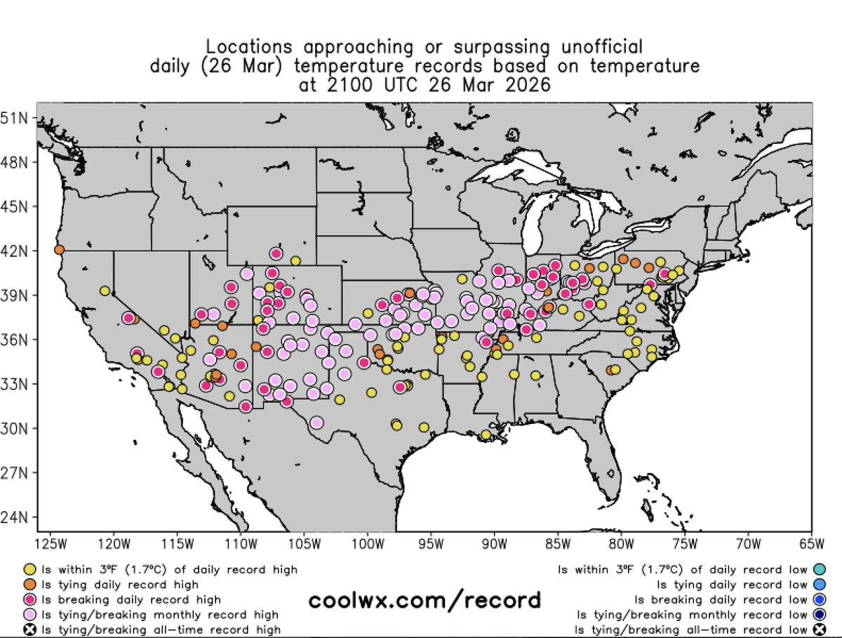
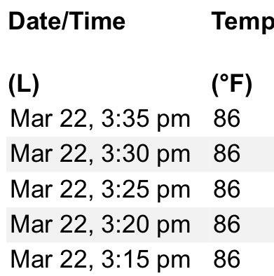
Record breaking highs from California to Pennsylvania were noted yesterday! Some locations even breaking the all-time high temperature for the month of March.
Iowa's March record high temperature of 92°F was recorded at three stations: Clarinda/Massena (25th, 1907) & Glenwood (29th, 1986). NWS station obs. are still coming in, but Little Sioux reported 97°F on the 21st. This will need to be verified, but likely a new record for March.
@mattswaim Prepare them for the prostration of the priest and deacon before the altar at start of Good Friday service. I recall a year that our altar server appeared very concerned at seeing the priest go to the floor 😟
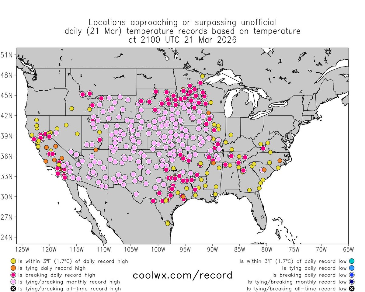
Incredibly, even *more* locations across U.S. are today experiencing their warmest March temperatures on record--many by a wide margin, with some even breaking April records. This includes most or all of: AZ, UT, CO, NM, WY, NE, KS, MO, IA, plus portions of many other states. 🫠
The signal for a robust El Niño for the peak of Atlantic #hurricane season (Aug-Oct) continues to grow. El Niño typically reduces Atlantic hurricane activity via increases in vertical wind shear. We'll have lots more to say with CSU's initial 2026 hurricane forecast on 9 April
Last 30 days of precipitation clearly indicates where some folks have simply missed out in the Plains. Meanwhile, heavy, flooding rains took place in the Ohio Valley.