Introducing the SPEECHLESS ’25 tour! After all of the touring I’ve done through the years, it’s hard to imagine there’s something I haven’t ever done. But it turns out I’ve never done a tour or even a concert where I play every song from a certain album. I’ve seen some artists do that recently and got the idea to take one of my favorite albums, and one that seemed to connect with a lot of folks, the album “Speechless” and do just that… play all the songs from that album from front to back, and of course, add in a few other “familiar favorites” as well. There were seven songs on that album that actually went to #1 on radio, and there’s a lot about every song on that album that makes them all really special to me. I’m also bringing some other incredible musicians along with me to help me breathe new life into these songs! So if I get anywhere close to where you are, please come join me for what I’m expecting to be a very special and unforgettable night… So here’s your “INVITATION”… I hope you’ll come with “GREAT EXPECATIONS” as we DIVE IN, and see the “FINGERPRINTS OF GOD”... ok, you get the point! (: #Speechless25
Join me on tour this fall to celebrate 25 years of the album “Speechless!” Sign up now to receive exclusive pre-sale access and get your tickets first at https://t.co/9T2rPGrjVF.
ICYMI: Jessie Holmes, from Odenville, Alabama, won the Iditarod Trail Sled Dog Race on Friday!
“It’s hard to put into words, but it’s a magical feeling,” Holmes said, per The Associated Press.
Read more: https://t.co/HuVD9sMErj
6AM UPDATE: Rain and thunderstorms are over North Alabama this morning with small hail in spots, but they are under severe limits and we have managed to go through "round one" with few problems. We have heard of no damage; hail has been the only real issue.
Storms will continue to fade over the next hour or so, and the weather should be quiet through late morning.
Key messages for later today and tonight...
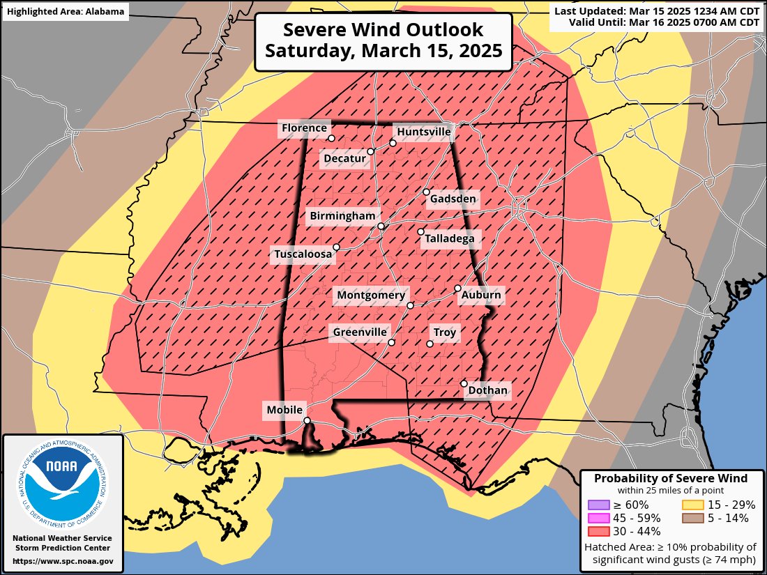
*The greatest concern is "round two", which comes from roughly 11:00 a.m. until a little after midnight. During this time a few violent, long track tornadoes will be possible anywhere in Alabama. A high risk (level 5/5) has been defined for much of the state.
*It is critical that you hear warnings. An outdoor siren is never, ever a primary way of hearing warnings. The "siren mentality" has killed more people than anything else during tornado events in Alabama. The baseline for every home and business is a NOAA Weather Radio; unfortunately many retailers have sold out of them due to the high demand this week. On your phone, be sure emergency alerts are enabled in notification settings... this is the tone you hear for tornado warnings and amber alerts. Have the free ABC 33/40 weather app installed. Turn the sleep/do not disturb modes OFF for the weekend so you will receive notifications at night.
*In your safe place, have helmets for everyone, including adults. Use a car seat for infants. Most serious injuries in tornadoes involve blunt force trauma above the shoulders. Wearing hard shoes is also a good idea. Have a portable air horn for everyone; they can alert first responders to your location if you are injured.
*If you live in a mobile home, know the location of the nearest shelter, or business open 24/7 that can serve as a shelter. Have transportation arranged so you can get there quickly. You cannot stay in a mobile home if you are in a tornado warning polygon.
*A car is a death trap during a tornado. If you are driving and get a tornado warning notification, pull off as quickly as possible and go into a gas station, fast food restaurant, or any other business that can serve as a shelter. Do not drive into a tornado warning polygon.
*You can be a hero. If you are reading this, you pay attention to weather. Let friends and family members today know this is a dangerous threat. During the event, if you have a friend or loved one in a tornado warning polygon, call or text them to let them know of the immediate danger. You can play a huge role in saving lives.
*Subscribe to the James Spann and ABC 33/40 YouTube channels so you can watch our live coverage. During the event itself all of my attention is focused on the live coverage. I simply am not able to respond to the hundreds of requests for individual briefings during a severe weather outbreak.
*Get the warnings, have a good plan, and we get through this together.
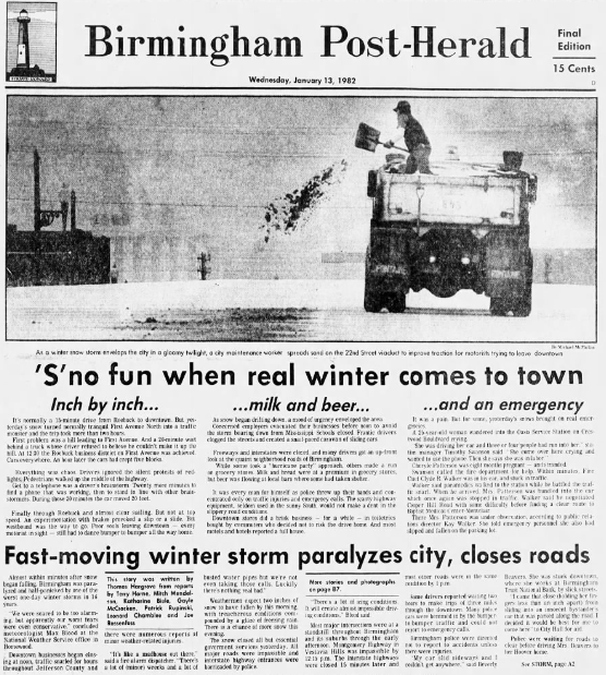
WINTER STORM WARNING: A winter storm warning is in effect today for areas along and south of a line from Thomasville to Montgomery to Opelika. North of the warning, there is a "winter weather advisory" as far north as Eutaw, Centreville, Pelham, Talladega, and Anniston. NWS Birmingham added a few counties to the advisory early this morning... Shelby, Talladega, Calhoun, and Cleburne.
Temperatures will stay below freezing across most of the state today as Arctic remains in place, and a surface low continues to form in the northwest Gulf of Mexico. Here are the key messages on what to expect today...
*There are echoes on radar early this morning (before sunrise), but that precipitation is not reaching the ground due to very dry air in the lower levels.
*Snow will begin to reach the ground later this morning over Southwest Alabama as the column becomes saturated... then becoming widespread across the southern counties of the state during the afternoon and evening hours. Snow amounts in the winter storm warning area will be generally in the 2-3 inch range, with locally heavier amounts. A good chance this system will bring the most snow Mobile has experienced since February 1973. Where banding occurs a few spots could see over 4 inches somewhere between Dothan and Mobile; accumulating snow is likely for places like Gulf Shores, Pensacola, and Fort Walton Beach. Panama City Beach could see some snow.
*Driving will become very hazardous across South Alabama and the Florida Panhandle today as snow will accumulate rapidly on road surfaces due to the very cold air in place. The snow will be out of the state by 9:00 p.m., but icy travel will continue into tomorrow morning.
*To the north, in the winter weather advisory area across Central Alabama, amounts will be much lighter (generally under one inch), but in this kind of airmass it doesn't take much snow for roads to become slick and dangerous.
*For now the winter weather advisory does not include Tuscaloosa, Birmingham, Gadsden, or points north. A few snow flakes are certainly possible, but for now the main travel impact is expected to be to the south. The advisory includes Sumter, Greene, Hale, Bibb, Shelby, Talladega, Calhoun, and Cleburne counties, and areas to the south. But, we all know winter storms can bring surprises, so watch for updates and radar trends this morning.
*Where snow accumulates, icy travel will continue through tomorrow morning. There could be some improvement tomorrow afternoon with strong January sun and temperatures just above freezing, but where moisture lingers icy spots are very possible into Thursday morning.
*Tomorrow morning will be the coldest morning of the week with lows in the 7-15 degree range over the northern 2/3 of the state; upper teens are likely down to the Gulf Coast.
From ALDOT:
The Alabama Department of Transportation (ALDOT) is preparing for a severe winter weather system expected to impact the state in the coming days. Hazardous conditions, including snow and ice, could develop, and ALDOT crews are gearing up to keep roadways safe and open.
This winter storm is expected to cause snow across Alabama, with the heavier snowfall expected south of Interstate 20.
ALDOT is planning extensive pretreatment operations across the state and will conduct active clearing and treatment operations when snowfall begins. Even with treatment and response efforts, road conditions in some areas may become challenging.
Here’s what you need to know about ALDOT’s preparations and how you can stay safe:
ALDOT’s Winter Weather Preparations
Monitoring Conditions: ALDOT personnel are actively tracking weather forecasts and roadway conditions, particularly in areas expected to experience the most severe winter weather.
Pretreatment Plans: Depending on conditions, crews may pretreat roads to minimize ice formation. This is highly dependent on whether rain precedes or accompanies the wintry precipitation, as rain can wash away pretreatment materials. Some pretreatment operations will begin as early as Saturday evening/night, but the majority of pretreatment operations are planned for Sunday and Monday.
Prioritizing Roads: ALDOT prioritizes bridges and interstate highways first, followed by U.S. and state highways based on traffic volume.
#BMX issues Zone Forecast Package (ZFP) at Jan 18, 4:08 PM CST ...COLD WEATHER ADVISORY IN EFFECT FROM MIDNIGHT SUNDAY NIGHT TO 11 AM CST MONDAY... https://t.co/PY7D5GsaCO
Don't compare your behind-the-scenes to someone else's highlight reel on social media. Instead, compare yourself to who you used to be and keep working toward where you want to be.