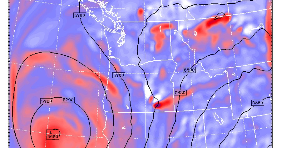
⚡️THUNDERSTORM OUTBREAK POSSIBLE TONIGHT ⚡️
Storms will bubble up over the Cascades this afternoon & march northwest into the region late tonight into Sat morning. Heavy 🌧 is also likely. Cover up your outdoor furniture!
⚡️THUNDERSTORMS POSSIBLE FRIDAY/SATURDAY ⚡️
Potential is increasing for a thunderstorm outbreak Fri night into Saturday. Winds will steer storms in reverse over the Cascades (from southeast to northwest). Lots of 🌧 possible as well.
It is certainly not all that often that a single storm is responsible for the wind direction across the entire length of the U.S. #snowstorm#blizzard#winter
Thanks for sharing, @pcavlin!
Here's an analysis of last night's windstorm. While the storm itself wasn't particularly strong, the track was perfect for high winds in Western Washington/Oregon and South/Central Puget Sound in particular. @theparkernathan@gwccwx https://t.co/TJ7yCEVFr8
The latest on the active weather expected this week for the Pacific Northwest. Many ski resorts in the Washington Cascades should have enough snow to open next week!
https://t.co/h9bxdUrU95
https://t.co/b3fZCbLH2J
Expect very heavy rain most of Monday and Tuesday morning in the North Cascades/Olympics, with lesser amounts in the lowlands. Portland should actually stay pretty dry tomorrow but will get a good 0.50-1.00 inches overnight Monday into Tuesday morning.
Check out the eye of Super Typhoon #Yutu in the western Pacific, seen today from #Himawari-8. The ferocious Category 5 storm is packing 180 mph winds and quickly approaching the U.S. territories of Saipan, Tinian and Rota. More imagery: https://t.co/naIsWtiBev
Super Typhoon Yutu passed directly over the U.S. territories of Tinian and Saipan in the Northern Mariana Islands earlier today with sustained winds of 155 knots (178 mph). These are the 5th strongest winds at landfall of any tropical cyclone on record.
#NOAA20 captured the moment the eye of Super Typhoon #Yutu passed directly over Tinian Island, one of three main islands of the Northern Mariana Islands and a U.S. commonwealth. More imagery: https://t.co/GIDRRoo6c0
Today we'd like to recognize our 2018 Weather Ready Nation Ambassador of Excellence! Congratulations @WallaWallaEM for being selected as a standout ambassador for promoting weather safety and resiliency! Find more at https://t.co/Zc40Rd4k4Y @WRNAmbassadors#wawx
1:30 PM CDT #HurricaneWilla Update: #Willa remains an extremely powerful and dangerous Category 5 storm with sustained winds of 160 mph. Note, there have been some minor structural changes due to vertical wind shear on the western flank. #Mexico (Imagery credit: @TropicalTidbits)
12:00 AM CDT #HurricaneWilla Update: #Willa remains an increasingly more dangerous Category 4 #hurricane with sustained winds of 145 mph with stronger gusts. Note the near-perfect symmetry. Interests in western #Mexico must pay attention. (Imagery credit: @TropicalTidbits)
Dense #fog this morning in Boardman, Oregon. What are you seeing where you are? #morning#orwx#weather
Photo taken by WeatherTogether contributor @markaingalls’ wife Alisha.