GOES 16 GRB meso-1 6/26/20 11am esdt. received via satelite in Brecksville, Ohio with 6 ft. spun alumnum dish. Processed with GRB Streamer, CSPP-Geo-grb and SatPy.
Next week the Eastern US will endure a large and dangerous #heatwave. NOAA forecasting 53 Million people to be impacted by extreme heat on Wednesday alone, with heat index values up to 115° in purple! The heatwave will last the entire week from Monday into the following weekend!
2026 and 1997 are El Niño twins. But they didn't always look alike.
Subsurface ocean warmth developed faster in 1997, but 2026 caught up following a record-breaking Kelvin wave that formed in April.
A new westerly wind burst into June will keep these two years neck and neck.
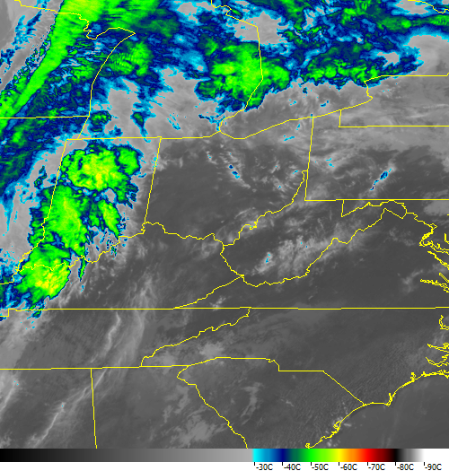
Iowa severe thunderstorm from yesterday (4/14) shown in storm-relative GOES-East 1-min VIS/IR Sandwich Imagery. Rapid convective initiation, an overshooting top, and an above-anvil cirrus plume are all evident. #iawx
More imagery: https://t.co/cWVA535TAX
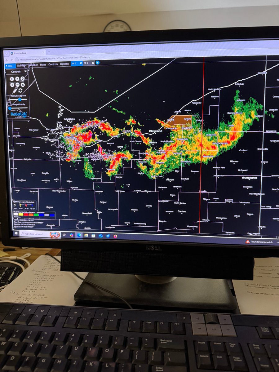
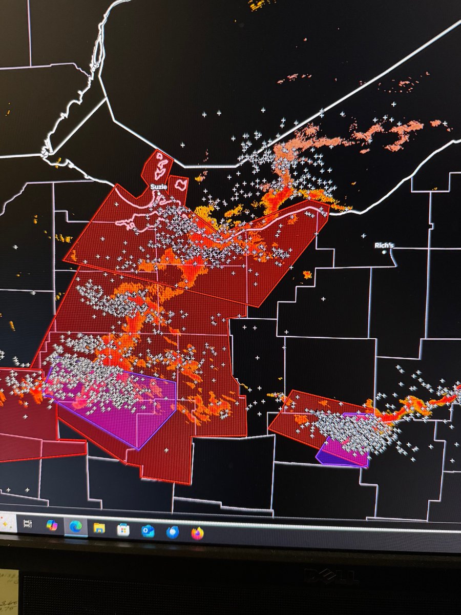
@mbartwx Wednesday 4/15/26 RE: (Garfield Hts. Hail episode.) Temperature and barometric trace recorded in Brecksville . ….. 11 degree temperature drop and 0.10 inch pressure jump at 5:00pm approx.