As Tropical Storm Dolly dissipates in the Atlantic, our Hurricane Hunters will continue to train and stand by for future missions.
Dolly Parton once said, “I've always believed that if you are in a position to help, you should. ”
Our crews do just that — ready to head into storms at a moment’s notice to help those back on the home front prepare.
Two Dollys. One mission: help people. ❤️✈️
🎥 by Staff Sgt. Stacey Thornburg & Lt. Col. Mark Withee
#WeatherReady #AirForceReserve #HurricaneHunters #53WRS #Dolly
[800 am MDT 8/26]: Thunderstorms will develop across much of the Northern Rockies this afternoon & evening.
Thunderstorms will be scattered in nature, rather than widespread, with gusty outflow winds of 30-50 mph.
Lightning may also lead to new fire starts.
#mtwx#idwx
🥵 We finally made it to triple digits. #Missoula hit 100° F at 3:16 PM MDT today! The last time we saw 100°+ was 722 days ago on August 2, 2024 (102° F). Stay cool out there! #mtwx
Severe thunderstorms are expected across portions of the Ohio Valley and Lower Great Lakes into the Mid-Atlantic and Northeast, this afternoon into the evening. Monsoonal thunderstorms may bring areas of flooding to the Southwest. Wildfire smoke continues to impact air quality from the Great Lakes region into New England and the Mid-Atlantic today with widespread Air Quality Alerts in effect. Check https://t.co/u1UB5MsD2V for your local air quality forecast.
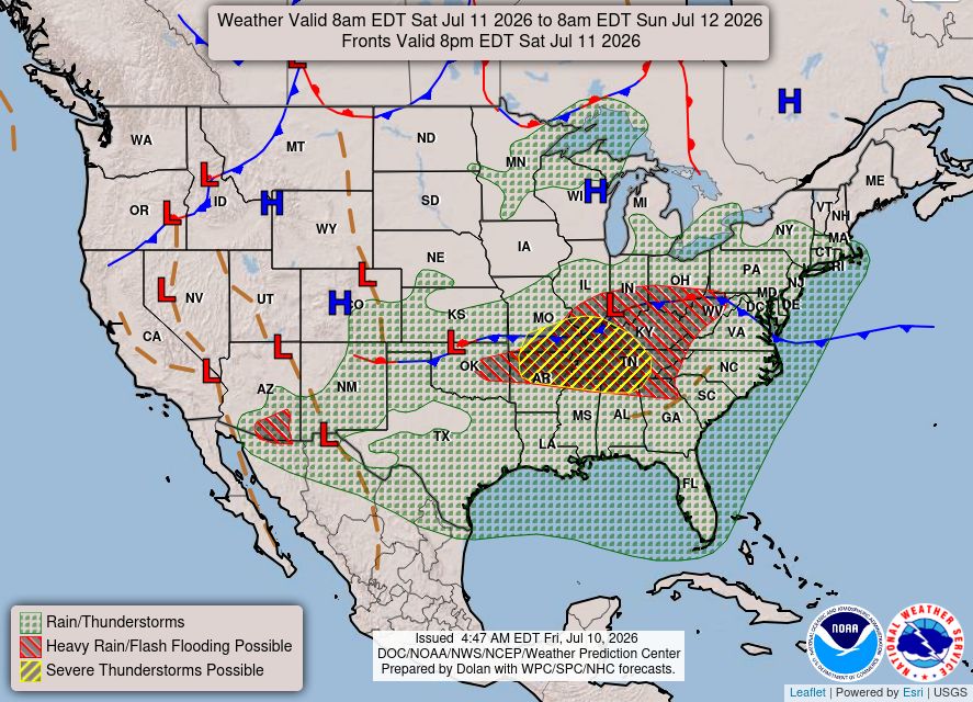
Severe thunderstorms capable of damaging winds will be possible from the Ozark Plateau east into the Tennessee Valley Saturday. Rounds of heavy thunderstorms ahead of a slow moving front will continue locally heavy rainfall and scattered flash flooding potential from the Ozarks to the Ohio and Tennessee Valleys Saturday. https://t.co/qk3BcVP5M8
⚠️ WEATHER ALERT ⚠️
Watch out for isolated heavy showers on Tuesday afternoon! 🌧️ Combined with already saturated ground, this rain could trigger sudden flash flooding—especially over at-risk burn scars.
Stay weather-aware and have a plan in place! 🌊🚗🚫
#MTwx#IDwx
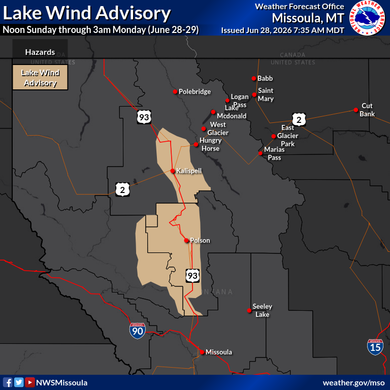
A lake wind advisory has been issued for #FlatheadLake from noon today (June 28) through 3am Monday. South winds sustained 20 to 30 mph are anticipated with gusts approaching 35 mph. Dangerous conditions for small watercraft due to choppy water #mtwx
[1 of 2] Looking for when your location might have relatively drier or lower intensity rainfall in the valleys this weekend? Here's an hourly loop showing probability for precipitation(greater than 0.00"). #mtwx#idwx
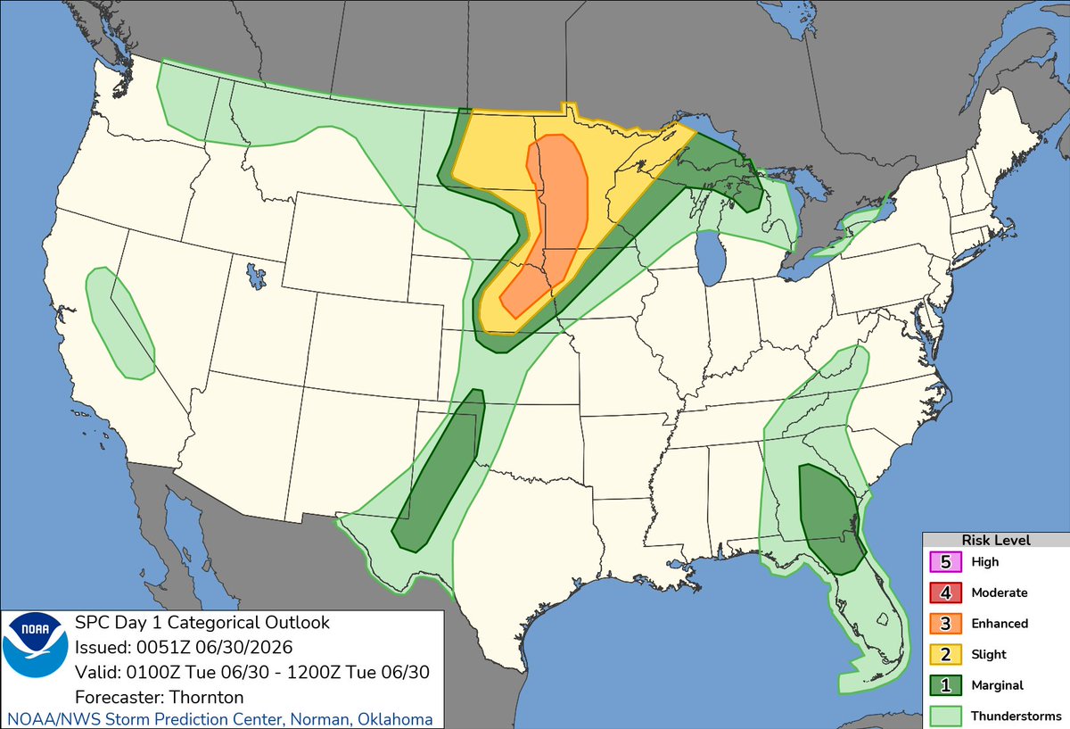
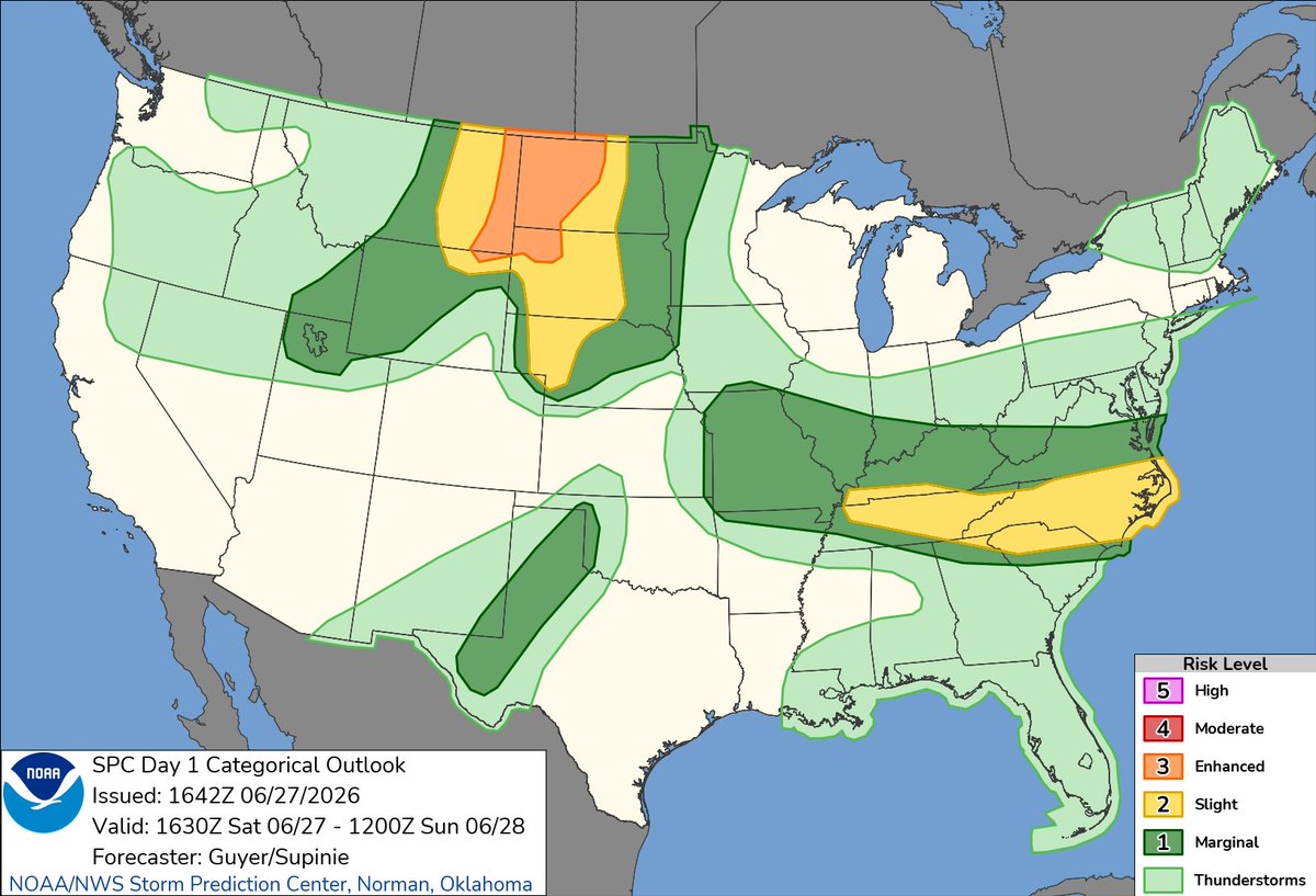
7:51am CDT #SPC Day1 Outlook Slight Risk: THIS AFTERNOON AND EVENING ACROSS PARTS OF THE OZARKS PLATEAU INTO THE LOWER OHIO VALLEY AND ACROSS PARTS OF THE NORTHERN HIGH PLAINS TO THE BLACK HILLS https://t.co/TgJgC6cj9Y