The heat wave of the week is finally past! Here is some data from my personal weather station in Hudsonville, MI. @wmichwx
🌡️ Highest Temperature This Week
• 92°F
• Wednesday July 1
🧽 Highest Humidity This Week
• 99%
• Saturday July 4
💧Total Rainfall This Week
• 0.57
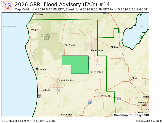
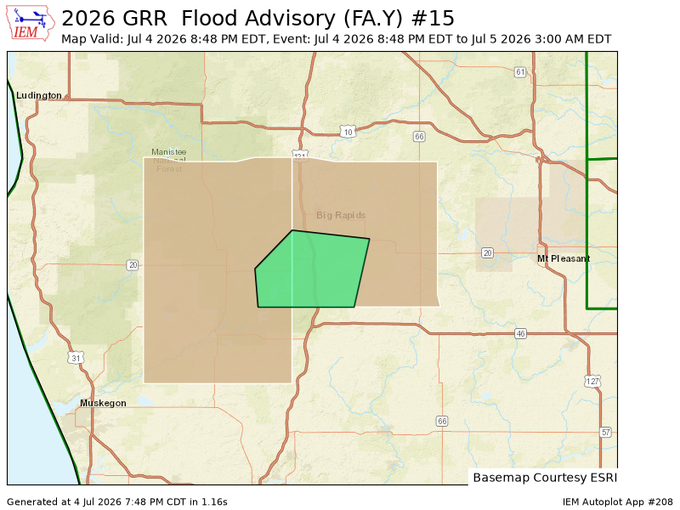
Uploaded the edited footage of yesterday’s damaging line of storms in Southern Lower Michigan. Definitely got slammed pretty hard where I was just west of Manchester.
https://t.co/kzSaJWIOzh
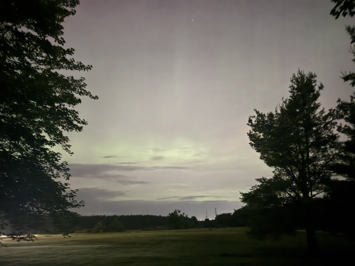
🇺🇸🇺🇸🇺🇸 As we begin the early hours of the 250th anniversary of our nation's independence, it appears as though solar activity wants to grace us with the northern lights. There are clouds around (see picture), but if you're lucky enough to be in a clearer area... LOOK NORTH! #MIwx
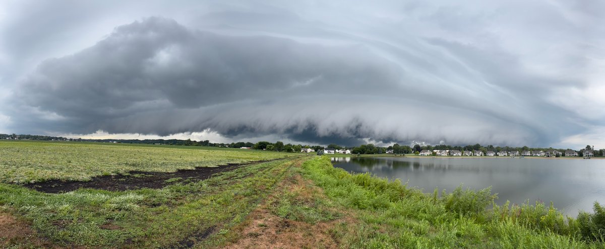
Skies look like this? Best to have someone checking the radar today.
Poofy cumulus clouds are a sign of instability in the atmosphere, all thanks to the sun and a lack of high pressure in the area. Cumulus turns eventually into cumulonimbus, the much larger poofy clouds. Enjoy your 4th of July, but please take note of the developing showers and storms. If you HEAR thunder, you are close enough to be struck by lightning. Don’t become a statistic.
A little weather safety for your holiday weekend. Share with friends to help keep them aware. Here at MSC, we will be live if anything goes warned. Yes, working on the holiday. 🤝
We are being told the structure fire in Tecumseh, MI is a party store, and the fire (supposedly) started when wind knocked a transformer onto the building.
We will let the officials on scene make the final determination. Unfortunately the structure is fully engulfed.