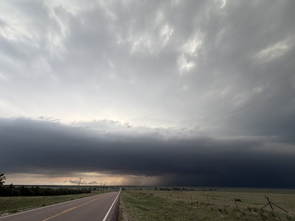
⚠️ TORNADO WARNING on this supercell that’s moving into Cope, Colorado! Watch out over the next 30-45 minutes for hail over 2 inches, 50-75mph wind and possibly a tornado.
Time: 7:10pm MDT
@RadarOmega@stsweathereye
The good news is Chicago is just a few social safe spaces at places like the Art Institute away from bringing the violence to an end.
We just have to guard against falling into the "criminality" trap by treating illegal conduct as a law enforcement issue rather than a socio-emotional issue rooted in young people's self-esteem and perceived sense of opportunity.
BLM Brandon is on the job.
Gas prices are falling, so naturally, the mainstream networks have completely scrubbed their daily price trackers from the screen…funny how that works.
Government rules make everything more expensive.
Take day care.
In DC, day care teachers must have a degree that can cost $22K!
"Of course you're going to pay a lot more," says @carrielukas of @IWF, "when you ask people to invest tens of thousands in degrees."
Storm Chasers Vince Waelti and Nathan Moore captured views of this picturesque rope-like funnel near Ipava, Illinois just moments ago! #ILwx
📸 @VinceWaelti
📸 @StormChaserIRL
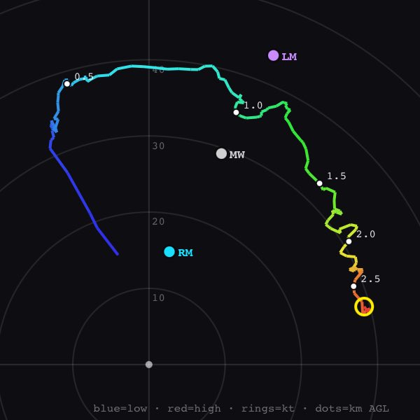
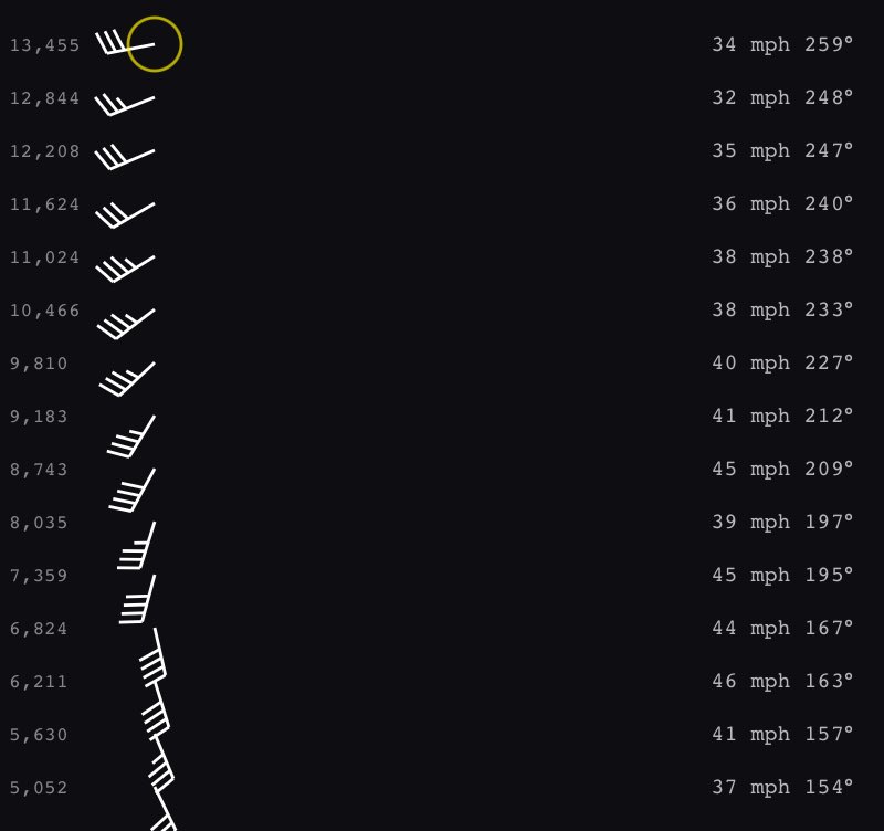
A really cool project being worked on with @stsweathereye is our STING fleet. Here's a crude hodograph and thermo profile of a test launch on Wednesday.
These tiny non-WMO radiosondes are paired with very small weather balloons. They compliment our standard WMO soundings. It would be extremely costly to spend $300-450 per launch, times 3-6 per storm, to retrieve data from supercells. With this new fleet of sondes, we can reserve the expensive flights for once per day, when we need all the data from surface to 80,000+ feet.
STING samples the surface to about 20,000 feet at 1hz frequency and supports up to 10 sondes per receiver. The sondes even talk to each other during flight to determine how many are being flown, frequency and other self-coordinating functions, as well as relay for each other if one or more flies out of range of a ground station.
Our robust ground station and server infrastructure allows multiple receivers to transmit this data live into our viewer. Internet not required... the receivers log all flights and batch upload if the connection is down.