Good evening, everyone! It’s been a while since I last posted here... But I’m back to give you an update on the development of pgModeler 2.0.0-beta.
I’m happy to announce that about 50% of the model versioning plugin (git) is now implemented. Here is what we have so far:
• Detailed commit history display, featuring well-rendered forks and merges, along with badges indicating tags and branches.
• Detailed information for the selected commit under the "Commit Info" tab.
• List of modified files in each commit, including the number of additions and deletions per file, under the "Changed files" tab.
• Support for Diff and Blame views. By clicking on a file, a window opens providing instant access to changes and authorship for every line.
• Branch management: Creation, removal, and checkout (supporting both local and remote branches [detached HEAD]).
What’s still missing:
• Commit operations: commit, cherry-pick, revert, and restore.
• Basic repository operations: clone (with SSH/HTTPS authentication), pull, and push.
• Advanced operations: merge and rebase (the latter is still under study).
It might seem like a small list, but getting this into the UI — especially the history rendering — was a massive amount of work. Anyway, I’m very happy with the results. This is the core set of operations I want ready for the stable release of pgModeler 2.0. I’ll add more features in the future as they become necessary or requested.
The main goal of this plugin is, first, to provide a user-friendly interface for those not used to the Git command line. Second, it aims to make pgModeler an even more complete tool, ensuring users don't have to rely on external software in their data modeling workflow.
Finally, this plugin will be a perfect fit for the .sdbm format (split database model, available in pgModeler Plus), which was designed for easier versioning by splitting the model into multiple smaller files to simplify conflict resolution.
As with all other plugins, this will be exclusive to the pgModeler Plus version.
I'll bring more news soon! :)
Un immense merci à @camptocamp pour son soutien en tant que sponsor Silver de DevOpsDays Genève ! 🚀
Votre engagement aide à faire grandir la communauté DevOps. Hâte de vous retrouver lors de l’événement !
#DevOpsDays#DevOpsDaysGeneve#Merci#Communauté#DevOps
The first GeoServer Cloud Community Code Sprint, hosted by Camptocamp, marked a significant step in advancing the GeoServer Cloud project.
https://t.co/HXcpdS8iDg
📷 Retrouvez Camptocamp à la 7ème édition des GéoDataDays 2024 !
💡 Venez nous voir sur notre stand pour discuter de nos dernières solutions géospatiales Open Source et découvrir comment elles peuvent faciliter vos projets.
🗓 19-20 septembre 2024
📍 Cité des Congrès, Nantes
@LaMineDeSel1@InfosReseaux Une autre possibilité : utiliser un "traceur" au bout d'une aiguille en partant de l'arrivée, chez vous. Il faut trouver la société qui propose ce genre de prestation. J'ai pu trouver où ma gaine était bouchée de cette manière.
https://t.co/y5meK2tJZW n'est pas si mauvais, finalement : https://t.co/LjekWbk6HQ
"Only 0.16 g of CO2 is produced every time someone visits this web page."
Le PGDay France, c'est dans moins d'un mois – les 11 et 12 juin. Les inscriptions sont toujours ouvertes, alors ne tardez pas ! :index_vers_la_droite: https://t.co/QvJXldsqI2
Do you know you can render maps from a #QGIS model? New post with an example of an automated workflow to creates a fire map by downloading near-realtime dataset, styling it and rendering a map template to create a map of latest fires https://t.co/RNUf9aXjLl
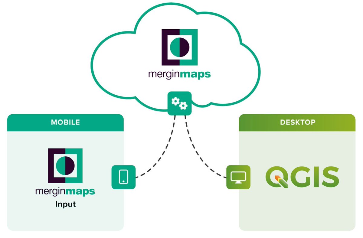
Discover QGIS 3.x, by @geomenke, goes deep on data collection – something not many other QGIS books do. In Part III, dive into data acquisition and syncing with practice exercises using Mergin Maps. Get it here: https://t.co/tQ9oG3qzif #QGIS#merginmaps (img. cred. Jonas Lingren)
The earthquake that struck Japan’s Noto peninsula on Monday was so strong that the coastline has moved up to 250 meters offshore due to significant land uplift.
Notre 🎁de🎄à la communauté #QGIS : l'appel à participation pour les Journées #QGISFR2024 est prolongé au 15 janvier 2024 !
VOTRE 🎁 de🎄à la communauté : proposer de beaux sujets d'ateliers !
N'hésitez plus! Déposez votre sujet ici 👢: https://t.co/dxOr85WybH

![pgmodeler's tweet photo. Good evening, everyone! It’s been a while since I last posted here... But I’m back to give you an update on the development of pgModeler 2.0.0-beta.
I’m happy to announce that about 50% of the model versioning plugin (git) is now implemented. Here is what we have so far:
• Detailed commit history display, featuring well-rendered forks and merges, along with badges indicating tags and branches.
• Detailed information for the selected commit under the "Commit Info" tab.
• List of modified files in each commit, including the number of additions and deletions per file, under the "Changed files" tab.
• Support for Diff and Blame views. By clicking on a file, a window opens providing instant access to changes and authorship for every line.
• Branch management: Creation, removal, and checkout (supporting both local and remote branches [detached HEAD]).
What’s still missing:
• Commit operations: commit, cherry-pick, revert, and restore.
• Basic repository operations: clone (with SSH/HTTPS authentication), pull, and push.
• Advanced operations: merge and rebase (the latter is still under study).
It might seem like a small list, but getting this into the UI — especially the history rendering — was a massive amount of work. Anyway, I’m very happy with the results. This is the core set of operations I want ready for the stable release of pgModeler 2.0. I’ll add more features in the future as they become necessary or requested.
The main goal of this plugin is, first, to provide a user-friendly interface for those not used to the Git command line. Second, it aims to make pgModeler an even more complete tool, ensuring users don't have to rely on external software in their data modeling workflow.
Finally, this plugin will be a perfect fit for the .sdbm format (split database model, available in pgModeler Plus), which was designed for easier versioning by splitting the model into multiple smaller files to simplify conflict resolution.
As with all other plugins, this will be exclusive to the pgModeler Plus version.
I'll bring more news soon! :)](https://pbs.twimg.com/media/HGynEeKakAA7TDp.jpg)
![pgmodeler's tweet photo. Good evening, everyone! It’s been a while since I last posted here... But I’m back to give you an update on the development of pgModeler 2.0.0-beta.
I’m happy to announce that about 50% of the model versioning plugin (git) is now implemented. Here is what we have so far:
• Detailed commit history display, featuring well-rendered forks and merges, along with badges indicating tags and branches.
• Detailed information for the selected commit under the "Commit Info" tab.
• List of modified files in each commit, including the number of additions and deletions per file, under the "Changed files" tab.
• Support for Diff and Blame views. By clicking on a file, a window opens providing instant access to changes and authorship for every line.
• Branch management: Creation, removal, and checkout (supporting both local and remote branches [detached HEAD]).
What’s still missing:
• Commit operations: commit, cherry-pick, revert, and restore.
• Basic repository operations: clone (with SSH/HTTPS authentication), pull, and push.
• Advanced operations: merge and rebase (the latter is still under study).
It might seem like a small list, but getting this into the UI — especially the history rendering — was a massive amount of work. Anyway, I’m very happy with the results. This is the core set of operations I want ready for the stable release of pgModeler 2.0. I’ll add more features in the future as they become necessary or requested.
The main goal of this plugin is, first, to provide a user-friendly interface for those not used to the Git command line. Second, it aims to make pgModeler an even more complete tool, ensuring users don't have to rely on external software in their data modeling workflow.
Finally, this plugin will be a perfect fit for the .sdbm format (split database model, available in pgModeler Plus), which was designed for easier versioning by splitting the model into multiple smaller files to simplify conflict resolution.
As with all other plugins, this will be exclusive to the pgModeler Plus version.
I'll bring more news soon! :)](https://pbs.twimg.com/media/HGynEeCawAAsaJn.jpg)
![pgmodeler's tweet photo. Good evening, everyone! It’s been a while since I last posted here... But I’m back to give you an update on the development of pgModeler 2.0.0-beta.
I’m happy to announce that about 50% of the model versioning plugin (git) is now implemented. Here is what we have so far:
• Detailed commit history display, featuring well-rendered forks and merges, along with badges indicating tags and branches.
• Detailed information for the selected commit under the "Commit Info" tab.
• List of modified files in each commit, including the number of additions and deletions per file, under the "Changed files" tab.
• Support for Diff and Blame views. By clicking on a file, a window opens providing instant access to changes and authorship for every line.
• Branch management: Creation, removal, and checkout (supporting both local and remote branches [detached HEAD]).
What’s still missing:
• Commit operations: commit, cherry-pick, revert, and restore.
• Basic repository operations: clone (with SSH/HTTPS authentication), pull, and push.
• Advanced operations: merge and rebase (the latter is still under study).
It might seem like a small list, but getting this into the UI — especially the history rendering — was a massive amount of work. Anyway, I’m very happy with the results. This is the core set of operations I want ready for the stable release of pgModeler 2.0. I’ll add more features in the future as they become necessary or requested.
The main goal of this plugin is, first, to provide a user-friendly interface for those not used to the Git command line. Second, it aims to make pgModeler an even more complete tool, ensuring users don't have to rely on external software in their data modeling workflow.
Finally, this plugin will be a perfect fit for the .sdbm format (split database model, available in pgModeler Plus), which was designed for easier versioning by splitting the model into multiple smaller files to simplify conflict resolution.
As with all other plugins, this will be exclusive to the pgModeler Plus version.
I'll bring more news soon! :)](https://pbs.twimg.com/media/HGynEdrWcAADkRw.jpg)


![pgmodeler's tweet photo. Good evening, everyone! It’s been a while since I last posted here... But I’m back to give you an update on the development of pgModeler 2.0.0-beta.
I’m happy to announce that about 50% of the model versioning plugin (git) is now implemented. Here is what we have so far:
• Detailed commit history display, featuring well-rendered forks and merges, along with badges indicating tags and branches.
• Detailed information for the selected commit under the "Commit Info" tab.
• List of modified files in each commit, including the number of additions and deletions per file, under the "Changed files" tab.
• Support for Diff and Blame views. By clicking on a file, a window opens providing instant access to changes and authorship for every line.
• Branch management: Creation, removal, and checkout (supporting both local and remote branches [detached HEAD]).
What’s still missing:
• Commit operations: commit, cherry-pick, revert, and restore.
• Basic repository operations: clone (with SSH/HTTPS authentication), pull, and push.
• Advanced operations: merge and rebase (the latter is still under study).
It might seem like a small list, but getting this into the UI — especially the history rendering — was a massive amount of work. Anyway, I’m very happy with the results. This is the core set of operations I want ready for the stable release of pgModeler 2.0. I’ll add more features in the future as they become necessary or requested.
The main goal of this plugin is, first, to provide a user-friendly interface for those not used to the Git command line. Second, it aims to make pgModeler an even more complete tool, ensuring users don't have to rely on external software in their data modeling workflow.
Finally, this plugin will be a perfect fit for the .sdbm format (split database model, available in pgModeler Plus), which was designed for easier versioning by splitting the model into multiple smaller files to simplify conflict resolution.
As with all other plugins, this will be exclusive to the pgModeler Plus version.
I'll bring more news soon! :)](https://pbs.twimg.com/media/HGynEeMbUAAO0pw.jpg)