The official account for the Adams Area Fire District Station 42 bringing you weather alerts. Tweets not monitored 24/7. To report an emergency call 9-1-1.
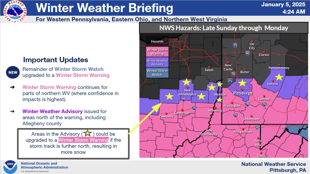
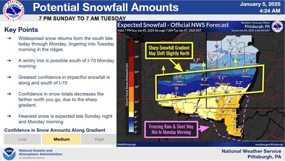
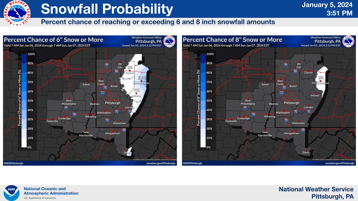
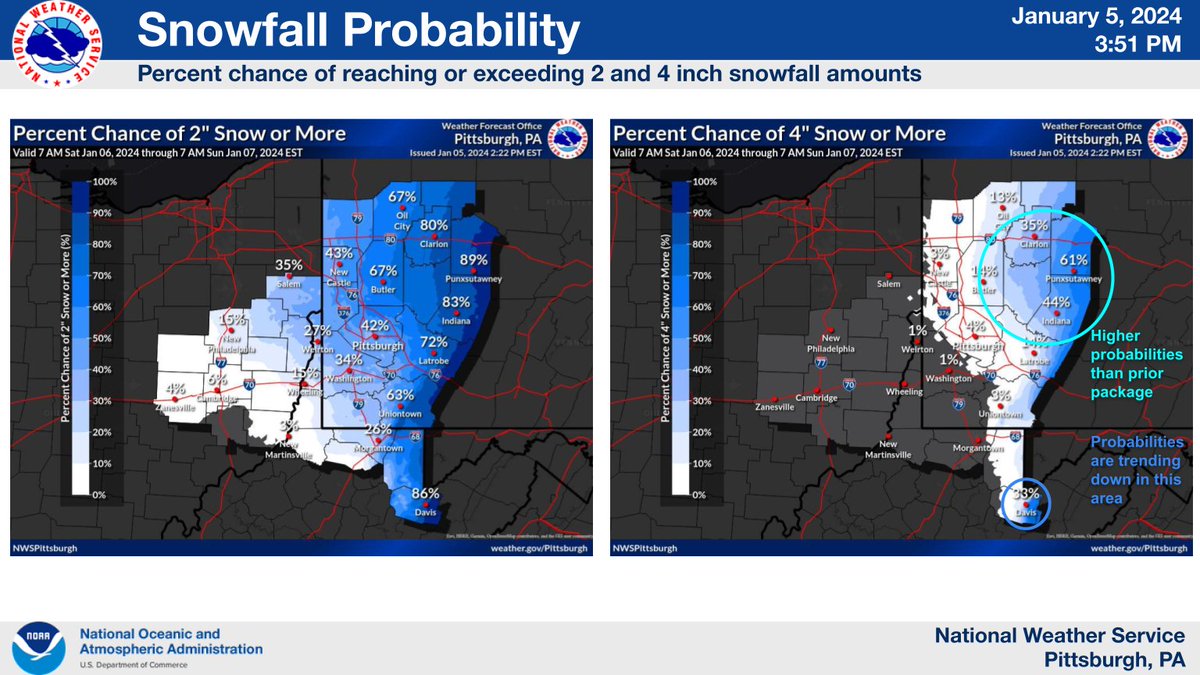
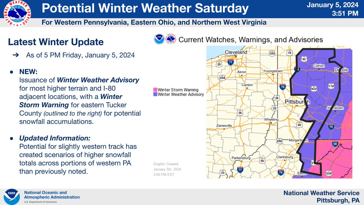
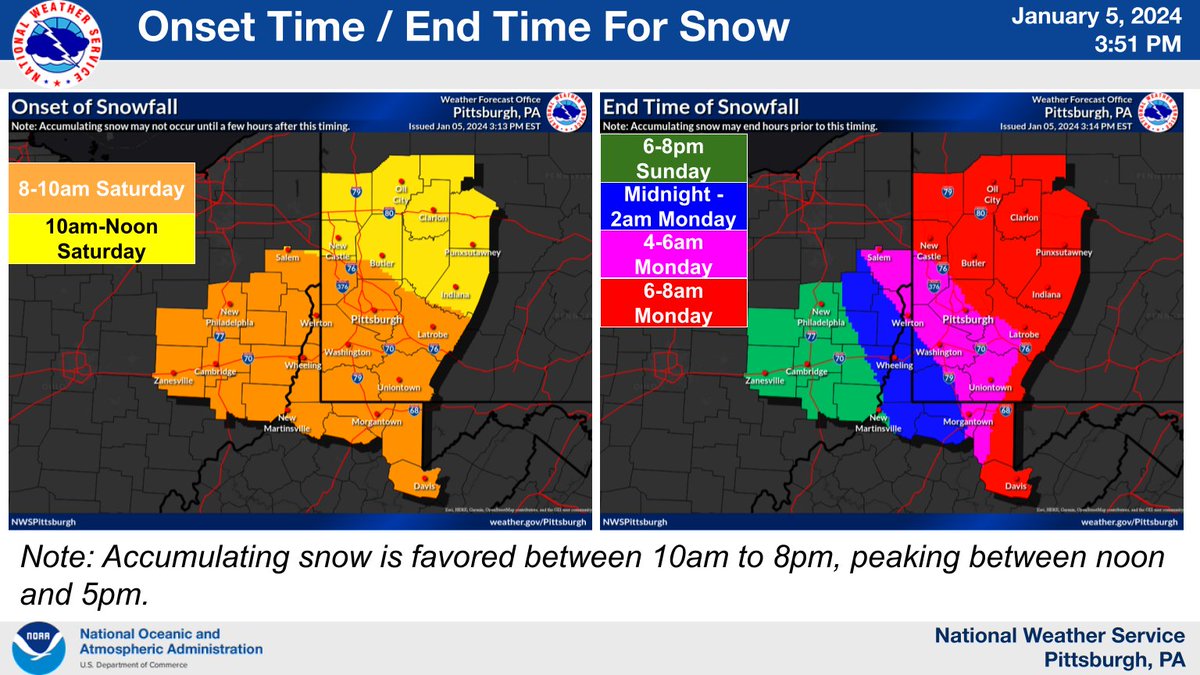
The remainder of the Winter Storm Watch has been upgraded to a Winter Storm Warning. A Winter Weather Advisory also issued just to the north of the warning. Images below contain more details on the upcoming winter weather. Latest at https://t.co/nR4yhzEq8F.
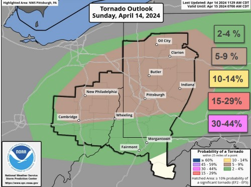
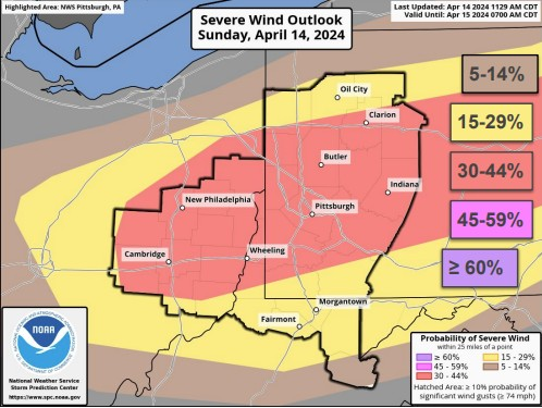
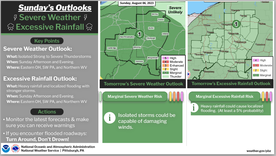
Another round of severe weather is possible tomorrow afternoon and evening. The primary threat remains damaging wind, tornadoes, and flash flooding. Remain weather aware and make sure you have multiple ways to receive warnings.
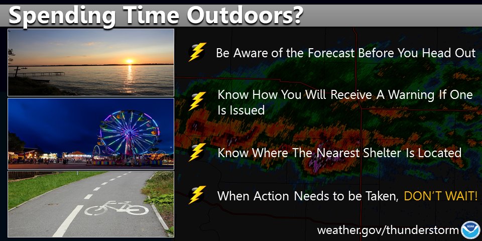
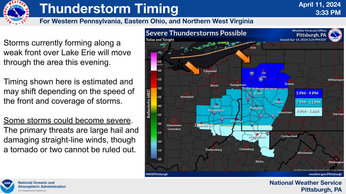
We're seeing thunderstorms forming over Lake Erie along a weak front that will push through the area this evening. Here's an estimate on timing for storms in the area. Have a plan in place to get to shelter quickly if you are outdoors enjoying the warm weather. #pawx#ohwx#wvwx
Big upgrade to the Severe Weather Outlook for tomorrow (Tue). This is a level 4/5 (Moderate) risk for much of Ohio, and a 3/5 (Enhanced) risk into WV & Western PA. All modes of severe weather (tornadoes, large hail, damaging wind) are possible tomorrow late afternoon & evening.
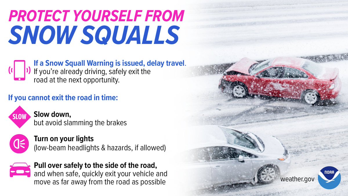
Snow squalls are possible on Sunday. During a snow squall, the last place you want to be is on the road. Stay #WeatherReady by delaying travel if there’s a snow squall warning.
Saturday Update:
- A Winter Storm Warning and a Winter Storm Advisory have been issued for 7am-10pm Saturday.
- There remains lower probability for higher snowfall amounts over west central PA (including Pittsburgh).
- Visit https://t.co/MfIlo9y6TH for detailed information!
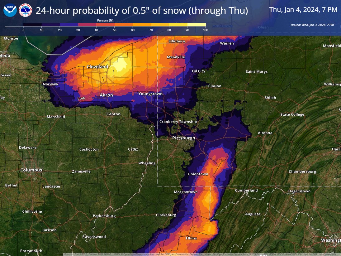
Areas near Lake Erie and in the higher elevations have the best chance of seeing 0.5" of snow over the next 24 hours.
As we said earlier, snow totals with the weekend system have been showing a downward trend in the models. Check back for updates!
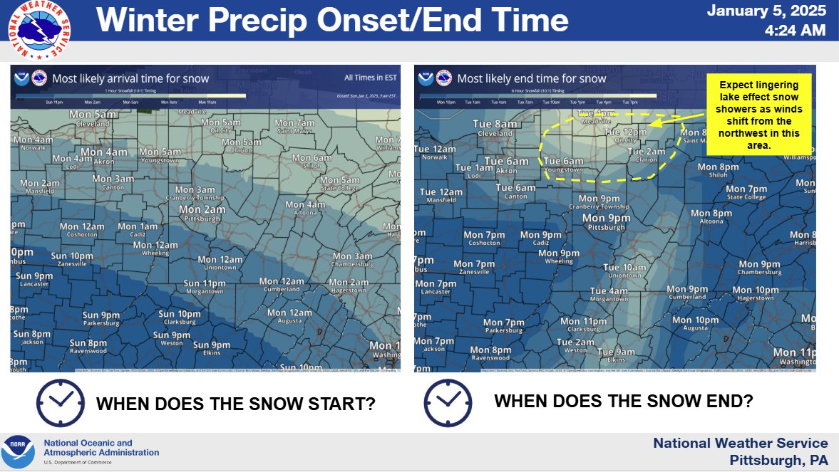
As probabilities for accumulating snow increase over the weekend, now is a good time to start preparing. Make sure your vehicle is winterized & you have an emergency kit for your home and/or car.
Storms will enter the area in the next hour or so, moving expediently across the region. Severe weather is possible, with probabilities decreasing from northwest to southeast. The highest threat at this time is wind, although isolated tornadoes and flash flooding are possible.
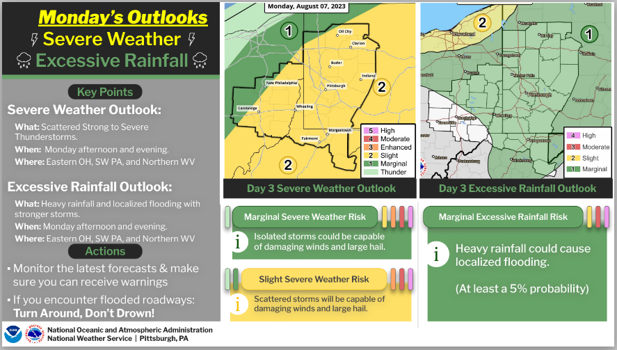
Teams are still out in the field evaluating the damage from yesterday. More storms are possible Monday. The atmospheric setup will be different from Saturday, but the models are showing the risk for multiple rounds of storms, increasing the threat for flooding. Stay tuned!
A watch, probably a Tornado Watch, is likely to be issued in the red circled area over the next couple of hours. Remain alert and be prepared to take action if warnings are issued!
All weather hazards have been dropped this evening.
The cold front is slowly advancing through eastern Ohio. However, the probability of this line of showers/storms becoming strong or severe is low. The majority of the lightning across the region is directed further southeast.
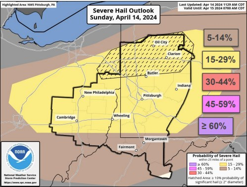
There is a potential for severe weather and isolated flooding on Sunday and Monday. There is low confidence on timing on the development on Monday. Stay tuned for further updates coming over the next 12 to 24 hours.