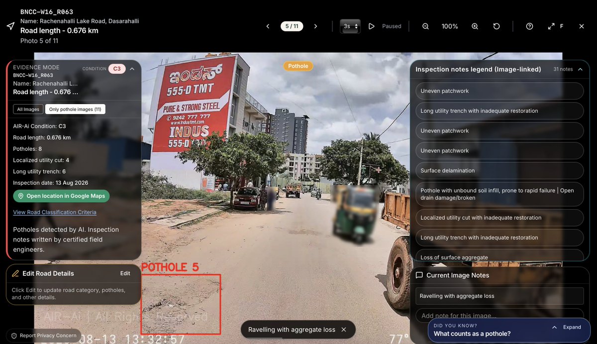
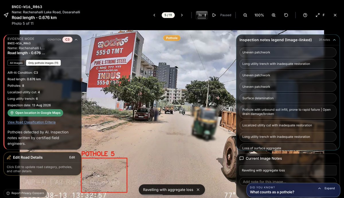
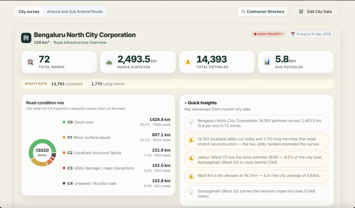
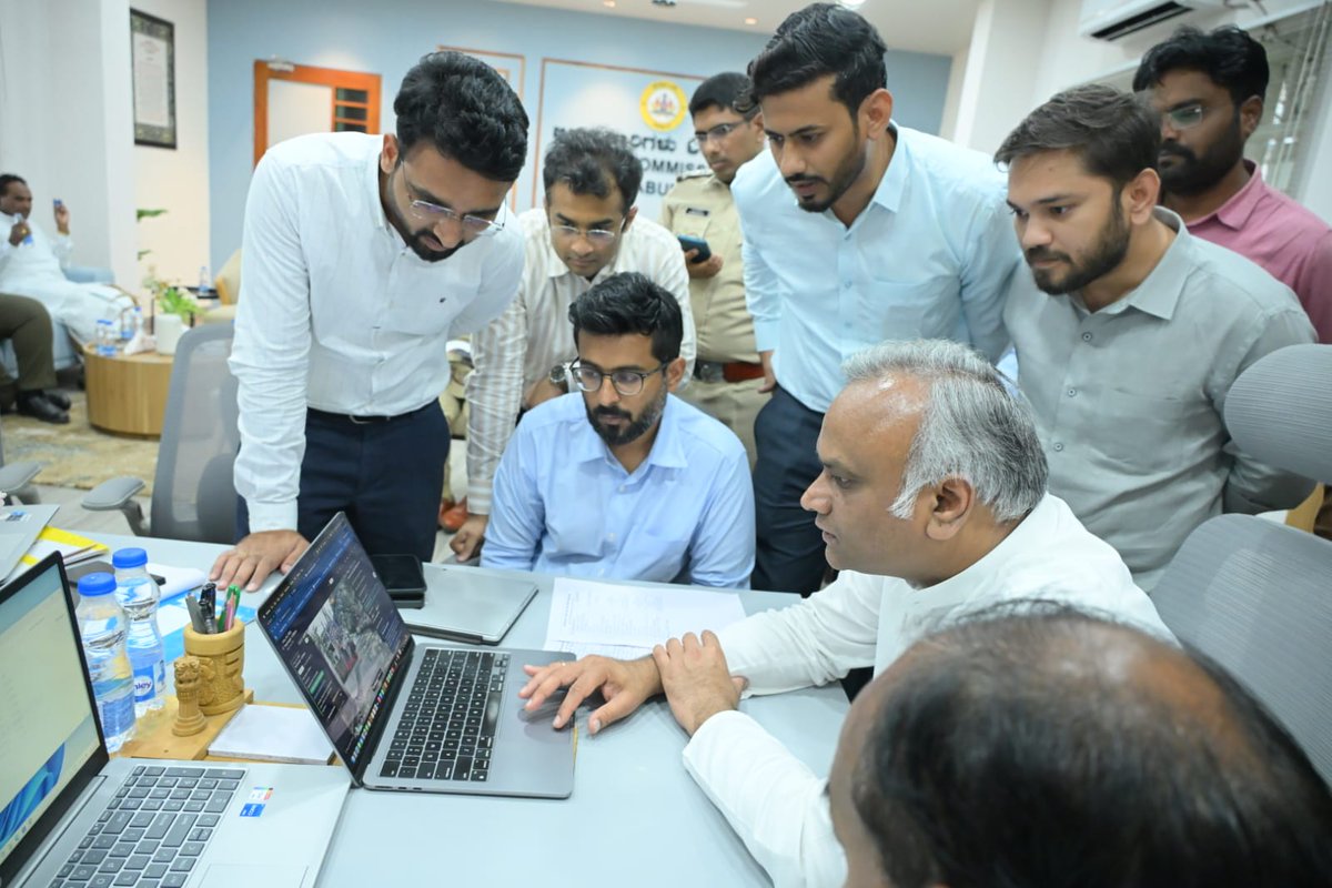
AIR-Ai was demonstrated to Hon’ble Minister Shri Priyank Kharge, Minister for IT & BT and District In-charge Minister for Kalaburagi. The Minister was briefed on the platform by the Kalaburagi district administration, reviewing ward-level road condition data, pothole evidence and the AI-generated assessment for the city.@PriyankKharge
Permissions show where digging is allowed.
AIR-Ai shows where roads are actually cut.
@bmcbbsr, you'd get one dashboard with every utility cut, pothole count and ward-wise C0–C4 condition. 7,000+ km already scanned. Could we have a 15-min Google Meet to discuss its viability? #SmartCities
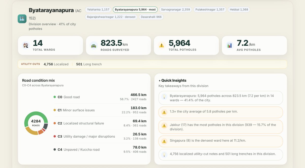
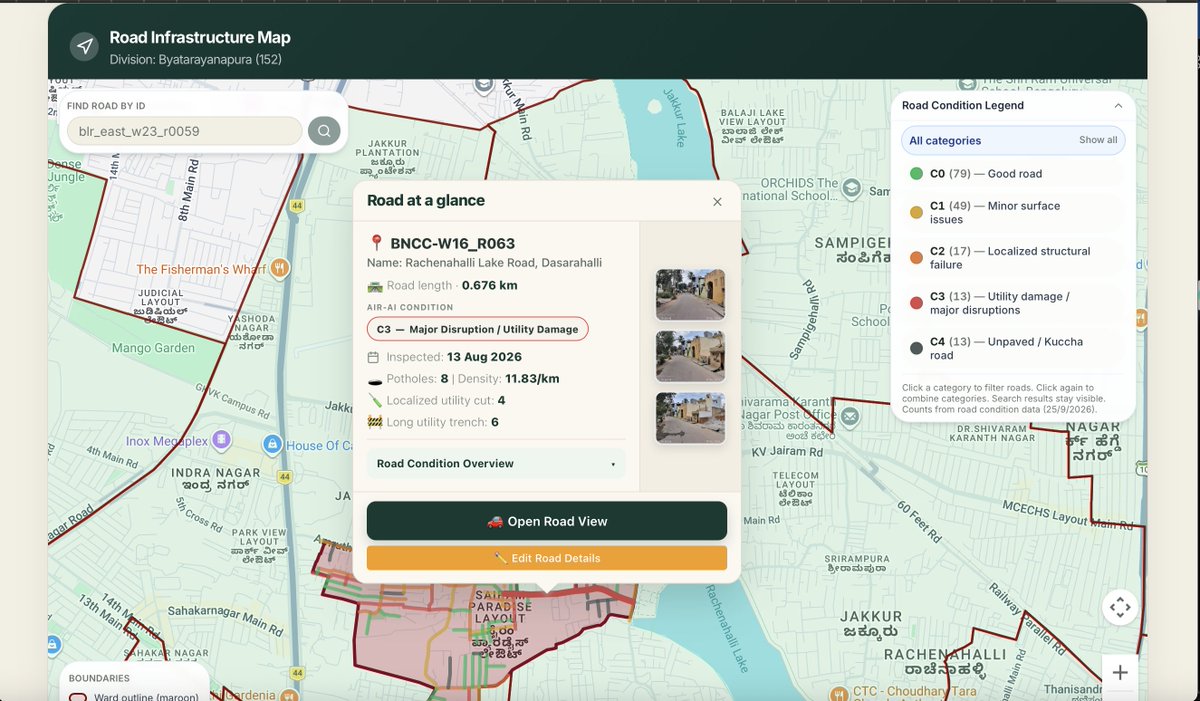
Sir @krishnabgowda, 824 km road surveyed in Byatarayanapura division and found 6000 road defects. AIR-Ai turns road defects into mapped evidence for smarter repairs and budgets. Could we have a 15-min Google Meet to walk you through the findings? Explore our work: https://t.co/wHwPb1Bw9z
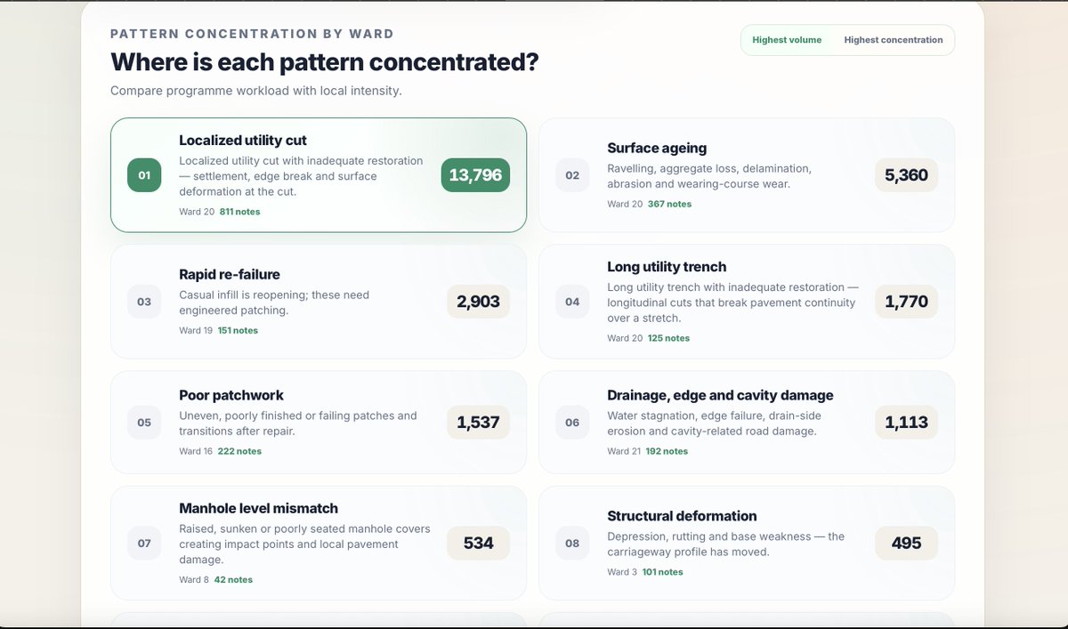
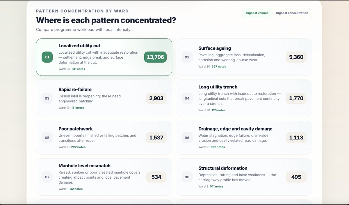
Sir @krishnabgowda , primary cause of road damage in the city is due to utility cuts , this issue needs to be addressed first . AIR-Ai survey found 14 thousand utility cuts just in Bangalore north city corporation.
learn more at https://t.co/waIS8VIjOX
Permissions show where digging is allowed.
AIR-Ai shows where roads are actually cut.
@bmcbbsr, you'd get one dashboard with every utility cut, pothole count and ward-wise C0–C4 condition. 7,000+ km already scanned. Could we have a 15-min Google Meet to discuss its viability? #SmartCities
Permissions show where digging is allowed.
AIR-Ai shows where roads are actually cut.
@bmcbbsr, you'd get one dashboard with every utility cut, pothole count and ward-wise C0–C4 condition. 7,000+ km already scanned. Could we have a 15-min Google Meet to discuss its viability? #SmartCities
Complaints show where people noticed.
AIR-Ai shows every road.
@AmdavadAMC, AIR-Ai provides a city dashboard with pothole counts, utility cuts and ward-wise C0–C4 condition, built from 7,000+ km already scanned in Karnataka. Could we have a 15-min Google Meet to discuss this further.
Fast repairs need fast data. @TMCaTweetAway, AIR-Ai scans every road in the city and shows pothole counts, utility cuts and ward-wise C0–C4 condition on one dashboard. 7,000+ km already scanned. Open to a 15-min Google Meet? #Thane
Sir @krishnabgowda, 824 km road surveyed in Byatarayanapura division and found 6000 road defects. AIR-Ai turns road defects into mapped evidence for smarter repairs and budgets. Could we have a 15-min Google Meet to walk you through the findings? Explore our work: https://t.co/wHwPb1Bw9z
Complaints show where people noticed.
AIR-Ai shows every road.
@AmdavadAMC, AIR-Ai provides a city dashboard with pothole counts, utility cuts and ward-wise C0–C4 condition, built from 7,000+ km already scanned in Karnataka. Could we have a 15-min Google Meet to discuss this further.
Sir @krishnabgowda, 824 km road surveyed in Byatarayanapura division and found 6000 road defects. AIR-Ai turns road defects into mapped evidence for smarter repairs and budgets. Could we have a 15-min Google Meet to walk you through the findings? Explore our work: https://t.co/wHwPb1Bw9z
The time for data-driven road maintenance is now.
A complaint tells us a road problem is already affecting someone. Regular road inspections can flag deterioration earlier.
AIR-Ai helps cities move from waiting for complaints to planning repairs with evidence.
learn more at https://t.co/HE673ffz2J
A defect photo shows one problem. Start-to-end road imagery shows the bigger picture.
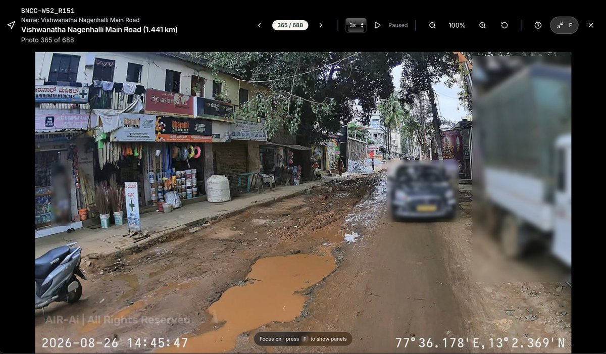
AIR-Ai captures imagery along the full road, helping governments assess its overall condition, understand how widespread the damage is and plan repairs accordingly.
700 images of Vishwanatha-nagenhalli main road has revealed extensive utility damage . The road needs immediate attention.
learn more at https://t.co/HE673ffz2J
A pothole is visible. The condition of thousands of roads across a city is harder to see.
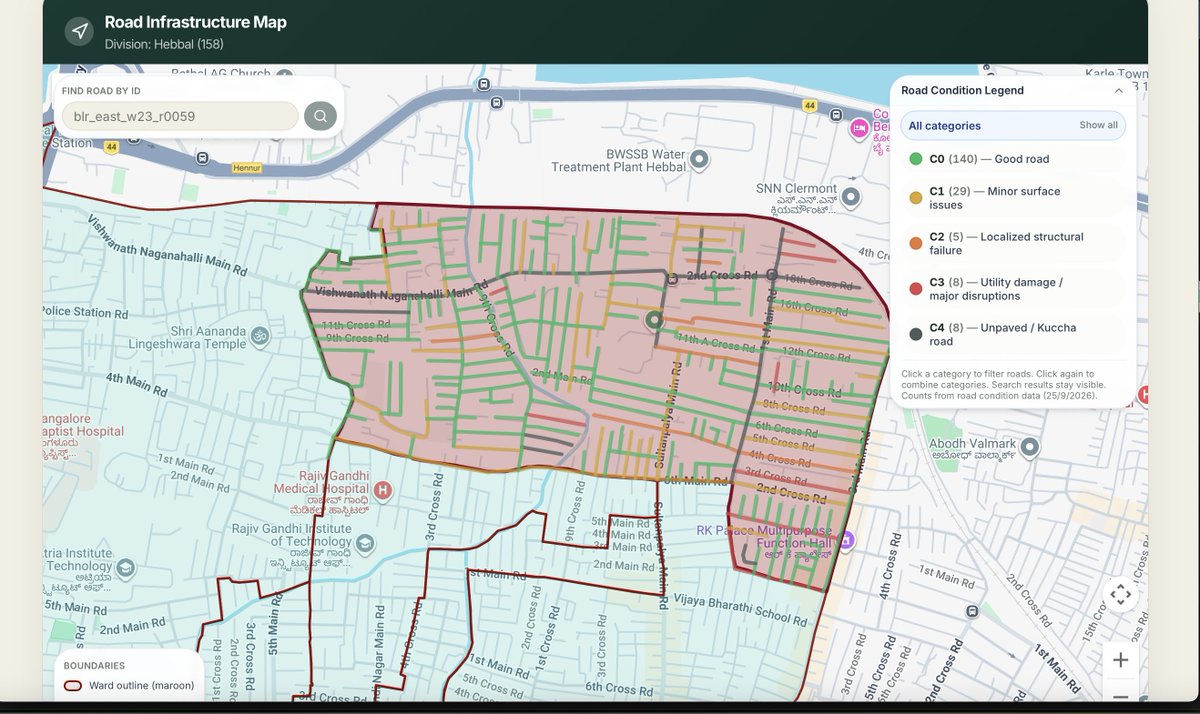
AIR-Ai brings road imagery and defect data into one view, helping governments understand where attention is needed, road by road and ward by ward.
learn more at https://t.co/waIS8VIjOX
Traffic and weather constantly wear roads down. Monitoring thousands of road segments needs technology.
AIR-Ai uses road imagery and AI to detect defects. Colour-coded road maps help governments prioritise repairs, monitor road conditions and plan maintenance.
@PMCPune Manual road surveys take weeks and still miss stretches.
> AIR-Ai scans the city, maps every road, and gives structured condition data ward by ward — so decisions rest on a complete picture, not scattered field notes.
> Live in Bengaluru & Kalaburagi. 7,000+ km already.
What AIR-Ai gives a corporation:
> City dashboard
> Every road mapped start to end
> Pothole counts
> Utility cuts & inspection notes on the map
> Ward-wise roads in classified condition (C0–C4)
Give us 15 minutes in google meet to discuss viability of AIR-Ai data to Pune municipal corporation.
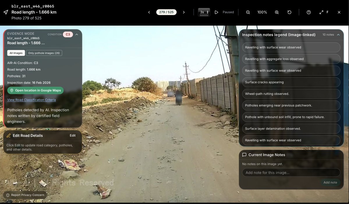
Inspection notes analysis tell us that bulk of this ~6000 road defects are utility cuts . AIR-Ai found 4,756 localised utility cut (from home to manhole chamber) and 501 long utility trench (that spans along the longitudinal length of the road).
Sir @krishnabgowda, 824 km road surveyed in Byatarayanapura division and found 6000 road defects. AIR-Ai turns road defects into mapped evidence for smarter repairs and budgets. Could we have a 15-min Google Meet to walk you through the findings? Explore our work: https://t.co/wHwPb1Bw9z
@anewalok Definitely Sir, AIR -Ai will be glad to work with noida corporation and deliver city wide road inspection data.we can do road inspection in a month and provide all the data required.