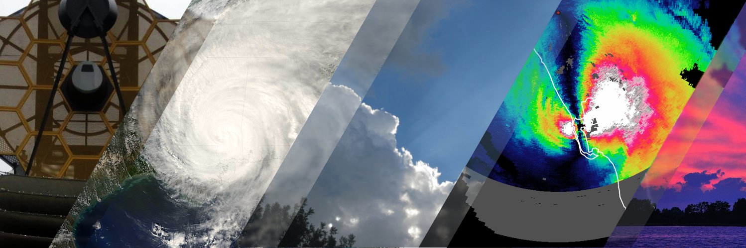
November 30 marks the official end of the 2025 Atlantic hurricane season. It was a statistically strange year, packing 3 powerful Category 5 hurricanes into a 13-storm season.
Here's a collage of all the storms from this season.
#hurricaneseason#wxtwitter
Tropical Storm Milton is forecast to approach Florida mid week. On top of the later threat of surge and hurricane winds, flash flooding across FL is possible starting tonight.
Follow @NHC_Atlantic for updates and get local weather information from https://t.co/7FhKvImgUS. #FLwx
Tropical Storm #Helene has been strengthening throughout the day. The increase in rain detected by the @conagua_clima radar in Cancun closer to the storm's center suggest further intensification may continue into tonight.
Satellite from @TropicalTidbits#HurricaneSeason
Hurricane #Beryl is now in view of Barbados radar. Winds + surge + rain are forecast to begin affecting Windward Islands tonight. Beryl is an unusually powerful storm for this time of year and area.
Radar from @BMcNoldy and @BarbadosMet. Satellite imagery from @TropicalTidbits.
With #HurricaneSeason underway, here's an updated chart / schedule for when computer models become available on @TropicalTidbits.
An active Atlantic hurricane season is anticipated this year. As always, stay #WeatherReady, and follow your local weather service for key updates.
High-res satellite imagery can help identify #tornado paths in rural or remote areas. When vegetation is present, before- and after-images can highlight paths, as shown here with the May 22 EF3 tornado in West Texas, WNW of San Angelo. There were fortunately no injuries here.
The @NHC_Atlantic released their TCR on Hurricane #Otis. The day before Otis rapidly intensified, capped convection might've allowed Otis to build stout low-lvl vortex. W mid-lvl winds + evap cooling aloft + high SSTs later destabilized mid-lvls, enabling rapid convective growth
Radar from Cancun shows Tropical Storm #Idalia organizing under the hood, with the radar-observed rotation nestled well within a large burst of convection observed on satellite
H/t @BMcNoldy / @conagua_mx for the radar imagery, @TropicalTidbits for satellite
#HurricaneSeason
@ChristophMontag Patricia had some high RI probabilities (85% and 87% for 24-hour windows), but not as high as those listed. However, the SHIPS-RII failed to produce estimates for Patricia for most of its life. It may have yielded higher values if it was functioning properly.
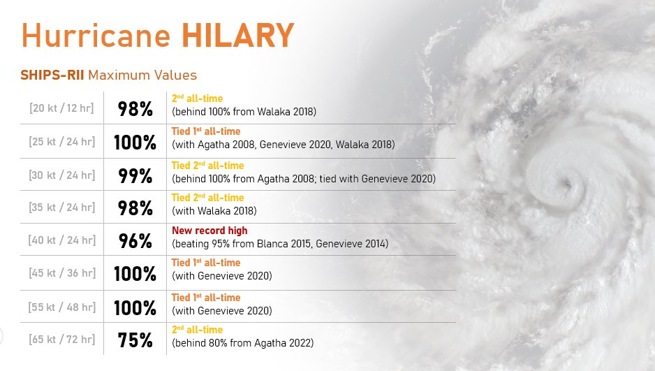
The environment for #HurricaneHilary has been exceptionally conducive to rapid intensification. The SHIPS rapid intensification index (which estimates the probability of rapid intensification) for #Hilary has set or nearly set all-time records over the past day.
#California
Careful precipitation trend analysis from ship based observations done by my @UW_AOS colleague Grant Petty and student Harrison Tran reveals patterns to "Seventy-Year Trends in Ship-Reported Oceanic Precipitation Frequency" https://t.co/uQg9sZbidi
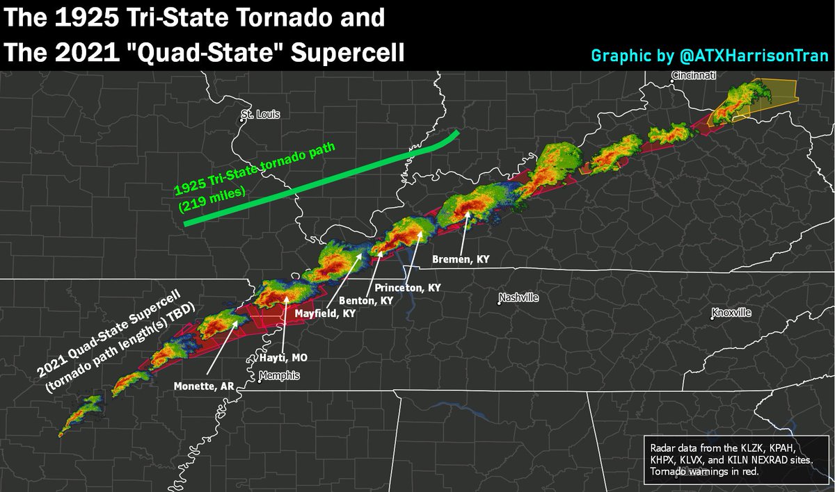
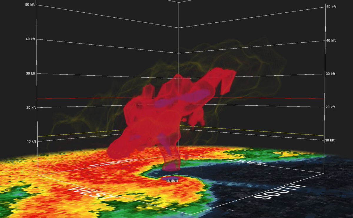
Comparison of the 1925 Tri-State tornado and the storm that produced at least one tornado striking communities including Monette, AR, and Mayfield, KY.
Regardless of whether or not it was a single tornado, the longevity of this storm will likely be studied for decades to come.
Radar clearly shows the structure of the mesocyclone and part of the strong tornado that recently moved through Mayfield Kentucky.
Hopefully everyone in storm's path was able to seek shelter and keep themselves and their family safe.
Here's a look at the maximum rainfall received in each county in the continental US from a tropical or subtropical cyclone between 1900-2020. Harvey and Florence leave noticeable marks.
Big thanks to @DRmetwatch for assisting w/ data collection!
#hurricane#tropical#wxtwitter
Today is the last day of the official 2020 Atlantic hurricane season ... but storms can still form in December! Here's a family portrait of the record-breaking 31 storms so far this year. It took many hours to draw all the storms!
#HurricaneSeason#weather#Tropical#hurricane
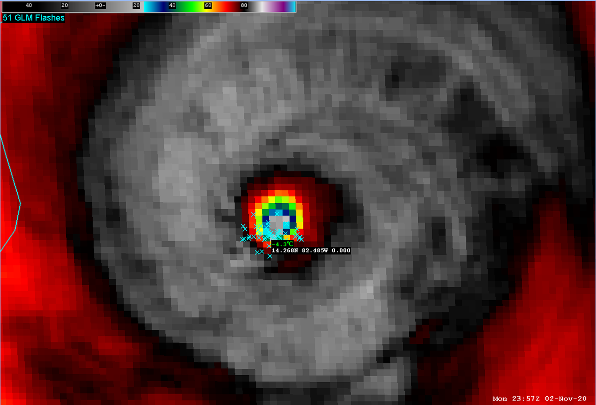
The eye of #HurricaneEta has been clearing out and warming considerably in the last hr, with numerous lightning strikes in the eyewall. This is often a sign of further intensification in an already intense storm. A plane is en route to probe the storm.
#wxtwitter#Eta#hurricane
@AndyHazelton As @cyclonicwx alluded to, the averaging radius used to generate those charts changed a few years ago. The climo line doesn't appear to be adjusted, so instability isn't actually as depressed as it appears. Here's a composite of the last few years w/o the climo line: