How do rivers and streams shape our world? In this activity, middle school students use MapMaker to explore the water cycle, trace major watersheds, and analyze local water pollution issues.
Explore the free resource:
https://t.co/TGlqBinOLg
Want to use digital maps in your classroom? 🗺️🎒
Explore this FREE, beginner-friendly web course for teachers: "Use a Map for Classroom Instruction."
🔹 ~4 hours, self-paced
🔹 No prior GIS experience needed
🔹 Uses free, login-free web tools
👇https://t.co/QRkgLaz5Xf
Ready to level up your GIS skills? 🌍📍
Esri Academy 101 helps you pick the right training:
🎓 MOOCs: Free 4-6 week deep dives
🎙️ Seminars: 1-hr expert tips
💻 Labs: Self-paced & practical
🗺️ Learning Plans: Curated roadmaps
Read here: https://t.co/zQ7gSTwbTC
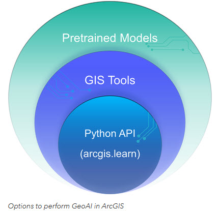
Ready to bridge the gap between AI and GIS? 🌍🤖
Check out this guide for students getting started with #GeoAI in ArcGIS. From using pretrained models to custom Python workflows, here is how to begin:
Read more: https://t.co/P992mJ3KGl
#ArcGIS#DeepLearning#GIS#Esri
Write Journal Articles with MyST Markdown + Auto PDF Generation
Learn how to write journal articles with MyST Markdown and automatically generate a publication-ready PDF and website in minutes. This step-by-step tutorial shows you how to use a GitHub template, manage citations, add figures/tables, and even create interactive research content.
Video Tutorial: https://t.co/cven49YDp2
GitHub Repo: https://t.co/SAFV43671H
Demo Website: https://t.co/LjU8ucclVz
Sample PDF: https://t.co/q01mGeAejX
#opensource #myst #jupyter
Major updates to OpenGeoPub: https://t.co/eZmLAjCWCV
OpenGeoPub now supports reading books directly online, in addition to downloading them as PDF or EPUB. This makes it much easier to search, browse, and navigate content seamlessly.
The platform is also fully optimized for mobile devices, so you can read your books anytime, anywhere.
#geospatial #opensource
I am excited to introduce OpenGeoAgent, a powerful open-source multimodal AI agent for automated geospatial analysis and visualization!
It supports QGIS, Jupyter notebook, and Python scripting. In this tutorial, you’ll learn how to automate GIS workflows using natural language, generate maps, analyze satellite data, and even run complex hydrological models.
You can even interact with the agent using voice commands (no typing needed).
Video: https://t.co/mJ0ort5dzb
GitHub: https://t.co/WgiWV1wGMS
QGIS Plugin: https://t.co/qNRP3WPJWe
#geospatial #GeoAgent #OpenSource #AI
Canada’s “second language” map is really a migration map in disguise. French dominates where history runs deep, but across much of the country the runner-up language reflects recent immigration flows. Punjabi in the west, Chinese languages in big cities, and a patchwork elsewhere. HT @cactusmapping
Got a student who’s curious about maps and data? 🌍 Check out this self-guided GIS exploration! It offers a 4-step pathway from basic map interaction to performing advanced analysis. Perfect for choice time or independent projects. Read more: https://t.co/4h5yn1DJvG
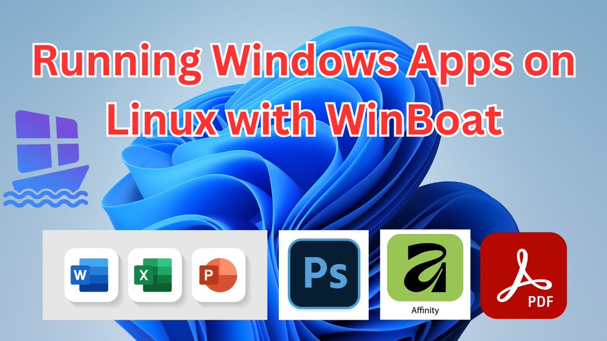
A New Way to Run Windows Apps on Linux with WinBoat 🚀
Discover an exciting new way to run your favorite Windows applications seamlessly on Linux! In this tutorial, I showcase WinBoat, a sleek, fast, and modern tool designed to make installing and managing Windows apps on Linux easier than ever. You can now use Windows apps like Microsoft Office, Adobe Acrobat, Photoshop, and Affinity on Linux with ease.
📺 Video Tutorial: https://t.co/bbvZUDubvv
🌐 Try WinBoat: https://t.co/uhjLjqreBC
📺 Watch more Linux tutorials here: https://t.co/Ee8pc3jcfn
#winboat #linux #opensource
Planning a GIS Day event for November 19? Check out the official media kit to access ready-made posters, videos, social media graphics, and event ideas. Share the power of GIS with your community and make your event a success.
Learn more: https://t.co/UGfOIh308B
Mañana lanzamos y ponemos en marcha uno de los proyectos más importantes para Medellín en las próximas décadas.
Mitigación del riesgo y adaptación al cambio climático.
Así como avanzamos en los Corredores Verdes 🌱🌳, ahora lo haremos también en los Corredores Azules 💧.
En Medellín tenemos un gran río y 4217 quebradas. La mayoría, afluentes del río Medellín.
Su extensión alcanza 2.261 km de cauces hídricos.
Este es un proyecto urbano que planificará la ciudad a partir de su estructura hídrica. Entender que la ciudad son montañas y agua.
Nuevos espacios públicos para comenzar a construir juntos la Medellín sostenible y con calidad ambiental que tanto hemos soñado.
La intervención en el río y en las quebradas finalmente terminarán por ser parques lineales, espacios públicos que articularán la ciudad desde las laderas hasta el centro, que permitirán la planificación urbana para los próximos años, orientarán principios de ocupación del territorio y que estructurarán de manera sostenible el crecimiento de la ciudad a partir de su estructura geográfica.
🌳🌱💧
Happy #WorldTeachersDay 📚🌍 Today we celebrate educators shaping the future. Explore these #GIS resources to bring mapping and spatial thinking into your classroom ➡️ https://t.co/3v8jfC8aM0
.
@esri
Want to bring state-of-the-art remote sensing into your curriculum? Esri offers guided workflows—beginner through advanced—plus materials for SAR, drones, deep learning, and more.
Explore the resources: https://t.co/vNQ8RiNNdH
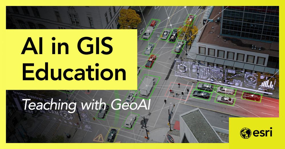
GeoAI is changing how students learn #GIS. See how educators can use AI-powered tools to enhance analysis, automate tasks, and build future-ready skills.
Read more: https://t.co/Za6CKW5Zzu
7️⃣Essential Spatial Operations in Python🐍 (with working code examples)!
Bookmark this thread and elevate your GIS game instantly. Your future self will thank you later! 🧵
As an educator, you can use maps to give students the knowledge and tools they need to find solutions 🧠
Use MapMaker in your lessons to help students build spatial thinking skills 🗺️ https://t.co/O8HmI8q4PY
GlobalBuildingAtlas' 2.75B Building Footprints are now on S3. 1.1 TB of uncompressed GeoJSON down to 210 GB of Parquet.
Download any city's buildings in seconds: https://t.co/TMxxEnDSPI