Transdisciplinary research+data center of @columbiaclimate studying human-environment interactions. Free data, map svcs+tools. Our main program is NASA SEDAC.
Data from NASA's Socioeconomic Data and Applications Center reveal what Earth observations mean for the lives of people and communities on our planet. Read how socioeconomic data put the who into the scientific questions of what, where, when, why, and how: https://t.co/nLFUWxSW6O
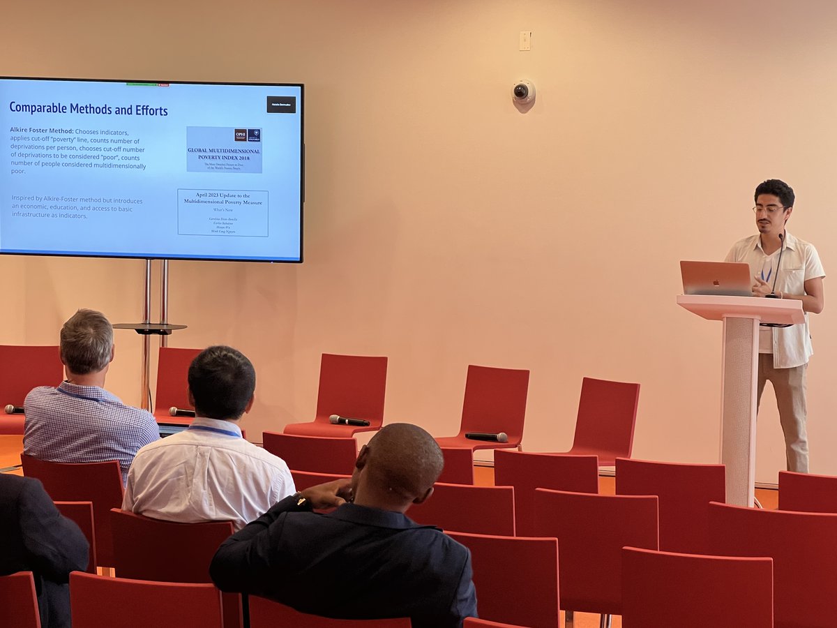
@columbiaclimate@ciesin’s Juan Martinez presents newest approaches to multidimensional poverty measures, @ at Human Planet Forum 2023 July 11-12. Agenda and zoom link for day 2: https://t.co/6EAtCMbt8x https://t.co/FdkPi4EFOZ
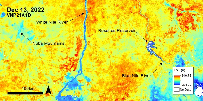
#VIIRS Version 2 Land Surface Temperature and Emissivity data are here! VNP21s, and the new NOAA-20 VJ121s come in various temporal and spatial resolution options. VIIRS LST is shown here over Sudan and South Sudan.
Visit NASA’s #LPDAAC to learn more: https://t.co/3JmuHxuPJ4
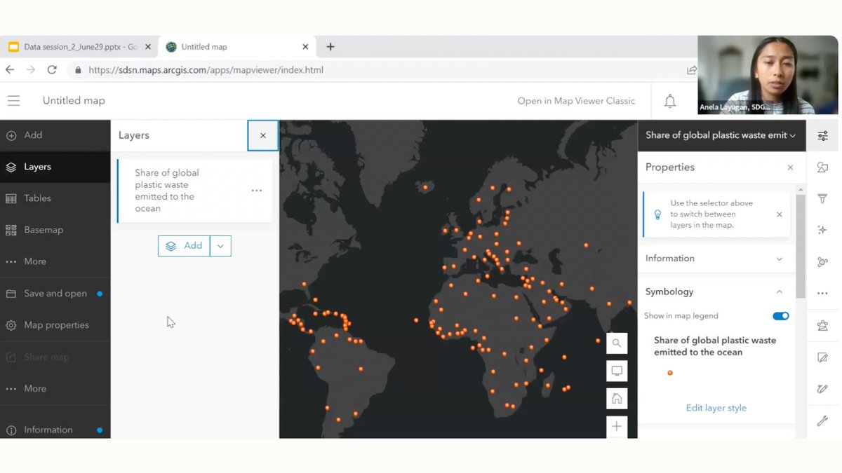
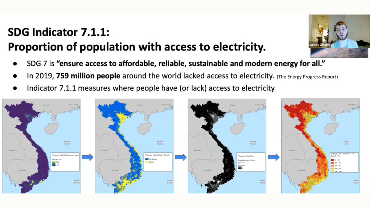
Thanks again to @JamesGib7 for joining today's session of the Eco Ambassadors summer program!
James shared the #geospatial analyses and data visualizations used at @CIESIN, and inspired our students to begin working with #GIS to work towards the UN's #SDGs 💻
Today the Eco Ambassadors learned #AGOL basics & how @JamesGib7 from @CIESIN uses GIS & data visualization for #SDG indicators🗺️
Our students have started developing ideas for their very own #StoryMaps that will showcase these new #geospatial data viz skills and creativity!
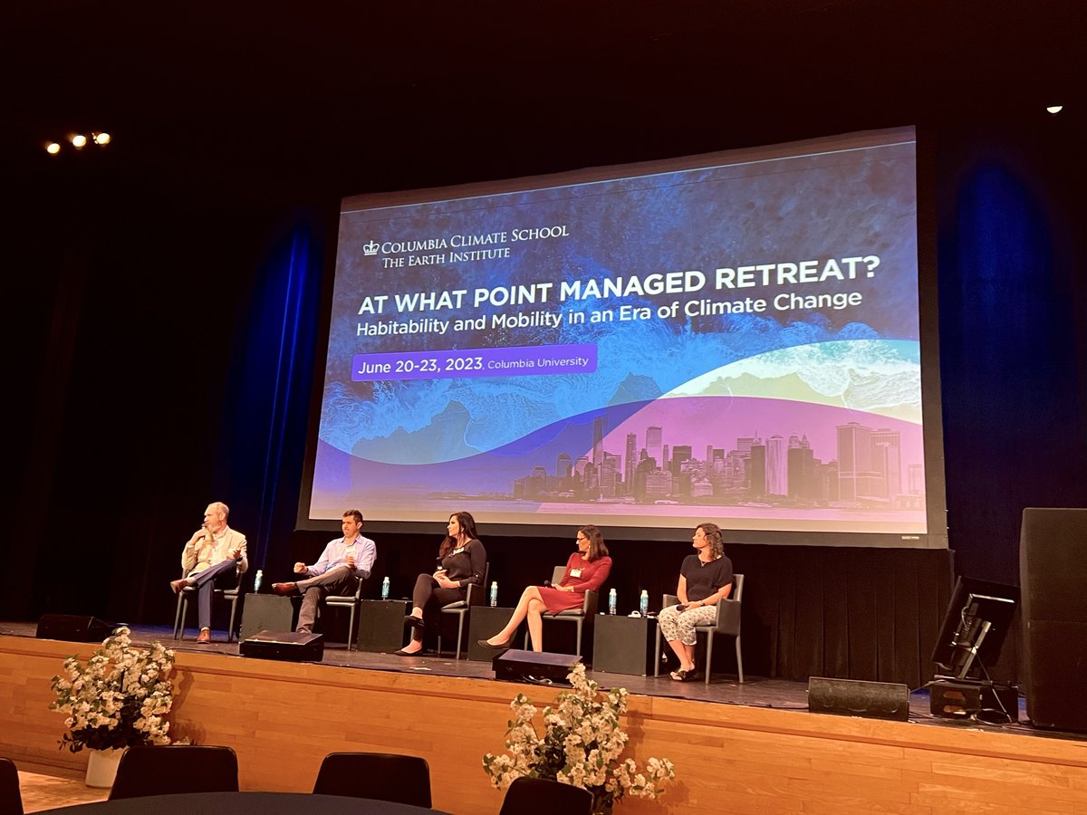
At our 2023 #ManagedRetreat Conference, experts from @LSU and @urbaninstitute present their research and discuss opportunities to advance capacity to reduce social, environmental, economic vulnerability in climate migrant receiving communities. Learn more: https://t.co/KADKqkd80M
How will decisions like State Farms’ to stop insuring in CA influence climate adaptation and/or managed retreat?@Alex_deS+others from @columbiaclimate comment: https://t.co/Zrcbxfhd6x Explore related topics @ the Managed Retreat conference June 20-23 https://t.co/wGAsVrMCou
Webinar on 6/21: Increasing NASA Earth Science Data Accessibility with GIS
Join us to learn about #GIS initiatives, services, and capabilities by NASA’s Earth Science Data Systems (ESDS) program to improve your data workflow.
To register: https://t.co/1eLapskSpz
Two weeks from today, join us and @UrbanOceanLab
for a free webinar on how local governments and communities can better address the urgency, scale, and complexity of climate-driven displacement -https://t.co/Z1lwJ6mahH
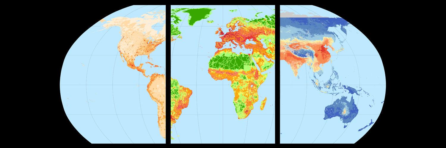
GLanCE has grown! The Global #LandCover Mapping and Estimation product now covers Europe. This product includes seven land classes or a greenness index as shown in this image over Venice, Italy.
Visit NASA’s #LPDAAC to learn more: https://t.co/fmQKz6Vg90
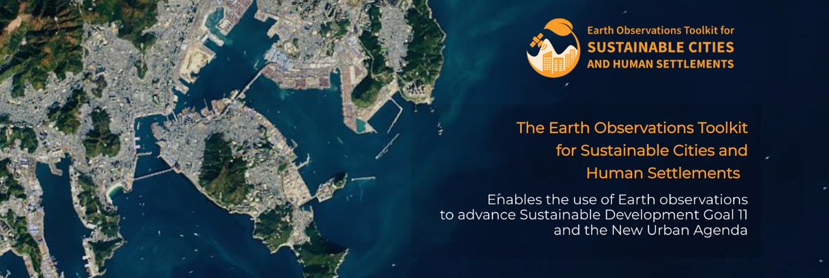
🛰️Thank you @SDSNYouth for hosting SDGs Today's @maryamarabiee & @dana_r_thomson from @IDEAMAPSNetwork for a presentation on @EO4SDG's EO Toolkit for Sustainable Cities & Human Settlements as part of the Local Pathways Fellowship webinar series! 👉 https://t.co/4Jxe53wdAB
The implications of climate-change-induced migration are the subject of an @LSEnews podcast, featuring @ciesin@columbiaclimate research scientist Susana Adamo: https://t.co/LfvKerWSBr
@ciesin’s #NASAsedac Hazards Mapper displays near-real-time data on fires, earthquakes, air quality+for the U.S., flood+tornado warnings. It can also estimate population in proximity to a hazardous event and identify nearby facilities at risk. https://t.co/Z2xKD5nld1
🔔 Job alert in #Data4Dev!
#Data4SDGs partner @ciesin is looking for an Associate Director to work at @columbiaclimate school and lead initiatives related to data sharing, climate change, sustainable development + more 👀
Details 🔗 https://t.co/hnFt1p7GVW
Developed by NASA Socioeconomic Data and Applications Center (SEDAC) at @columbiaclimate@CIESIN, an accessible new mapping tool will make it easier for individuals and communities to plan for flooding & sea level rise across nearly all of New York State. https://t.co/dceIP4mBhi
New! Easy-to-use flood planning tool contains digitized data for all NY (except NYC). Developed by @columbiaclimate@ciesin's #NASAsedac. Blog: https://t.co/F6plZygEOV Mapping tool: https://t.co/Nrt41Hyy2Z
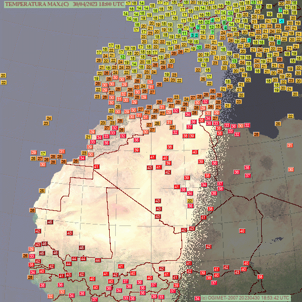
Brutal heat in Sub Saharan Africa with temperatures up t 46/47C these days.
Today the highest was 46.4C at Podor in Senegal.
Hottest April day on records at Akjoujt in Mauritania with 45.3C.
This station had already beaten its record for March.
This Saturday May 6 2-6pm ET, join our Climate Imaginations Network for inaugural Spring Festival (at Lenfest Plaza/The Forum at Columbia) to build connections, engage with climate stories and art, and cultivate joy and strength. Learn more/register today! https://t.co/r5upDMzYsU
Job Opportunity: @ciesin is looking for a new associate director for our Science Applications Division, one of 4 divs. —w/Geospatial Applications, Data Ctr Svcs+IT—w/in this center of the new @columbiaclimate school. Go here for a description+to apply: https://t.co/333jE5h3CX