Geographer researching and mapping environmental niche and sustainable agriculture via remote sensing • Assistant Professor, Geosciences, University of Arkansas
I often think about modifiable spatiotemporal unit problems and how to better communicate such geographic challenges. I built this #EarthEngine app to support a project on LULC in SE Asia and I hope that others will find it fun, valuable, or interesting! https://t.co/1qGj9COOQn
Our website is now live! Here you can find information about events, leadership, and objectives unique to our chapter at the University of Arkansas. Visit us to learn more about where Razorbacks map! @youthmappers • @UArkansas • https://t.co/UBloKCUHHG
My new lab website is live! If you're interested in collaborating or coming to work with me (Department of Geosciences at the University of Arkansas; @UArkResearch), please feel free to reach out. https://t.co/gckVbk7cOC
Creatures travel, climate changes, habitat suitability is a 'living' spatiotemporal phenomenon. Here's what 15 years of oscillating inter- and intra-annual tsetse suitability looks like in Kenya.
Every day, @NASA data makes it to our plates. From fisheries to our favorite fruits and veggies, our Earth satellites help develop more sustainable farming practices and plan for the future. Dig in! ⬇️ 🍽
https://t.co/YQL3e7CTYH
#Landsat 9 launch countdown is on! All coming together for September 16, 2021, launch. 🚀🛰️📡
-#OLI2 radiometric and geometric performance equals or surpasses #Landsat8 OLI performance
-#Landsat9 observatory at launch site
-detailed pre- & post-launch timelines shared.
Earth-art Sunday features some beautiful alluvial fans seen from space!
They represent the distinct pattern of water runoff from the mountains, where the eroded soil, with the help of rain, is carried from the mountain slopes to lower lands.
📷Northeastern Iran
📷Tibetan Plateau
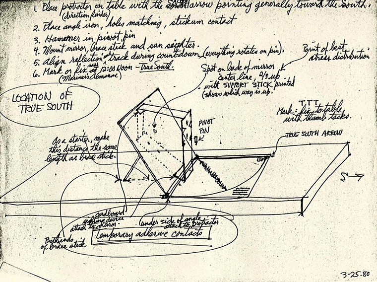
Since #EarthDay is next week, we wanted to share this very special painting for #FullDiskFriday.
Commissioned in 1954 by Dr. Harry Wexler, a meteorologist with the U.S. Weather Bureau, it imagined what a satellite might "see” from orbit—before the first one was ever launched.
The vantage point of space has been valuable in teaching us more about our home planet. 🌎 Join us as we celebrate how we’re #ConnectedByEarth — through virtual Earth Day events happening from April 21-24. Get the details: https://t.co/5y5pWvT5vJ
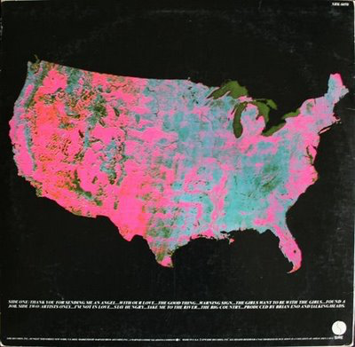
We're unveiling a new dimension to Google Earth — time. Launched today with @nasaEarth@EU_Commission@USGS@esa, Timelapse in Google Earth provides a better understanding of Earth’s dynamic changes. Explore our changing planet: https://t.co/xz95CfPlaN
The coastal state of Sinaloa is one of the largest shrimp farming regions in #Mexico. Vast areas of wetland (blue-green) and grassland (yellow) found along the coast in 2010 were inundated with water (light blue) by 2015. https://t.co/WsJBGcRjdW
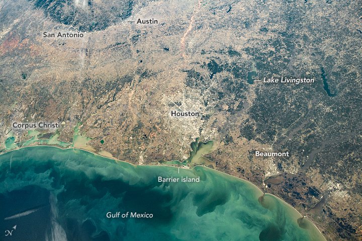
An astronaut took this photo of the #Texas Gulf Coast showing its flat coastal wetlands, barrier islands, and inland woodlands. The photo centers on Houston, home to @NASA_Johnson, where astronauts live and train. https://t.co/oajZLVGmNR
Agricultural monitoring is getting GLAMorized. A key web-based platform for tracking crop conditions during the growing season is now faster and more flexible. 🛰️👨🏾🌾🌽 https://t.co/6PgdAjA7BU
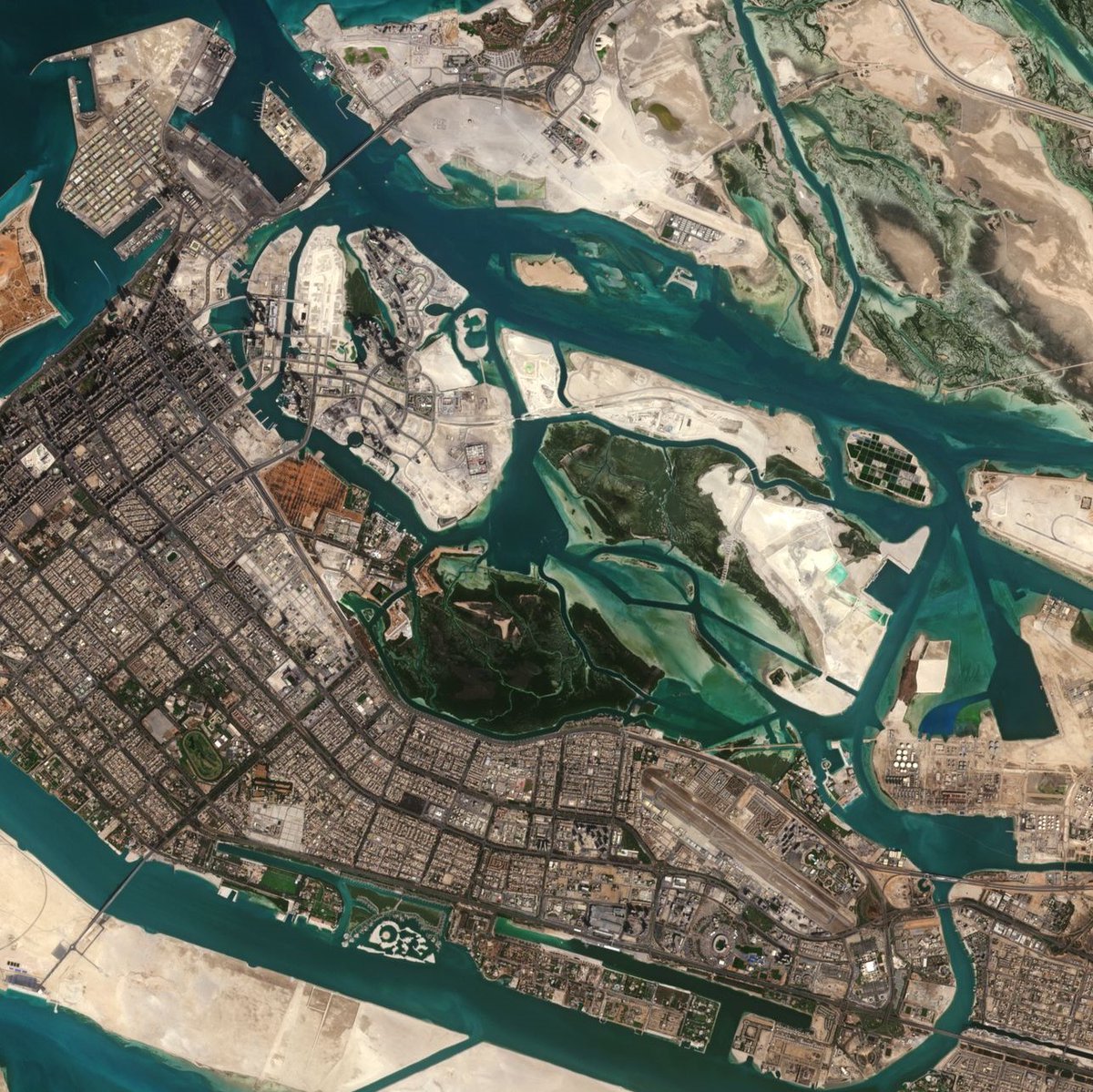
Tides, currents, and human activity combine to produce art-like patterns in the waters off China’s southern province of Guangdong. https://t.co/Euttl7TxDO