Chief Meteorologist, @WTXLFirstToKnow (#TheABC27Original) since 2008. Useful/straightforward information.
Husband, Dada. Born in the '70s, crafted by the '80s.
Can't watch your new format...
I'll tweet/follow someone else...
You guys don't matter anymore...
Your family is a bad example for children...
All are forms of remarks I've received before.
Regardless, I will still cover your weather.
Don't underestimate.
#TheABC27Original
Is your preferred tropical forecast source posting *models,* or posting *forecasts*?
Tropics check: Monitoring the moisture blob (09/19/2024) https://t.co/ZIdSB4Ajnc
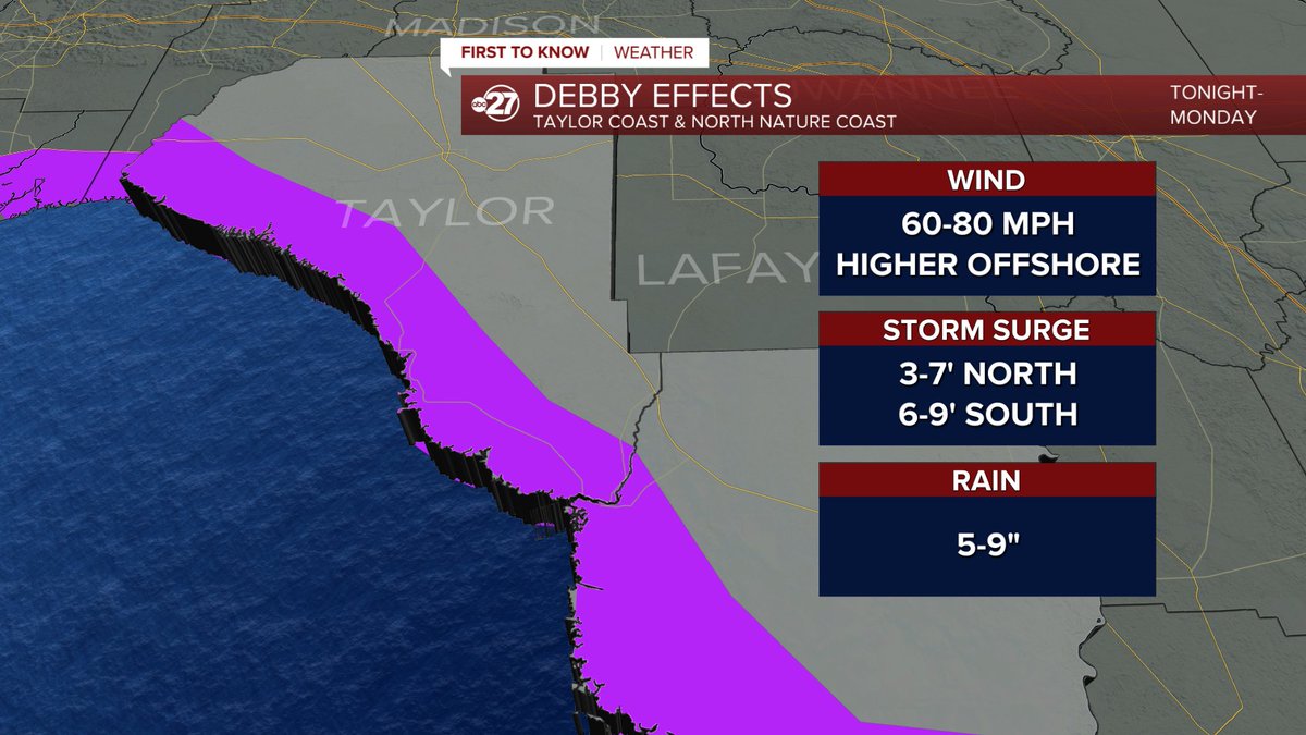
The most noticeable change as of the 8pm advisory is shift east in Debby's tropical storm force wind field. Tropical storm force winds of 39+ mph now extend farther into the west coast of Florida. This supports the idea of a landfall farther east in Taylor County.
Stay vigilant
Spaghetti is best served on a plate for dinner.
Breaking down my thoughts, current expectations, and unknowns related to Disturbance #97L ...
https://t.co/ixhj4ZmuBH
and
https://t.co/E1QhKppsQ6
This. I’m even seeing meteorologists, not just weather weenies, sharing single deterministic runs from one model 10 days out. Please please stop, only increases unnecessary hype. It’s not informing. If you want to inform, include either multiple models or ensembles. Show the whole story, not just one chapter.
3:35pm -- The stretched-out line of heavy rain parallels US 84 just to the south. Some neighborhoods along US 441 will encounter frequent lightning and stronger wind gusts. Current severe thunderstorm warning continues until 4:15pm.
2:15pm -- Small but hefty thunderstorm will move east-northeast into several northern Madison County neighborhoods with strong wind gusts, downpours, and active lightning. A severe thunderstorm warning is up through 2:45.
3:44pm -- Individual thunderstorm with strong winds, small hail, and frequent lightning set to move through neighborhoods along Mt. Carmel Road and surrounding areas in Brooks County. Moving slowly so the downpours can add up quickly in rain gauges.
Torrents of "spaghetti" no doubt will be tossed around in the days/weeks to come.
HERE'S WHAT I THINK about the Atlantic disturbance 95L, with video and context ... and no spaghetti.
https://t.co/EZjJdrxgqI
6/19 7:30am ET: We wanted to use Potential Tropical Cyclone (PTC) 1 as a learning opportunity and reminder for this Hurricane Season. A PTC does not have a well-defined center, but is capable of producing tropical storm force winds. Take a look at the graphic for more info!
2:01pm -- Thunderstorms focusing on the Suwannee/Withlacoochee river areas, with one point in northern Suwannee County with higher hail chances along with strong wind gusts. Severe thunderstorm warning straddles this section of the Suw. River until 2:30.
11:51pm -- Latest round of heavy rain will come with quick pick-up in wind gusts for the Highway 37 region between Cook and Lanier counties. Heavy rain action is renewed which can/will worsen flooding situations. Severe thunderstorm warning in effect until 12:30.
10:23pm -- Flash flooding risk will be ongoing in sections of Berrien, Lanier, and Cook counties where around 2-3" has fallen and another batch of downpours are expected within the next couple of hours. The flash flood warning there will now expire at 1:30 am.
7:49pm -- The blob of severe thunderstorm action near the Alapaha River area is forecast to affect northern Clinch County, so a new severe thunderstorm warning has been raised there. Northern Lanier County will be in more immediate line of a zone of intense wind gusts.
7:43pm -- Wind gust threat remains on the higher side in Berrien County, with a higher hail risk near Highways 37 and 76 in Cook County. Severe weather is possible extending into Lanier and northern Lowndes counties with the warning in effect until 9:15.