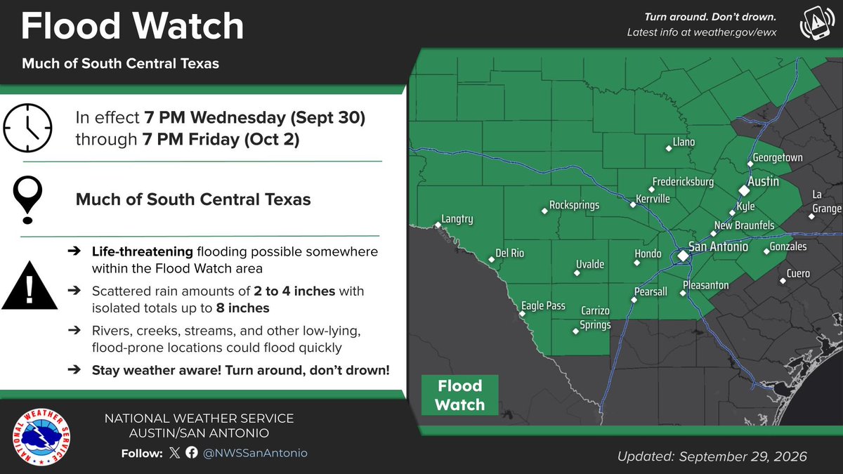
A Flood Watch has been issued which includes much of South Central Texas from 7 PM Wednesday through 7 PM Friday. A cold front will bring periods of heavy rainfall which could lead to life-threatening flash flooding. Stay weather aware and have multiple ways to receive warnings.
5:30AM Radar Update: A FLASH FLOOD EMERGENCY has been issued for the Guadalupe River between Center Point, Comfort, & Bergheim. A LARGE and DEADLY FLOOD WAVE is moving down the river. River gauge at Center Point has risen 32 feet in 4 hours!! Seek higher ground now!!! #txwx
Severe thunderstorms capable of producing damaging winds (isolated 75+ mph), large to very large hail, and tornadoes (some strong) are expected today across parts of northern New York and New England. Thunderstorms with scattered severe winds and isolated hail will also be possible across portions of Montana. Visit https://t.co/qk3BcVP5M8 for more.
June 15 8pm EDT Key Messages: A disturbance over Mexico is expected to emerge into the NW Gulf around midweek and could become a tropical storm. Regardless of formation, periods of intense rainfall are expected from Texas into the Lower Mississippi Valley this week. Stay up to date with the latest at https://t.co/Wq6ZtKfHp9 and https://t.co/zJDnFUKPfU.
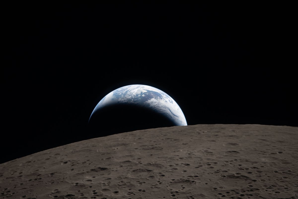
Earthset.
The Artemis II crew captured this view of an Earthset on April 6, 2026, as they flew around the Moon. The image is reminiscent of the iconic Earthrise image taken by astronaut Bill Anders 58 years earlier as the Apollo 8 crew flew around the Moon.
Today’s Artemis II: Integrity on its way to the Moon. Crossing the field of view from the bottom left to the top right. Time-lapse covering the period from 03:34:53 to 06:12:07 UTC on 2026-04-06.
Make new friends, but keep the old.
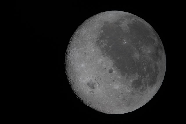
A new photo captures the Moon's near side on the right (the side we see from Earth, identifiable by its dark splotches) and its far side on the left. The Artemis II crew are the first to see the far side with human eyes.
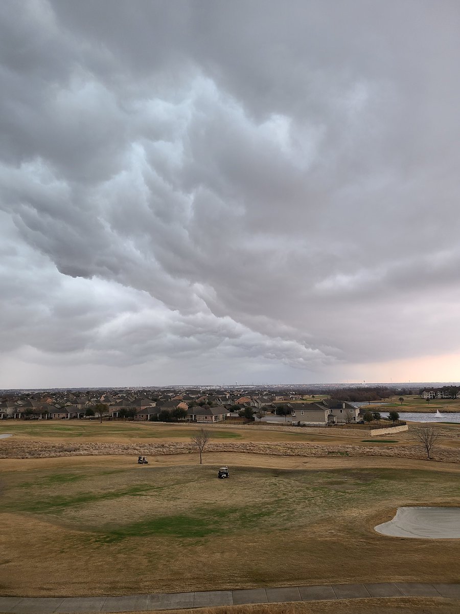
An upper level disturbance & cold front will move across our area late today through Wednesday. This will bring showers and storms. Severe storms & heavy rains are possible with the greatest chances over the Edwards Plateau and Hill Country. All modes of severe storms possible.
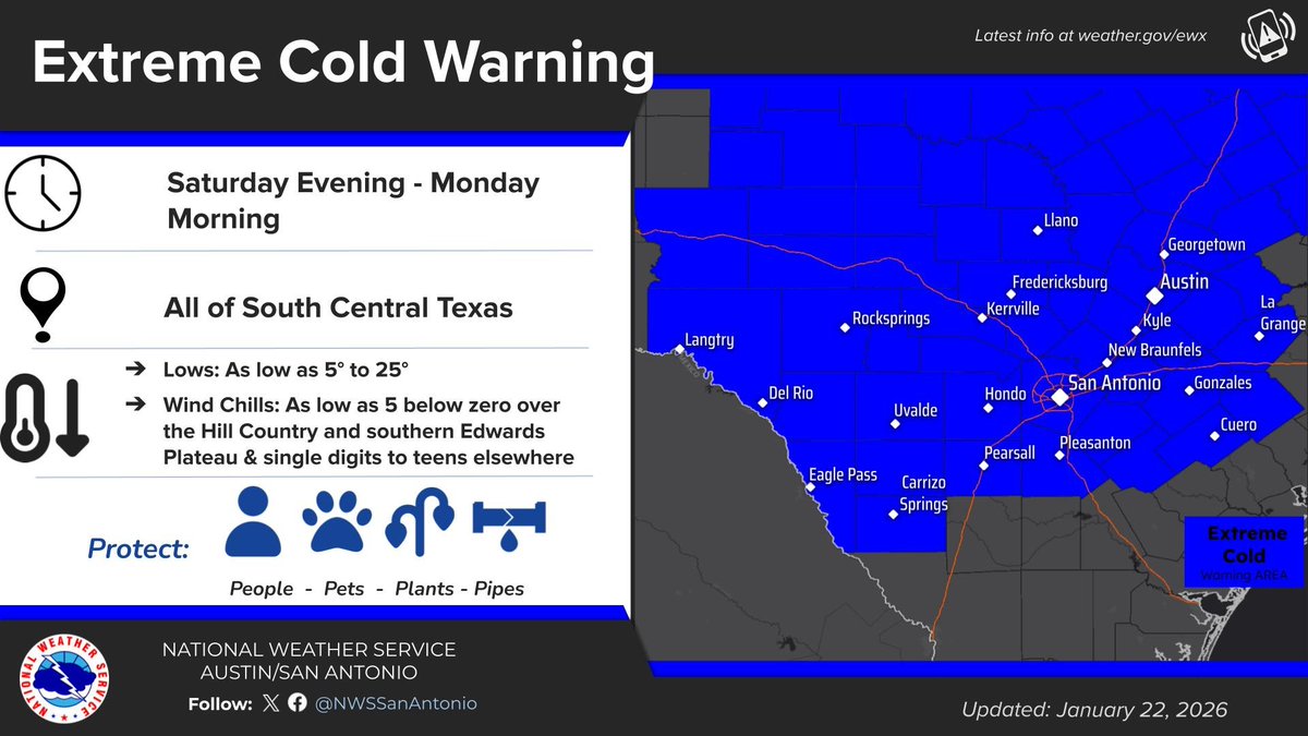
We upgraded the Extreme Cold Watch to Extreme Cold Warning to begin Saturday evening through Monday morning. Lows as low as 5 to 25 degrees and wind chill values as low as 5 below zero over parts of the Hill Country and southern Edwards Plateau. #txwx
The weather will be cool to start December, but the pattern by mid-December favors a shift to warmer than average temperatures. Rains this month may bring some drought relief for the Coastal Plains, but drought is forecast to continue for most of South-Central Texas. #txwx
Looking through the video footage of Hurricane Melissa a bit more closely and it turns out there was some lightning visible even during the daytime over on the left side
👁️ The eye of the storm.
🌀 On 28 Oct, Hurricane Melissa - the strongest in 🇯🇲 Jamaica’s history - made landfall with winds up to 298 km/h and pressure of 892 hPa.
🛰 The eye was captured by #CopernicusEU#Sentinel2.
🔗 https://t.co/0JILNAkvnQ
#ImageOfTheDay