⚠️ Automatic posting of weather data on Twitter is currently unavailable, apparently due to recent changes made by Twitter.
We are actively working to find a solution as soon as possible.
We apologize for any inconvenience this may cause and greatly appreciate your patience.
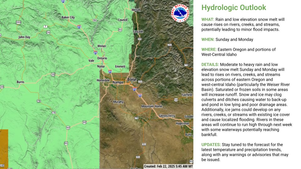
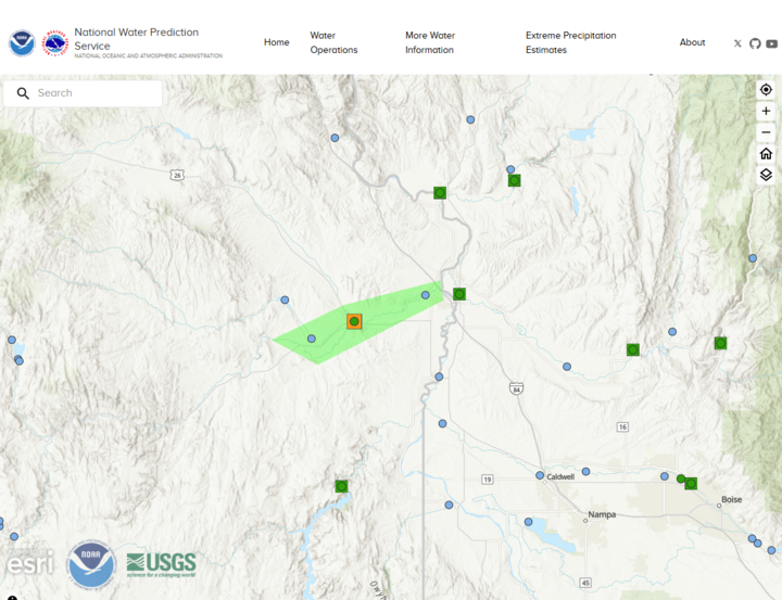
We have received reports of minor lowland flooding, mostly across the Payette and Weiser Basin in southwest Idaho today. We are also watching the Malheur River as high inflow from rain and snowmelt works its way through the system. A flood warning for the Malheur River at Vale.
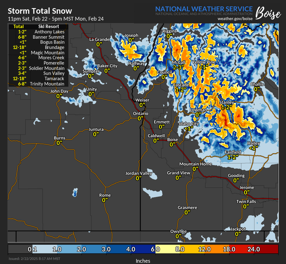
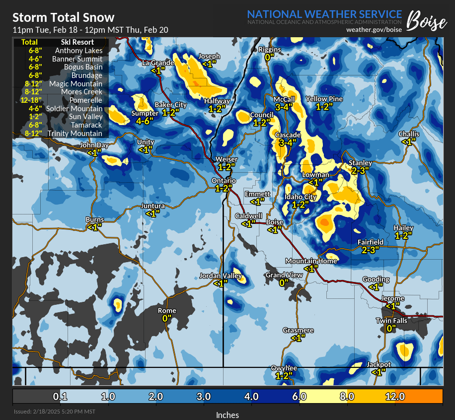
🌨️More valley rain & mountain snow through Tue. Snow levels currently 6k-7k feet, lowering to 3k-4k feet overnight.
🏔️Locally heavy snowfall rates possible for SW Idaho mountains.
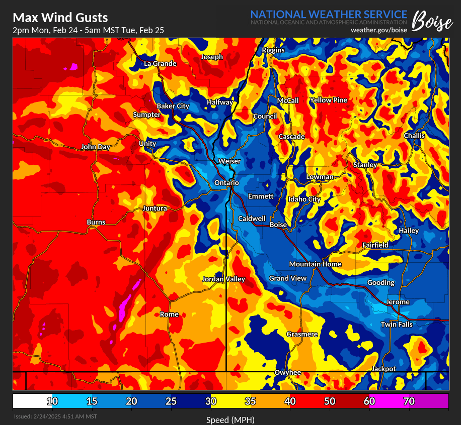
💨Very windy conditions across SE Oregon & mountains of SW Idaho later today into early Tue.
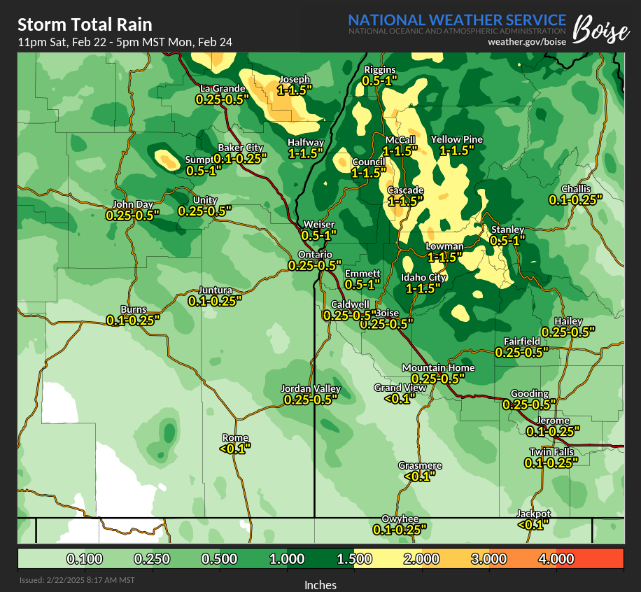
Here are some of the preliminary rainfall/liquid equivalent totals from the past 24 hours. Several mountain sites received 1.50" to 2.00", so far. Periods of precipitation will continue through Monday evening/early Tuesday.
"Waves" can be seen on the Rhinehart Butte webcam (especially toward the end of the video) as low stratus and fog slosh around the valley near Vale, Oregon.
Webcam Courtesy of Univ. of Oregon, OHAZ, and ALERTOregon. https://t.co/8JyHA2nvWO
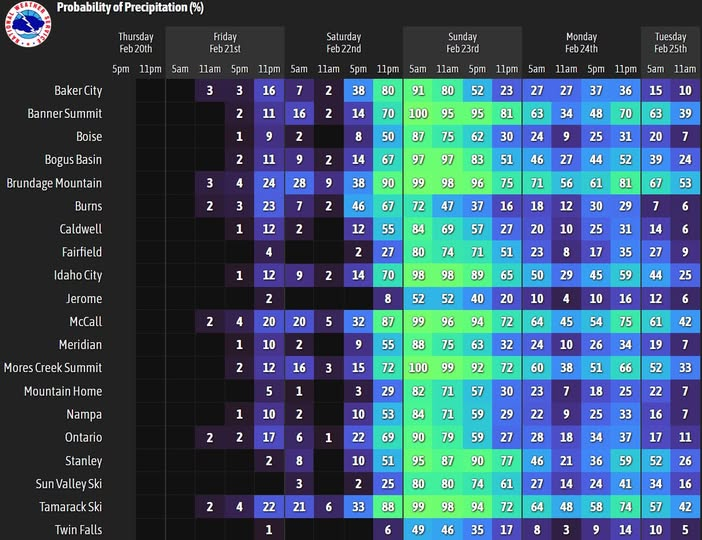
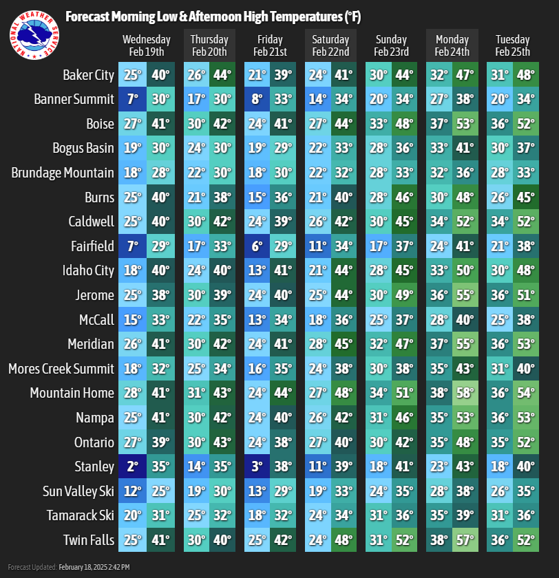
💧❄ Locally heavy rain and high elevation snow will return for tonight and Sunday. We'll see mild temperatures and snow levels rise to between 6500-8500 feet on Sunday. This will lead to rises on rivers and streams and the potential for minor flooding. Stay safe and stay dry.
We are expecting another wet period☔over the weekend from late night Saturday through Sunday evening, with rain🌧️over the lower valleys and some snow🌨️over the mountains.
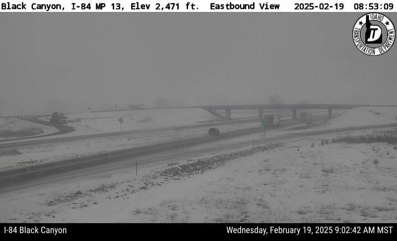
❄️🧊A Winter Weather Advisory has been issued for mixed precipitation (snow, freezing rain, sleet) until 3 pm MST.
⚠️Slick snow covered roads will make travel difficult in some spots. Slow down and allow extra time if traveling in these areas!
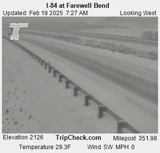
5:30 AM MST 2/19: Snow/rain showers are moving into Western Idaho this morning. Accumulations are expected above 4000 feet while a rain/snow mix is expected in most valley locations. Exercise caution during morning commutes, as slick roads and low visibility are expected.
The next round of rain and snow arrives early Wed morning. Snow levels will begin around 2500-4000 feet MSL, and rise to 3500-5000 feet by mid-day Wed. Spring-like temperatures are expected by late this weekend and into next week. 🌷
A moderate rain shower will pass over the Boise Metro shortly. The intensity could result in wet snow mixing in. If so, brief slush on cold surfaces would be likely.
January was colder than usual across much of the U.S., averaging 0.9°F below normal. It was also the 6th driest on record, with widespread dryness across the West and Northeast. https://t.co/3THPX8vKJi
❄️More snow is on the way for Sunday. Roads could be slick to start. Lower elevations will see a rain/snow mix or changeover to rain during the afternoon as temperatures warm above freezing.
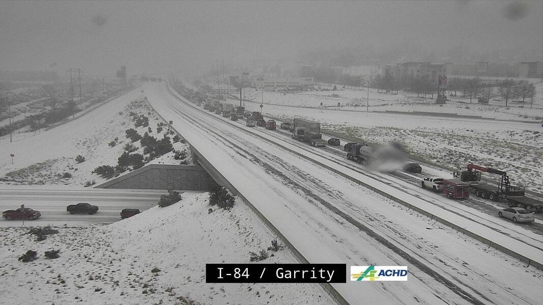
Snowfall in the last hour has rapidly increased. Here is a traffic cam along I-84 & Garrity Blvd. In the last 2 frames, you can see the visibility rapidly decrease and traffic stopped in the still image.
❄A broad area of snow is moving through SW Idaho, bringing blowing/drifting snow. Roads will rapidly become slick, with visibilities becoming less than a mile while this is moving through the area. Be sure to slow down and drive safe!❄
Current satellite view (as of 3am Thursday) of the winter storm that will impact our area later today. Despite it's visual appeal from above, this system will bring hazardous winter conditions to the majority of our area.
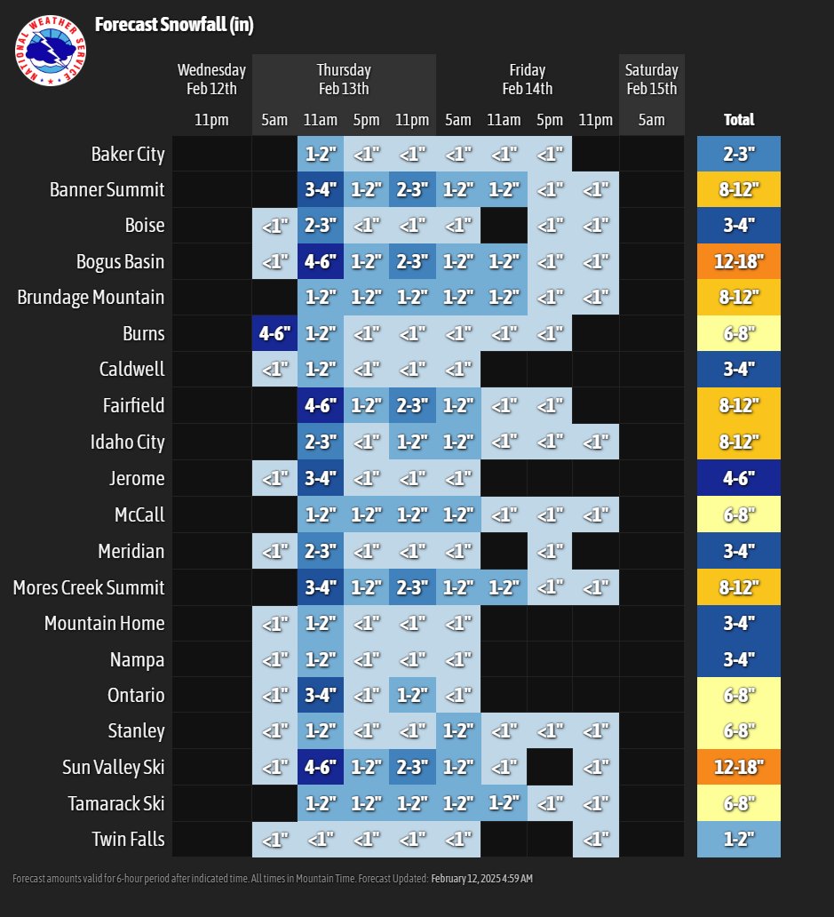
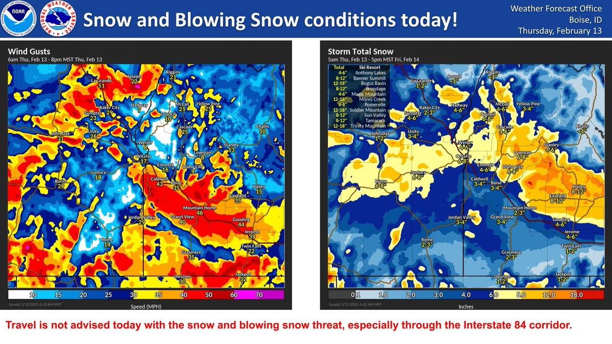
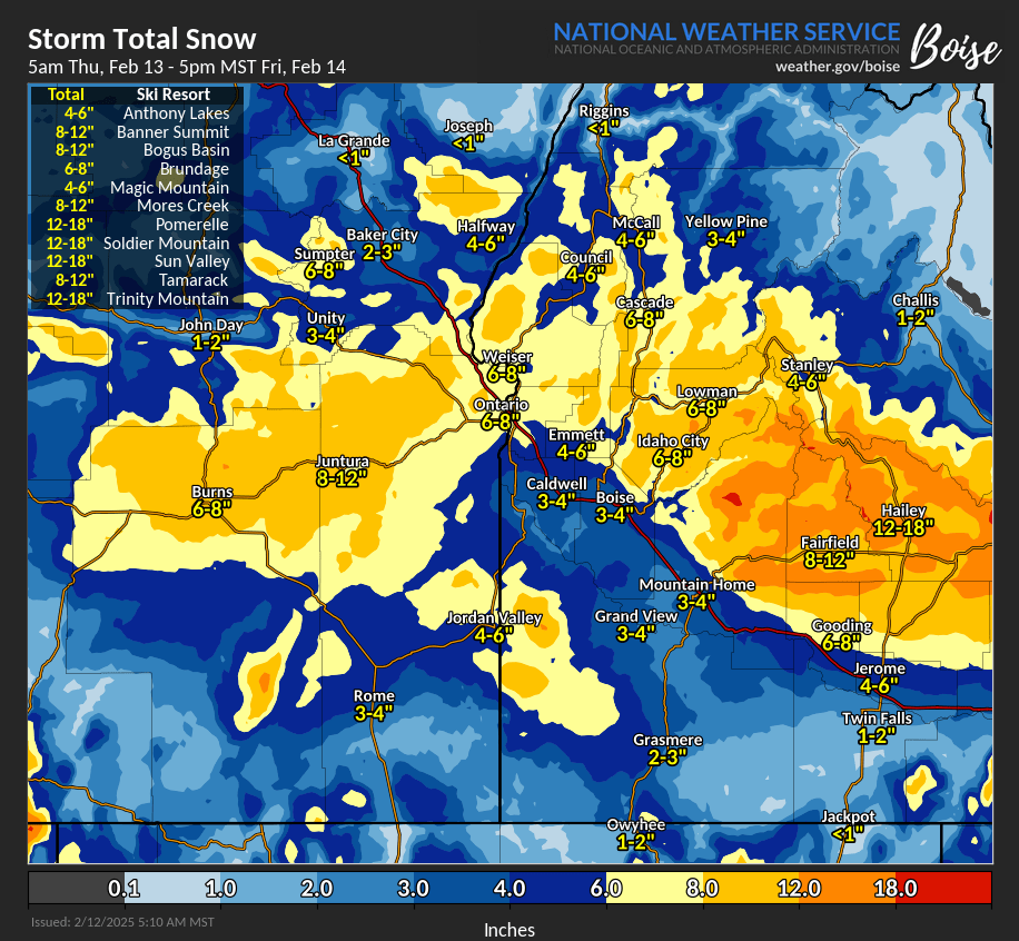
🚨❄𝐖𝐈𝐍𝐓𝐄𝐑 𝐒𝐓𝐎𝐑𝐌 𝐖𝐀𝐑𝐍𝐈𝐍𝐆. Confidence remains high for impactful winter weather Thursday-Friday. Windy conditions with snow, blowing snow causing significantly reduced visibility and white out conditions in certain areas. Travel not recommended in these areas.
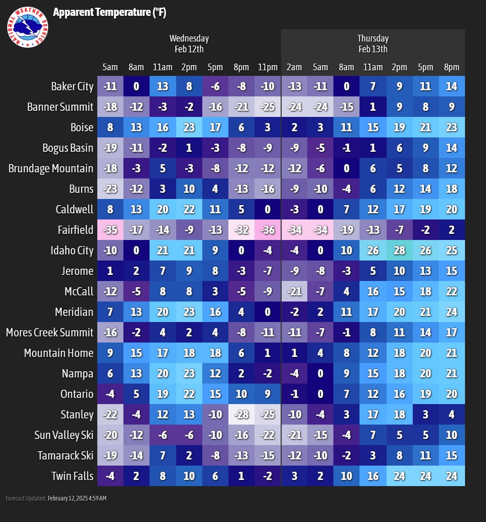
❄Cold through Thursday morning. WINTER STORM to impact region on Thursday into Friday. Windy conditions with snow, blowing snow causing signficantly reduced visibility and whiteout conditions in spots. Travel in these areas is not recommended, especially along Interstate 84.
⚠️Prepare for very cold temperatures across the region beginning tonight. The valley will see single digit temperatures each morning Tuesday through Thursday.