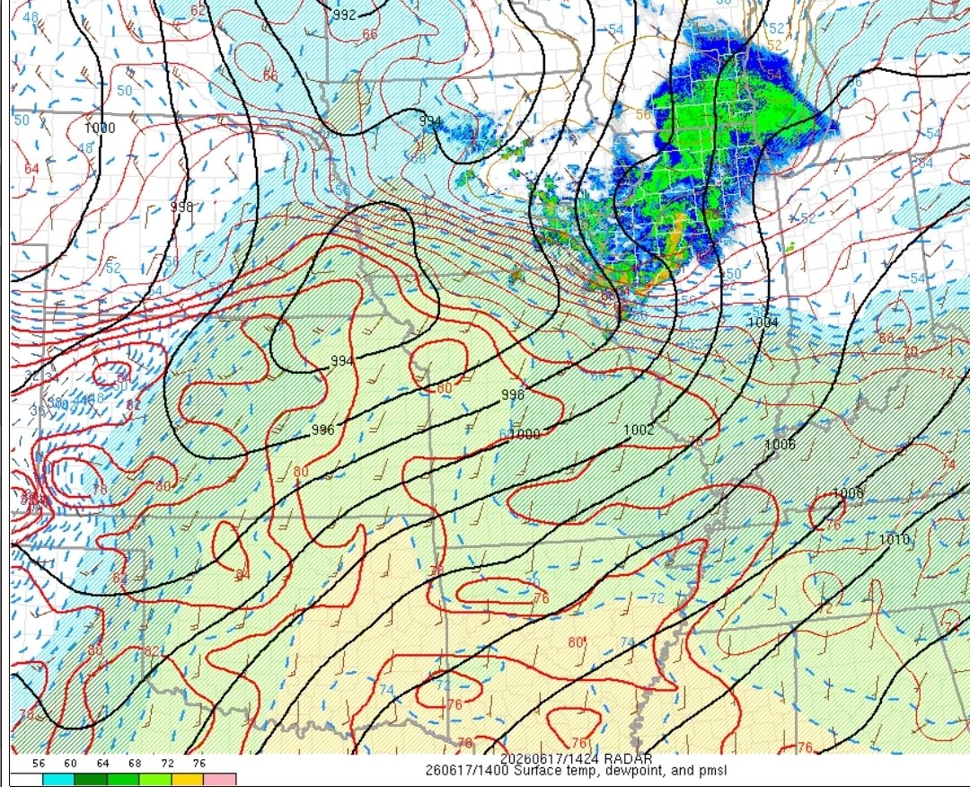
Had tomorrow been more favorable thermodynamically, even talking just up to 1500 CAPE, easily could've been constituted as a Moderate risk for New England. The absurd wind fields/kinematics and intense synoptic forcing will significantly compensate and lead to damaging winds.
This is not a good luck at all for Southern New England tomorrow afternoon and evening. We certainly have quite a bit of wind shear (well over 40 knots) yielding a tornado hazard.
Oh yeah it is like a bomb atmosphere behind this morning convection and it is smaller and moving after out. Air mass recovery will be perfect.
There is truly a chance we see the high risk still in play at the noon issuance and 30% tor risk...models were way off on a "downtrend" and SPC has noted linear mode is not gonna happen today.
Everything is on the cards for a significant tornado outbreak. I wasn't buying the downtrends and I been consistent daying today was gonna be huge....and it appears so and then some. Even MO where we are likely will go big.
This is extremely impressive. If you look closely, the leveled home was NOT in the core’s center.
That, combined with strong nearby denuding and the destroyed tension tower makes me think true intensity was EF4.
Low-end EF4 rating candidate depending on home construction.