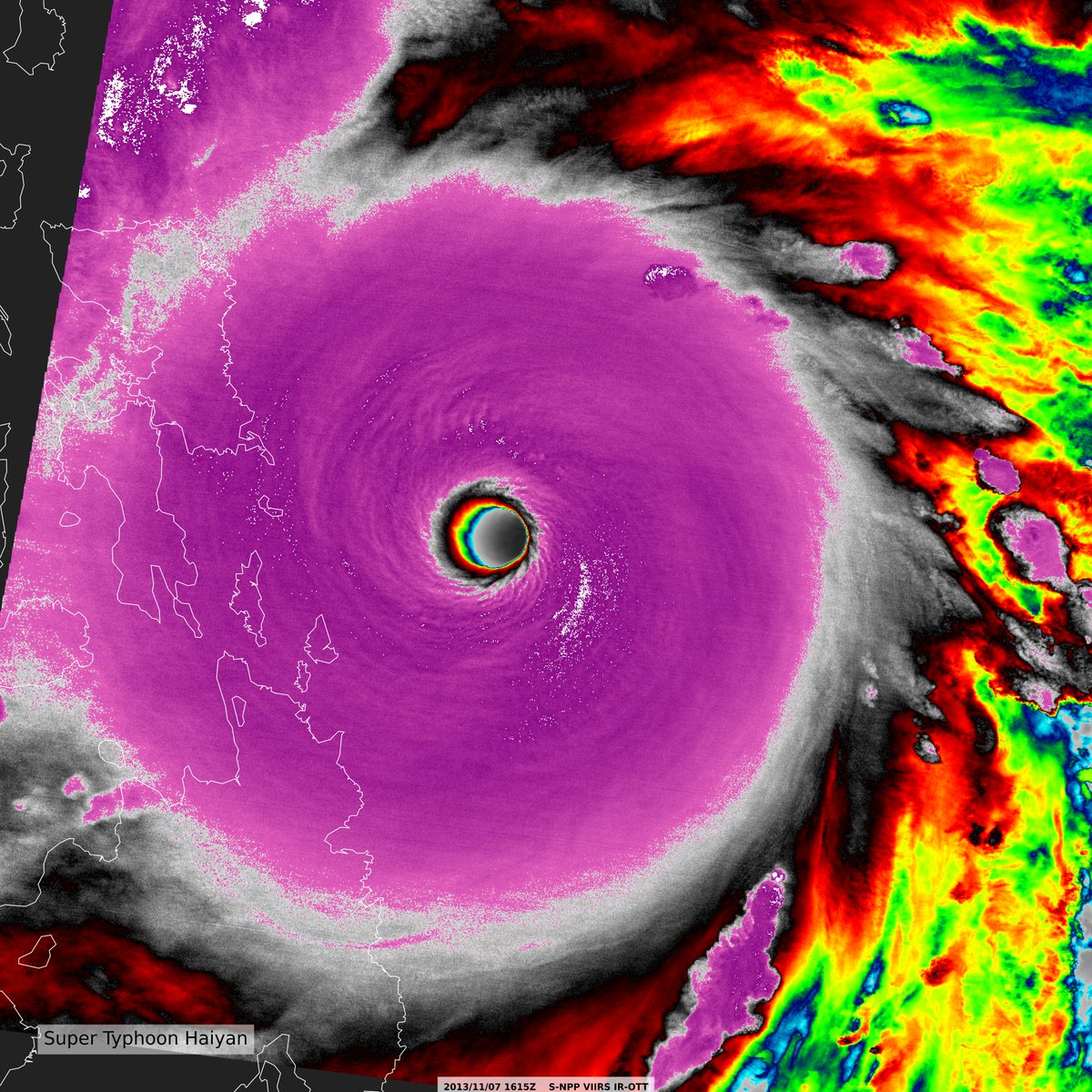
Super Typhoon Haiyan on this day reached its 'insanity' point if you will. Here's a few images from the SNPP VIIRS Satellite as it was bearing down on the Philippines with 170kt winds & 205kt gusts. #Haiyan#JPSS#VIIRS#Haiyan10
OTT/Dvorak(BD)(Open image in new tab for all res)
That's us! 🌍
The Artemis II crew captured beautiful, high-resolution images of our home planet during their journey to the Moon. As @Astro_Christina put it: "You guys look great."
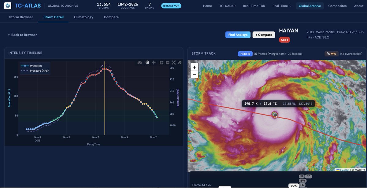
Interested in hurricanes? I want to introduce TC-ATLAS: the Tropical Cyclone Analysis Tool for Live and Archived Structure. Explore live or past storms without writing a line of code or downloading a data file, building on the capabilities of TC-RADAR: https://t.co/TR53wLxqxP
Storm Recap: NE IL. In order:
1. Aroma Park EF3
2. Possible satellite (or re-emergence) of Aroma Park (EF3/UNK)
3. Separate rope (had a power flash before video) (UNK)
4. Likely anticyclonic tornado in same area (UNK)
@NWSChicago, have you seen evidence of these tornadoes?
Zoomed-in, 1-minute loop leading up to Melissa's record-tying destructive landfall - notice the Air Force plane circling in the eye after experiencing severe turbulence before leaving the storm:
Multi-panel view of the last few days of Hurricane Melissa:
↖️ GOES-19 infrared brightness temp
↗️ GOES-19 visible satellite
↙️ Hurricane hunter planes & flight paths
↘️ Recon-derived flight level wind swath
⬇️ Estimated minimum pressure from recon dropsondes
Twenty years ago, Hurricane Katrina made its devastating landfall in Louisiana.
This satellite animation shows Katrina's journey from the Florida coast to Louisiana.
Interesting fujiwhara-like behavior observed in the squall line that crossed over KMVX last night/this morning. Can see two interacting mesovortices wobble around each other, and one launches northwards, before it all develops into a larger mesovortex.
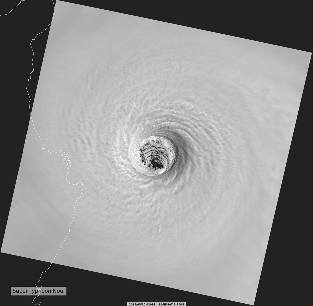
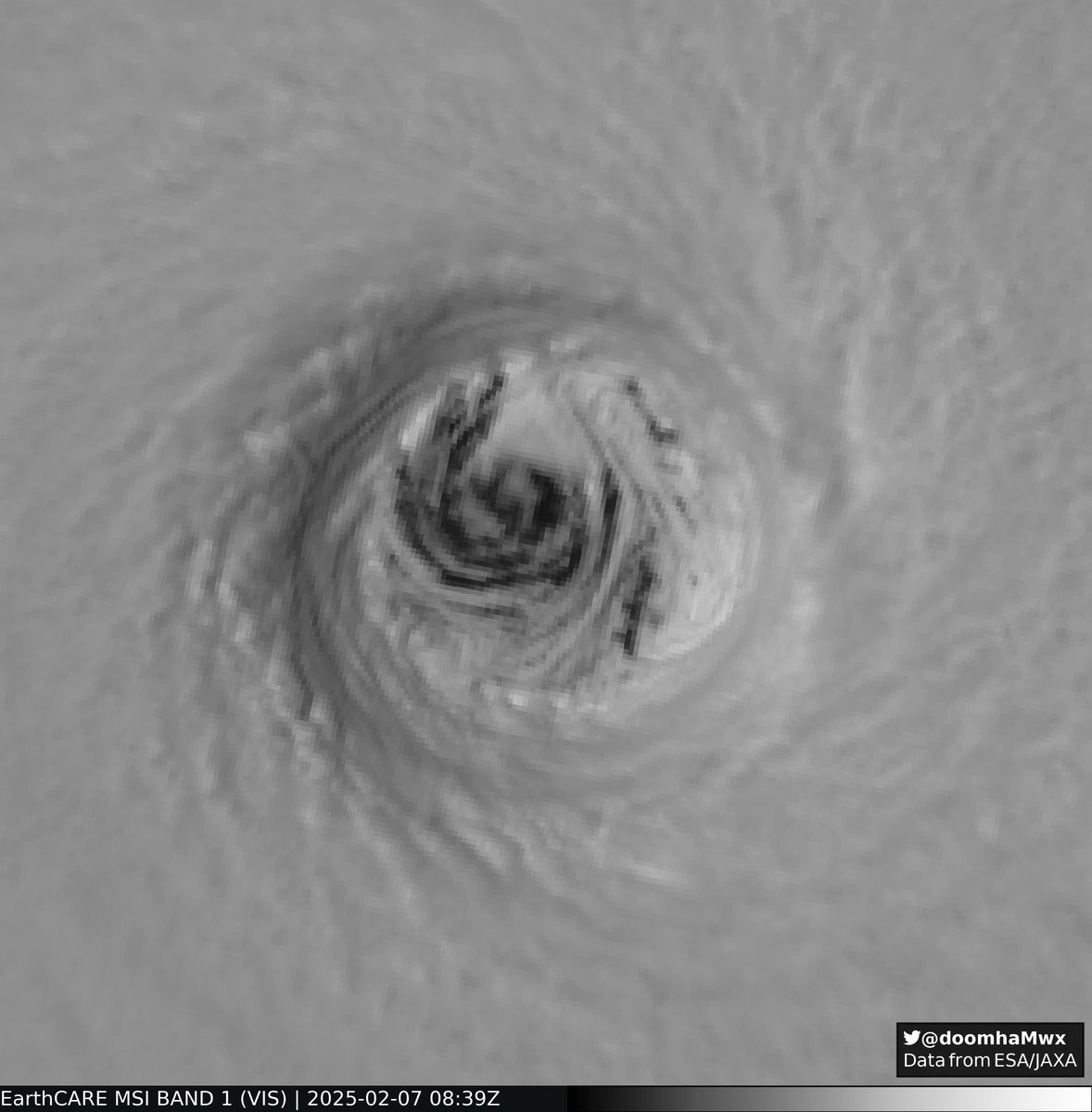
Incredible view of Super Typhoon #Noul back in 2015, the stadium effect is very very notable here as it was captured by Landsat-8. Many thanks to @doomhaMwx for pointing me towards this data back in November.
Over the past few days, I ran a 500 meter sim. of Hurricane Maria's RI in 2017. This simulation resembled reality pretty well on track and intensity (Model 906mb, Reality 908mb).
It even got the eyewall replacement cycle, a process that many models struggle to resolve today.
On this day 12 years ago, the last EF-5 rated tornado impacted Moore, Oklahoma.
Multiple nearby radars captured this tornado from start to end, including OU’s PX1000 mobile radar at very high spatiotemporal resolution (20 second samples at 30m resolution!) -
Catching the Vortex!
During this week’s buoy drop test mission, aircrew from the 53rd Weather Reconnaissance Squadron captured a stunning view of wake vortex in action.
Wake turbulence forms when an aircraft produces lift, creating two powerful, counter-rotating vortices trailing from the wings. It’s an incredible sight.
Just another day in the sky for the Hurricane Hunters as they prep for the 2025 hurricane season.
#HurricaneHunters #53WRS #WakeVortex #ReserveReady
Finally got around to looking at Tropical Storm Erin from 2007, this storm decided to intensify slightly over Oklahoma and this was the view from MPAR.