Super stoked to announce my commitment to studying atmospheric science at the University of Albany! Can’t wait to continue my academic journey and continue to pursue my passion in meteorology and research!
See you in the state capital this fall 🫡
@NWSNewYorkNY I thought this was cool. Little backdoor cold front just passed by, dropping temps by several degrees. I saw this thin rope cloud moving east just under cumuli moving west, showing how shallow this front is
May 31, 1998:
The Northeast's only high risk event brought over three dozen tornadoes, including six F3s, to several states. One person was killed and 109 more were injured. Two days later, Pennsylvania would experience another major tornado outbreak.
#wxhistory
@rushtropicalwx I doubt the relationship between the two is anything but meager. Also the AO is literally falling right now per your first image not surging. The westerlies persist despite AO fluctuating near neutral, also showing the two aren’t closely related
Probably another marginal heavy rainfall threat for southern New England later this week. Sometimes when you get a slow-moving cutoff low and an offshore disturbance interacting you can get a band of heavy rainfall. Another scenario that’d probably be really bad if it were summer
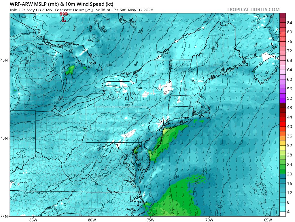
I’m interested in a conditional thunderstorm/flash flooding event across the tri-state region tomorrow. A slow-moving shear vorticity line associated with a decelerating sea breeze will likely coincide with a potent shortwave overhead. PWATs will be marginal but watching anyway.
I’m interested in a conditional thunderstorm/flash flooding event across the tri-state region tomorrow. A slow-moving shear vorticity line associated with a decelerating sea breeze will likely coincide with a potent shortwave overhead. PWATs will be marginal but watching anyway.
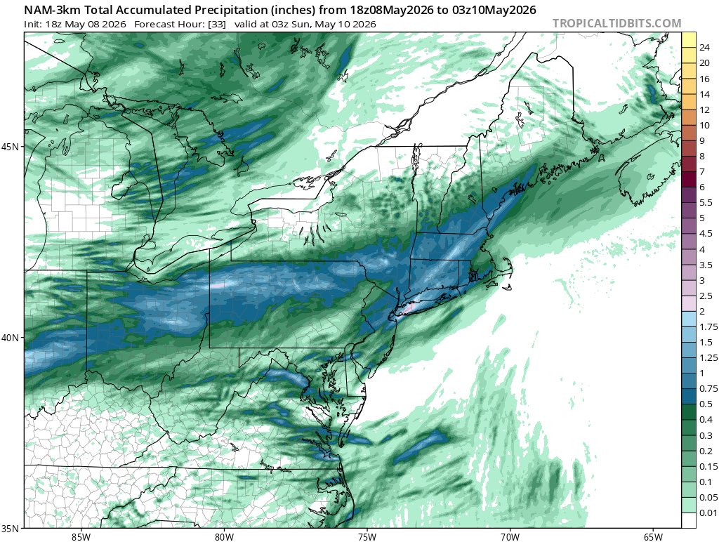
Still watching this conditional slow-moving thunderstorm/downpour threat across the Tri-State area today. 12z NAM came in aggressive. Some clearing across NJ too which is interesting.
Still watching this conditional slow-moving thunderstorm/downpour threat across the Tri-State area today. 12z NAM came in aggressive. Some clearing across NJ too which is interesting.
I’m interested in a conditional thunderstorm/flash flooding event across the tri-state region tomorrow. A slow-moving shear vorticity line associated with a decelerating sea breeze will likely coincide with a potent shortwave overhead. PWATs will be marginal but watching anyway.
@PROLIFICSHlTTER@WxTca Should be noted that the current Atlantic configuration isn’t too great. We need that to flip or else we may look more like 2022/2025.
I’m interested in a conditional thunderstorm/flash flooding event across the tri-state region tomorrow. A slow-moving shear vorticity line associated with a decelerating sea breeze will likely coincide with a potent shortwave overhead. PWATs will be marginal but watching anyway.
I still can’t get over how bats**t crazy the forecast is for Colorado and Kansas is this week
Wednesday will feature temperatures ~35F below average across portions of W Kansas and Colorado and a bona fide snowstorm w/ temps near freezing. Then right back to summery (70’s) Thu