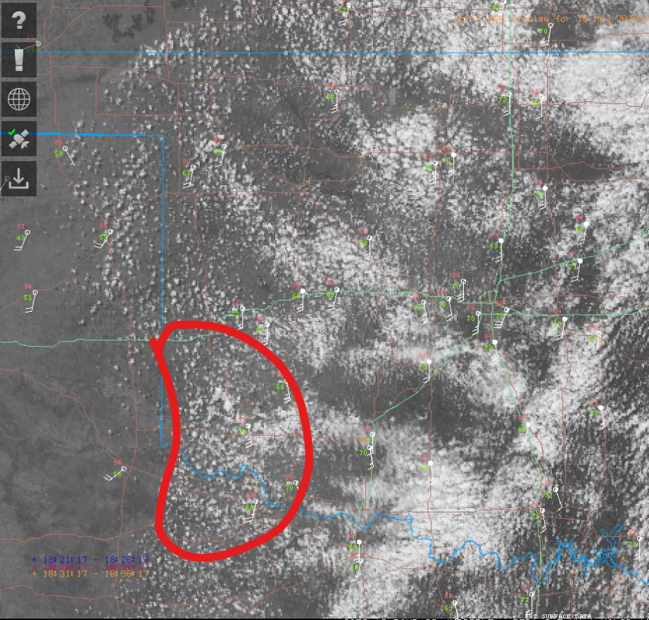
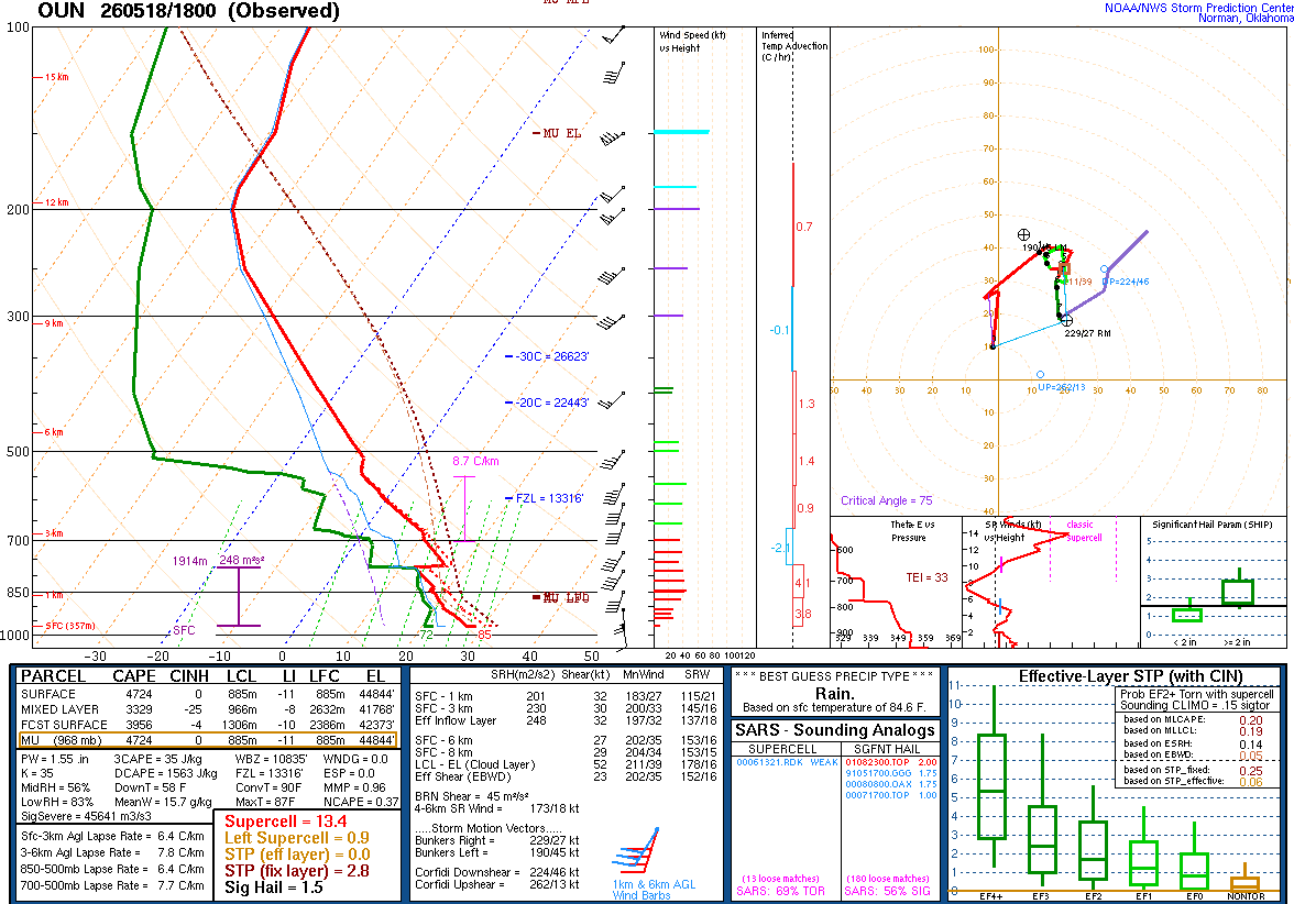
Watching some enhanced convergence along the dry line in SW OK. 18z Norman sounding shows small cap that, unlike yesterday, could be breakable.
Shear so far though is very weak. Any severe threat will likely hold off till at least 00z, and hinge on well-timed, later initiation.
@ConnorB2241 There are some software and hardware issues that we are working on to fix and resume soundings. While we don't have an estimated restoration time, we are working to get the system back up and running as quickly as possible.
@dubsinfive You're probably right. I hope NWS Norman conducts soundings today. It was surprising to see them skip it yesterday, especially with severe weather in the forecast.
Yes. But compared 4/19 had proper synoptic forcing and it wasn’t mistimed. The trough for tomorrow is quite mistimed and doesn’t arrive until 00z or later, which is why CI is extremely unlikely.
And, even for days like 4/30/24 in Oklahoma, convective temperature is not met.
If the trough can speed up and eject over the Dryline by 21z, then you will get convective initiation. Otherwise, it won’t be able to fire since convective temperature isn’t met.
I’d love to be wrong, but right now all signs point towards Oklahoma not firing, similar to how Oklahoma cap busted last Monday.
First time in forever? Oklahoma is at 38 tornadoes for the year. We had tornadoes in the state on Friday. January tied most tornadoes in that month and March set a record for most tornadoes in that month. NWS Norman leads the county in severe thunderstorm warnings issued.
@MikeMorganKFOR@kfor Just had a déjà vu moment reading this. If I remember correctly you were one of the only Mets saying the same thing the morning of April 19 2023 👀👀