It’s not often (almost ever) you see a map like this, where temperatures go from 25° above normal, to 25° below normal! Quite a shock to the system with dozens of record highs Friday-Saturday on the South, followed by some record lows in #Florida early week! #hot#cold
Don’t forget that the talented, dedicated meteorologists at the NHC/NOAA have provided accurate and life saving forecasts and recon data for Melissa while not getting paid and lacking resources due to the government shutdown.
Weather never stops and neither does our mission.
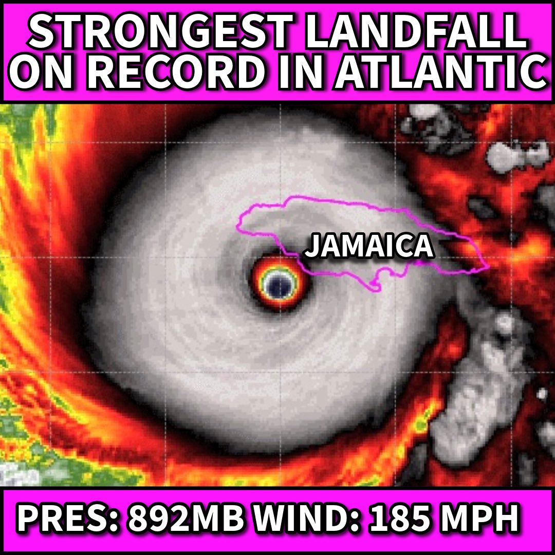
***ALL-TIME RECORD***
#Melissa is now the Strongest landfalling storm ever on record in the Atlantic (and it may be getting stronger)
892mb, winds 185 mph. (Tied with the FL Keys Labor Day Hurricane of 1935 in wind and pressure)
Let’s see what the official “landfall” is to verify.
#jamaica
Overheated deep-hot Caribbean waters are a big reason for this history making event… 2 degree F + above their 20th century normals. Hotter water = Stronger Potential Intensity as has beared out in Melissa
Heads up #MyrtleBeach#Charleston#Wilmington - massive rainfall from future #Imelda being shown on the overnight run of the Euro model. 10-20" locally not out of the question. Slow-moving system + warm waters = rain maker. Turn sprinklers off over the weekend and watch closely!
8/3 2pm- The Tropics are heating up with 3 systems that we are monitoring. #AL95 offshore of the Carolinas has a high chance of becoming a TS by Monday as it moves away from the US. Two other systems have some development potential this week- More: https://t.co/tW4KeGdBFb
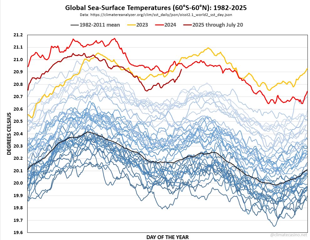
Crazy rapid heating going on right now in the world's oceans as global sea surface temperatures continue to spike.
SSTs are roughly 25 days away from their mid-year peak. Will they break 21.0°C again? The climate 8-ball says that SSTs are the canary in the ... oh, never mind.
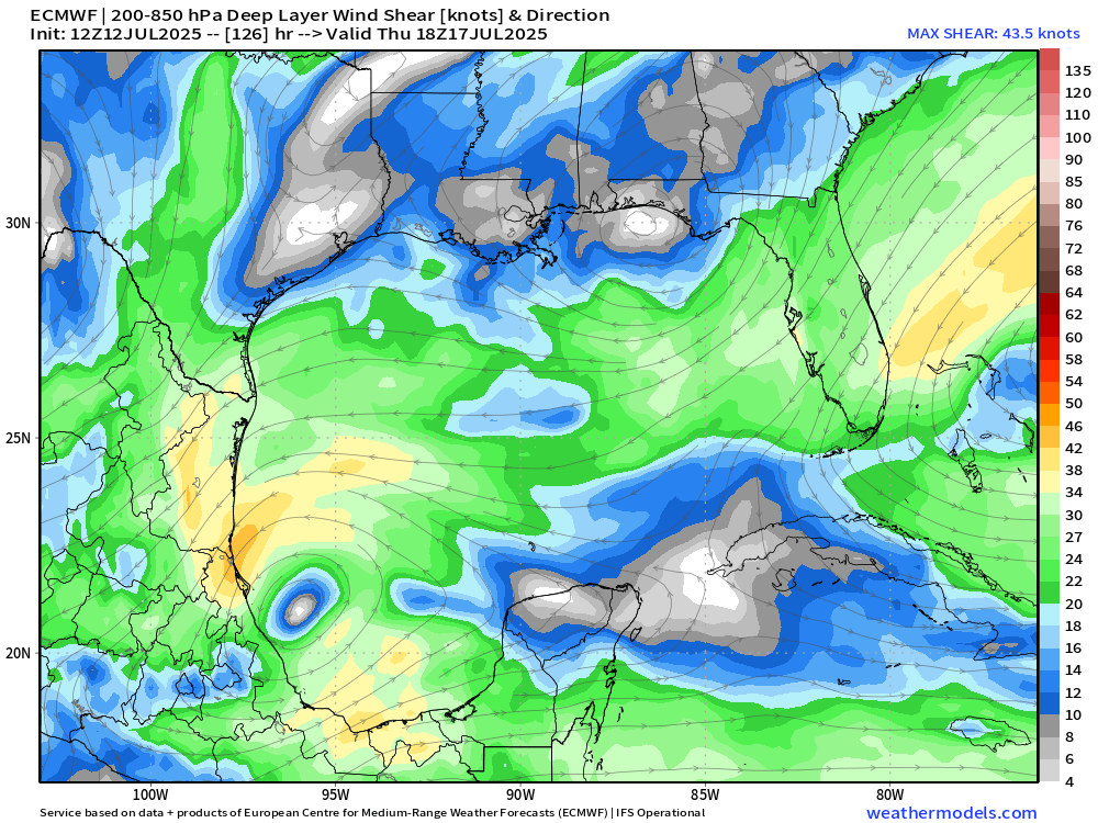
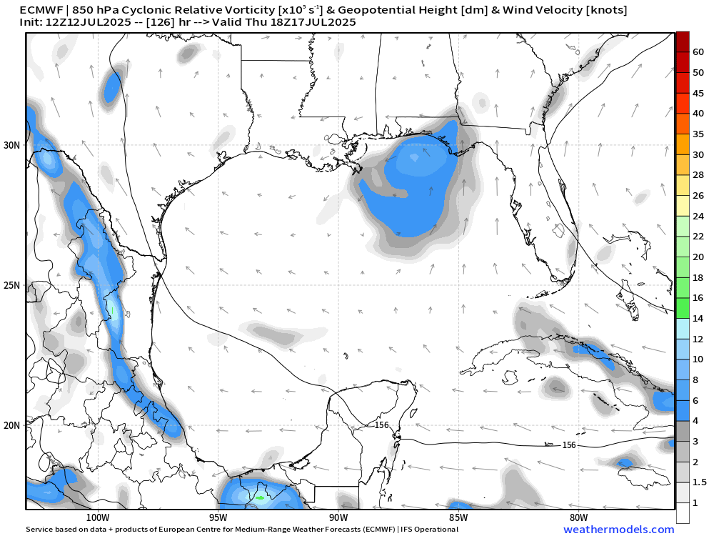
Small low-shear window in the northern Gulf next week that could allow something to try to form along a stalled front. Seems unlikely we'll get anything strong out of this, but a brief TD/TS seems possible. NHC currently giving it a 20% chance of development. The next name on the list is #Dexter.
NHC and the Weather Prediction Center (WPC) are planning to highlight areas that are at risk of heat impacts after a storm due to power loss in NHC’s Tropical Cyclone Public Advisory and Key Messages, when appropriate this season. Find out more information here https://t.co/jcwrz2e8Sn
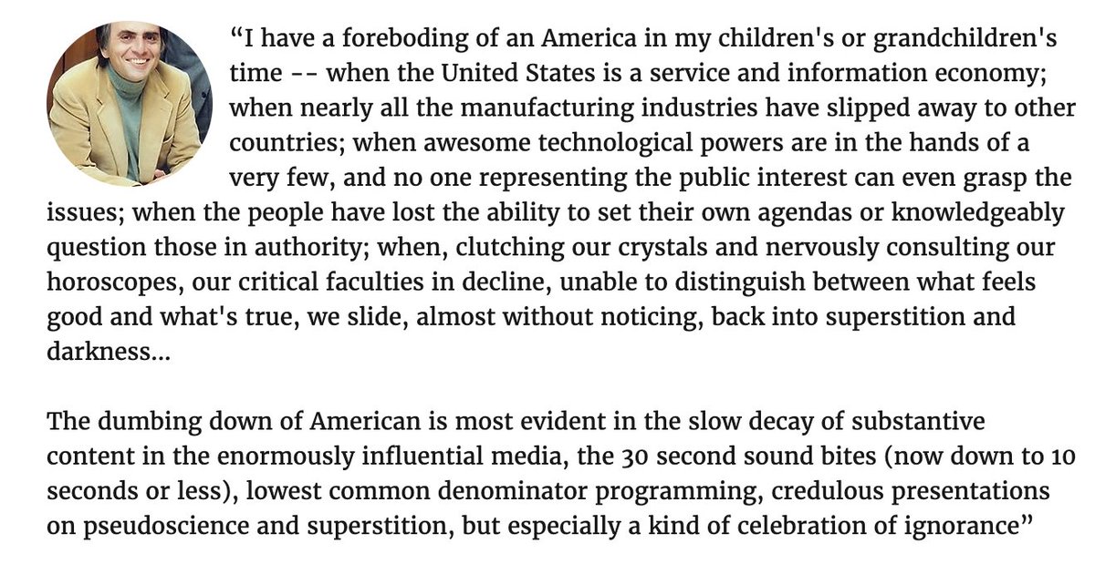
We are quickly going down the road of being sent back to the proverbial stone ages of weather forecasting in the CONUS.
People take for granted how bad forecasts truly used to be & weren’t alive to remember a time in the distant past (19th and early 20th centuries) when it was very commonplace for many hundreds or thousands to die from a “surprise” event
🙃
I've tried to stay fairly positive with recent messaging, but this is a direct attack that would cripple NOAA modeling capabilities and directly lead to more death and property loss if it is carried out. I definitely recommend calling your representatives ASAP to oppose this.
https://t.co/GiUZJdVkKV
NCEP is the nucleus for all weather data in the United States. If this true and there is any lapse in coverage, it will make it nearly impossible for ANY weather entity to predict a severe weather event due to lack of computer model functionality. This is a huge deal. @DOGE
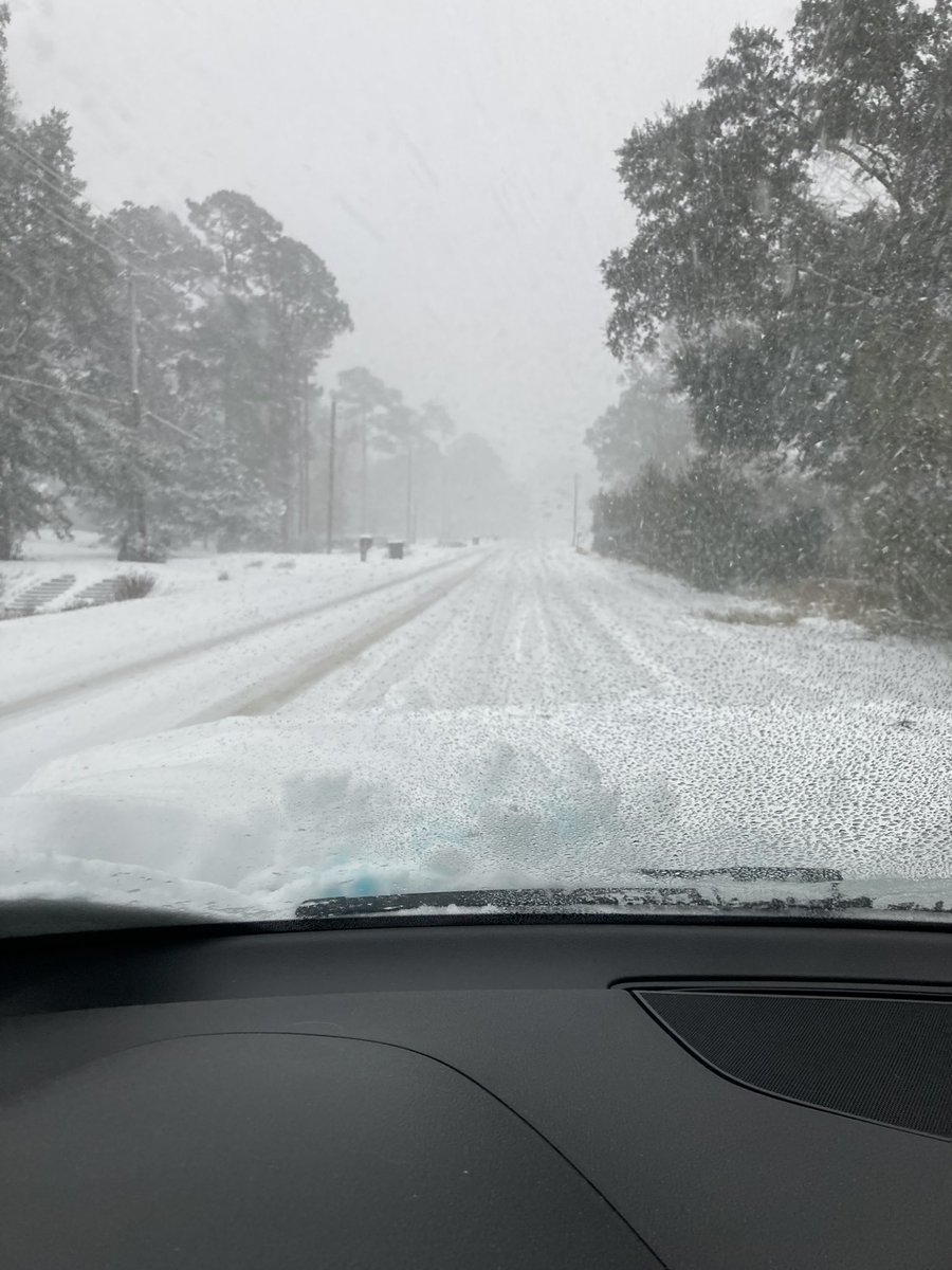
The all-time 24 hour record snow record is being OBLITERATED for many on the I-10 corridor. Pensacola (pictured here) is nearing 6”.
For perspective: this city did not record a single freeze in the winter of 2018-9.
Their previous record snowfall was 3” back in 1895.
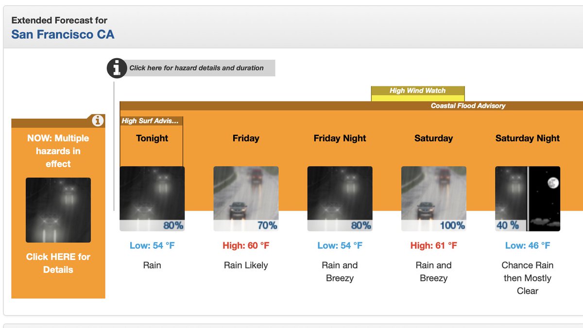
Uh @KirkHerbstreit Idk which meteorologist told you there was a "40% chance" of rain for the @49ers game tonight. Here's the NWS forecast, might wanna ditch whatever app you're using dude!