It’s my second time @hilleastburger. The first time there was a pop up so it doesn’t count. The burgers are incredible. Best meal in town. w/@CiancioReporter
From the Brightline Safety and Security Team: Railroad safety is a community wide effort. For everyone’s safety, never drive around crossing gates when they are down.
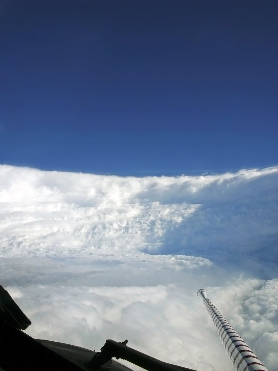
The Hurricane Hunters took this image inside the eye of Hurricane KATRINA 19 years ago today.
At this time, KATRINA was near peak intensity, with winds of 175 mph and a pressure of 902 mb.
On this date 19 years ago, Hurricane Katrina's huge 30 mile wide eye was sporting 175 mph winds...even though Katrina officially made landfall as a Cat 3 with 125 mph winds on the 29th, this huge storm already had written that it was going to bring a tremendous and record-breaking storm surge.
At it's most intense on the 28th, the pressure was down to 902mb/26.64" and was likely producing peak waves over 100 feet in the Gulf of Mexico...the surge along the Mississippi Coast reached a record 27 feet that penetrated inland some 6-12 miles.
With the levee failures in the New Orleans area the storm became the most costliest on record with 200 billion dollars in damage, and tragically, an estimated 1,836 fatalities.
23 days later a more intense Hurricane Rita (180mph/885mb max) struck the Louisiana Coast as a Cat 3 bringing a huge storm surge that covered more than 1500 square miles of coast and up to 30 miles inland.
Hurricane Wilma a month later (183mph/882mb max) went on to become more intense than both Katrina and Rita.
I'll never forget covering that storm and its aftermath...
Let's hope we never see another season like 2005... #lawx #HurricaneKatrina
This imagery spanning the last 16 days showcases Hurricane Beryl- from its formation as a tropical storm, through the post-tropical severe weather and flooding it brought to eastern North America.