If you are wondering why places further south are forecast to record the highest temps today, it's due to the wind
The longest stretch over land of the ne'ly wind
At the same time, the urban heat island of built up cities like London won't be far behind
⚠️⚠️🔴 Red weather warning now in force 🔴⚠️⚠️
Storm Goretti will bring exceptionally strong winds to the Isles of Scilly and parts of Cornwall, with peak gusts of 80-100 mph or more in exposed areas
Winds will increase rapidly with violent gusts that may persist for 2-3 hours
⚠️⚠️ Amber weather warning issued ⚠️⚠️
Thunderstorms across parts of southeast England and parts of East Anglia
Friday 2000 – Saturday 0500
Latest info 👉 https://t.co/QwDLMfS950
Stay #WeatherAware ⚠️
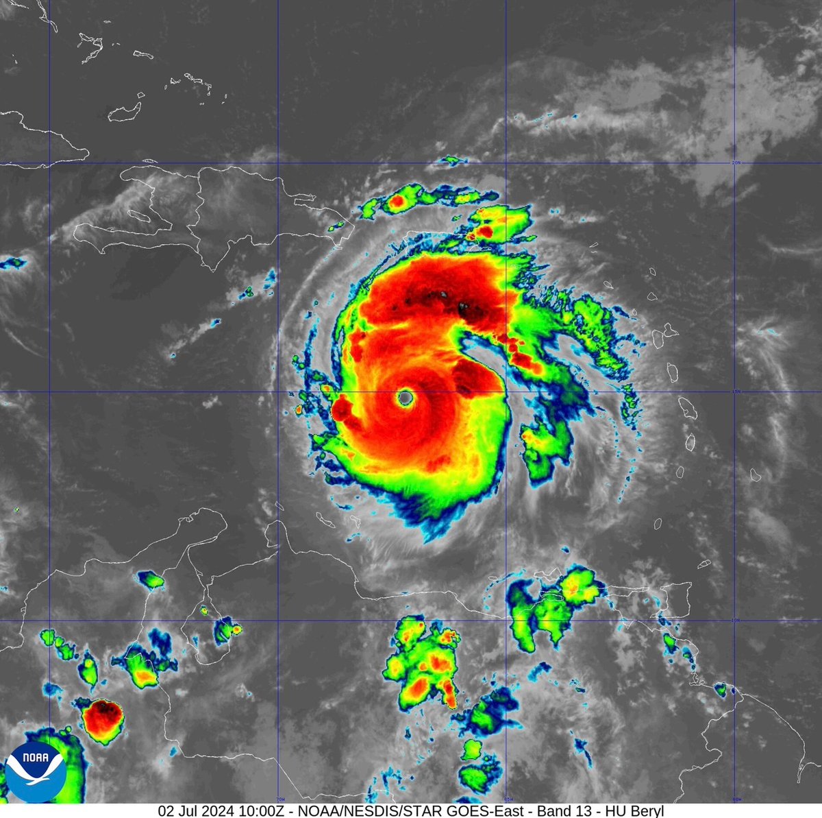
Hurricane #Beryl was an ultra-rare and unfortunately destructive storm. For nearly every hour she churned, an early-season record was being shattered. She was:
- The earliest-forming Cat 5 in recorded history (surpassing Emily-2005).
- The earliest-forming Cat 4 (surpassing Dennis-2005).
- The strongest June Hurricane by wind speed (surpassing Audrey-1957).
- The strongest July Hurricane by wind speed.
- The easternmost-forming Hurricane in the tropical Atlantic in June (surpassing the 1933 Trinidad Hurricane).
- The highest ACE generated by a Hurricane before August.
- The first Hurricane to rapidly intensify in the MDR in June.
- The first June Major Hurricane (Cat 3+) east of the Lesser Antilles.
- And the only Atlantic Hurricane to intensify from a Tropical Storm to a Category 5 in under 48 hours before the month of September.
Did you hear any thunder last night? ⚡
Several thousand lightning strikes were recorded across France and southern Britain
Post any photos you took below 👇
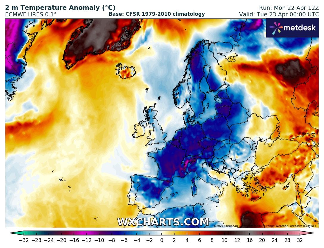
Extreme contrast.
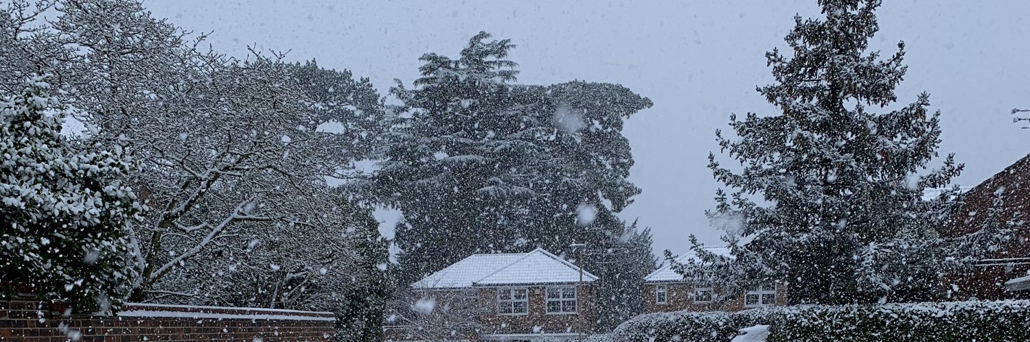
April 2024 will go down as one of the most incredible flips on record in Europe. Summer to winter for some.
The warmth broke an enormous number of April records and the cold is now beating some late April records.
The UKV is now suggesting rainfall totals of >300mm locally over the next three days.
Not sure I’ve ever seen rainfall that extreme forecast for the UK before.
Storm Tracking - #stormBabet
[UPDATE 1] Storm Babet's impacts from wind are not going to be substantial, but some very strong wind gusts will occur out at sea & NE parts of Scotland, with inland gusts of 60-70mph possible for a time. Rain is the biggest impact from this storm.
Half way through the month, just about, and here's where #September2023 currently sits on a plot of #UK mean max vs mean min temperature anomalies compared to 1991-2020 #climate
Estimated from SYNOP but usually pretty close; mean max anom +5.2 degC, and mean min anom +3.2 degC
😴 Getting to sleep might be a little tricky for some of us tonight...
🌡️ Temperatures will remain above 20 Celsius well into the night, especially in urban areas, which means that a 'tropical night' is possible in places🌴
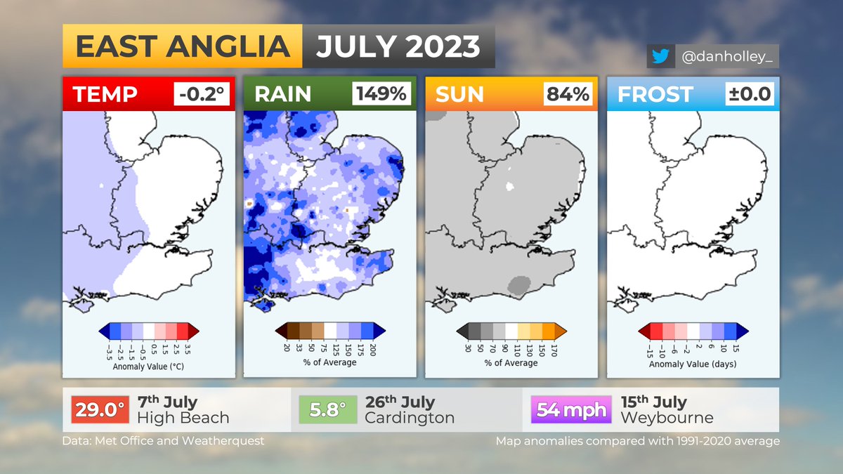
EAST ANGLIA - JULY 2023:
🌡️ Near-average temperatures (-0.2°C)
🌧️ Wettest July since 2015 (149%)
☁️ Dullest July since 2012 (84%)
☔️ Highest number of July rain days since 2012
This was the first July to not reach or exceed 30°C in this region since 2012.
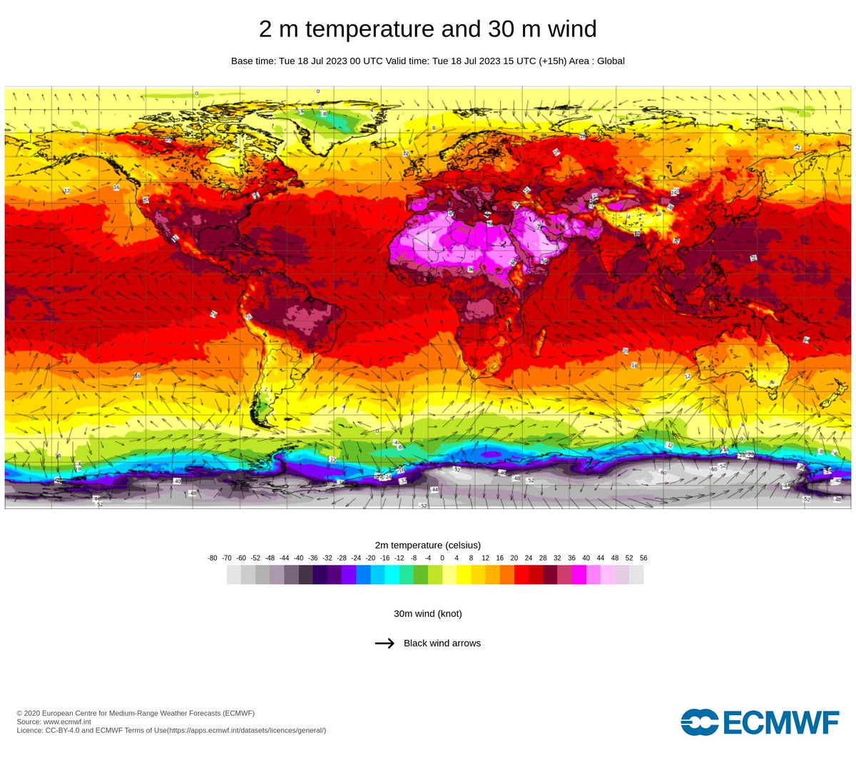
Simultaneous heatwaves are occurring across the northern hemisphere, with prolonged day time temperatures well above 40°C (104°F).
Extreme heat is a major hazard and we need to step up #EarlyWarningsForAll.
WMO heat-health round up at
https://t.co/oYOYBsk6VF
Chart from @ECMWF
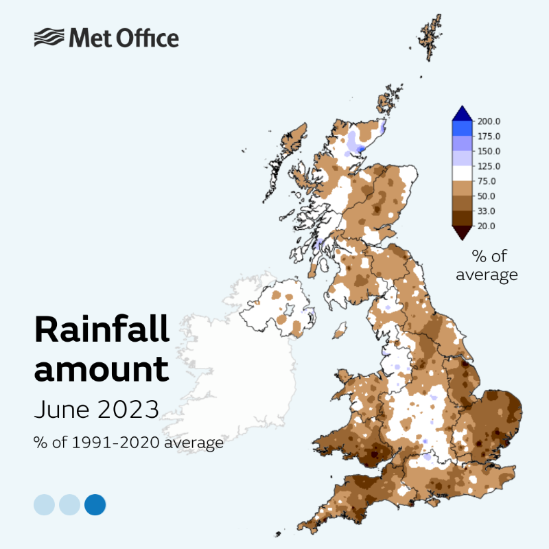
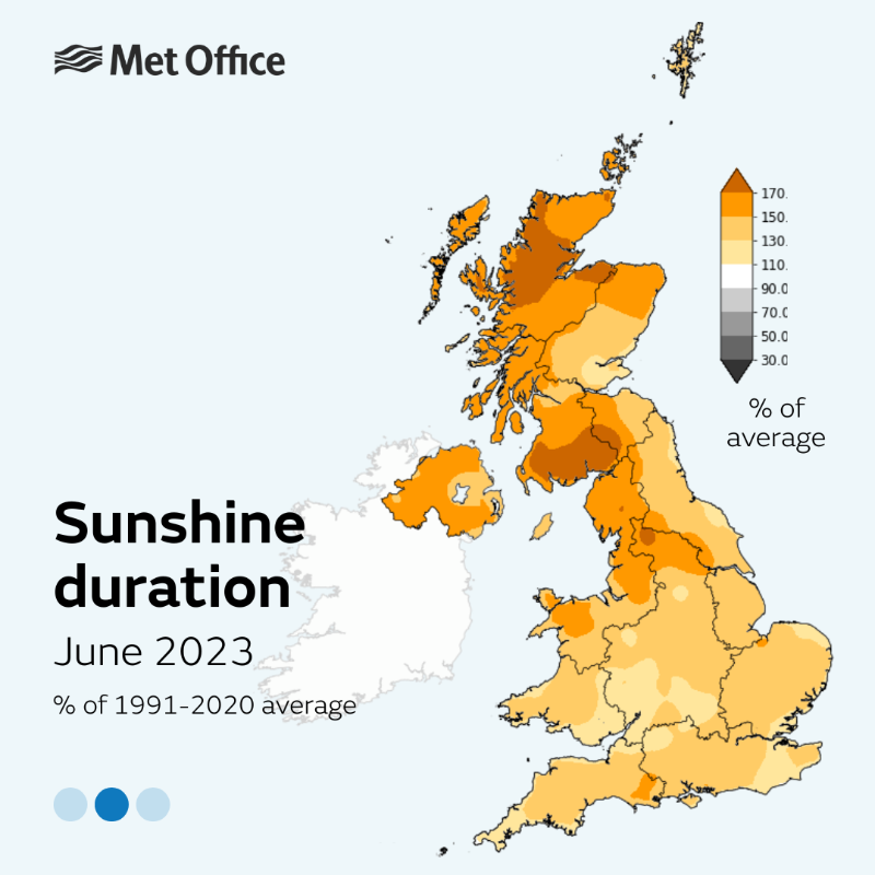
June 2023 was the hottest on record for the UK, according to provisional Met Office figures.
The headlines, as well as the influence of climate change, in the thread 👇
�June 2023 was the hottest on record for the UK, according to provisional Met Office figures.
The headlines, as well as the influence of climate change, in the thread 👇
�June 2023 was the hottest on record for the UK, according to provisional Met Office figures.
The headlines, as well as the influence of climate change, in the thread 👇
🧵









![UKWX_'s tweet photo. Storm Tracking - #stormBabet
[UPDATE 1] Storm Babet's impacts from wind are not going to be substantial, but some very strong wind gusts will occur out at sea & NE parts of Scotland, with inland gusts of 60-70mph possible for a time. Rain is the biggest impact from this storm. https://t.co/iBcFECV3AS](https://pbs.twimg.com/media/F8sYwRFXAAA6Pft.jpg)