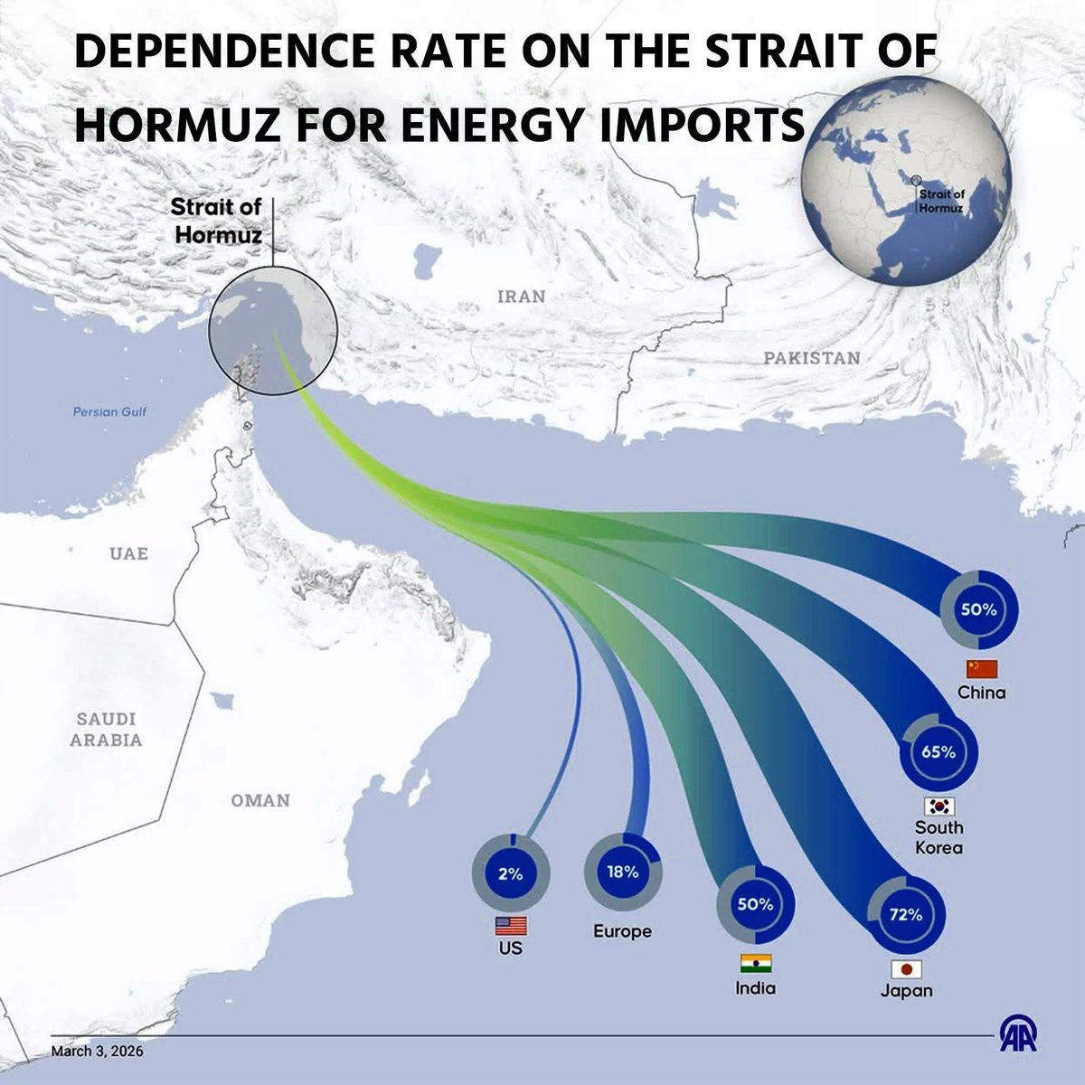
Informe final: Áreas de actividad y dieta del Canis latrans en el contexto etnoecológico de los bosques tropical seco-transición húmedo, bosque muy húmedo, premontano, montano y subalpino en Costa Rica https://t.co/YNA3vkIqcj a través de @academia
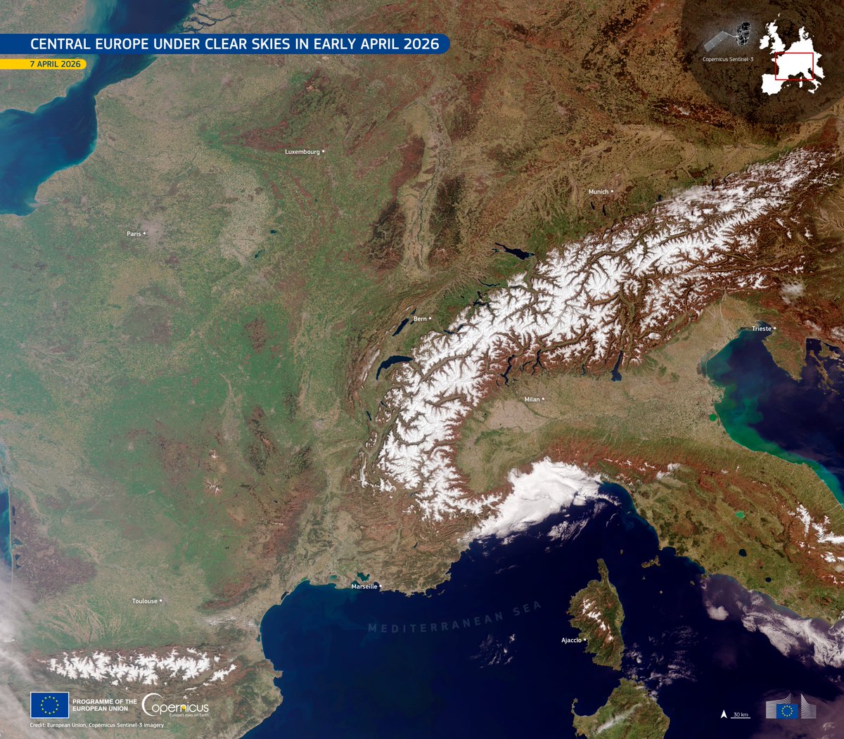
🌤️ After weeks of rain, Central Europe saw clear skies on 7 Apr.
🛰️ #CopernicusEU Sentinel-3 captures the seasonal shift: snow-covered Alps, green lowlands, hazy Po Valley & dark blue lakes.
🔗 https://t.co/GGuGrL82KE
#ImageOfTheDay
From snow-covered Oslo to volcanic Iceland, Copernicus Sentinel-2 captures the striking contrasts of Nordic landscapes ❄️🌋
Today, the EU signed an agreement with Norway & Iceland to join GOVSATCOM and IRIS² strengthening cooperation in secure connectivity 🛰️🛡️
#EUSpace
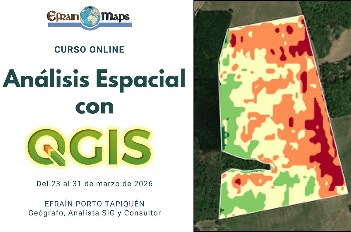
Este curso está dirigido a estudiantes y profesionales de geografía, ingeniería, biología, urbanismo, planificación territorial y áreas afines.
📩 Si te interesa participar, escríbeme y te envío la información completa.
⚠️ Cupos limitados
A partir del 23 de marzo estaré impartiendo un curso online de Análisis Espacial con QGIS, orientado a aprender técnicas reales de análisis geográfico utilizadas en proyectos ambientales, territoriales y de ingeniería. Durante el curso aprenderás a trabajar con herramientas como:
La Loire des Confluences 🇫🇷 was designated a Wetland of International Importance under the Ramsar Convention.
🛰️ This #CopernicusEU Sentinel-2 #ImageOfTheDay shows the river corridor between Angers & Tours, where the Loire & several tributaries meet.
🔗 https://t.co/E1YIX6OmPQ
🆕QGIS 4.0 Norrköping: la versión más potente hasta la fecha
QGIS 4.0 representa la culminación exitosa de una migración técnica que ha llevado una larga planificación, que integra el núcleo de QGIS en el marco Qt6.
https://t.co/W6d8LGFHBN
¿Quieres aprender QGIS desde cero?
Abrimos inscripciones para el Curso Básico de QGIS.
📅 Fecha: 2 al 10 de marzo de 2026.
💻 Modalidad: Online.
Si quieres asistir y conocer el temario, el horario o el precio, contacta por:
📱 +34691334993📧 [email protected]
Te espero en clase!
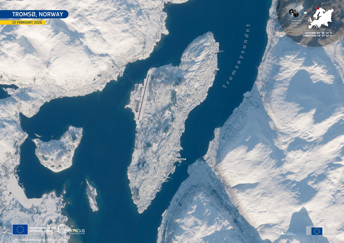
❄️ Tromsø 🇳🇴, around 350 km north of the Arctic Circle, emerges from the polar night.
🛰️ This #CopernicusEU Sentinel-2 #ImageOfTheDay (20 Feb) shows snow-covered Tromsø and its surroundings.
🔗 https://t.co/9CXzDmAiTJ
¿Quieres aprender QGIS desde cero?
Abrimos inscripciones para el Curso Básico de QGIS.
📅 Fecha: 2 al 10 de marzo de 2026.
💻 Modalidad: Online.
Si quieres asistir y conocer el temario, el horario o el precio, contacta por:
📱 +34691334993📧 [email protected]
Te espero en clase!
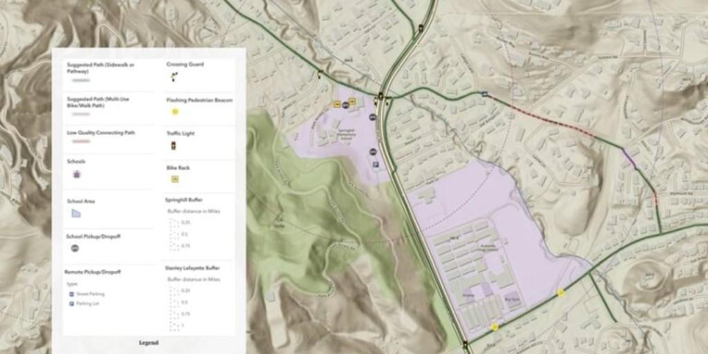
High school students are using ArcGIS Online to map safer routes for kids who walk and bike to school 🚶♀️🚲
See how GIS is making a difference in this article: https://t.co/Rn4drOAH8p
Informe final: Áreas de actividad y dieta del Canis latrans en el contexto etnoecológico de los bosques tropical seco-transición húmedo, bosque muy húmedo, premontano, montano y subalpino en Costa Rica https://t.co/YNA3vkIqcj a través de @academia
CLASS 2
Learn how people, hardware, software, spatial information, and methods integrate to solve real-world problems with Introduction to GIS (a Nexus GIS Professionals Course)
Registration Link
https://t.co/EErTgSAhP2
Next Classes starting on the 4th of February, 2026
CLASS 1
Enhance your problem-solving capabilities by learning how to plan in relation to locations with Fundamentals of Spatial Thinking (a Nexus GIS Professionals Course)
Registration Link
https://t.co/d6h5uWaBJg