Woke up to over 100K likes and it seems unfair to piggyback off a business without giving them credit so you may look at the ferrets here: https://t.co/WenPb2P2Re
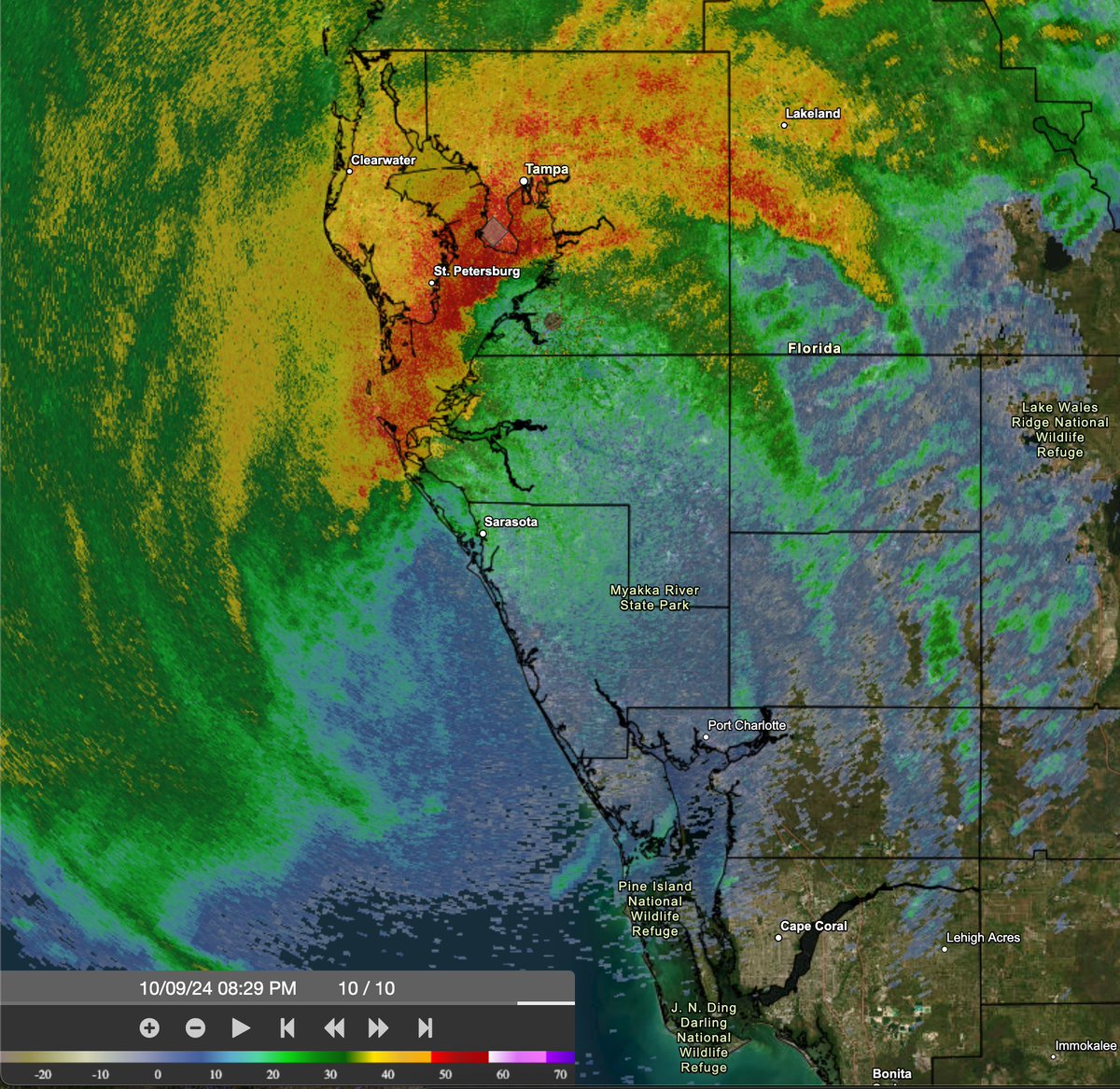
830pm EDT Oct 9th: Doppler radar data indicates that the eye of #Hurricane#Milton has made landfall near Siesta Key in Sarasota County on the west coast of Florida.
Max sustained winds at landfall are estimated at 120 mph.
Landfall TCU: https://t.co/YUc7mT6LuJ
I’m now at end of life care - palliative care-and will be going into a hospice for the foreseeable - thanks to everyone who sends me love and support- you’ve been amazing
From @khcgrandtravel (IG) “Never thought I would be sending you pictures from the outskirts of a hurricane, but I am in Cabo and the waves are unbelievable.”
As some have noted, the last time a tropical system made landfall in SoCal was 1939. #Hilary, steered by a heat dome & upper low, will weaken well below hurricane threshold before landfall, but dump a year+ worth of rain in one day, making for a life threatening flood event.
Thanks to the positioning of the #GOESWest mesoscale sector on Hurricane #Hilary, we can now get some high-resolution gems like this! Beneath the cirrus, we can see several mesovortices rotating around the edge of #Hilary's eye, typically observed during rapid intensification.