I wasn't kidding. This winter is going to be the wildest in 30 years across the Western US with boatloads of rain & shedloads of snow.
Median precipitation of 35" in San Francisco. 24" Los Angeles
❄️ Denver 6 feet of snowfall
Our seasonal forecast maps: DJF 2026-27
Waves as tall as a 4-story building are headed for the California coast this weekend...
A huge storm with hurricane-force winds out in the North Pacific is building seas close to 50 feet. That energy travels hundreds of miles toward the coast as a swell, with waves about 18 seconds apart.
Swells that far apart carry a lot of power, so they stand up big when they hit shallow water. Surf could reach 30–35 feet on Saturday, and some spots could see waves up to 50 feet.
Maximum wave height across northeast Pacific from two powerful storms: 70 to 90 feet.
Hmax ~ 1.8 • Significant wave height
Imagine looking up 70 to 90 feet 😳
HISTORIC FLORIDA RAINFALL: An unbelievable 20 - 24" of rain fell in just 12 hours across Southern Brevard County today, especially in Grant-Valkaria. Major flooding was reported from Palm Bay to Melbourne with water going into homes, cars stalled and roads closed.
Why did this happen? A nearly stationary boundary helped focus the activity, a disturbance provided additional lift, unusually high tropical moisture brought the juice while storms were "training" and raining over the exact same spots.
Could El Niño have influenced the broader weather pattern? It's possible, but that also doesn't mean every heavy rainfall event is caused by El Niño.
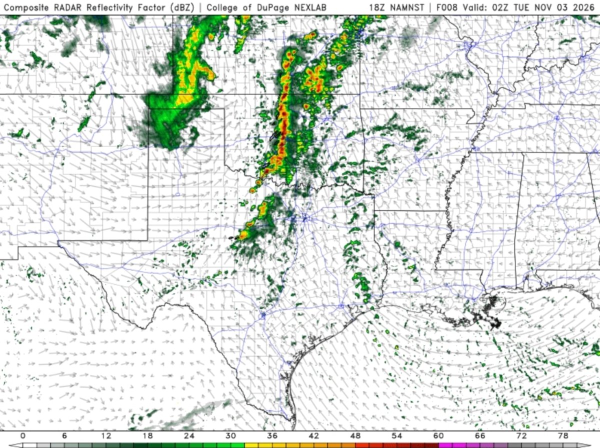
It really shouldn't be a surprise why our storms are so linear. At 500 mb, you can crudely draw the direction of the wind, and you'll begin to notice how the storms are nearly in line with the flow itself. This leads to upshear thunderstorms feeding hydrometeors into the downshear updrafts, which tends to cause thunderstorms to grow upscale together. The better chance for discrete storms was always in TX. That all being said, we likely have a long evening/night ahead for severe weather in the plains tonight, regardless of storm mode.
Tonight is officially the end of an era in the weather world:
OUT:
NAM (3k and 12k)
SREF
HREF
HIRESW
NAM MOS
IN:
RRFS
REFS
Personally, I will miss these models. The NAM was known for being silly, but it was usually on the money when it came to CAD setups and nailing warm noses. That was a certainly a useful tool during mixed precipitation events in the winter. I also found great use cases for the HREF.
The jury is still out on the RRFS, but I can't say I've been overly impressed by its output - nothing has convinced me that it's some magic bullet or that it's significantly better than what it's replacing. I certainly would not have been mad if this was delayed further.
Still, we are meteorologists rather than modelologists. Over time, we will be able to assess the strengths, weaknesses, and biases of the RRFS/REFS and adjust accordingly. Just like we do with, say, the GFS which has well documented issues. But also, it's just one tool of many we use to forecast.
Rest In Peace: The NAM Model Suite
Operational From 2006-2026
(Technically since 1993 if you count the Eta model but who really cares at this point)
You will be missed dearly.
NOAA is pulling the plug on the NAM, NAM MOS, SREF, HREF, and HiresW tomorrow. RRFS and REFS take over. Love it or hate it, the CAM landscape we��ve used for years is about to change forever...