At 6:05 pm ET, a strong earthquake (preliminary magnitude 7.1) occurred near the coast of Venezuela. The NWS Pacific Tsunami Warning Center (PTWC) has issued a Tsunami Advisory for Puerto Rico and the US Virgin Islands. Please see https://t.co/WFrsqZqIMk for the latest information and forecast updates.
A Severe Thunderstorm Watch is in effect through 7 PM this evening across western North Texas and 10 PM this evening across North Texas. The main threats are damaging wind gusts up to 70 MPH and hail up to quarter size. Have multiple ways to receive warnings!
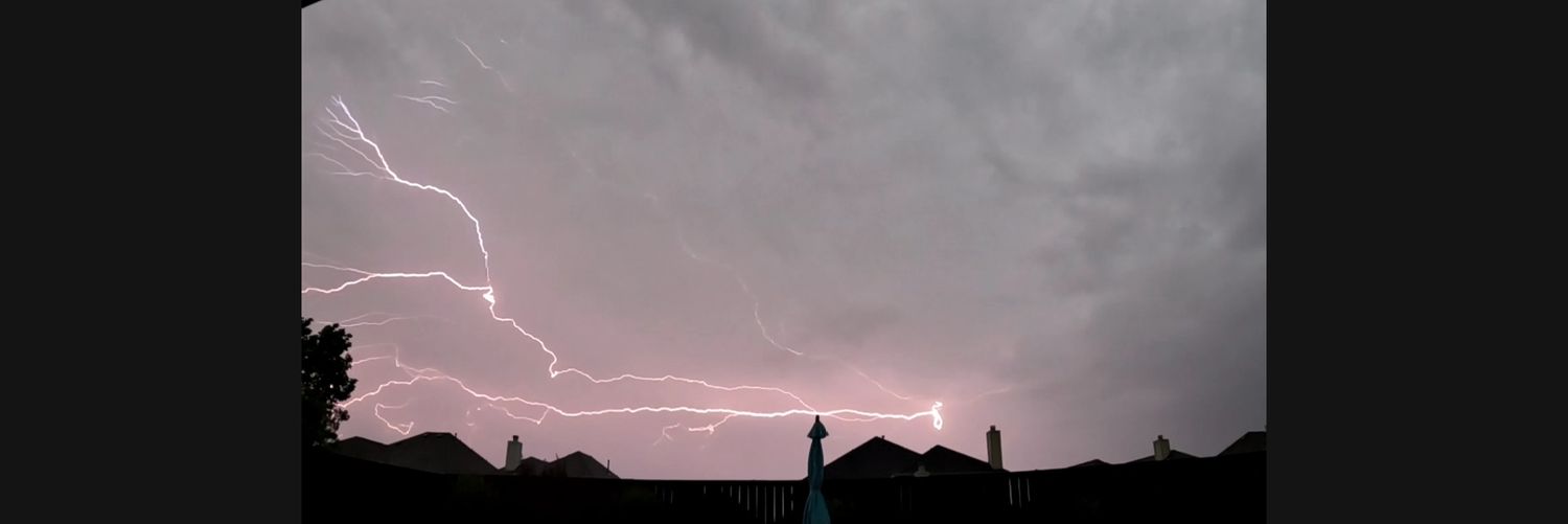
Storm chances will continue this afternoon and tonight across North Texas. A few storms may be strong, with gusty winds, frequent lightning, heavy rainfall, and localized flooding possible.
Severe Thunderstorm Watch for parts of North Texas including Denton and Collin Counties until 11am. A line of showers and storms in Oklahoma will take a dive south of the Red River over the next few hours. #wfaaweather
We have a "complex" forecast. A "convective complex" forecast!
AM: Storm complex drops down, weakens
PM: Heating into 90s
Eve-night: Sct'd storms. Heavy rain
Watching more of these "complexes" each night-AM thru Thursday, esp up north. Then we dry out/heat up into the weekend.
Thunderstorm chances will continue across North TX through midweek. A few strong storms are possible with gusty winds and heavy rainfall the primary concerns. Also, cannot rule out additional storm development later in the day along lingering outflow boundaries. #dfwwx#ctxwx
2:39am CDT #SPC Day3 Outlook Marginal Risk: from the central High Plains and southern Plains to the Mid-South and into the Carolinas and Mid-Atlantic. https://t.co/K89lXjsmlK
Hot and humid weather continues next week, with occasional showers and thunderstorms mainly across parts of North Texas towards the Red River counties. Expect highs in the upper 80s to 90s each day with afternoon heat index values near 100 up to 110 #txwx#dfwwx#ctxwx#texomawx
Scattered showers and thunderstorms continue for parts of North and Central Texas this evening, mainly along and east of I-35. Frequent lightning and gusty winds are possible. Expect more scattered storms Saturday before a return to oppressive heat on Sunday. #dfwwx#ctxwx
6:45am update: Over 1,900 lightning strikes (in the red box) just in the last 15 minutes! Heavy rain continues, but no active warnings are in place. #wfaaweather
Storm chances increase tonight into Friday.
A few storms may develop west this evening, but the better chance arrives tonight into Friday morning as a cold front moves south. More scattered storms are possible Friday afternoon, but exact coverage remains uncertain. #dfwwx#txwx
A cold front will approach North Texas late Thursday, bringing a renewed chance of showers and storms. A few storms may be strong and produce heavy rainfall. This will increase the threat for flooding, however, confidence in the exact location of the heaviest rain remains low.