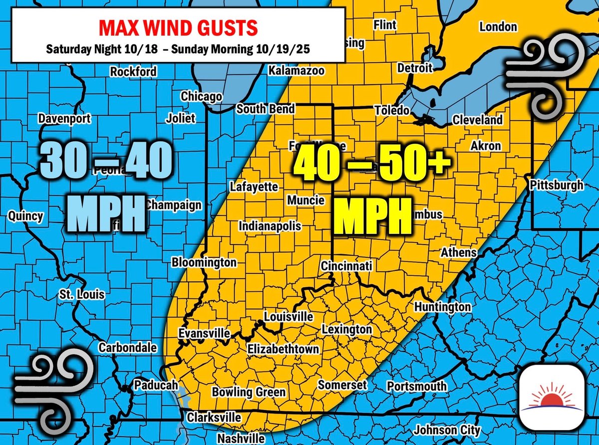
💨HIGH WIND GUSTS: With and behind storms Saturday Night and Sunday morning, winds will gust to 40-50+ MPH across much of Indiana, Ohio and Kentucky.
Batten down those Halloween decorations...
More details on Clarity 👇
Just $99 gets you alerts right from a meteorologist before anyone else — download and sign up right inside Clarity today.
Sign up now →
📱https://t.co/Ef1g64TWVV (iOS app)
📱https://t.co/Q3Z9k2vBhQ (Android app)
A week ago an EF-3 tornado touched down in a highly populated part of St. Louis. The tornado sirens weren’t sounded.
The NWS issued a warning with only 11 minutes of lead time before the tornado touched down. 5 people lost their lives.
There is technology available to prevent these things from happening. Enough is enough. When it comes to weather warnings and advanced notice, things HAVE to change.
Read our full article here: https://t.co/O7j8GYlayf
🚨BREAKING NEWS:
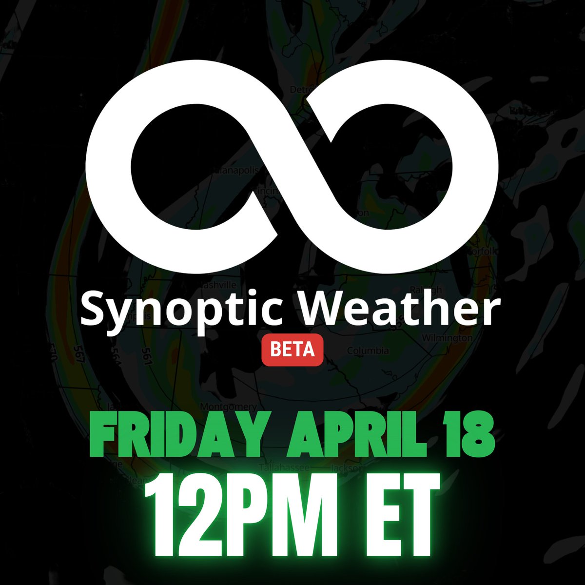
The BETA version of the Synoptic Weather model platform will be available TOMORROW at 12PM ET.
Stay tuned for details on how to access when it drops tomorrow. 👀
Reboot initializing...
Forecasters and enthusiasts: we're helping to forever change how you use weather model guidance.
This is for everyone on the edge of fixed weather model domains👀
Coming soon...
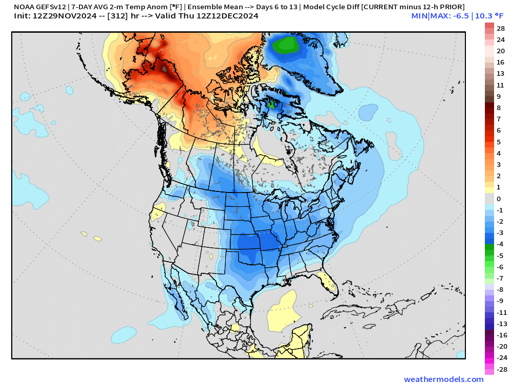
Big colder trends on the mid-day GEFS - a step towards our forecast of staying COLDER through Mid-December vs. warmer weekly data.
Clarity will be a great tool for the Energy and Power industry too! Daily temperature probabilities for ANY spot in the CONUS & our daily long-range outlooks.
Get it for 40% OFF NOW: https://t.co/UEhtB6mpmm.
❄SNOW CHANCES ARRIVING IN TIME FOR THANKSGIVING?
For several days now, we've been mentioning the pattern changing with cooler temperatures arriving for the end of November/start of December.
With the cooler temperatures, comes the possibility of winter precipitation👀
Now... snow lovers, this map does NOT mean you are guaranteed snow.
👉For our entire winter outlook, be sure to join us TOMORROW at 11AM ET via Zoom for our Winter Webinar! https://t.co/ZadBHvmZsM
#winter #winter2024 #winter2025 #snow #INwx #KYwx #OHwx #PAwx #NYwx #NDwx #SDwx #COwx
We've made some changes to the winter season outlook and we have TWO upcoming events that you won't want to miss!
👉Wednesday, November 13 at 11 AM ET via Zoom: Winter Weather Webinar
https://t.co/qBBOZmnJ58
👉Thursday, November 14 from 5PM-8PM in Bargersville, Indiana: Winter Weather Workshop for businesses and operations
https://t.co/S2ObWLQDc9
Join us to learn more about what to expect this winter!
#winter #winter2024 #winter2025 #snow
One of the most impactful variables of race weekend?
Weather.
Travis Houge from @WTRAndretti joined us to discuss the critical role of weather in their race weekends and how they not only stay proactive, but leverage it for success!
#WTRAndretti#WeatherMadeSimple
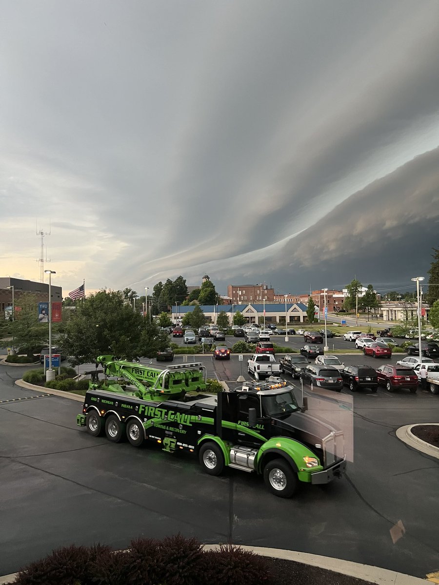
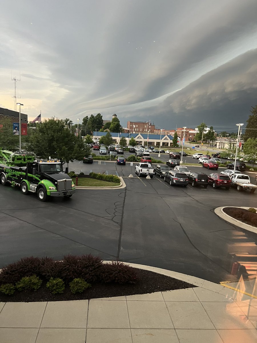
@spann@bamwxcom great chance to see a shelf cloud in Angola, IN on Tuesday of this week. Looking north out of Cameron Memorial Community Hospital. @GriffMet
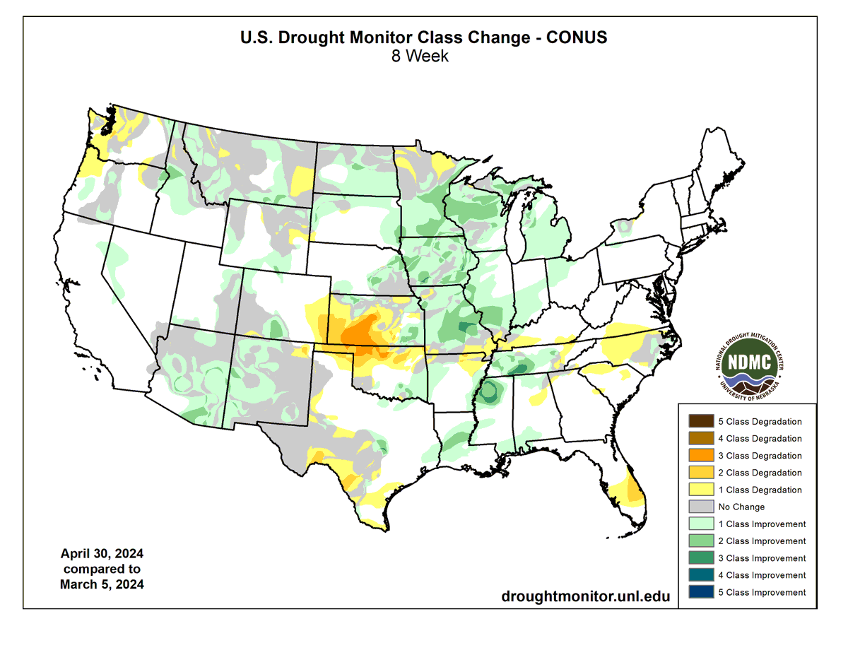
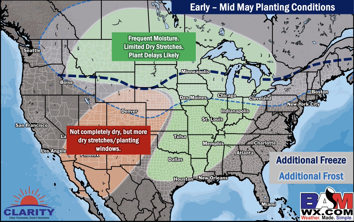
Three points here from where we've progressed the past 8 weeks for the corn/soybean dense areas:
Vast improvements across IA/MN --> this will continue to improve in May
C/W KS --> Mid to late May still open for some flow, (especially May 6 -11) pattern would lean towards in improvement instead of degradation (North Pacific Pattern main support)
N Plains--> improvement likely across May
#corn #soybeans #plant24 #AGwx
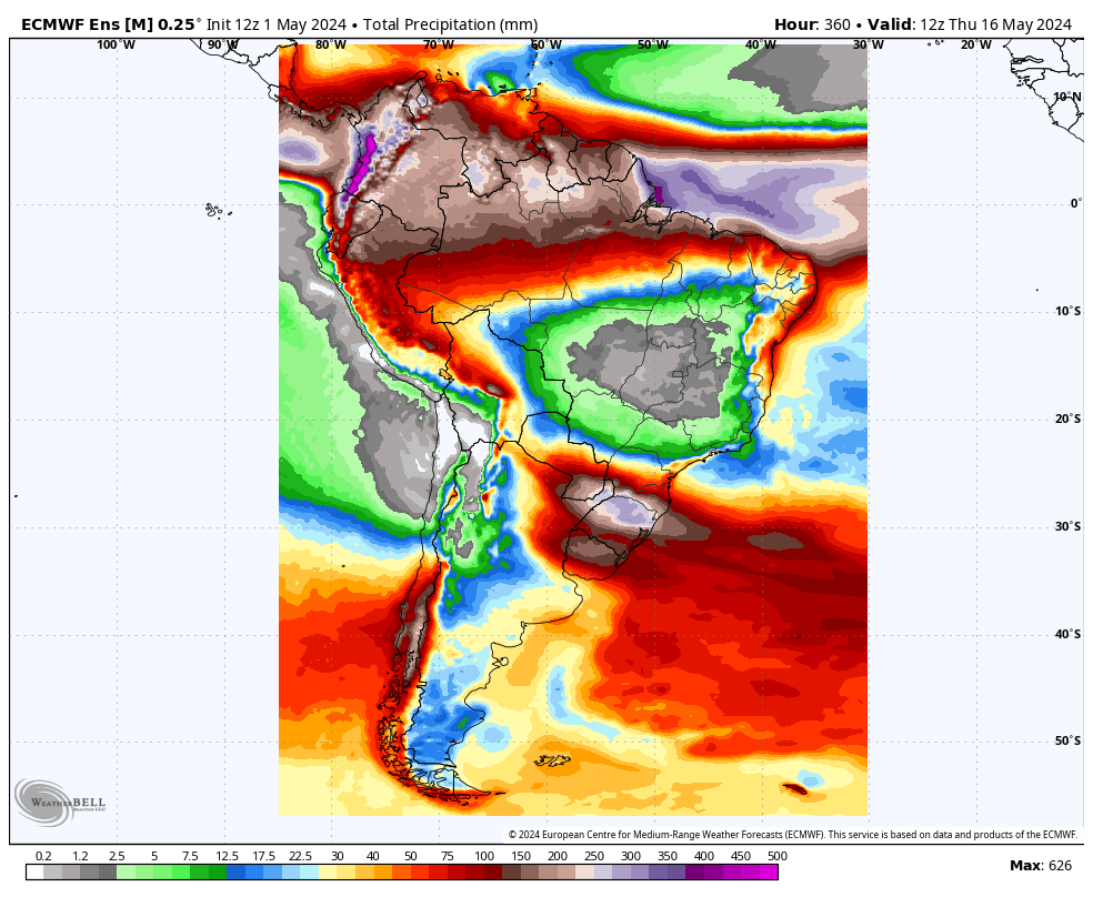
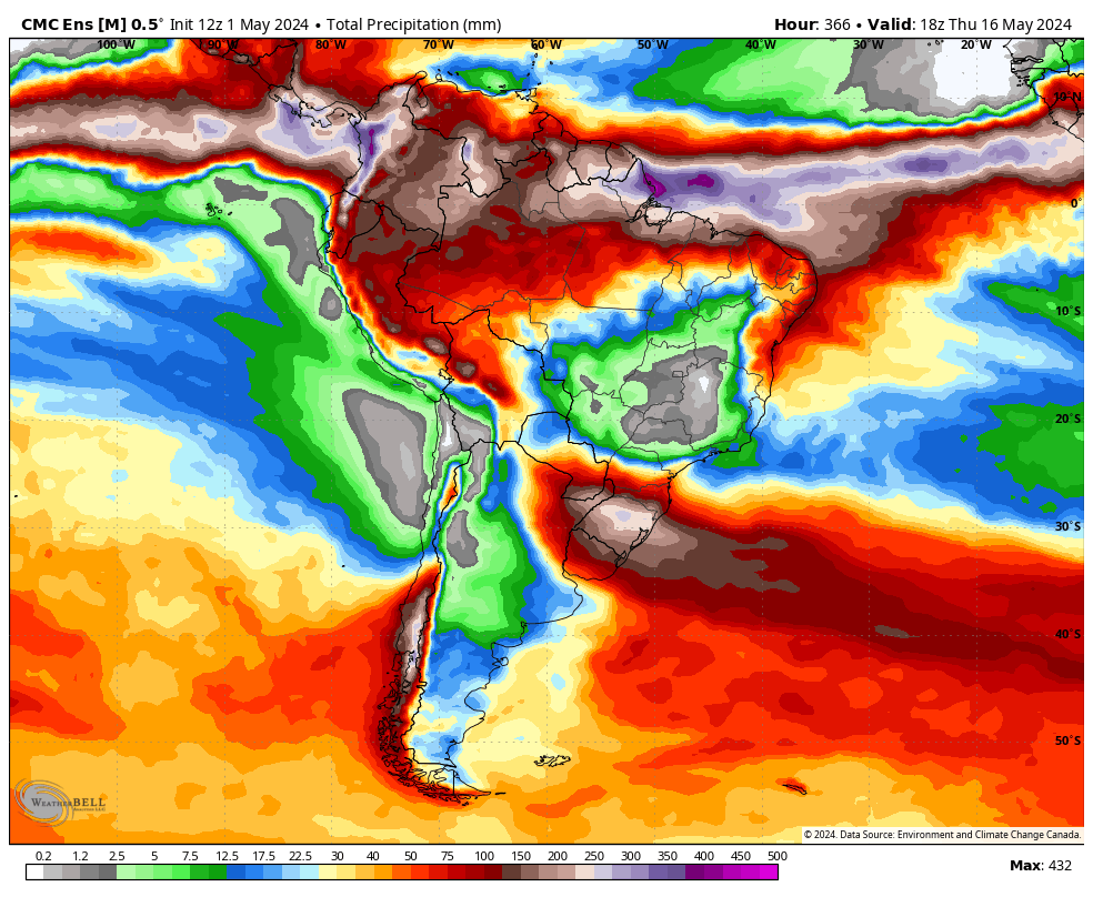
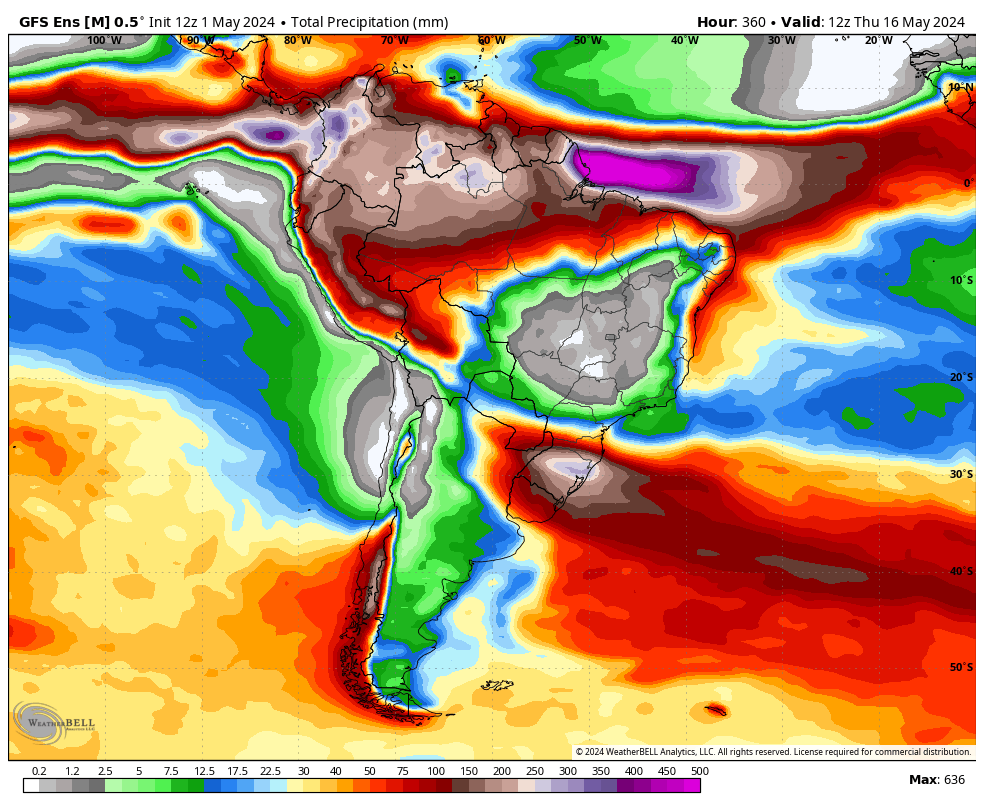
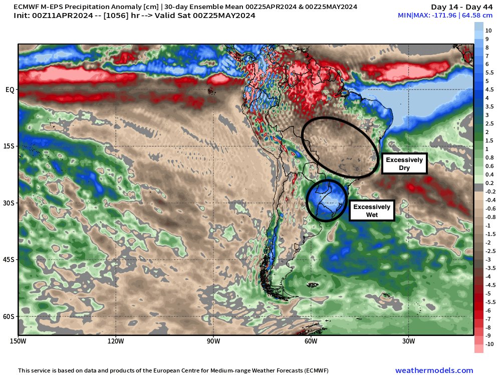
✖️Latest EPS, GEFS, and GEPS in South America the next 2 weeks have essentially 0 rain in the major safrinha areas into central Brazil. There isn't much hope beyond the week 2 timeframe either.
...And excessively wet into the southern Brazil.
👉Interested in Ag commentary for North/ South America? Email [email protected] for samples of our Ag commodity reports!
#OATT #corn #soybeans #plant24
Episode 1 of "Weather Yield" is live on our YouTube Page Here: https://t.co/Apouxt2FLr
In today's update we discuss the persistent wetness causing problems with planting & the threat for significant heat waves and warm nighttime lows this summer.
#AGwx#OATT#Plant24#Corn
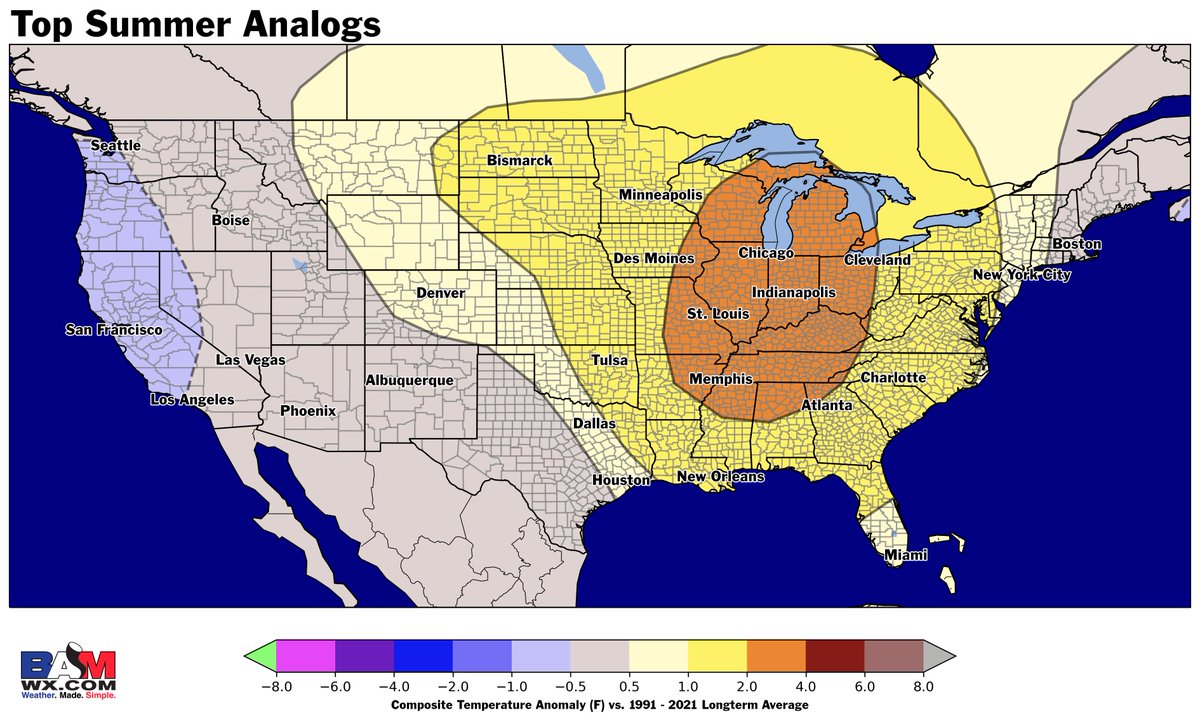
Latest research into Summer 2024 indicates the potential for one of the hottest summers on record for the United States.
We are expecting a La Niña to develop by late this summer and the top 6 hottest summers on record from a cooling demand perspective were either in a La Niña or had one developing.
We'll break it down month by month and what to expect for summer rain/storm threats in our webinar on May 15th! Sign up for free here: https://t.co/8vjRGDf9OF.
Plus check out our update today on our first episode of WeatherYield on YouTube: https://t.co/cu9jd4gZ6Y
#Heat #Summer #HeatWave #Climate #AGwx
Here's closer look of the tornado that crossed I-80 out of Lincoln, NE. The same cell that is currently tracking to the northeast of Omaha.
We have heard multiple reports of devastating damage in the tornado's path.
📸: HippieStormChaser
#NEwx#tornado#severeweather
There are few things more impactful to a motorsports event than weather, especially for the speedway dubbed the "World's Greatest Dirt Track".
BAMWX and @EldoraSpeedway have worked together for the better part of a decade, check out the article here to read how Eldora has been able to utilize BAM Weather and Clarity to assist in some of their biggest annual events.
FULL ARTICLE: https://t.co/yyKWBlfYsv
“You could not have timed it out any better…had we not had those conversations throughout the day [with BAM], there would have been no way we would have got that event in.”
#AutoRacing #Motosports #SprintCar #DirtRacing #DirtTrack #Racing #NASCAR #Eldora
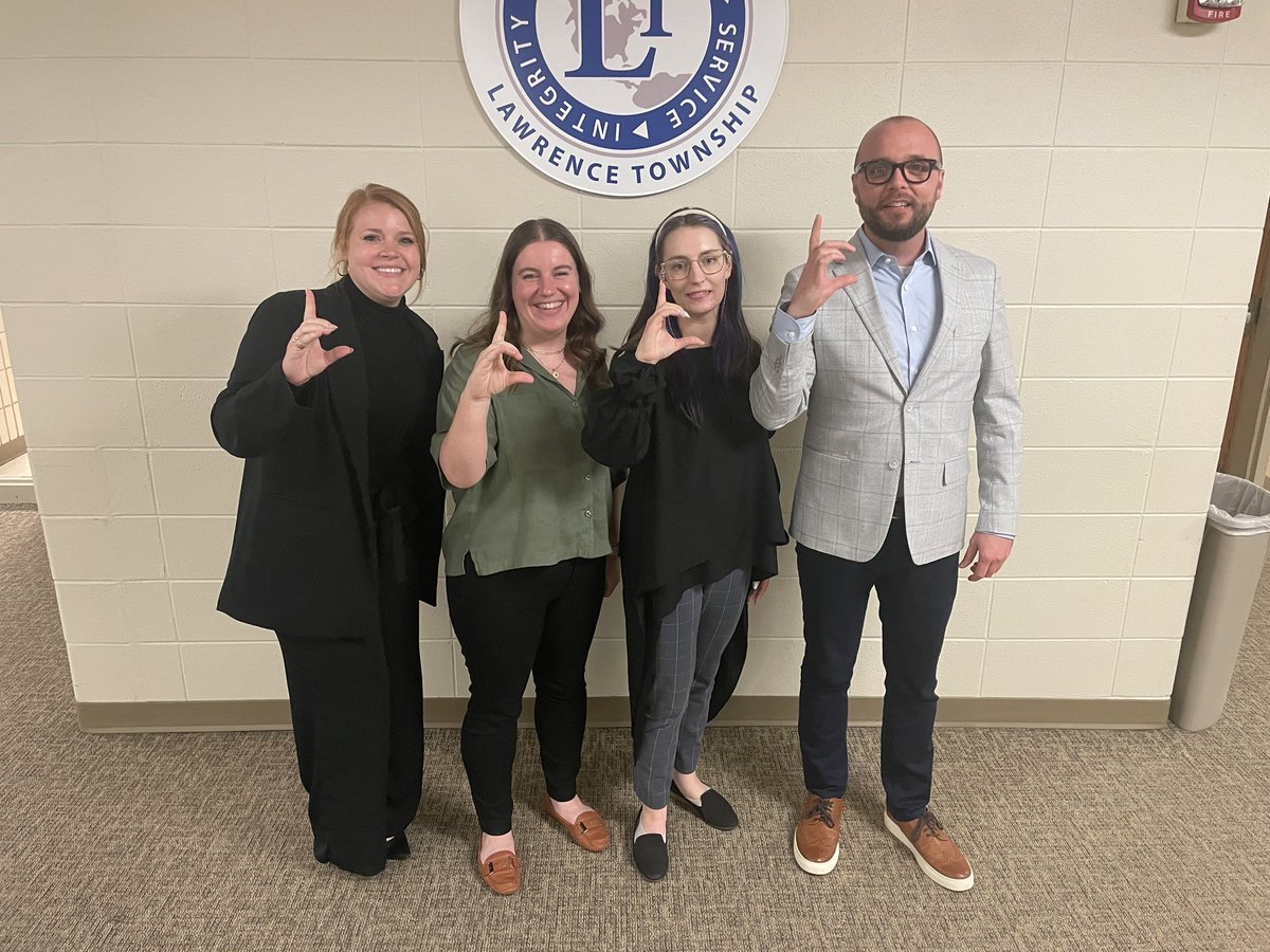
Congratulations to our 4 amazing educators that completed TLA! We look forward to you continuing your phenomenal work in the classroom and throughout the community! #BearPride#LCexcellence
As the sun rises across the West Coast today, this will be the next nuisance for the week to produce some severe weather!
Strong tornadoes are a possibility across OK and KS early Tue AM
Crucial to be careful during overnight severe threats!
#KSwx#OKwx#severewx#storms
⚠️Weather problems ahead for #Brazil#safrinha#corn?
Latest SA ag weather update to @bamwxcom today highlights a pattern returning next 4-6 weeks of both excessive dryness (central) & moisture (south).
Will be interesting to see how the market reacts to this.
#AGwx#OATT





![bam_weather's tweet photo. There are few things more impactful to a motorsports event than weather, especially for the speedway dubbed the "World's Greatest Dirt Track".
BAMWX and @EldoraSpeedway have worked together for the better part of a decade, check out the article here to read how Eldora has been able to utilize BAM Weather and Clarity to assist in some of their biggest annual events.
FULL ARTICLE: https://t.co/yyKWBlfYsv
“You could not have timed it out any better…had we not had those conversations throughout the day [with BAM], there would have been no way we would have got that event in.”
#AutoRacing #Motosports #SprintCar #DirtRacing #DirtTrack #Racing #NASCAR #Eldora](https://pbs.twimg.com/media/GMBLzCCWEAARaFu.jpg)










![bam_weather's tweet photo. There are few things more impactful to a motorsports event than weather, especially for the speedway dubbed the "World's Greatest Dirt Track".
BAMWX and @EldoraSpeedway have worked together for the better part of a decade, check out the article here to read how Eldora has been able to utilize BAM Weather and Clarity to assist in some of their biggest annual events.
FULL ARTICLE: https://t.co/yyKWBlfYsv
“You could not have timed it out any better…had we not had those conversations throughout the day [with BAM], there would have been no way we would have got that event in.”
#AutoRacing #Motosports #SprintCar #DirtRacing #DirtTrack #Racing #NASCAR #Eldora](https://pbs.twimg.com/media/GMBLzCCWUAAqQyQ.jpg)