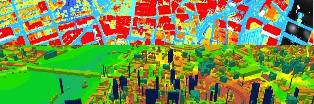
Thinking on creating a live feed interactive map of PDX police 911 logs. Any recommendations on where/how to collect all PDX911 logs? @rosecitytransit
Looking into https://t.co/mXGaKz7aB3. Not sure if premium is the way.
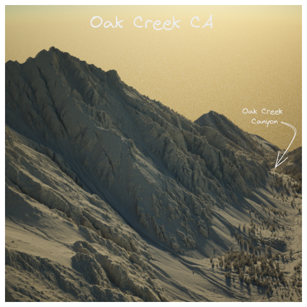
Oak Creek California Mountains. Hillshade Data came from #OpenTopography website. The 3d render was made with #AERIALOD.
First try with #Aerialod. Let's go for more...
My new book The Self-Taught Computer Scientist is out this month! To celebrate, I am giving away a FREE physical copy to someone on this thread daily until Oct 19th! To enter to win: follow me, retweet this, and leave a comment! Full terms: https://t.co/VFh5UjYUQf #100DaysOfCode
In the journey of self-taught programmer for around 3 years, but have to admit I have failed many times and many time I have got up, seems like this books by @coryalthoff could definately show me the right path.
Cheers
My new book The Self-Taught Computer Scientist is out this month! To celebrate, I am giving away a FREE physical copy to someone on this thread daily until Oct 19th! To enter to win: follow me, retweet this, and leave a comment! Full terms: https://t.co/VFh5UjYUQf #100DaysOfCode
This is by far the most downloaded podcast episode #geospatial#python with the legendary @underdarkGIS!
Just under 6500 listens!
https://t.co/VYuP1YfAqO
@Vuoggis@tenkahen Hey @Vuoggis , Thank you for the fast respond. The course is great. Will find my own data to work on. Thank for providing such a good GeoSpatial courses, as well for open it to everyone.🎖️
finishing with the amazing #autogis2020 open course from Helsinki University , but can't find the data for Raster lesson https://t.co/nrKMhvZkIL, @Vuoggis , @tenkahen please HELP!!!
Actually you have to feel sorry for poor old Mercator. How could he know that four and a half centuries later, on a frequency of about once a week, people would find new ways to demonstrate how crap his map is.
Can you think of a good time to use this projection?
@JuanSVas @Jorgesays Hola @JuanSVas, excelent content (Data Science). Estoy interesado en tus stock market classes, donde puedo encontrar video o notas del primer webinar ?
Gracias
History is not your fault, but as long as people are still suffering, until there is justice, it is absolutely your responsibility.
U.S. Native land loss from 1776 to 1930
By Ranjani Chakraborty
@Mapbox Dear @Mapbox, hurts to see this mistake happening again & again in the GIS community. The distance between the city of Columbia in South Carolina U.S. and the country Colombia it's +/- 2000 miles.check the poster it says COLOMBIA. #colombianotcolumbia
Thank you @jbellmaps for building a #storymap live for excited @NACoTweets & county leaders in #Portland!
@ArcGISStoryMaps offers a simple, effective platform for sharing their successful local programs to a much larger audience. Check out the demo story: https://t.co/6dFGo3qbFR