Scientists at the National Center for Atmospheric Research have confirmed that a dropsonde deployed into Hurricane Melissa, as it was closing in on Jamaica, officially recorded an astonishing 252 mph wind gust, the highest ever recorded in a tropical cyclone.
NEW! Here's Cat-5 #Hurricane#MELISSA's #Jamaica landfall as captured on Cayman Islands radar. These images did not exist until a few days ago, when @fathercay & team at CINWS processed the data. This is at the very edge of the radar range—the radar site is over 200 mi away—& it's quite attenuated. Even so, this gives us a second complete look at that intense (160-knot) eyewall screaming ashore. The star indicates my location, scraping along the right edge of the eye. An absolutely ferocious storm that remains burned in my mind.
15 years ago today, one of the most prolific tornado outbreaks ever recorded took place across the south.
Alabama, Mississippi, Tennessee, and Georgia would experience an onslaught of tornadoes; 4 EF5's, 11 EF4's, and 20 EF3's would touch down that day.
All visualized here in 30 seconds.
Making a living as a full-time chaserdude is achievable. The trick: Diversify your income sources. Mine is a mix of TV reporting, footage license fees, appearances in TV shows, social-media monetization, speaking gigs, & being a spokesman for multiple brands.
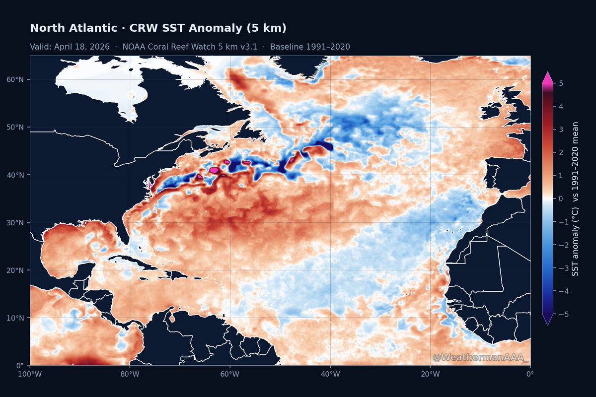
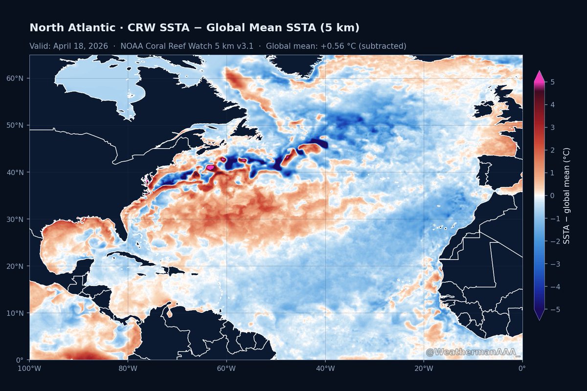
Contrary to the Pacific, the Atlantic's SST configuration appears exceptionally hostile for TC development this season.
Note the cold canary current showing up on both the standard SSTa and global mean removed SSTa plots. El Nino aside, this alone would suggest below average activity this year.
I’ve seen a number of people saying “SoCal could experience a tropical cyclone (even hurricane) this year.” Realistically, water temps off Southern CA would have to increase by another 15F & that’s just one component. The absolute most you’ll get is a transitioning tropical storm
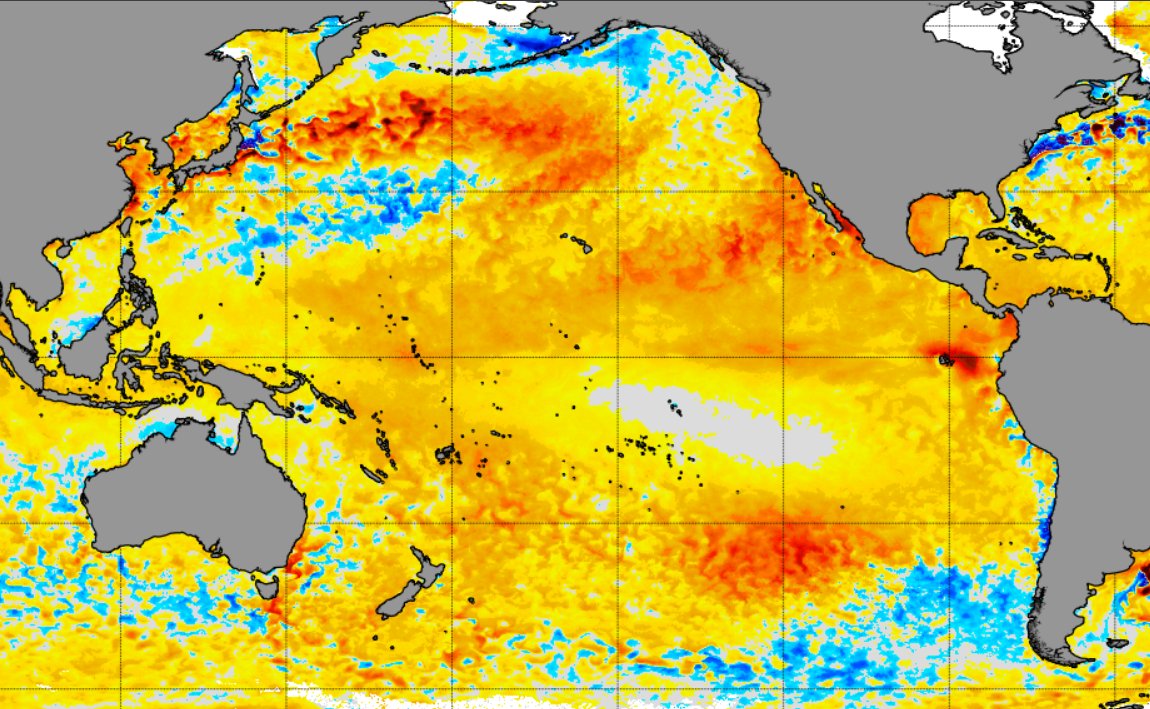
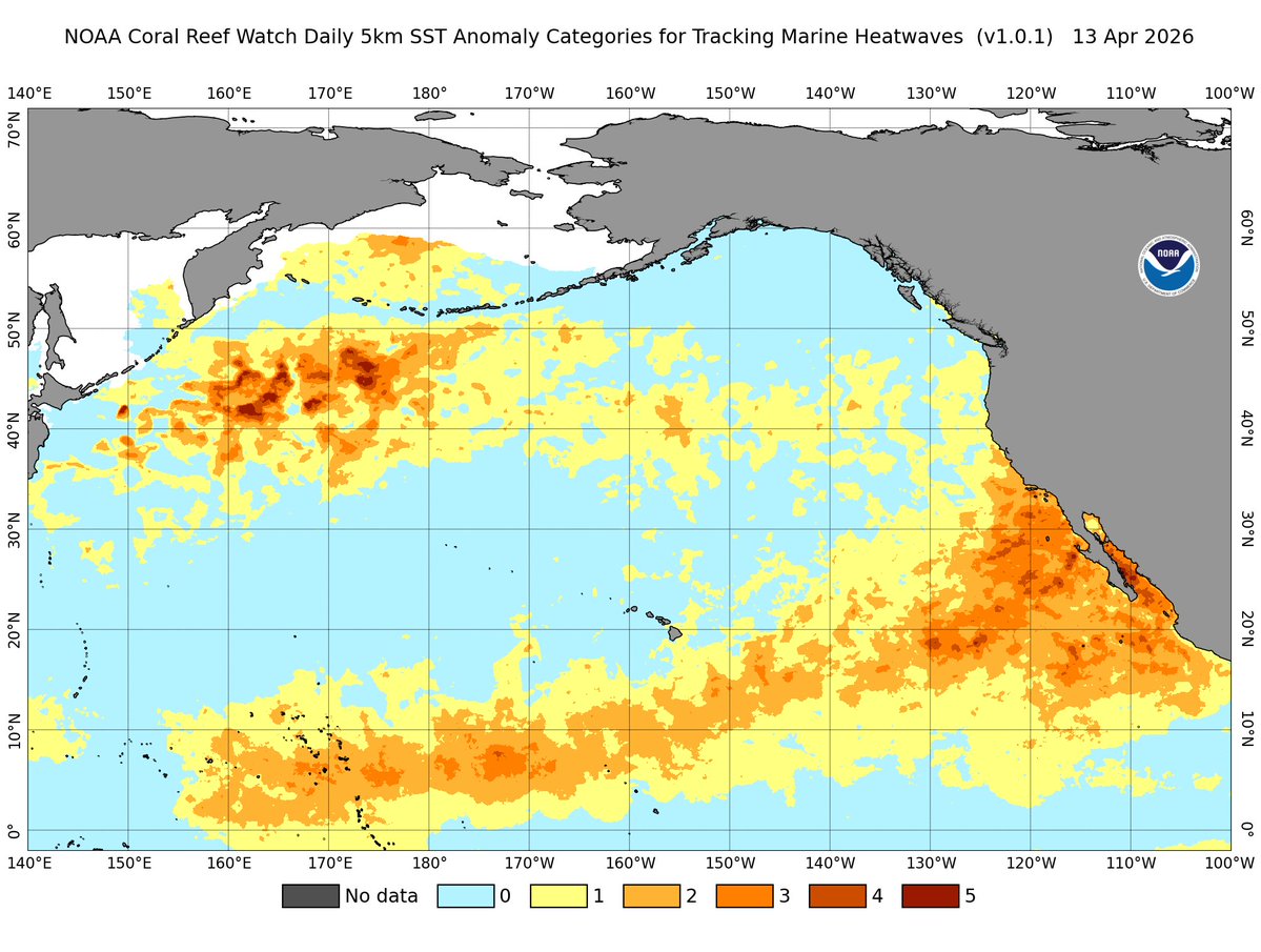
California’s coastal waters are the warmest ever recorded for April.
A severe to extreme marine heatwave is underway off the coasts of California and Baja California, locally reaching Category 5 intensity.
There is just a ton of warm water across the Pacific, with a strong to severe marine heatwave conditions extending from the Marshall Islands all the way to the California coastline.
Expect a very humid summer in Southern California, along with major impacts on marine ecosystems. With a strengthening, potentially Super El Niño expected by autumn, if there were ever a year for a hurricane to make landfall in SoCal, this would be it.
We’ll be watching closely for El Niño to rapidly emerge in the coming weeks.
Radar estimation showing Typhoon Sinlaku pulling away from the Mariana island chain. Fortunately for the Mariana, the typhoon had a perfectly-timed eyewall replacement cycle, weakening the storm before and during landfall.
Sinlaku looks to be undergoing an eyewall replacement cycle right as it’s making landfall over Tinian and Saipan islands. The radar still is also an estimation. The site to the south is down.