Video of the Descartes Labs technology incorporating the Segment Anything Model (SAM), showing fast prototyping leveraging SAM powered by the Descartes Labs platform to retrieve imagery & display vectorized output in an interactive way.
#segmentanything#computervision#ai#ml
Our Part 3 ML Tooling post is live! Here we cover how we train, test, store, deploy, and share our ML models. Check it out here! https://t.co/UmrS0sRUUa
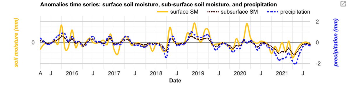
Soil Moisture Active Passive (SMAP) tutorials are here!
@KarynTabor and Manh-Hung Le introduce you to the three @NASA SMAP products #EarthEngine hosts and show an example of using them for drought monitoring.
🔹https://t.co/cfJP9yU5yL
🔹https://t.co/heO1oLq7tq
A little divergent from the typical remote sensing I do, but I made a ghost sightings web map! Lot's of little quirks in it but I built it following a course I took from @TalkPython . If you're into #ghosts it's neat. Has coverage over the whole US. #gis
https://t.co/3QCJhbMO4n
Nice example of 'mixed data' learning from the @MetaAI paper: Sub-meter resolution canopy height maps https://t.co/3Yus68Tv1O 🌳
'After the convolutional layers, we also input a collection of scalar values.. the latitude, longitude position of each image.. We trained the GEDI model to output a single scalar value, with a L1 loss on a regression task'
Despite the clear relevance of the 'mixed data' approach in the remote sensing domain I have seen relatively few examples of it. Learn more at https://t.co/SobM2C2DQo
Exciting to see the official release of Astraea's advanced satellite tasking service!🛰 Almost makes me feel like some NGA agent being able to task a satellite from my living room with a few clicks.
Big news! Astræa has launched new imagery tasking capabilities with major providers, like our partners at @planet. Read more below about how Astræa is making imagery-derived insights more accessible and an enterprise-grade space strategy more obtainable.
https://t.co/DdaXXl5Hlf
troubling to check my account after some time off and see I am spamming some crypto scam. 😑 Lesson learned on the risk of using a common password for low-priority apps.
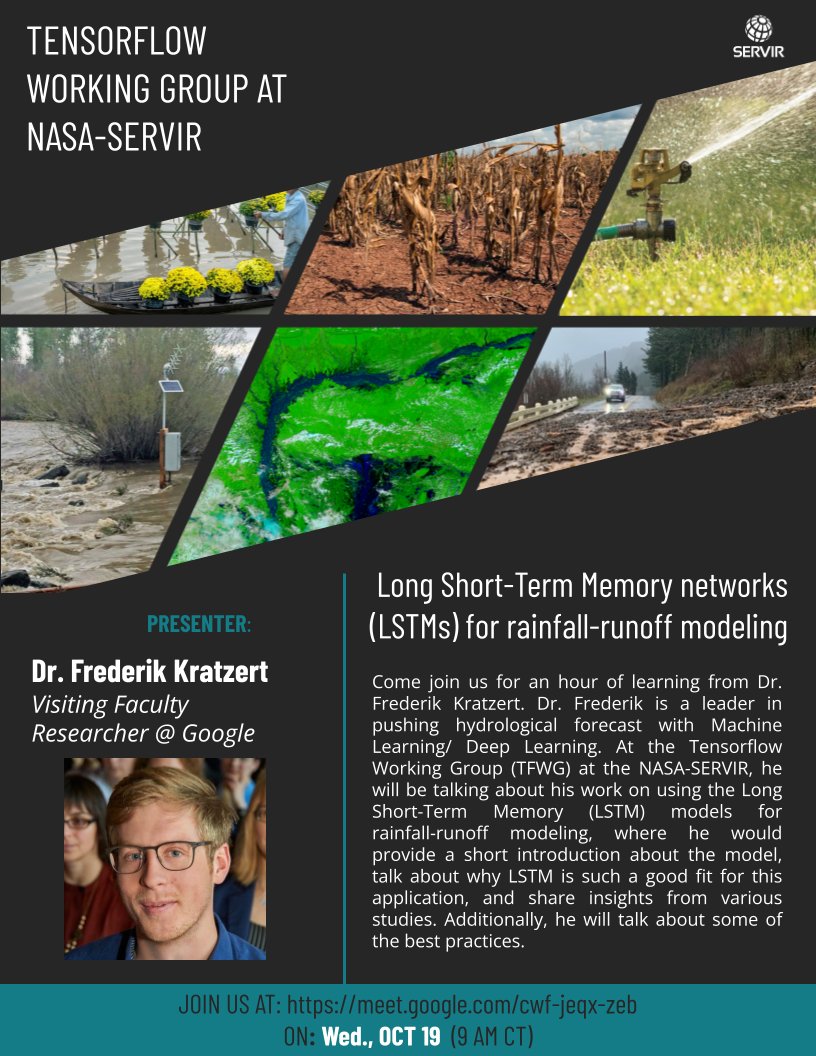
Join us on Wed Oct 19, for a spicy session by @fkratzert on using #LSTM for rainfall-runoff modeling at the #TensorFlow Working Group (TFWG).
Link to Call: https://t.co/rbCiKkOiMi
Link to join the TFWG: https://t.co/wRPV1FvVTx
Website: https://t.co/fwviqfPKCf
#SERVIR#Hydrology
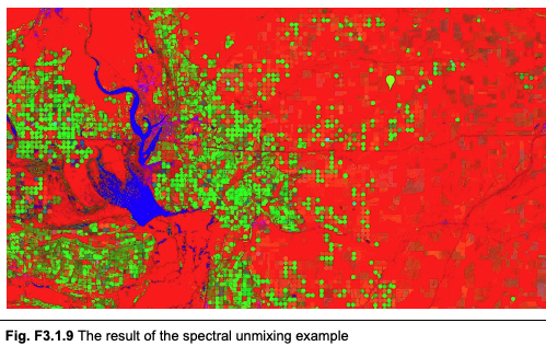
This version of the multi-scale app lets you control the location and zoom level with gestures. It uses https://t.co/A1R2eSEtmx.drawingTools to quickly update bounding boxes client-side. Also see the use of ui.util.debounce to throttle redraw rate.
https://t.co/b4UBI7HnO9
Hello! Come see the book kickoff presentation at Geo For Good, Thursday at 1130AM Pacific. Get access to book materials! You can attend via livestream at https://t.co/upGXDyRqw4
See you then!!
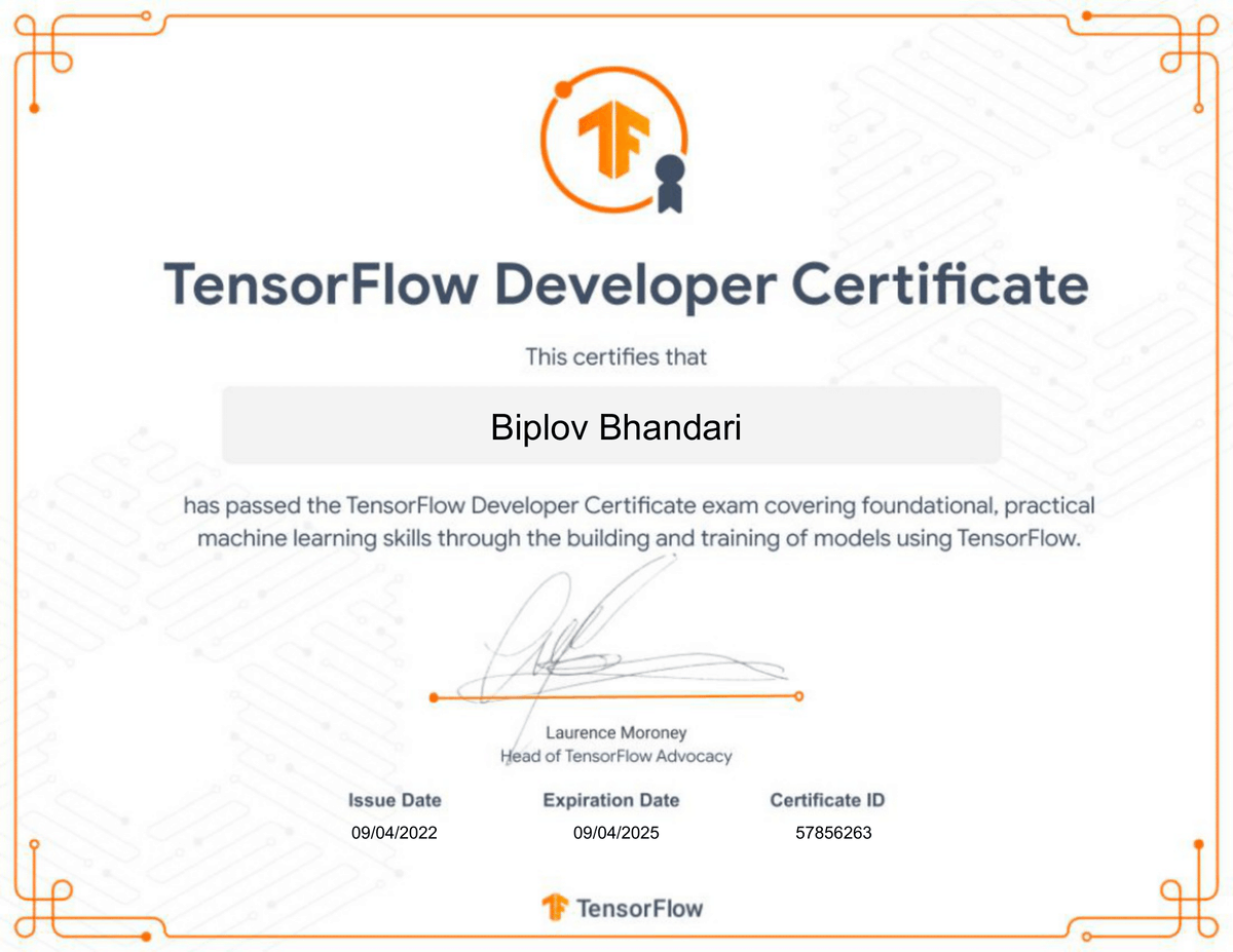
I have completed the @TensorFlow Certification Examination. The journey started after the 3-day TF Exchange for the SERVIR after 2019 @GeoForGood. After the exchange, we completed several machine learning-related projects and published multiple papers through the Working Group.