I'm excited to announce that I accepted a position working for fed agency, no more county EM for me. I'm staying in EM but more related to maritime/port security. Funny thing, I started a month ago but I've never been to the office, working remotely this whole time. #EMGTwitter
Conditions aren't as brutal as Friday, but cold and wind continue today. Some light snow is occurring this morning with patchy blowing snow still an issue in open areas. We are watching lake effect potential along the eastern lakeshore tonight into Christmas Day. #OHwx#PAwx
⚠️DO NOT TRAVEL: This is video from outside the Thruway's Buffalo Emergency Operations Center in #Cheektowaga. Blizzard conditions are making travel impossible. The NYS Thruway is closed from exit 46 to the PA line and all of I-190. Stay off the roads. #buffaloblizzard
A short clip from a @NITTEC traffic camera of what conditions currently look like on Route 5 in downtown Buffalo. Please abide by any travel bans or advisories set by local officials, they are in place for a reason.
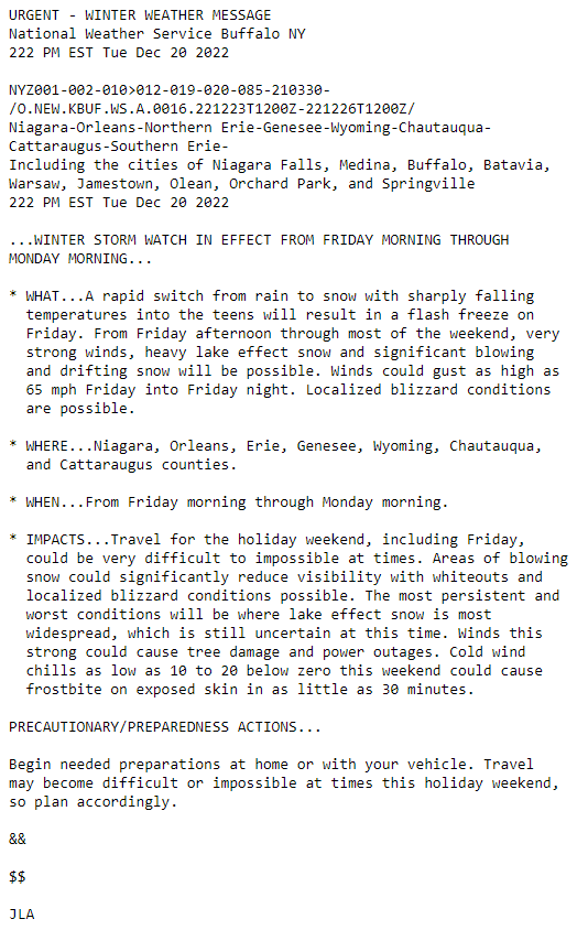
Here are some significant details for the upcoming storm:
* flash freeze
* strong winds - to 65mph
* heavy lake effect snow
* localized blizzard conditions, whiteouts
* power outages/tree damage
* difficult to impossible travel at times
* wind chills 10 to 20 below zero
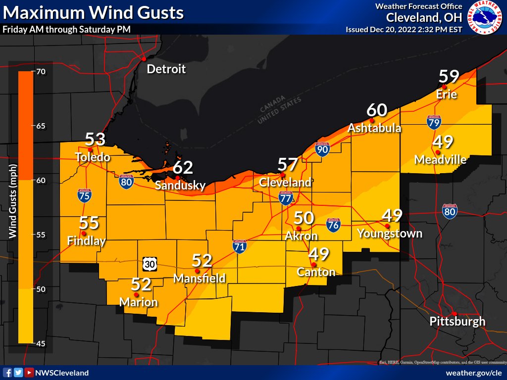
Highest confidence with the holiday weekend storm system remains to be the strong winds and extreme cold. Wind gusts could reach as high as 50-60 mph through Saturday evening. Strong winds coupled with arctic air will lead to wind chill values between -15°F and -25°F. #ohwx#pawx
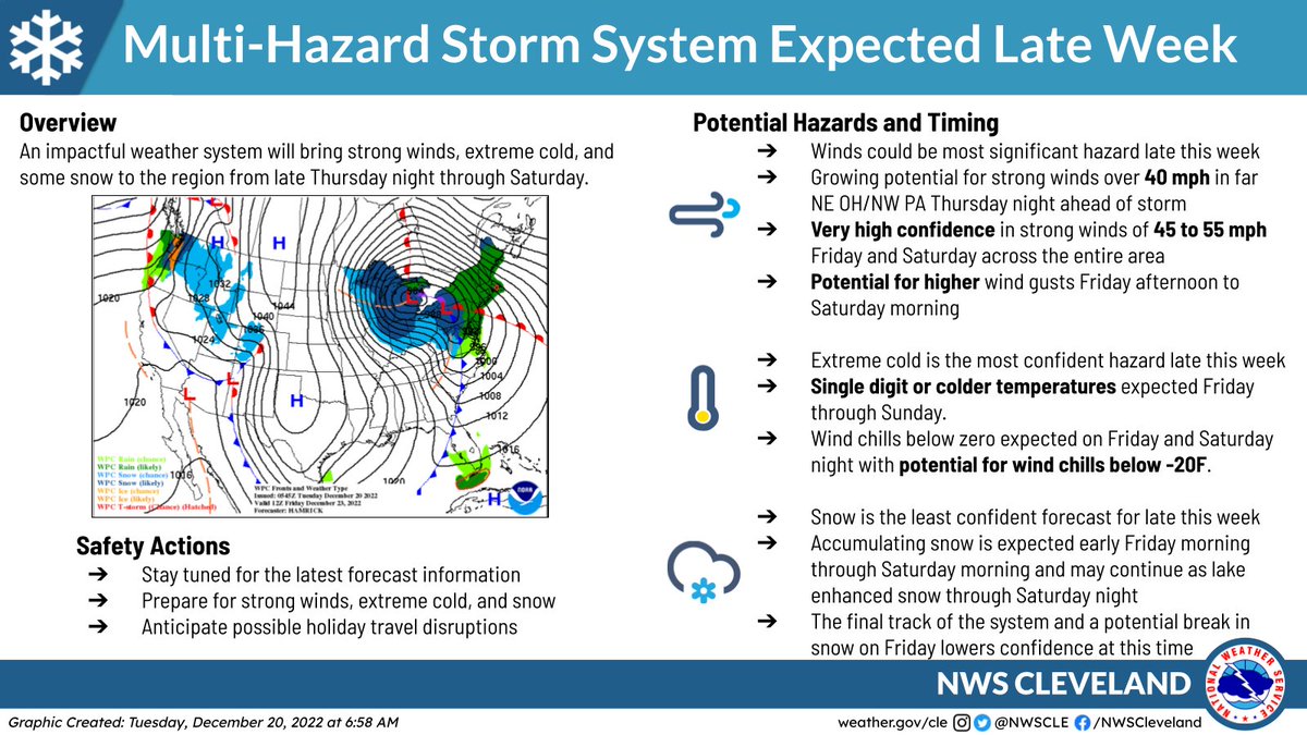
A multi-hazard storm system will bring strong winds, extreme cold, and some snow to the region from late Thursday night through Saturday. We are most confident in the wind and cold, but the snowfall forecast still remains less certain. Prepare today for later this week!
Rescue teams have launched in Fort Meyers and are engaged in multiple active high-water rescues.
Add as much info as you can here --> https://t.co/YWri18OFTe
CALL 911 FIRST.
Help is 100% not guaranteed. But promise to do everything in our power to help FL. #HurricaneIan
Sep 28 7am EDT -- Here are the key messages from the special advisory issued on Hurricane #Ian.
Catastrophic storm surge inundation expected today as Ian moves ashore in the southwest Florida peninsula.
Latest: https://t.co/tnOTyg5UEw
#WNY Travelers: Lake effect rain showers across far SW NY will push north this morning, causing a soggy commute. Expect: up to 1/2 inch per hour rainfall rates, reduced visibility & localized ponding. If you come across flooded roads please remember to turn around, don't drown!
What does it look like to be in a category 4 hurricane? In partnership with NOAA, Saildrone is storm chasing in the Tropical Atlantic. Here is video from a saildrone near the eyewall of #Fiona yesterday.
👋🌴New to the coast? Know anyone who is new to the area?
👀 Check out our Hurricane Preparedness YouTube Playlist stocked with lots of #HurricanePrep information & tips https://t.co/rYu1ninRHd 🌀 #Ian