It is a heartbreaking scene in Madison County, as Million Church has been destroyed after flooding in the area.
Follow updates: https://t.co/5PWuKW13eA
So apparently, a super El Nino transition means Illinois gets nuked. It'll be another 25+ years before the next one. Enjoy it. What a legacy year, set of years honestly, for Illinois and tornadoes.
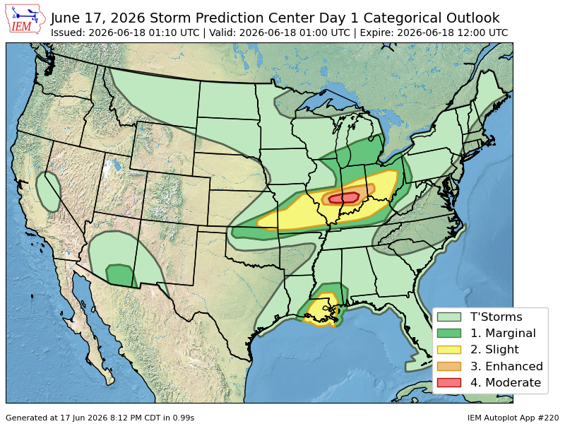
🚨 Forecast change: The atmosphere over parts of Kentucky, Indiana, and Illinois is becoming noticeably more unstable than expected this afternoon. That could have implications for tonight's storm potential.
- Using split view in the Weatherwise app we can compare the 12z HRRR run (left) to the newest run (right). That newest run, on hour 0, shows the current cape measurements.
- By doing this, we can see the environment is certainly more unstable than the model data indicated. This is why comparing data, to real time ingredients is important, and Weatherwise makes it super easy to do that.
- This increased storm fuel could help the developing storm line pack that punch this evening, into the overnight for the Missouri and Ohio Valleys.
If the 114mph wind gust from the Kentucky Mesonet site in Mason County is verified, it would be the 2nd highest wind gust ever officially recorded in Kentucky history.
A 120mph wind gust was recorded during the western Ky tornadoes on December 10th, 2021. #kywx