@JacquelynGill Maybe someone's already said this and I missed it, but this looks like it's just a *screen shot* from the JHU C-19 Dashboard. Turning that (admirable) dynamic web map where granularity is clear (with the ability to zoom) into a poor-resolution static map is the main problem here.
@RobertCMahon Here are those Cedar River landslides using the same lidar portal that @ampfeiff linked to:
https://t.co/sT52wIy3T1
Awesome resource, indeed!
@RobertCMahon 47.396836, -121.834937 should get you close to the Cedar River locale in this presentation:
https://t.co/7PjuvMcZ6y
Up is to the south-ish in the Cedar R. images in the Coe PDF...
Spectacular when paired with Oso case study!
Well, it finally happened. This #ICE International #StudentBan got me back into the “organizing effective lobbying action via twitter” game.
Want to make sure our lovely international students can keep their visas? Here’s how to do it:
THREAD.
https://t.co/k8xmv5dNyE
1/14
New #EarthEngine app online! This app visualizes the global SRTM 30m DEM. https://t.co/Rw5Rt1oI2K
Color ramp is dynamicly linked to the elevation range within the viewport. As you zoom and pan, the topography you see is always vividly portrayed by the updated color ramp.
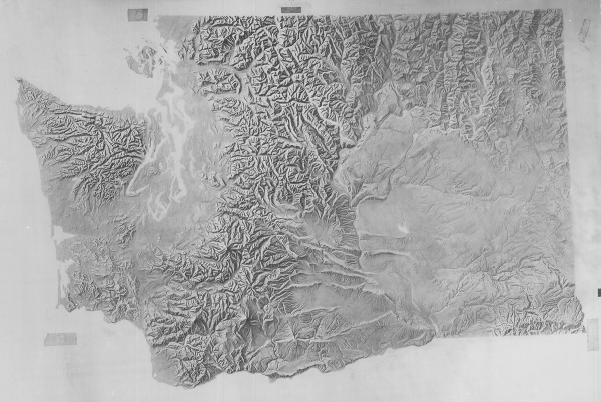
Today is the 40th anniversary of the Mt. St. Helens eruption. This old shaded relief of Washington, produced by the USGS for a 1:1.5 million state base map, shows the mountain when it still had a pointy top.
@GeoJoeK@ArcGISPro@FJBowlick@qgis Do you do all your relative elevation model work in @qgis? I've found working with rasters in Q to have a steeper learning curve than general vector work and layout. Longtime user of Arc for topographic analyses, so perhaps I'm just stuck in my ways. Love your maps, btw!! 2/2
@GeoJoeK@ArcGISPro@FJBowlick@qgis I had to switch my students over to @qgis mid-semester due to a switch to remote learning (and they all had Macs). I have to say that I quickly grew to like a lot about Q (especially symbology and layout stuff). I agree that ArcGIS Pro is a big improvement, though. 1/2
@MtnMapper Below the junction of the Walhonding and the Tuscarawas, the river becomes the mighty Muskingum. The whole watershed is named for the Muskingum, so it would be worth labeling that stretch west of the High Hill feature. The Licking River east of Columbus is also quite significant.
@MtnMapper -What appears as a reservoir north of the Mohican label is actually free-flowing river unless the Mohawk flood control dam is closed. What you show is more like a max-inundation extent. Just rivers there is more true.
2/3