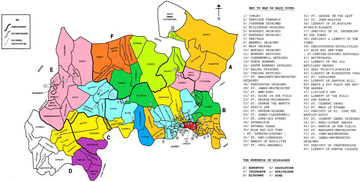
Parishes of Middlesex - colour grouped into modern day London Boroughs for which they would form the base of. Many parishes are ancient but some (such as Stepney) were broken up into several new civil parishes in the 19th century to reflect the growth in population.
Detective work required at Warley St, Bethnal Green, London. The street contains several bricked-up arches beneath the railway tracks. One arch has a post built onto it with a commemorative stone in two halves containing letters and the dates 1885. Any ideas?
Unnoticed by the majority of passersby at the bottom of the stairs leading up to Waterloo Bridge, on the Somerset House side, is the boundary marker showing the historical boundary of the Manor of Savoy, that became part of the Duchy of Lancaster.
🔎Our second query relates to this boundary marker in Muswell hill 📷 What parish is this? And what does it say? If you know, call me on 0800 731 2000 📷 ☎️
The land around "Mus Well" used to be an exclave of Clerkenwell (and also County of London from 1889) bordering Hornsey and Tottenham. In 1900 it became part of Hornsey UDC, Middlesex. In 1934 the boundary was altered, with parts of it becoming Wood Green UDC. #Haringey today
Some parish boundary markers are hard to find as parts are buried deep below street level, but even if that's the case as here, if there's no overgrown hedgerows they are still clear indications of extent of historic parish
#GipsyHill#Lambeth#Southwark#BeatingTheBounds
Civil parishes of Surrey in 1888, just a year before the northern parishes were grouped into the administrative County of London. The maps also shows 'Sanitary Districts'. The Local Government Act 1894 replaced these with more general local authorities (rural and urban districts)
Boundary marker for the Strand district on Wardour Street. Strand was a local government district from 1855 until 1900 when metropolitan boroughs were created in the County of London
@HistoryOfStokey@droedmawr yes definetly after the houses were built. between 1889 and 1900 this was also the boundary between the administrative counties of London and Middlesex
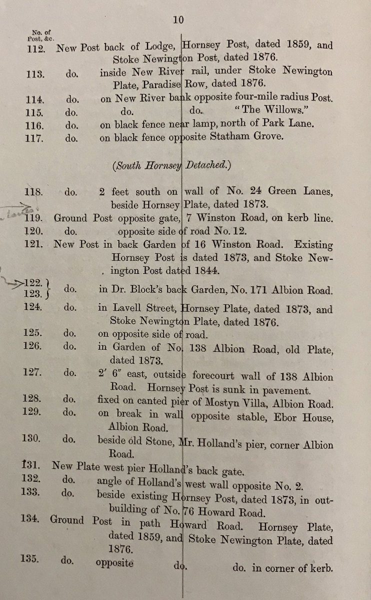
What a thrill it was just now going with @Ldn_Boundaries (right) to see the Hornsey Parish boundary marker from 1887 in the back garden of a house on Albion Road, where the boundary between Stoke Newington and one of Hornsey parish’s detached sections was until 1900.
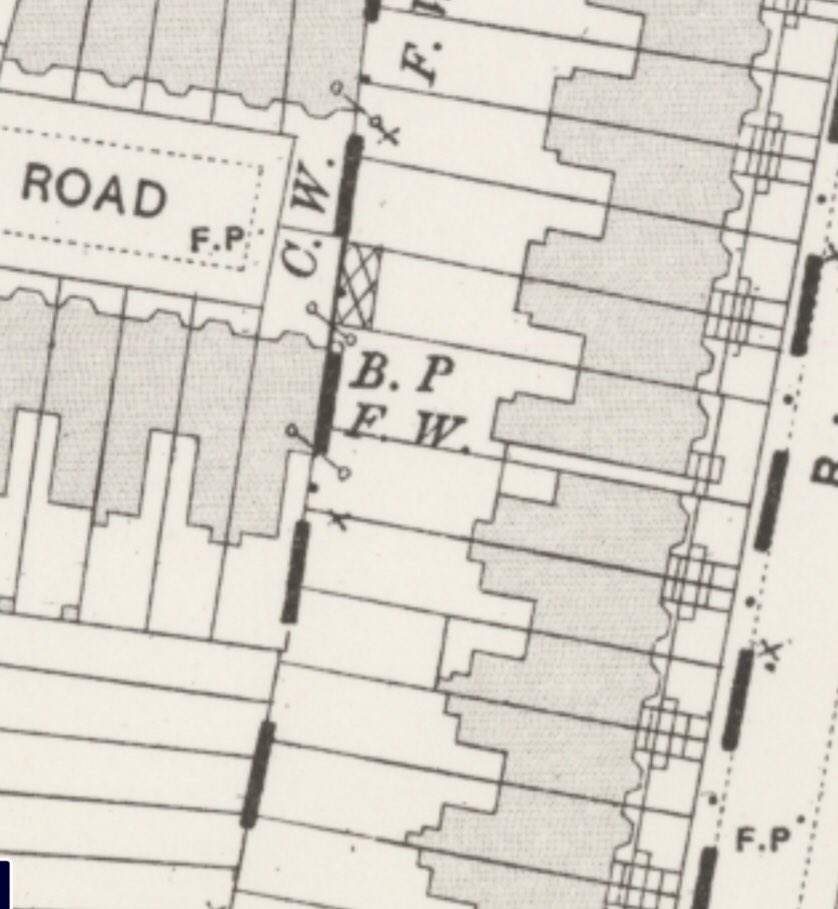
Such boundary posts, each with a unique identification number, were dotted along the boundary line, and there were many of them around. They were marked in OS map as B. P (Boundary Post, Boundary Plate/Plaque). The post was halfway in the ground originally.
Only a few survive today, and as some were in back gardens, I used to joke with @Ldn_Boundaries that we should go and knock on houses to ask if the boundary marker in the back garden, as indicated on the map, is still there. Imagine my excitement when I received a message from someone who said there was a boundary post in their back garden!
Boundary marker expert @Ldn_Boundaries has concluded the rare 1822 triangle parish boundary marker was next to the former Sutton Arms pub where the three parishes (Stoke Newington, Hackney and Islington) and created this handy visual to illustrate the boundary of each of them. Thanks Tom!
map of the old parliamentary borough of Finsbury (Middlesex), created in 1832. It included parishes such as Islington, Stoke Newington, Bloomsbury, Holborn and Clerkenwell (excluding its Muswell Hill exclave). Initially, Finsbury had 2 MPs in the House of Commons