🚨 The town of Kanosh, Utah has been placed under Level 1: READY evacuation status due to potential danger from the #WideMouth2Fire
Extreme fire behavior has been witnessed throughout the day.
Please see Millard County Sheriff’s Office attached post for additional information.
@MillardCountySO@FishlakeNF
Powerful microbursts damaged buildings and toppled trees onto vehicles and roads across Philadelphia this weekend. The storms produced estimated wind gusts of 60-70 mph along a path about 12 miles long and 4-5 miles wide. https://t.co/NLdiDhc71b
UPDATE: Salt Lake City has now observed a high of 109 degrees so far as of 2:58 PM MDT, which sets a new all-time temperature since records began at the site in 1874. This shatters the previous record of 107 degrees, previously set in 1960, 2002, 2021, and twice in 2022. #utwx
🚨WILD VIDEO🚨: A microburst is being blamed for the wild flooding that took place in the Wynnefield neighborhood of Philadelphia on Saturday afternoon.
Multiple large trees were toppled and cars were swept away by the flood waters. #PAwx
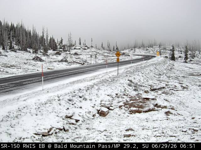
Hello, summer? Are you there? 🧐
It may be almost July, but that doesn't stop the occasional snowstorm in Yellowstone. If you visited the park this week, you may have been surprised to experience snowfall. Since most of the park lies at an elevation of 6,000 feet (1,829 m) above sea level or higher, unpredictability characterizes our weather around here! No matter when you visit, bring a warm jacket, rain gear, and lots of layers.
👉 Be sure to check the weather forecast before you arrive: https://t.co/QLb94DQ3tX
A PDS Red Flag Warning is in effect Friday from 9 AM to midnight for portions of the Southwest Desert, Central & Southern Mountains including the #CottonwoodFire. This is a PARTICULARLY DANGEROUS SITUATION. Gusty winds & dry conditions will lead to very rapid fire growth. #utwx
Water spouts confirmed over the Great Salt Lake during my hike last night! What’s awesome is in the dark shadow on the lake below the water spout you can see the water displacement!
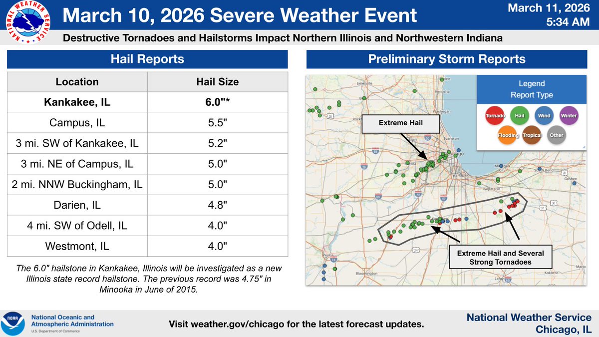
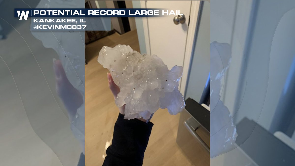
Forget state records, hail near Kankakee, IL yesterday may be challenging NATIONAL records.
This hail stone will need to be examined, but it could be topping 7-8 inches in diameter.
Record is currently held at 8 inches from Vivian, SD.
More: https://t.co/E8zZ5A76HH
An impactful severe weather event with multiple strong tornadoes and exceptionally large hail occurred yesterday afternoon and evening in portions of NE Illinois and NW Indiana. Our thoughts are with those who were significantly impacted by yesterday's storms. #ILwx#INwx
(1/3)
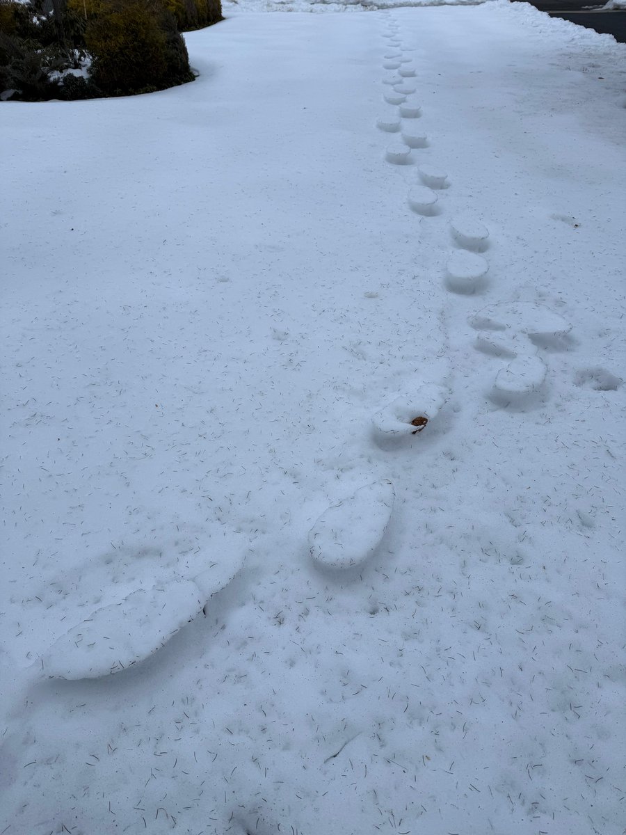
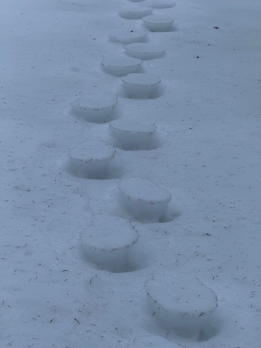
Our Trenton snow observer photographed these yesterday... inverse snow tracks! The snow was walked in when it was changing to sleet (ice pellets) back on January 25th, then the footprints filled up with sleet, and now the softer snow around them is melting faster than the sleet.
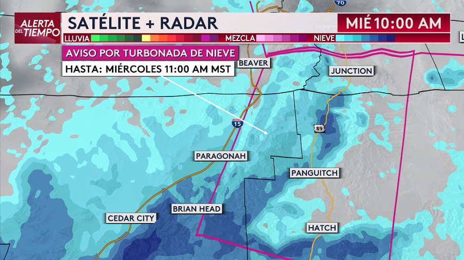
Tres avisos por turbonada de nieve en el sur de Utah, incluyendo tramos de carreteras i-15, i-70 y US-89, UT-20, UT-12 Y UT-143
Condiciones muy peligrosas por visibilidad completamente reducida y vientos a más de 50 mph
Hasta las 11am de este miércoles
#utwx#latinosenutah