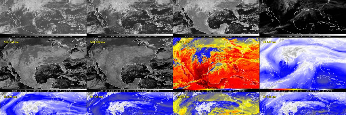
To continue celebrating SSEC's Anniversary, here is yesterday's (8/20/2026) Local Noon composite in globe format. Piggybacking on @NOAASatellites tradition of #FullDiskFriday. Local noon composites in Mollweide projection are here: https://t.co/z1De886LAw @UWSSEC@UWMadison
Happy Anniversary to UW-Madison's SSEC founded on 20 August 1965! To celebrate here is @NOAASatellites#GOES19 in CIMSS Natural Color from sunrise to sunset. Glad to have made it another trip around the sun! @UWMadison@UWSSEC
This 10-minute @NOAASatellites#GOESEast FD animation in CIMSS Natural Color showed the shadow of today's solar #eclipse / #Éclipse over North America and the northern Atlantic on its way toward Western Europe (which we can't see from GOES-East). From sunrise to (almost) sunset.
There's a seam where the image starts and ends, because at that point they're about 24-hours apart and the atmosphere doesn't line up anymore. Accepting brain-storms on how to make that less ugly.
Here's what Earth looked like yesterday (26 July 2026) from geostationary satellites around the world at "local noon" everywhere. You can play with this on this website: https://t.co/rbT8mrZi7T;
Follow #Bavi from July 1 to July 9 as it developed from a tropical depression into a gargantuan Cat 5 Super Typhoon. This is the Himawari IR window band centered on the storm's center of rotation as it moves W/NW across the Pacific. More on the blog: https://t.co/BIPBXUDPf8
Happy #summersolstice! Here is @NOAASatellites#GOES19 true color imagery at ~sunset every day from the winter (21Dec) to summer solstice (21Jun). The earth's tilt on our axis makes the seasons and you can see how much more sunlight the northern hemisphere gets during our summer.
Here's @NOAASatellites#GOES16 today at local satellite noon (19:00UTC) with the CIMSS Natural Color enhancement. GOES-16 is out of storage for testing for about 2 weeks. Happy #FullDiskFriday!
Here's our local noon composite for #EarthDay made from 5 geostationary imagers (2 USA, 2 EUMETSAT, 1 JMA). Where were you at noon? Unless you were off planet or in the arctic/antarctic circle, you must be in this image somewhere! About local noon images: https://t.co/z1De886LAw
Now that the sun has set on the @NOAASatellites#GOESEast subpoint, here is an animation from sunrise to sunset for #EarthDay with the "CIMSS Natural Color" enhancement:
We did not forget that today is #EarthDay! Here is @NOAASatellites#GOES19 Full Disk at local satellite noon. More images and animations will be added to this CIMSS Satellite Blog post: https://t.co/s88KM3a4f5
From @NWSSPC: A small cluster of elevated tstorms has persisted into early afternoon in SE WI, aided by forcing for ascent attendant to an upstream shortwave trough. This animation shows what we saw from @NOAASatellites#GOESEast and our rooftop cameras as it appeared overhead.
SSEC founder Verner Suomi was passionate about teaching. That commitment continues today at SSEC and @UWCIMSS. Help support student learning and research during #DayoftheBadger: https://t.co/XQCWTCbRt5
2.5-minute @JMA_kishou#Himawari9 Infrared images showed Super Typhoon #Sinlaku after it had rapidly intensified to a Category 5 storm (as of 1200 UTC on 12Apr2026), southeast of Guam and the Mariana Islands. https://t.co/6I5HDOptji
The large eye of Cyclone #Narelle in 2.5-minute @JMA_kishou#Himawari9 Infrared images as it approached North West Cape in Western Australia. It's a Category 4 again, like when we blogged about it 8 days ago! https://t.co/hOY8EMmrid
There GOES 2025! We're celebrating with a full disk image in CIMSS Natural Color every day of 2025 at satellite noon (17:00UTC) from @NOAASatellites#GOESEast. Look back at some of the most exciting weather events (from GOES) on the CIMSS Satellite Blog: https://t.co/KtIKKgqYiC
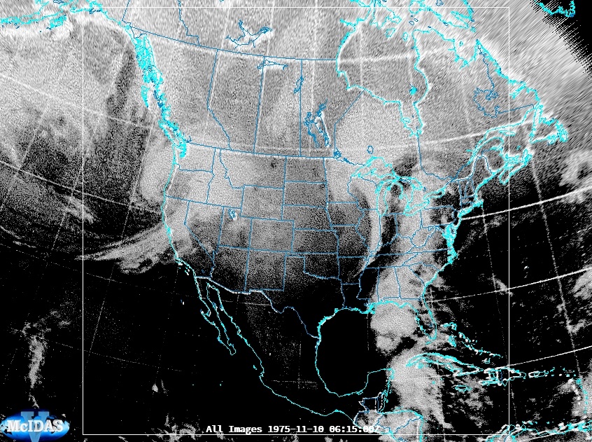
SMS-2 (precursor to GOES) images from 11/9&10 show progression of storm that sank the Edmund Fitzgerald. Images restored from physical photos (hence poor res), digitized, and given navigation (not perfect), which allows us to navigate and display.
Thanks to @NOAASatellites GOES, improvements in weather forecasting models, and the hard work of the @NWS we have not seen a major industrial wreck on the Great Lakes since the Edmund Fitzgerald in 1975.
It's the 50th Anniversary of the launch of GOES-1! Check out this blog post celebrating 50 @NOAASatellites GOES loops, one for each state! https://t.co/9oJZoTrAEP