It looks as though the NI August Bank Holiday record temperature has been broken thanks to tropical air from ex Hurricane Erin. All change after tonight.
Hurricane Milton is undergoing one of the fastest rapid intensifications ever observed in the Atlantic.
It is now a 155 mph Category 4 storm, just 2 mph shy of Category 5 status.
Not a single weather model predicted the storm would strengthen this quickly.
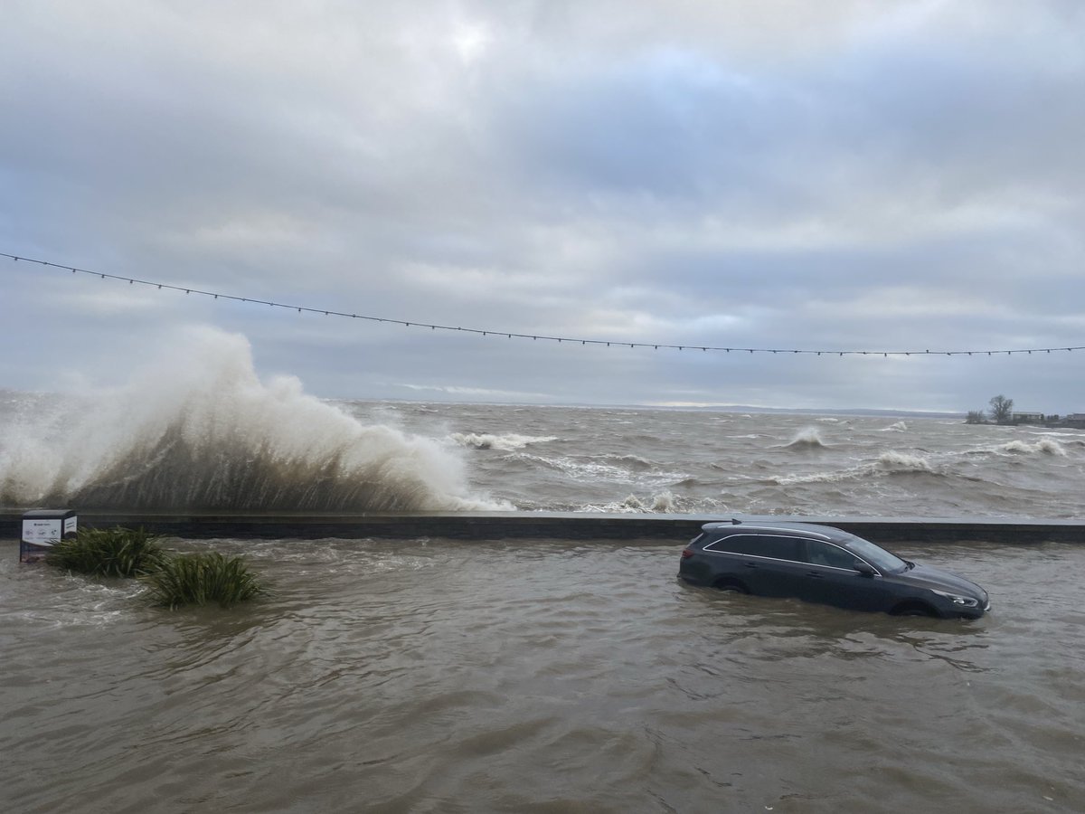
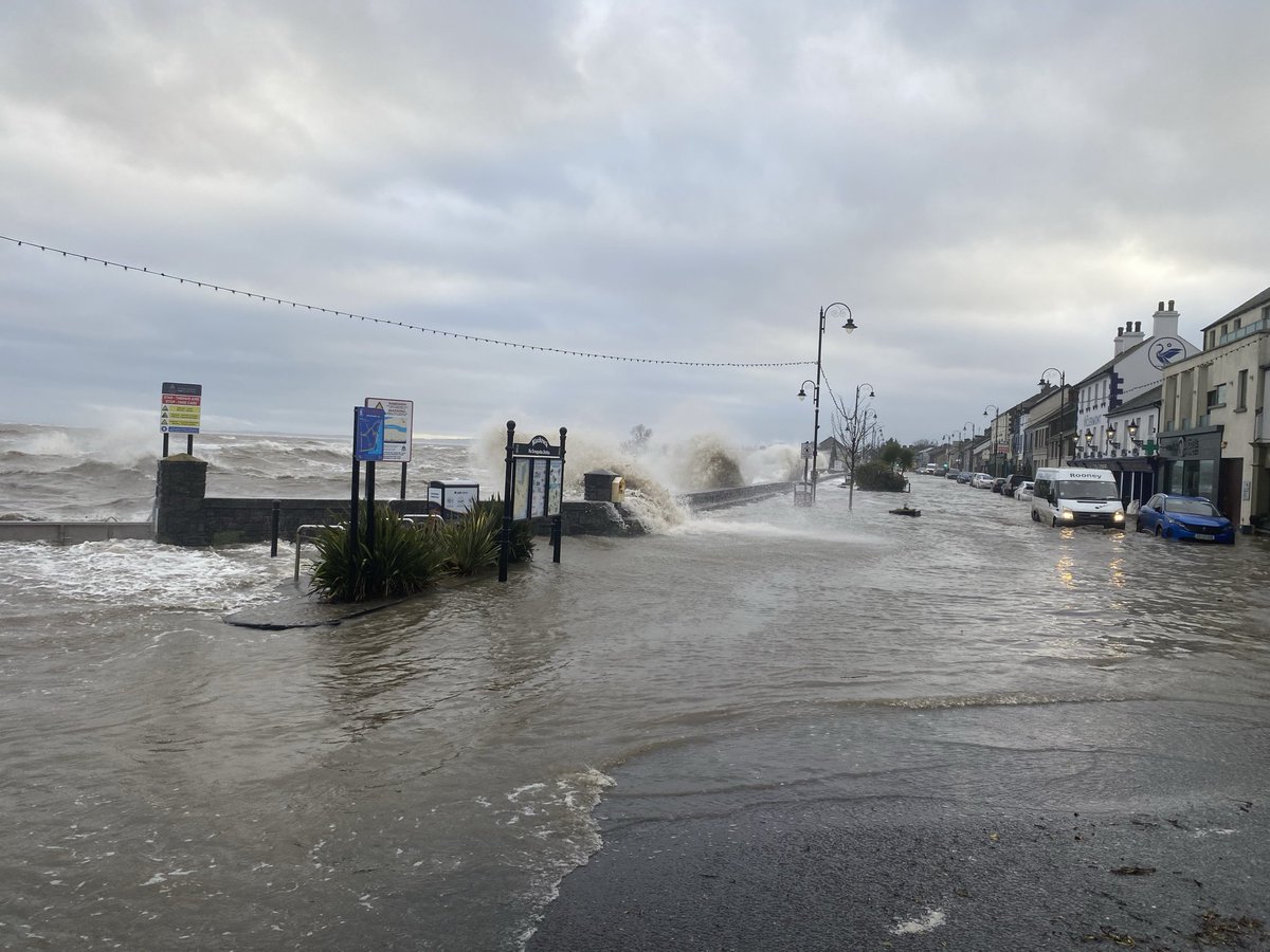
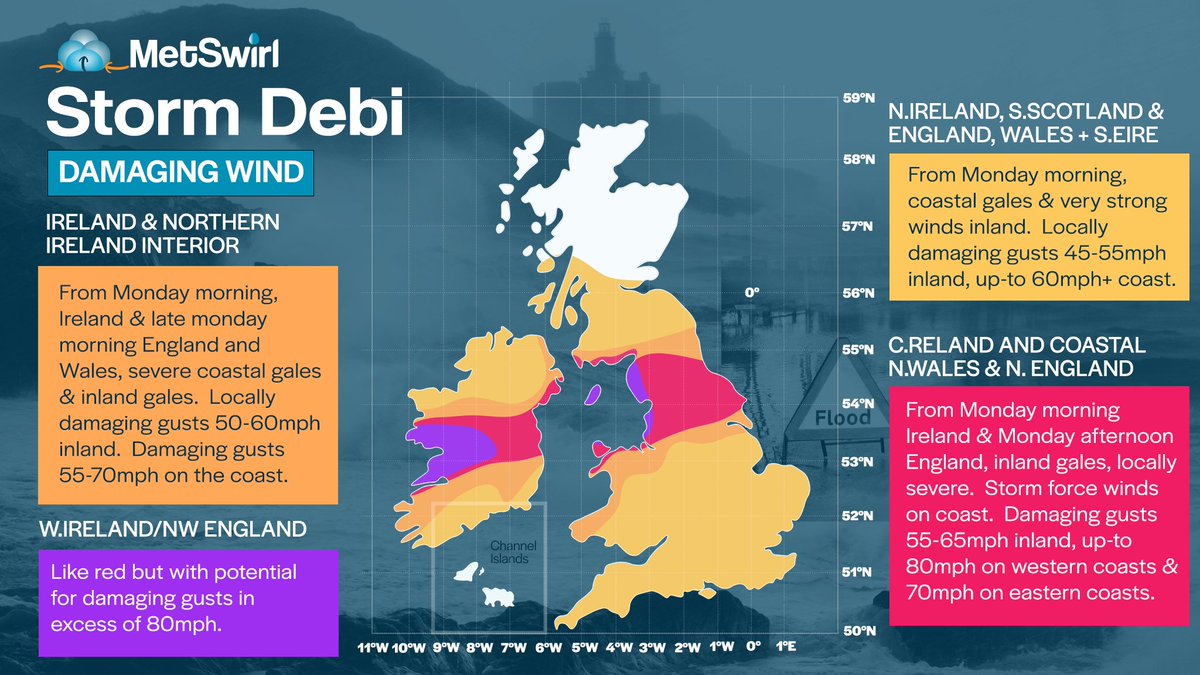
#StormDebi will sweep across Ireland on Sunday night & Monday morning
There will be severe and damaging gusts, likely to lead to:
🏡 Damage to vulnerable structures
🚗 Dangerous travelling conditions
⚡️ Disruption to services & power lines
More here 👇
https://t.co/Xg3aMJlyuS
#StormDebi is expected to bring dangerous storm conditions to parts of Ireland, N. Wales and N. England on Monday. The impacts worst across Ireland in the early morning hours of Monday, perhaps the most disruptive across N. England during Monday late morning/early afternoon.
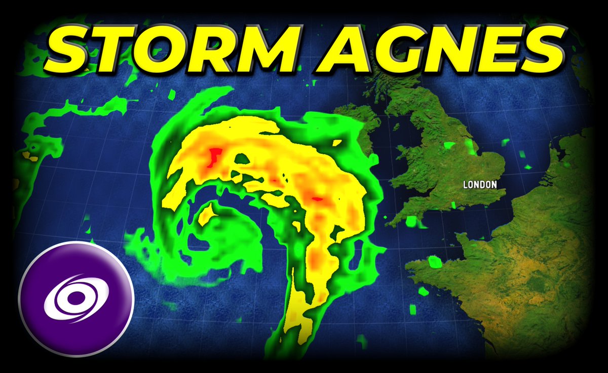
Our roof-mounted camera is now live for the duration of #StormAgnes - we'll also have updates throughout the day here on Twitter and on our YouTube channel
https://t.co/oOuR4R1cRQ
Storm Agnes 👉🌬️🌧️⚠️ Here's Met Éireann’s Meteorologist Mark Bowe with some updates and insights on #StormAgnes
For the latest weather forecasts and warning details, go to https://t.co/e0QpncNkig and the Met Éireann app📲
July 6
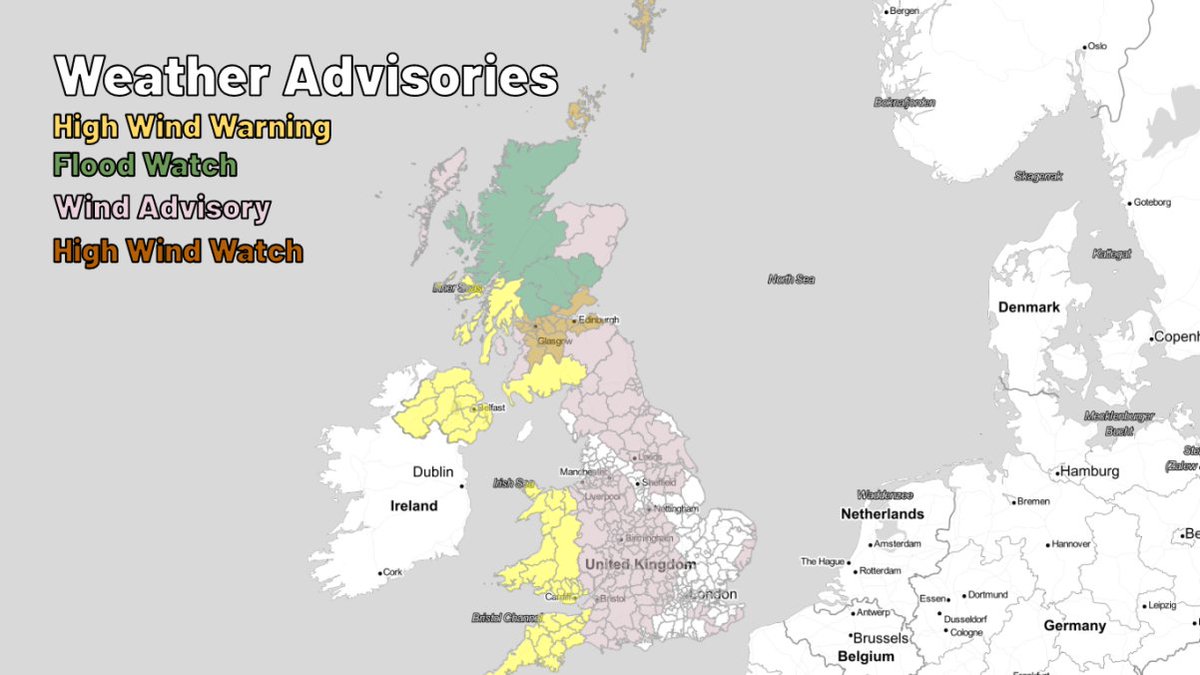
Windy in nearly the entire country today, with gales expected across Wales, Cornwall and most of Scotland during the remainder of today heading into tonight. Some flood alerts are also active.
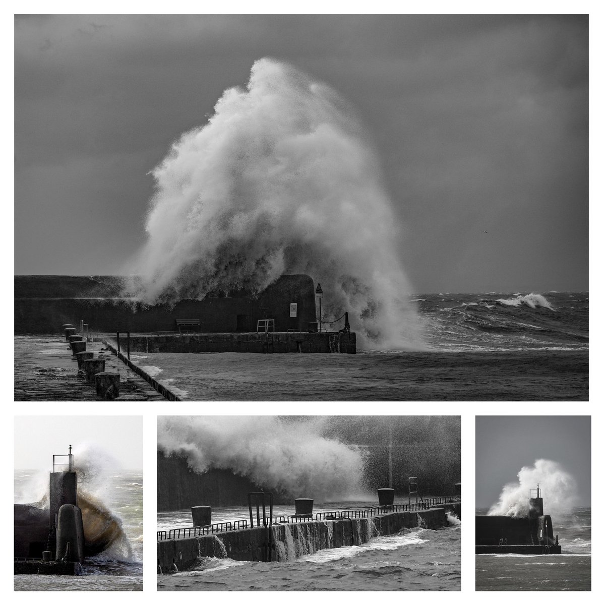
Big disclaimer, maybe have sworn a few times but I’ve not quite experienced a thunderstorm like this. The strongest wind gusts I’ve ever experienced by a mile! Must be a fair bit of damage from this system across the UK🤯