Rain with some thunder will move into the region today with the greatest rain coverage expected this afternoon and evening. Temperatures ahead of the main batch of rain will be well above normal in the 60s and 70s.
⚠️Stay Weather Aware Today!⚠️Atmospheric conditions are coming to together for the potential of severe weather this evening. Severe storms capable of damaging wind up to 70 mph and large hail up to golf ball size. Isolated tornado threat can't be ruled out.
#ohwx#pawx
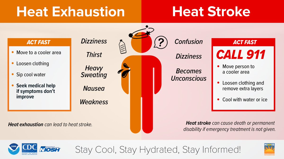
This week is Heat Season Awareness Week! Do you know the difference between Heat Exhaustion and Heat Stroke? During hot and humid weather, your body's ability to cool itself is challenged in ways you may not expect. @HeatGov#NIHHIS#HeatSafety
4 pm update...The general message is that the severe risk has diminished due the prefrontal showers which has used up available energy. We will maintain the severe🌩️watch for a little longer and the potential for an isolated strong to severe wind gust possible.
#OHwx#PAwx
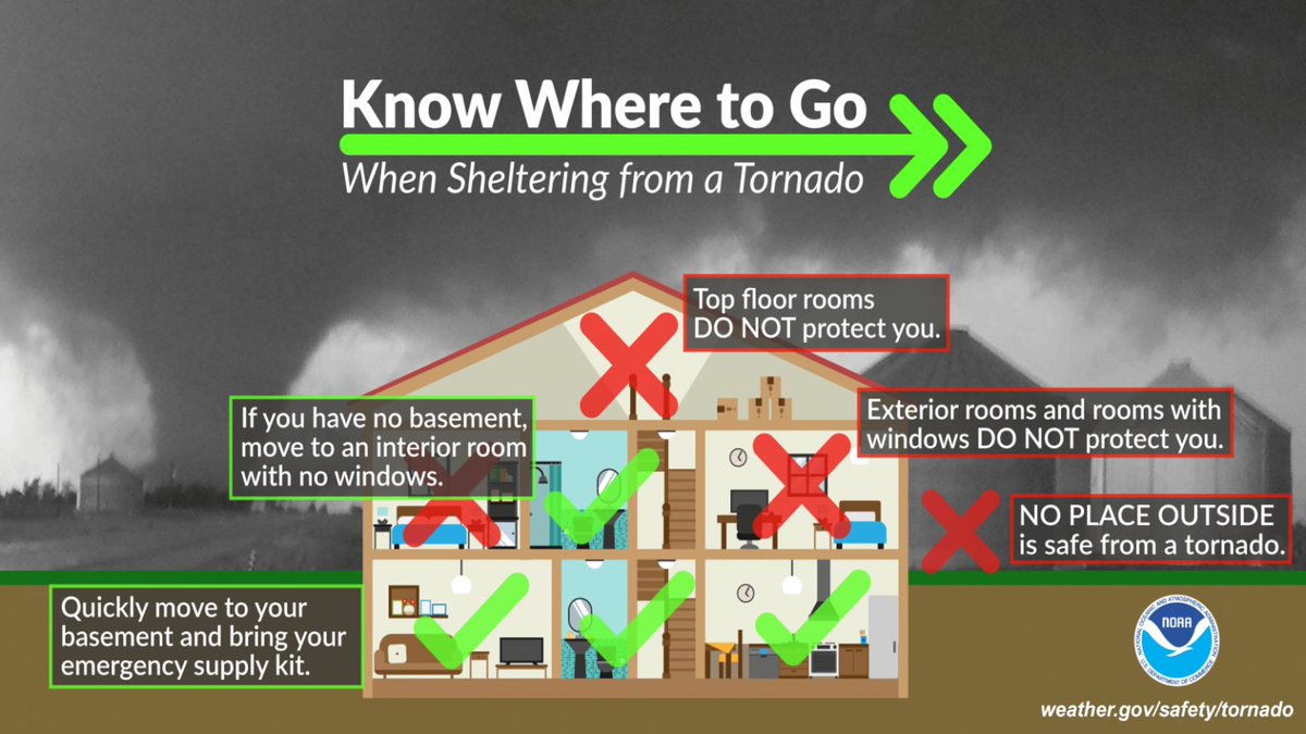
In addition, today is #SafePlaceSelfie Day! Do you know where to go during severe weather? Here is an infographic on where to go to shelter from a tornado. Send us a selfie showing your safe place and how you are prepared for severe weather today!
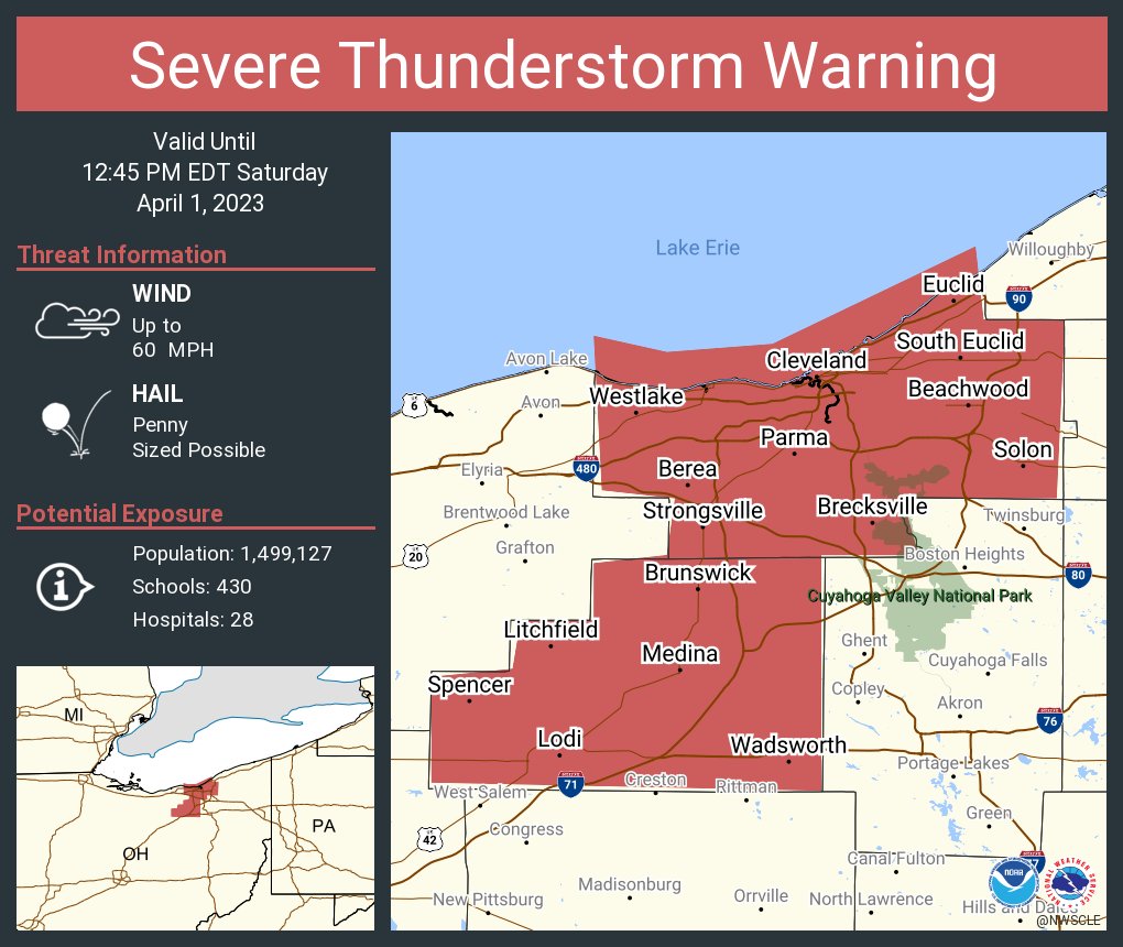
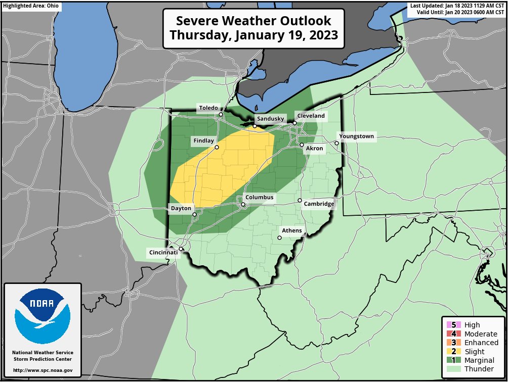
⚠️There will be a marginal threat for a couple isolated strong to severe thunderstorms this afternoon and early evening.⚠️The main threat will be isolated damaging wind gusts up to 60 mph possible along with frequent cloud to ground lightning.
#OHwx#PAwx#NWS#Cleveland
Morning snow showers drift off to the east. We then await the next cold front to bring increasing chances of precipitation late this afternoon into tonight. Most locations get light rain before a change back to snow overnight. Snow amounts of a dusting to an inch are possible.
Snow continues across the area this morning before changing to a wintry mix and then rain. Snow will persist across Northwest Ohio, where snowfall totals will reach 5 to 9 inches by tonight.
7:45 AM UPDATE: The southwestern part of our area has been upgraded to an Enhanced Risk for severe weather and the Slight and Marginal risks have expanded east. Damaging wind gusts remain the primary hazard, with the highest confidence/likelihood in the Enhanced Risk area.
Tomorrow could be a good day for severe storms in our region of Ohio so be prepared and take precautions, even though Medina county is not currently in the yellow portion, it doesn’t rule out the tornado probability. Stay safe, Be prepared.
Severe thunderstorms may impact northern OH late tomorrow afternoon and early evening, especially in the yellow shading. Damaging wind gusts and a brief tornado are possible. #OHwx
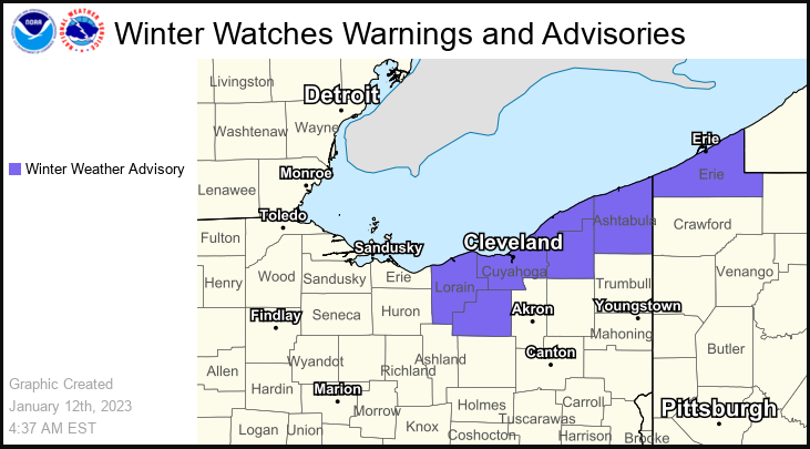
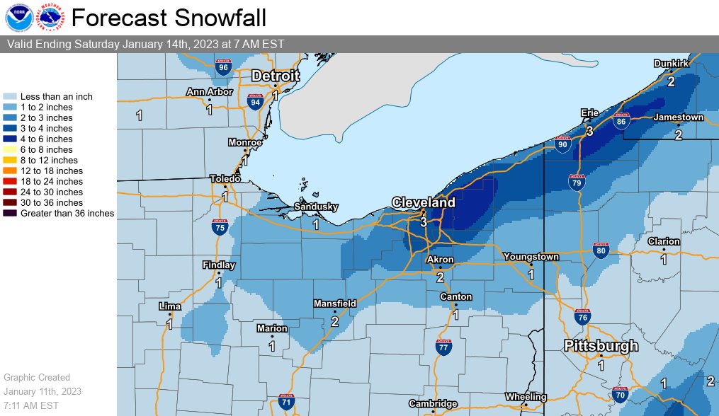
Since the big winter storm in Dec, there has not been much winter to speak of. That changes for some tonight when rain changes to snow and persists through Friday. Despite some higher totals, the forecast is over a 30hr period. A Winter Weather Advisory is in effect. #ohwx#pawx
A variety of weather Thursday into Friday. A storm system will bring milder temps in the 50s Thursday with rainfall amounts 1.0" to 1.5". Rain will change to wet snow Thursday night. Isolated thunder is possible Thursday afternoon and our winds will become very gusty too.
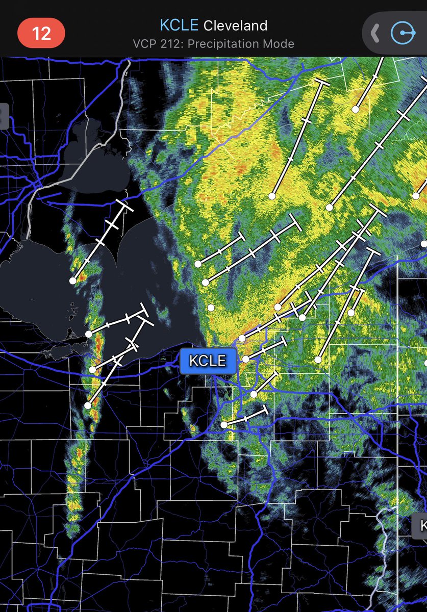
Little line of showers pushing north east after the big glob of rain passing by, Medina county could expect more rain if it moves a little more eastward