Accurate Weather Data and Forecasts to keep you ahead of the curve. Severe Weather. Flooding. Tropical Weather. Winter Weather all covered on this account.
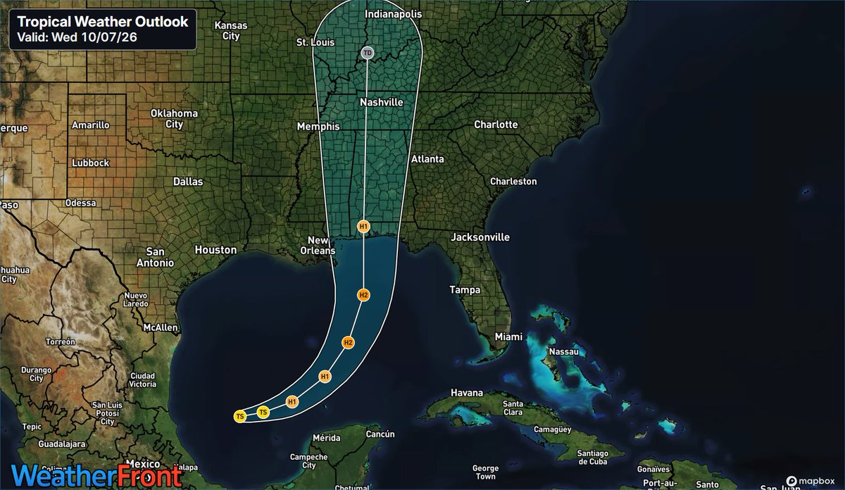
If you live in portions of the northern Gulf coast highlighted here, winds are forecast to be high enough to make further preparations for Isaias impossible by Friday. Do you have an evacuation plan? Is your home ready?
Prepare now. https://t.co/SqrQiDnUzK
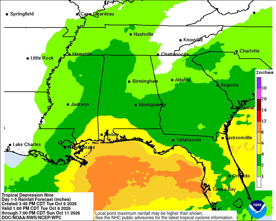
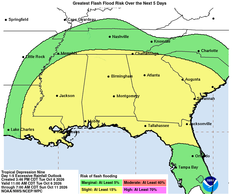
TS Isaias has 65 mph winds, rapidly strengthening toward hurricane status before a late-week Gulf landfall. Severe threats include 3–10" heavy rain, flash floods, life-threatening surge, and tornadoes in outer bands (LA to FL).
#flwx#severewx#alwx#wxtwitter#hurricane
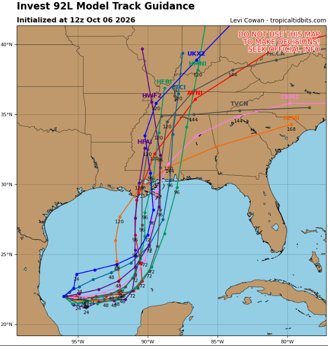
TS Isaias has formed in the SW Gulf and is expected to rapidly intensify into a hurricane over the warm waters. It will track north-northeast toward the Gulf Coast by Friday night/Saturday, bringing heavy rain, storm surge, and gusty winds from LA to FL.
#wxtwitter#FLwx#mswx
If you are in any of these colors, you will especially want to monitor the situation with Tropical Storm Isaias and have an action plan ready...
These areas will be narrowed and changed as confidence in the track continues to grow!
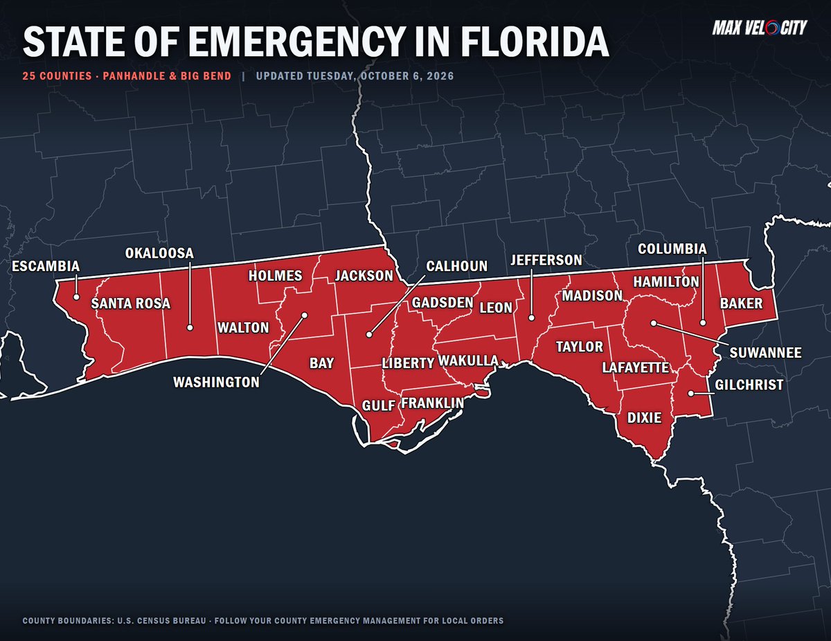
BREAKING: State of emergency declared for 25 counties across the Florida Panhandle and Big Bend region....
With Tropical Depression Nine brewing in the Gulf and forecast to strengthen into a hurricane as it tracks northward toward the coast this weekend, this declaration ensures that local communities have the necessary resources to prepare for severe weather impacts.
Tropical Depression Nine formed in the southern Gulf. It is forecast to rapidly intensify into Hurricane Isaias by Thursday as it turns northeast toward the northern Gulf Coast and Florida, bringing heavy rain and wind.
#mswx#alwx#gawx#flwx#lawx#Hurricane#wxtwitter
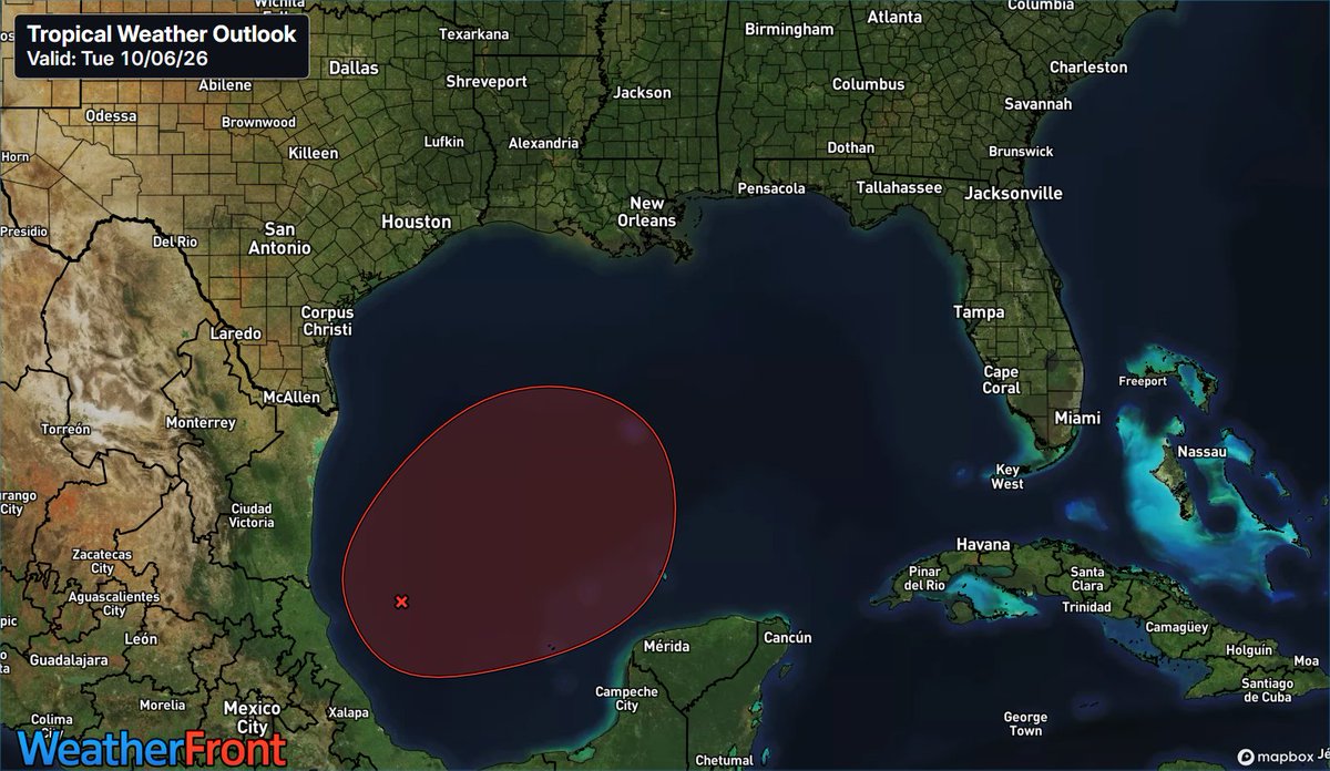
Invest 92L in the SW Gulf has a 90% chance of forming a tropical depression within 48 hours. It is drifting east and will turn north toward the northern Gulf Coast by late week, bringing heavy rain and gusty winds.
#txwx#lawx#mswx#alwx#wxtwitter#tropicswx
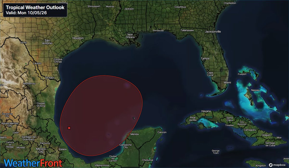
A trough of low pressure in the southwestern Gulf is producing disorganized showers. NHC gives it a 70% chance of forming into a tropical depression mid-to-late week as it drifts east and turns north. Land impacts are unknown.
#wxtwitter#severewx#tropicswx#txwx#lawx#flwx
@MortgageSense83@DodgerBlue1958 Shhhhh don't ruin the reverse jinx bro LMAO 🤣. I know how good they are once October hits. I just gotta work some magic
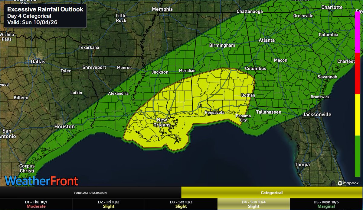
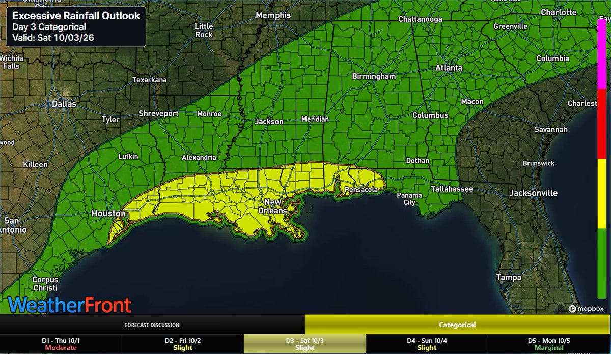
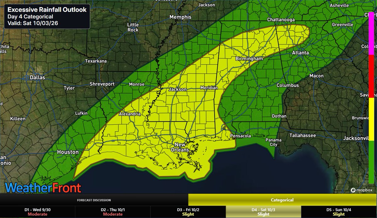
A slow-moving front drawing deep tropical moisture creates a Slight Risk for scattered flash flooding across LA, MS, and AL this weekend. Expect multi-day heavy rain and localized street flooding into Sunday.+Monday
#wxtwitter#lawx#alwx#mswx#severewx#gawx#flwx
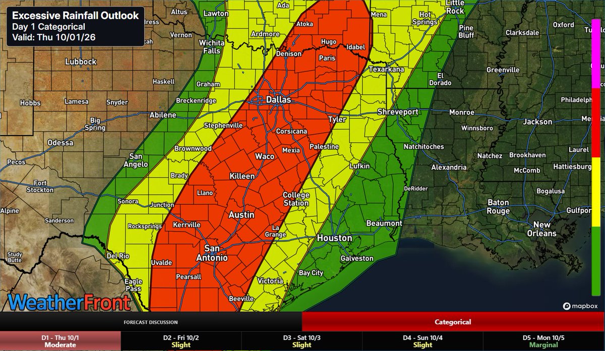
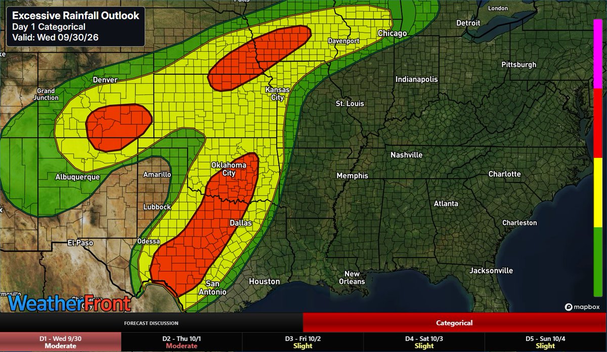
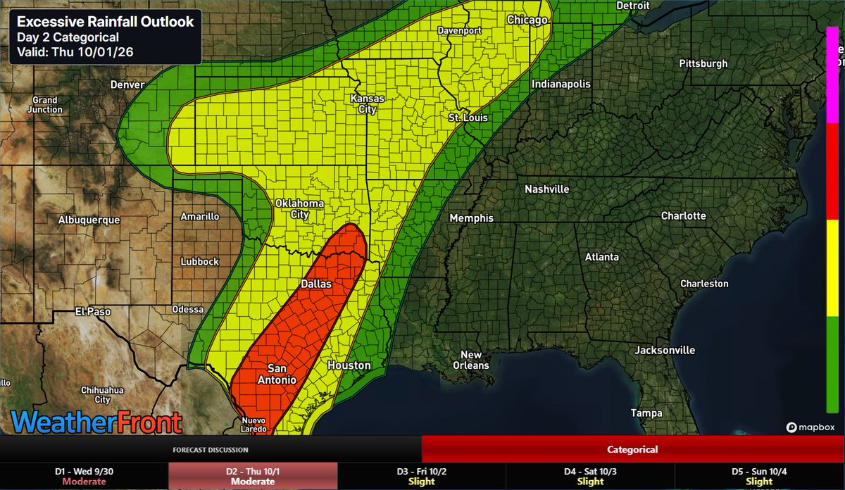
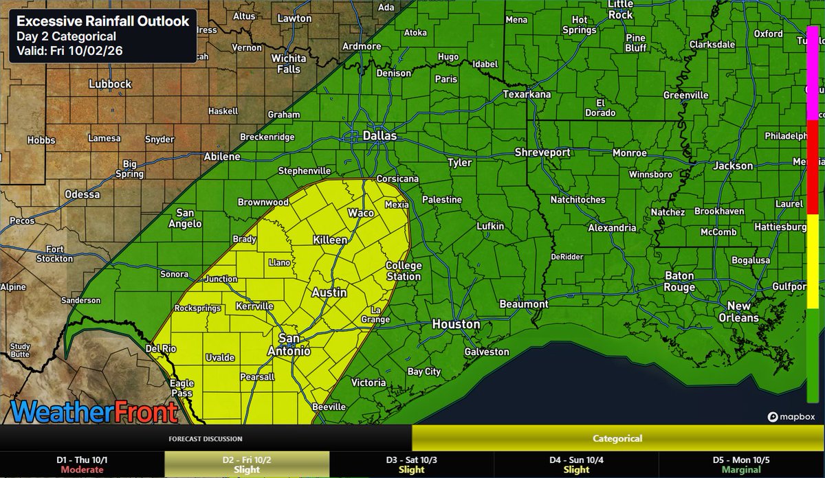
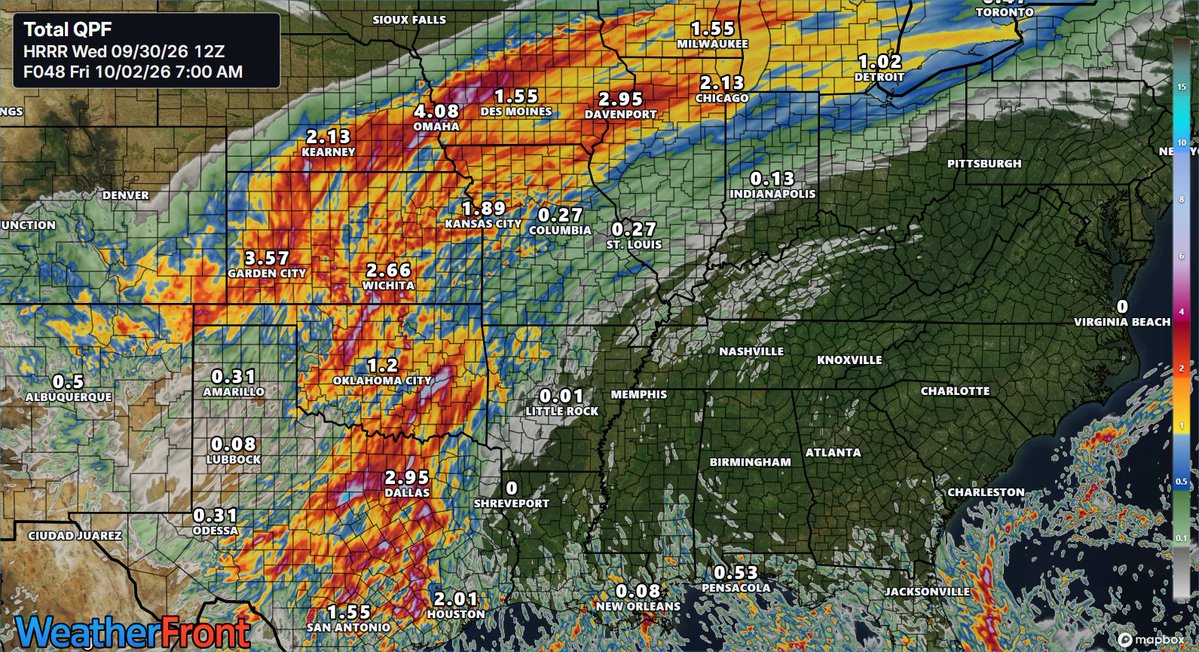
Slow front taps rich tropical moisture to fuel heavy rain across central/south TX today into Friday. 2–4"+ rain totals present Moderate Excessive Rainfall Risk with urban flash flooding along I-35 corridor before front shifts east.
#txwx#okwx#wxtwitter#severewx
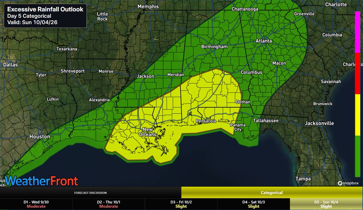
An upper trough and front will tap deep moisture to bring heavy rain to the Central Gulf Coast and TN Valley. A Slight Risk for excessive rainfall shifts strictly to the Gulf Coast by Day 5. Model timing uncertainty may require future updates.
#alwx#flwx#lawx#mswx#wxtwitter
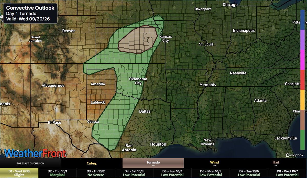
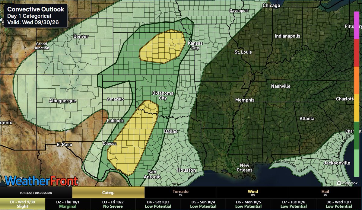
Severe storm risk targets the Southern Plains today into tonight. Main threats include damaging wind gusts and hail within linear storm clusters, plus a conditional 2% tornado risk across Central/North TX into OK. Flooding remains the top hazard
#txwx#kswx#wxtwitter#okwx
Extreme tropical moisture fuels a multi-day flash flood event across the SW and High Plains today, expanding into TX and OK Wed–Thu. Widespread 3–6"+ rain totals will cause dangerous arroyo surges, severe urban street flooding, and river rises.
#iawx#kswx#okwx#txwx#wxtwitter