Severe Thunderstorm Warning continues for Dickinson ND, South Heart ND and Gladstone ND until 6:15 PM MDT. This storm will contain golf ball sized hail!
The weather community lost a true legend this week with the passing of Gary England. He was a pioneer with his groundbreaking use of Doppler radar and helped set the standard for TV severe weather coverage. He was a good friend and great partner to NWS and he will be missed.
Showers in the middle of Minnesota currently - Currently in Wolf Lake MN, Menahga MN, Osage MN, Evergreen MN, Park Rapids MN, Butler MN. (not trying to doxx people)
Storm In Northwestern North Dakota currently - Currently in Wildrose ND, Alamo ND, Fortuna ND.
------------------------------------------------------
Another storm from south of North Dakota which is coming into north of South Dakota - Currently in Eureka SD, Long Lake SD.
Generally - the pattern trends over the weekend favor a more active pattern persisting vs. what sub-seasonal data/pattern drivers would've indicated last week.
Prevalence of the southeast US ridge will pump Gulf moisture northward and then rain/storm cluster activity in the Midwest from NW flow.
What you end up with are frequent rains east and timely rain chances even for areas that have still leaned a bit drier lately.
Our full analysis available with our Ag Commodity Reports, inquire here: https://t.co/hWUD6UsVEP
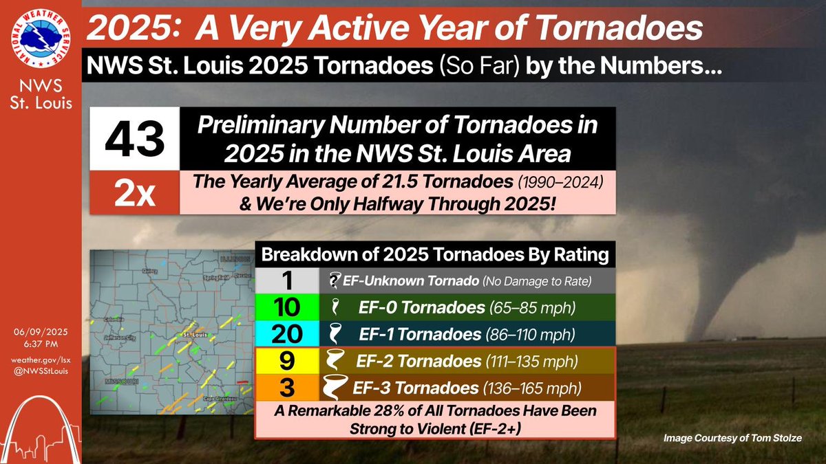
It's wild that Missouri is experiencing one of the most active tornado seasons on record, and almost every tornado is confined to areas south of I-70 & I-44. #mowx
If you’ve noticed that there have been a lot of tornadoes so far this year, you're not wrong! We have seen double the yearly average & we’re only halfway through 2025. Additionally, a remarkable 28% of these tornadoes have been strong to violent (EF-2+).
#stlwx#mowx#ilwx