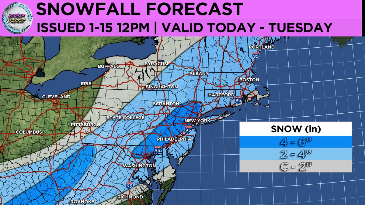
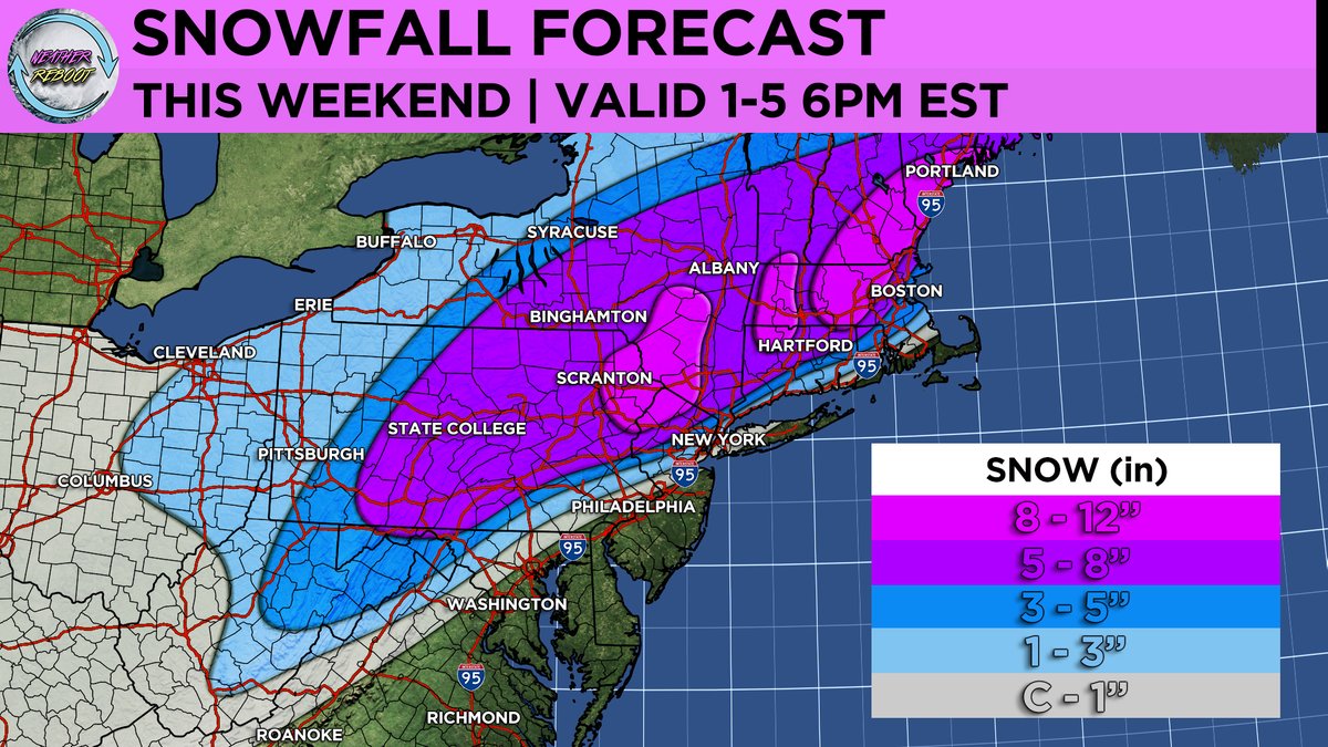
Here's our team's snowfall forecast for the snowstorm tonight into Saturday for the Mid-Atlantic and Northeast regions. Areas under the heaviest banding will see the higher end of snowfall amounts! Stay tuned for updates!
Over the past 24 hours model guidance has significantly shifted south with tomorrow’s winter storm system. What originally looked like a primarily interior snowstorm is now looking like a classic I-95 snowstorm. We will be posting a detailed snow forecast early this evening. Stay tuned for updates!
Winter Storm Watches have now been issued for areas extending from central Pennsylvania up into New England, as confidence grows regarding the likelihood of a significant winter storm in the Northeast.
Here's our team's snowfall forecast for tomorrow into Monday. Highest snow totals are expected across the interior Northeast and high elevations areas where temperatures aren't as marginal for snowfall. Stay tuned for updates!
RGEM has slowly trended colder and more moist with Sunday night-Monday morning storm...may mean more efficient dynamic cooling..something to watch for!
Here's our team's latest snowfall forecast for late tonight into tomorrow. Highest snow totals are expected across Southern New Jersey, Southeastern PA, Northern Delaware, and Northeastern Maryland where 3 to 6 inches could fall. Stay tuned for updates!
Here's our team's snowfall forecast for today and tomorrow. This snow will be much drier in nature than the last storm, as temperatures across the Mid-Atlantic and Northeast regions are much colder. Therefore, we expect higher-ratio snowfall, with a maximum zone of 4 - 6 inches running northwest of the I-95 corridor from northern Maryland to the lower Hudson Valley. Closer to the coast, there could be mixing issues leading to slightly lower snowfall amounts. Stay tuned for updates!
For today's NFL Wild Card game at Arrowhead Stadium in Kansas City featuring #ChiefsKingdom vs #FinsUp, fans and players should brace themselves for frigid conditions🥶
Wind chills are forecasted to drop into the -30s °F, adding an extra chill to the game's excitement! 🏈❄️
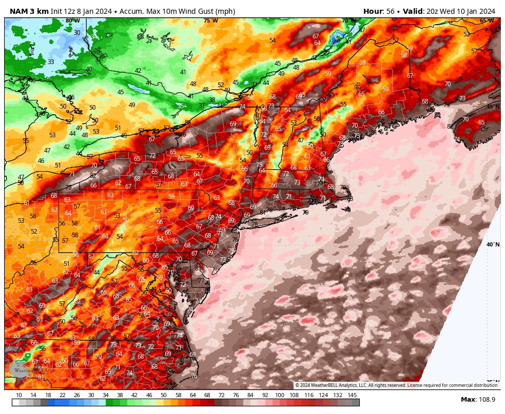
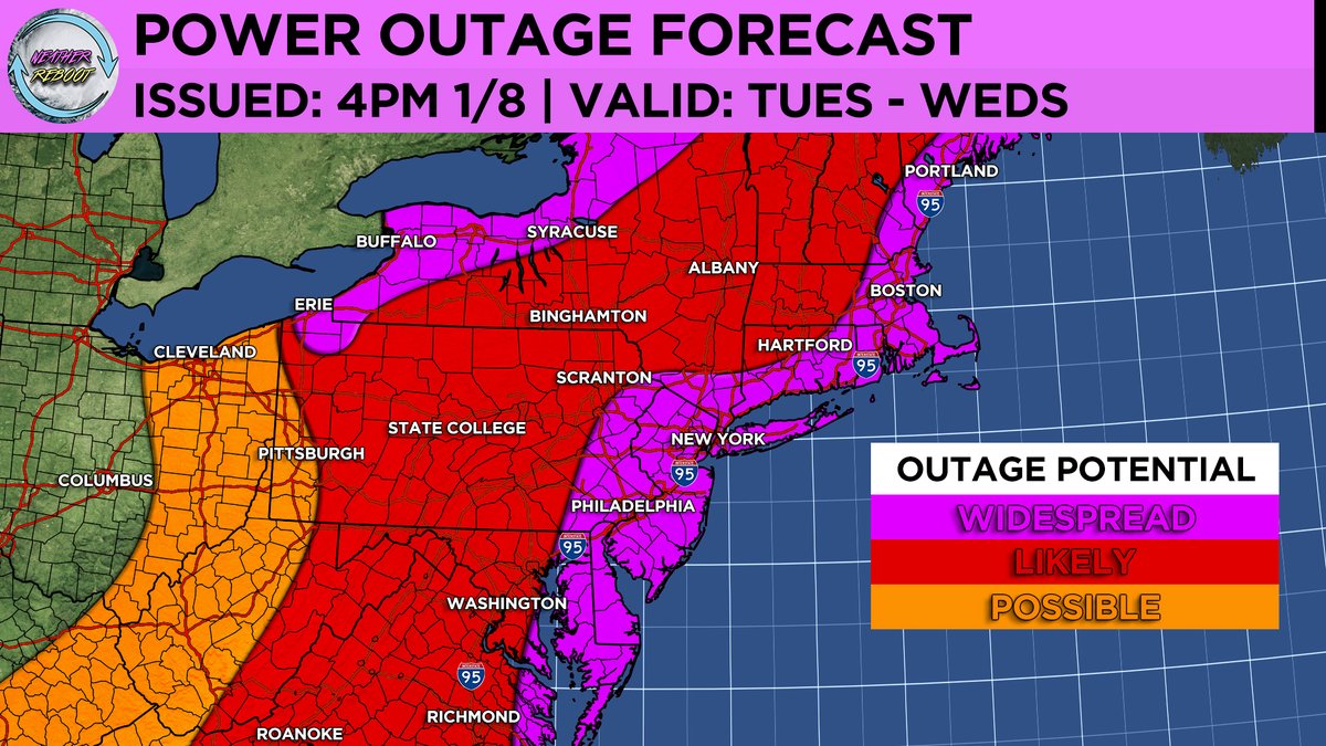
Power outages continue to significantly increase across the Mid Atlantic and Northeast states as strong winds blow through from a strong low pressure system over the Great Lakes.
- WxReboot Team
Here are the latest wind alerts from the National Weather Service regarding the strong low-pressure system currently moving northwest over the Great Lakes region. This system is expected to deliver high winds and flooding rainfall to the Mid Atlantic and Northeast over the coming hours. Expect wind gusts of 40 - 55 mph in inland areas, and stronger gusts of 60 - 70 mph closer to the coast. The most severe winds are anticipated to arrive late tonight, so stay prepared.
- WxReboot Team
Our team remains concerned about the potential for strong wind gusts, reaching up to 50 - 60+ mph, along the Mid Atlantic and Northeast coastlines, as well as around the Great Lakes region. In light of this, we have decided to issue a power outage forecast graphic, which is attached below. The combination of melting snowpack, heavy rainfall, and high winds is a recipe for a significant weather related power outage event.
- WxReboot Team
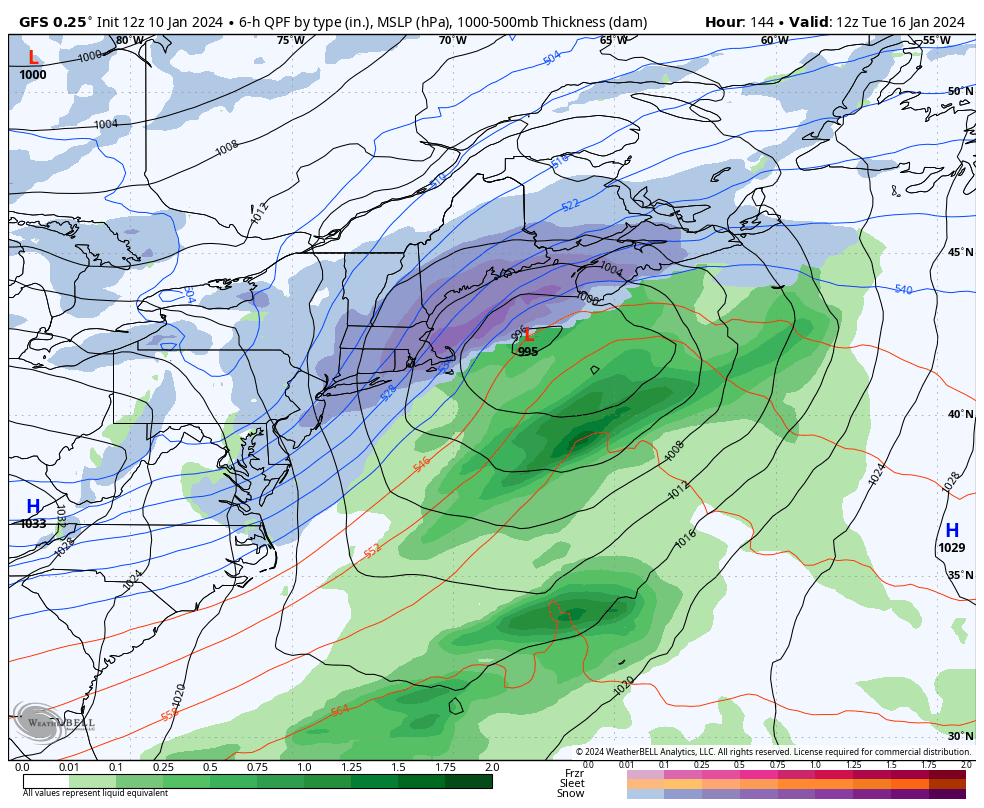
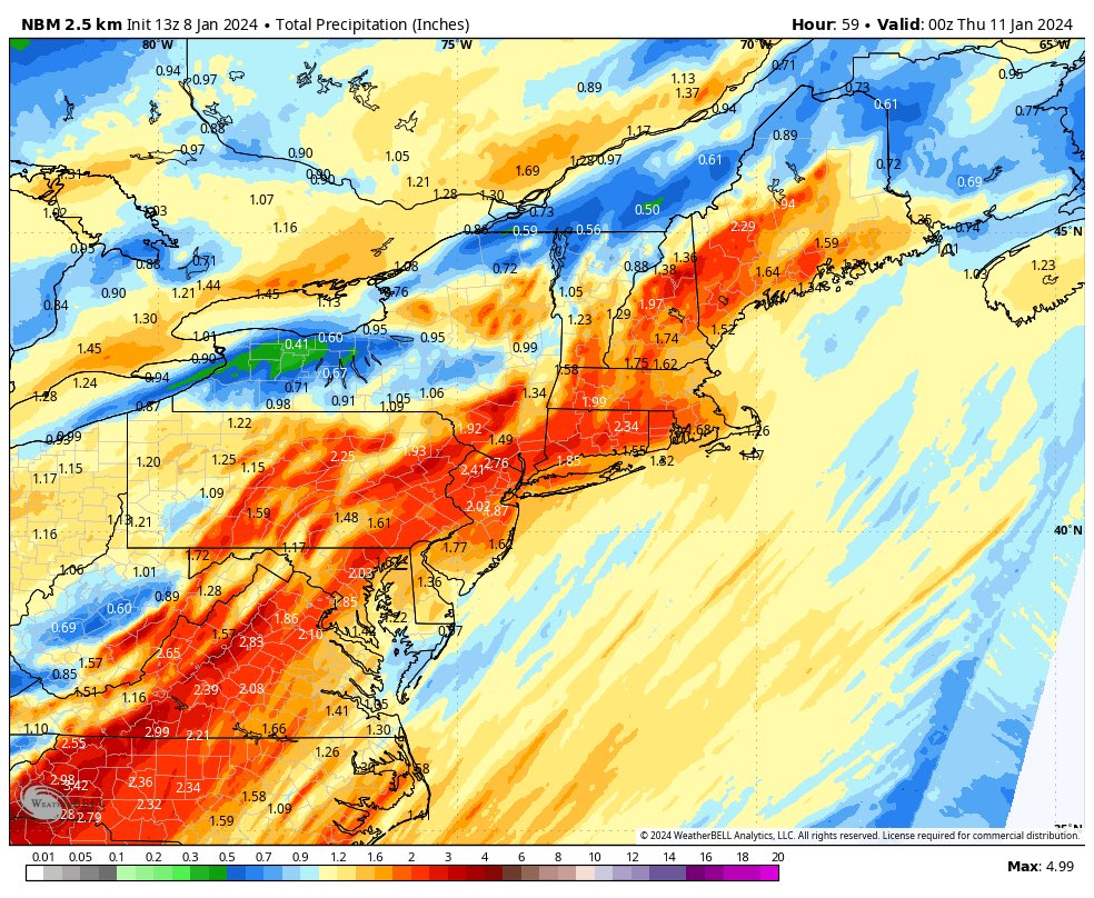
The next system our team is watching will be moving over the Eastern Seaboard early tomorrow morning into Wednesday. The main threat with this storm will be the risk for substantial flooding (1 - 4” of rain) and high wind gusts (50 -60mph) which could cause widespread power outage issues closer to the coastal areas.
Here is our updated snowfall forecast for this weekend's winter storm arriving tomorrow into Sunday! Our team expects the heaviest snowfall to fall over the interior regions of the Mid Atlantic/Northeast. There will be a very tight gradient in snowfall amounts as you approach coastal areas due to mixing/rain issues! Final forecast map will be posted tomorrow morning. Stay tuned for updates!
Updated snowfall forecast map for this weekend's winter storm (1/6 - 1/7)! Our team continues to analyze new model guidance and narrow down the heaviest snowfall axis corridor along with the tight snowfall gradient associated with this storm. Stay tuned for updates!
First call snowfall forecast map for this weekend's winter storm (1/6 - 1/7)! Our team continues to assess that the axis of most significant/heavy snowfall will fall to the northwest of the I-95 corridor with mixing/rain issues closer to the coastal regions. Stay tuned for updates!